My Italy Experience

Author: admin

  • Grotte Is Zuddas: Aragonite Caves and a Sulcis Day Trip

    Grotte Is Zuddas: Aragonite Caves and a Sulcis Day Trip

    Grotte Is Zuddas near Santadi offers an extraordinary underground contrast to southern Sardinia’s beaches: delicate aragonite formations, cool cave rooms and a guided walk through geological time.

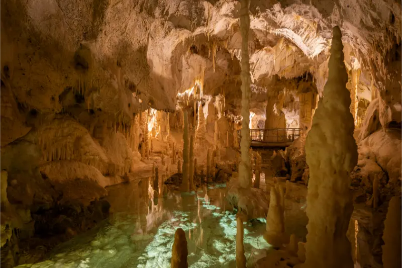
    The Sulcis countryside is not the obvious place to imagine another world under your feet. At Monte Meana, near Santadi, the surface gives way to a network of chambers decorated by mineral formations that appear almost improbable in their complexity. Is Zuddas is especially well known for aragonite crystals, including twisting, branching shapes that seem to defy the straight lines of familiar stalactites. The visit is carefully managed for good reason: these are delicate natural structures, not ornaments that can be touched or taken.

    If Grotte Is Zuddas is part of a longer route through Sardinia, our Sardinia travel guide is a useful starting point for choosing the next stop.

    Plan your visit at a glance

    WhereMonte Meana, Santadi, Sulcis area, southwest Sardinia
    AllowAllow around one to two hours including arrival and a guided visit
    Best approachTravel by road and check the cave operator’s current scheduled departures
    Good to knowThe cave is cool, humid and visited with guidance; do not touch formations
    Suggested baseSantadi or Carbonia; consider Iglesias for a wider southwest trip

    The recommendations below distinguish the permanent character of the place from rules that may change by season. Check the official visitor information shortly before your trip, particularly if a permit, guided departure or protected-area access is involved.

    The unusual aragonite formations

    Is Zuddas is famous for a concentration of aragonite formations, including delicate needle-like sprays and unusual eccentric crystals. These shapes form through complex interactions of mineral-rich water, changing conditions and slow deposition. They are not manufactured and cannot be replaced on a human holiday timetable if broken by a careless touch.

    The cave also contains familiar speleothems such as stalactites, stalagmites and flowstone. Look for differences in texture: some walls have a soft-looking mineral veil, while other formations are sharply crystalline. Lighting can make them seem more colourful or monumental than a camera captures. Resist using a bright flash in restricted areas; obey the guide’s instructions on photography.
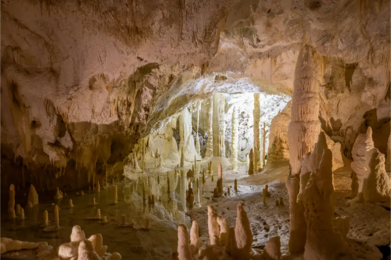
    Stalactites Stalagmites Famous Caves Italy Grotte di Frasassi Marche Italy

    What the visit feels like

    A guided cave visit is generally a sequence of chambers reached on a managed route. The operator describes a tourist itinerary of roughly half a kilometre, with changing surfaces and a high-humidity environment. That distance may sound short, but in a cave, steps, low-light conditions and slower walking can make it more demanding than a half-kilometre city stroll.

    The constant cool atmosphere is part of the experience. The official cave operator describes temperatures of about 16 degrees Celsius and very high humidity. Bring a light layer even when it is hot outside. Sensible shoes with secure soles are more important than stylish sandals, particularly where condensation can make a walkway slippery.

    Why the rock itself matters

    The caves lie in the Monte Meana area, where ancient geological deposits form the host rock. Over immense spans of time, groundwater dissolved and reshaped openings, and later left new mineral forms behind. The distinction between dissolving rock and depositing crystal is one of the most interesting things a guide can explain.

    Visitors sometimes read a single figure for the age of the surrounding rock and assume the formations are equally old. They are not necessarily the same age. Host rock, cave formation and individual crystals can belong to different phases. Asking how a particular formation developed is more informative than trying to assign one date to everything you see.

    Reaching Santadi from the coast

    The caves are near Santadi in Sardinia’s southwest, a region often overlooked by travellers concentrated on Costa Smeralda or the northeast. A car is generally the most practical way to link the rural attraction with accommodation and other sites. Plan the drive using current road conditions and the operator’s exact entrance address at Località Is Zuddas.

    If you are staying near Cagliari, the area can be considered for a dedicated day trip, but do not confuse a road-distance estimate with the actual time needed for a cave visit. Add buffers for navigation, parking, waiting for the next tour and any lunch stop. A hurried arrival risks missing a scheduled guided group.

    Combining the cave with the Sulcis

    Santadi and the surrounding area provide a useful introduction to the rural southwest. You might combine the cave with a local village stop or another clearly open attraction, keeping the underground visit as the centrepiece. Some travellers will prefer to continue toward the coast, but it is better to choose one meaningful companion activity than a list of distant beaches.

    The region is associated with food and wine traditions as well as archaeological and mining history. Arrange tastings or tours directly where relevant and never assume that a family-run producer accepts walk-ins. Inland Sardinia often rewards advance contact and a slower pace more than improvised stop-after-stop driving.

    What not to do in a fragile cave

    Do not touch mineral surfaces, even when they appear smooth or sturdy. Oil from hands and physical contact can affect delicate formations; repeated touching by visitors would cause lasting damage. Stay behind barriers and avoid leaning over railings for photographs. Tripods and professional equipment may require separate permission.

    Do not bring food into the cave or make a child’s visit depend on running around. Explain the environment before entering: darkness, echo, cool air and the need to stay with the group. A calm introduction makes the underground experience more enjoyable and helps protect the remarkable mineral landscape.

    Why the cave needs carefully controlled lighting

    Photographs of Is Zuddas often emphasise the extraordinary crystal shapes, but the lighting is itself part of how a managed cave tour works. Artificial illumination helps visitors see fragile formations and remain on safe routes; poorly managed light can also affect underground environments over time. That is another reason to follow the operator’s stopping points and photography instructions. If you want a sharp image, brace your phone where permitted instead of touching a formation or leaning outside a railing. Expect slight differences in tone from one chamber to another rather than trying to “correct” every colour to an internet image. The best experience is partly tactile in the ordinary sense of feeling the cool, humid air, but not tactile in the sense of reaching out toward crystals. Leave room in your itinerary to appreciate the silence between guided explanations; otherwise the cave can become a succession of hurried camera screens.

    A realistic visit: three ways to organise your day

    A dedicated cave excursion

    Reserve or verify a departure, arrive early enough for instructions, and join the guided circuit without rushing. Afterwards, enjoy lunch in the Santadi area or another nearby place that has confirmed opening hours. Allow your day to remain spacious rather than adding a distant evening drive.

    A southwest Sardinia discovery day

    Use Is Zuddas as a highlight of a wider Sulcis itinerary. Choose one other cultural or countryside stop and arrange it around the cave tour rather than assuming tours depart continuously. This pairing gives a better feel for the region beyond its beaches.

    A cool alternative to the hottest hours

    When the coast is extremely hot, an underground visit can provide a welcome change of environment. It is not, however, a substitute for checking opening schedules or booking requirements. Keep a layer handy and remember that high humidity may still feel intense for some visitors.

    Practical details people often overlook

    Use the cave operator’s actual website to confirm current tickets, departure times, seasonal opening and language availability. A general regional tourism article explains what you will see but may not reflect temporary closures, special events or the daily tour roster. The official website also provides the Santadi contact details.

    People with mobility limitations, claustrophobia or difficulty walking on damp ground should ask the operator about the precise route before booking. A general “accessible attraction” label says little about steps, low ceilings or the possibility of sitting during a visit.

    Carry a light jacket even in August, wear footwear with grip and keep your phone secure. Low light can tempt repeated camera flash; observe instructions and let the guide determine appropriate stopping points. Do not risk contact with formations for a close-up photo.

    Where to stay and what to combine nearby

    Santadi is convenient for exploring rural Sulcis at an unhurried pace, while Carbonia gives access to a larger town setting. Iglesias can fit a broader multi-day southwest trip if you also want mining heritage and the spectacular coast, but it introduces extra driving for each cave visit.

    Consider a separate day around Iglesias and Porto Flavia rather than trying to fit both a guided cave circuit and a long mining-coast excursion into a tightly planned afternoon. The southwest rewards longer stays because its attractions are dispersed.

    Questions travellers ask

    Do you need a guide to visit Is Zuddas?

    The tourist cave is visited on managed routes; confirm the guided departure and any booking instructions with the operator.

    What makes Is Zuddas special?

    Its exceptional aragonite formations, including needle-like and eccentric crystals, distinguish it from caves dominated by more familiar stalactites and stalagmites.

    Will I be cold inside?

    The operator describes a cool, nearly constant environment near 16°C with high humidity. A light layer and shoes with reliable grip are sensible.

    Is the cave suitable for young children?

    Many families can enjoy a guided cave visit, but assess each child’s comfort with dark enclosed spaces and the ability to walk calmly. Ask about steps and age-specific requirements in advance.

    Further reading on My Italy Experience

    Build a wider Sardinian route with Chia and the south coast, Cagliari, our ten-day road trip, where to stay in Sardinia. These guides were already published when this article was prepared; they provide the region-level context rather than repeating this specific visit.

    Official information and final advice

    For the latest visitor rules and practical notices, consult the Grotte Is Zuddas cave operator. Use the official source to confirm dates and booking conditions, then keep your daily plan flexible for weather, traffic and any local restrictions.

    The pleasure of Is Zuddas is in looking carefully. When visitors accept a guide’s pace and leave the crystals untouched, the cave feels like an invitation into a process still quietly unfolding underground.

    Last updated: October 17, 2026

  • Su Gologone Spring: Emerald Water and the Quiet Side of Oliena

    Su Gologone Spring: Emerald Water and the Quiet Side of Oliena

    Su Gologone is a dramatic karst spring near Oliena, where deep blue-green water emerges from limestone below the Supramonte and changes the pace of a Sardinian road trip.

    Sardinia’s most famous waters are usually photographed from beaches. At Su Gologone the water appears in a completely different setting: beneath rock walls, among greenery and in a small natural basin where depth and colour suggest a much larger underground world. The spring makes an exceptional contrast to a beach holiday, but it deserves respectful viewing rather than treating the dark blue water as a swimming pool.

    For travel beyond Su Gologone Spring, consult our Sardinia travel guide; it explains how to choose a base and link nearby destinations.

    Plan your visit at a glance

    WhereOliena municipality, near the base of Monte Uddè and the Supramonte
    AllowOne to two hours for a relaxed visit; longer with a wider inland circuit
    Best approachDrive from Oliena or Nuoro following the signposted spring area
    Good to knowRespect any swimming prohibitions and current visiting arrangements
    Suggested baseOliena for countryside stays; Dorgali or Nuoro for broader travel routes

    The recommendations below distinguish the permanent character of the place from rules that may change by season. Check the official visitor information shortly before your trip, particularly if a permit, guided departure or protected-area access is involved.

    What you are looking at

    Su Gologone is a karst spring: rainwater moves through fissures and underground cavities in limestone before emerging at the surface. The striking basin is connected to a complex hydrological system rather than being an isolated ornamental lake. The narrow setting amplifies sound, shade and the colour of the water, especially when sunlight reaches different angles.

    The depth and intricacy of the underground passages have drawn cave divers and researchers, but those activities have nothing in common with recreational swimming. Visitors should stay in designated observation areas, avoid dropping objects into the water and follow local instructions. The appeal of the place is witnessing the force and mystery of a natural system, not entering it.

    Stintino Old Harbor Clear Spring Day Italy

    Reading the colours and the landscape

    From one viewpoint the basin may look bright turquoise; from another it becomes deep blue or green. These variations reflect light, depth, water clarity and surrounding vegetation. A cloudy day does not make the spring less important, but it changes the photograph. If you want images without glare, experiment with positions on authorised paths instead of leaning dangerously over barriers.

    Beyond the water, pay attention to the surrounding rock and plant communities. The transition from dry countryside to the shaded spring zone makes the place memorable. Birds and insects may be present, and the background sounds of water are often more evocative than a loud phone recording. Keep noise low, especially when other visitors are enjoying the small space.

    The relationship with the Supramonte

    The spring is one visible expression of the great limestone landscape of the Supramonte. Nearby mountains, ravines and underground drainage systems illustrate how geology shapes eastern-central Sardinia. Understanding that relationship turns a short scenic stop into a lesson in the island’s natural history. Water has been working beneath these hills for periods vastly longer than human settlements nearby.

    It is tempting to use the spring as the start of an improvised off-trail mountain expedition. Resist that temptation. The wider Supramonte contains difficult terrain and routes that require appropriate skill or a local guide. Visiting Su Gologone does not prepare someone automatically for challenging canyon treks, and the two experiences should be planned separately.

    Getting there from Oliena or Nuoro

    Oliena is the nearest useful town base and provides a natural cultural complement to the spring. Nuoro is another practical starting point with roads that reach the valley. A rental car makes the visit easiest for most travellers; rural public transport may not connect conveniently with the attraction’s specific entrance and desired departure time.

    Roads in this area can be winding, so give yourself time and do not use optimistic straight-line kilometre estimates. Check the actual visitor access point rather than driving toward any place name containing “Su Gologone,” as accommodation and local businesses also use the name. Parking and entrance procedures should be verified before leaving your base.

    Combining nature with local culture

    An Oliena day can balance scenery and local life. Visit the spring in the gentler part of the day, then explore the town’s streets or arrange a suitable local meal. This approach gives the countryside a human dimension instead of treating Oliena solely as a motorway exit for a landmark.

    Wine, artisan traditions and mountain food are part of the area’s identity, but opening hours for workshops and producers can be limited. Choose one meaningful cultural stop and make contact in advance if a tasting or guided visit is important. Spontaneity is more enjoyable when the day still has a structure.

    Weather and the best time to visit

    Spring and autumn offer attractive conditions for exploring inland Sardinia, with more comfortable temperatures for walks and road trips. In summer, the spring’s shade feels refreshing, but the surrounding day may still be extremely hot. Winter can be atmospheric, although rainfall and local access conditions require checking.

    Water appearance and discharge vary with seasonal weather; do not assume the spring will look identical to the photograph taken on a previous trip. A flexible visit is preferable to a rigid photo appointment. The attraction is interesting for geology and landscape even when its colour is more subdued.

    Understanding why swimming is the wrong idea

    The still-looking turquoise surface conceals a powerful spring connected to underground cavities, variable flows and depths that are not comparable to a supervised pool. Water colour does not indicate safety: deep water can look inviting when clear and sunlit. The appropriate way to experience Su Gologone is from managed visitor areas, where you can see the spring without disturbing it or exposing anyone to unnecessary risk. Explain this distinction before arriving if children have seen pictures of the basin. Bring them a different water activity on another day, such as a suitable beach under safe conditions, rather than treating the spring as a substitute. The most memorable detail here may be the sound of emerging water and the dramatic dark-to-light transitions within the rock. A careful visitor comes away knowing something about the Supramonte as well as enjoying a lovely view.

    A realistic visit: three ways to organise your day

    An easy inland escape

    Travel from Oliena after breakfast, spend time observing the spring, then have lunch in the surrounding area if a suitable venue is open. Return through the town and stop for a short walk before the late-afternoon drive. This is a satisfying day with little unnecessary mileage.

    Part of an eastern Sardinia road trip

    If crossing between Nuoro and Dorgali, use Su Gologone as a deliberate inland stop. Add enough time for the final local road rather than marking it as a five-minute detour. Keep demanding hikes or boat trips on separate days.

    A culture-and-nature pairing

    Arrange one local Oliena cultural experience first, then explore the spring at an unhurried pace. This balance helps you understand the relationship between the town and the landscape. It is a particularly good alternative when coastal weather makes swimming or boat travel unattractive.

    Practical details people often overlook

    Check whether there is a current admission charge, seasonal ticket arrangement or opening restriction before setting out. Older websites sometimes quote fixed prices that are no longer valid, so use an official regional information source or the site’s actual manager rather than copying an amount into your itinerary.

    Treat the water as a natural monument. Do not swim or enter an area that is not explicitly authorised, and supervise small children near railings, slopes and water. Diving and underground exploration are specialist pursuits involving major hazards, not activities for ordinary visitors.

    Carry comfortable walking shoes and enough water for your wider outing. Mobile maps may be inconsistent in rural settings; save the return route and remember that some narrow roads require slower driving than the navigator predicts.

    Where to stay and what to combine nearby

    Oliena is the most atmospheric close base, especially for travellers interested in the local wine and mountain culture. Nuoro works if you want a larger inland centre, and Dorgali allows a later continuation toward the Gulf of Orosei. Choose one region as a hub rather than commuting repeatedly across the island.

    The Supramonte and eastern Sardinia deserve more than one rushed stop. You can pair the spring with a separate day near Dorgali or Cala Gonone, but major adventures such as Gorropu require their own safety and route planning.

    Questions travellers ask

    Can you swim at Su Gologone?

    Treat it as a protected natural spring, not a swimming spot. Follow the local posted rules; the depth and underground environment make casual water entry inappropriate.

    Is Su Gologone worth a detour?

    Yes for travellers interested in geology, unusual water landscapes and the Oliena countryside. It is particularly rewarding when combined with another nearby attraction.

    Do I need a guide?

    Ordinary scenic visits may be straightforward when the attraction is open, but guided interpretation can enrich the geology. Cave diving and demanding mountain routes are separate specialised activities.

    Does the water always look turquoise?

    No. Light, season, water conditions and viewpoint all change the colour. The spring’s importance does not depend on a particular shade in a photograph.

    Further reading on My Italy Experience

    Build a wider Sardinian route with Nuoro and Barbagia, the Gulf of Orosei, our seven-day Sardinia road trip, Sardinia travel planning. These guides were already published when this article was prepared; they provide the region-level context rather than repeating this specific visit.

    Official information and final advice

    For the latest visitor rules and practical notices, consult Sardegna Turismo’s Su Gologone guide. Use the official source to confirm dates and booking conditions, then keep your daily plan flexible for weather, traffic and any local restrictions.

    Su Gologone works best when you allow the setting to speak for itself. Look at the spring, listen to the water, connect it with the larger limestone landscape and continue toward Oliena with a stronger sense of inland Sardinia.

    Last updated: October 17, 2026

  • Cala Coticcio on Caprera: Protected Trails, Guides and Sea Views

    Cala Coticcio on Caprera: Protected Trails, Guides and Sea Views

    Cala Coticcio is small, exceptionally beautiful and strictly sensitive: understanding Caprera’s protected access rules matters more than finding a shortcut to its turquoise cove.

    The image is familiar: tiny granite rocks framing improbably clear water, with Caprera’s scrub-covered hills behind. What that image leaves out is the protected path, the summer heat and the need to follow the National Park’s access system. Cala Coticcio is not a place where everyone can arrive casually and walk down to the shore. Planning it responsibly means checking authorised guide arrangements and being willing to choose a different experience if the conditions or permissions are not right.

    Planning more than Cala Coticcio on Caprera? The Sardinia travel guide compares the main areas and helps you put this stop into a manageable route.

    Plan your visit at a glance

    WhereCaprera island, La Maddalena National Park, northeastern Sardinia
    AllowAllow much of a day once transfers and guided walking are included
    Best approachConfirm current park access procedures and authorised hiking guides before travel
    Good to knowThe restricted zone is regulated; do not enter via informal or unauthorised trails
    Suggested baseLa Maddalena town; Palau if arranging a full island day

    The recommendations below distinguish the permanent character of the place from rules that may change by season. Check the official visitor information shortly before your trip, particularly if a permit, guided departure or protected-area access is involved.

    What makes this cove different

    Cala Coticcio is celebrated for a narrow inlet between granite outcrops and a transparent patch of sea. The effect is especially striking from the permitted approach route, where successive glimpses reveal the cove among rock and Mediterranean plants. Its small scale, however, is exactly why visitor pressure can be damaging. There is less room for people and fewer opportunities to absorb careless foot traffic.

    Caprera itself is more than one beach. It is an island of scrub, pine, granite and historical associations, joined to La Maddalena by a road connection. Seeing the wider island gives context to Cala Coticcio and offers alternative viewpoints or walking routes when the protected cove cannot be visited safely or legally.

    Cala Sinzias Villasimius Italy

    Why park rules come before the route

    The La Maddalena Archipelago National Park manages highly protected zones, including access connected with Cala Coticcio and Cala Brigantina. The park has issued formal guidance on authorised environmental hiking guides and access arrangements. Requirements can evolve, so information from old social media posts or hiking maps should not be treated as present permission.

    Before booking your accommodation around the hike, consult the park’s official notices and ask a legitimately authorised operator exactly which trail, group size and access authorisation the activity covers. A paid tour advertised online is not automatically proof of a valid permit. Ask for precise meeting instructions and what happens if the park changes access due to environmental or safety concerns.

    The landscape is more demanding than the photograph

    Paths on Caprera can involve exposed granite, uneven descents and heat reflected from rocks. Even when distances appear modest, the terrain can be awkward in trainers without grip and unpleasant in the middle of a summer day. A guide can explain the route, manage the group and highlight fragile habitat, but cannot eliminate basic physical demands.

    Carry sufficient water for the whole walk and return, protect your head from the sun and keep both hands available where footing is uncertain. Do not follow cut-throughs made by other walkers: erosion quickly creates more visible scars on dry island slopes. If the group includes someone with limited mobility, ask about actual terrain rather than relying on a tour’s generic difficulty label.

    Respecting a tiny beach

    The cove has no capacity to absorb every visitor who sees it online. Avoid entering sensitive vegetation, collecting rocks or disturbing wildlife, and follow guide instructions about where the group may stop. Do not treat a protected area as a place to leave beach equipment for the day or play loud music. Quiet observation may be part of the experience, rather than simply a prelude to swimming.

    Conditions may change at the shoreline. A cove sheltered from one wind direction can be exposed to another, and the rocks near the water may be slippery. The availability of swimming should be confirmed by current guidance and actual weather, never guaranteed from a tour photograph. Leave the site as you found it.

    Land trips and boat views are not interchangeable

    Some travellers choose an organised boat excursion through the archipelago rather than a hike. A sea-based day offers island scenery and potentially other authorised swimming stops, but a boat passing Cala Coticcio does not necessarily have permission to land there. Protected-zone navigation and anchoring rules can differ from pedestrian trail rules.

    Ask precisely which islands and coves are on the itinerary and whether each stop involves landing or only viewing. Beware descriptions that use famous beach names loosely to sell a cruise. A compliant excursion may provide better overall value than one promising access that would undermine park regulations.

    Adding Caprera’s history to the day

    Caprera is linked to Giuseppe Garibaldi, who lived on the island, and visitors can explore historic attractions when their opening arrangements permit. This cultural dimension gives the island another identity beyond photographs of turquoise water. If your hiking booking is cancelled, a history-focused outing with suitable coastal viewpoints can still be worthwhile.

    The short bridge connection makes Caprera accessible from La Maddalena itself, but reaching La Maddalena from mainland Palau still involves a ferry. Build those legs into your timing and do not arrive late for a guide meeting because you assumed the islands share one continuous road network.

    A responsible alternative when the trail is closed

    If the protected route is unavailable, change the goal rather than attempting to find an unmarked entrance. Caprera remains appealing from its public roads and permitted visitor areas, and the island’s Garibaldi heritage offers a meaningful cultural alternative. This is an opportunity to learn why access is restricted: when many people try to reach a very small cove, vegetation, path edges and shore habitats can suffer disproportionate damage. A compliant island excursion might include a scheduled museum visit, a gentle stop at an authorised coastal viewpoint and dinner back in La Maddalena. Ask the park or local visitor services which routes are open at the time. This approach gives the archipelago more than one identity and reduces the sense that a holiday is wasted if a single famous beach is inaccessible. In a protected national park, good planning includes the possibility of not entering the most fragile place.

    A realistic visit: three ways to organise your day

    A properly guided cove visit

    Confirm current park rules, find an authorised hiking guide and verify the exact meeting point before departing. Carry suitable footwear and water, accept the pace set for habitat protection and leave time after the guided walk for food and rest rather than racing to catch a ferry.

    An easier Caprera day

    If the protected trail is too demanding, explore accessible parts of the island, its history and authorised viewpoints. The experience still reveals granite landscapes and Mediterranean vegetation without pressuring a very small beach or placing family members on unsuitable terrain.

    A wider archipelago excursion

    Book a compliant boat itinerary that clearly identifies authorised stops. Treat Cala Coticcio as a possible scenic reference rather than an unconditional landing. Consider the sea forecast, ferry connections to Palau and the return time before committing to another appointment.

    Practical details people often overlook

    The most important information source is the National Park, not a review written several seasons earlier. On its pages look for current zone maps, visitor authorisations and the latest communications about hiking guides. Conditions described for June 2026 do not automatically apply unchanged to 2027.

    To reach Caprera from Palau, travel by ferry to La Maddalena and continue by road across the link between the islands. Check both vehicle regulations and ferry schedules if bringing a car. An early hiking appointment may justify sleeping on La Maddalena the night before rather than attempting a complicated same-day transfer.

    Bring grippy shoes, sun protection, water and a small personal first-aid kit. Do not enter closed areas even if an old GPS route appears to cross them. Avoid hiking alone on unfamiliar ground merely because other visitors seem to be doing so.

    Where to stay and what to combine nearby

    Staying in La Maddalena is especially convenient for exploring Caprera without repeatedly taking a mainland ferry. The town also has restaurants and a compact evening scene. Palau can be preferable if your wider itinerary uses mainland Gallura roads, but ferry timing becomes part of every island day.

    Pair an authorised Caprera excursion with time for the town of La Maddalena or with a separate island boat tour. The archipelago is richer when enjoyed over more than one rushed stop. Our regional guide explains the relationships between islands and helps avoid making Cala Coticcio your only goal.

    Questions travellers ask

    Can I walk to Cala Coticcio without a guide?

    Do not assume so. Access to the highly protected zone is regulated and official park guidance should determine whether an authorised guide or specific authorisation is required for your dates.

    Can boats land at Cala Coticcio?

    Do not rely on this as a standard feature. Protected-zone marine restrictions and landing authorisations can limit what boats may do, and a scenic sail-by is different from a beach stop.

    Is the hike easy for children?

    The route includes exposed and uneven terrain. Suitability depends on the individual child, temperature and guide assessment; the photograph of the cove does not show the full walk.

    Where should I sleep for an early start?

    La Maddalena town avoids a mainland ferry crossing on the morning of a Caprera tour. Palau is reasonable if the activity starts late enough and ferry timing is confirmed.

    Further reading on My Italy Experience

    Build a wider Sardinian route with La Maddalena Archipelago, Costa Smeralda, where to stay in Sardinia, our Sardinia travel guide. These guides were already published when this article was prepared; they provide the region-level context rather than repeating this specific visit.

    Official information and final advice

    For the latest visitor rules and practical notices, consult the La Maddalena National Park’s access guidance. Use the official source to confirm dates and booking conditions, then keep your daily plan flexible for weather, traffic and any local restrictions.

    Cala Coticcio is worth protecting precisely because it is small and fragile. A lawful guided approach, or a different itinerary when access is unsuitable, is a better memory than an unapproved shortcut.

    Last updated: October 17, 2026
  • Cala Brandinchi: How to Book and Enjoy San Teodoro’s Famous Beach

    Cala Brandinchi: How to Book and Enjoy San Teodoro’s Famous Beach

    Cala Brandinchi near San Teodoro has beautiful shallow-looking turquoise water, but a successful visit begins online: summer access is regulated and a casual unreserved arrival may mean you cannot enter.

    The beach is often nicknamed a miniature Tahiti, a comparison inspired by pale sand and delicate shades of blue. The setting is undeniably beautiful, but it is also a protected and heavily visited stretch of coastline. Cala Brandinchi is one of those places where practical information affects the entire day: reservation windows, QR-code confirmation, parking and rules about access are as important as choosing the right towel.

    To see where Cala Brandinchi fits into a wider Sardinia itinerary, use our Sardinia travel guide for transport, bases and possible neighbouring stops.

    Plan your visit at a glance

    WhereSan Teodoro municipality, northeast Sardinia, around Capo Coda Cavallo
    AllowHalf-day or full day; book access before planning the drive
    Best approachCheck the authorised municipal booking portal and current seasonal regulations
    Good to knowThe 2026 summer system requires reservations from 1 June to 30 September; confirm later years separately
    Suggested baseSan Teodoro, Porto San Paolo or Olbia according to travel style

    The recommendations below distinguish the permanent character of the place from rules that may change by season. Check the official visitor information shortly before your trip, particularly if a permit, guided departure or protected-area access is involved.

    Why the bay attracts so many visitors

    Cala Brandinchi is a remarkably photogenic stretch of light sand and bright water framed by a northeastern Sardinian landscape of dunes, shallow sea and the outline of Tavolara in the wider distance. On a calm sunny day the colours are striking. This beauty also creates intense demand, especially in the heart of summer and during Italian holiday periods.

    Its reputation for pleasant bathing should not lead visitors to ignore changing conditions. Wind, tides and crowded access areas alter the experience. Families should pick a spot with a clear line of sight, know where children are swimming and take breaks from the strongest midday heat rather than treating the whole day as a competition for the front row.

    Cala Gonone Sardinia Italy

    The official summer reservation system

    The municipality uses a booking and quota system for Cala Brandinchi and nearby Lu Impostu. The official San Teodoro beach platform describes a QR-code process, with a restricted period in 2026 running from 1 June through 30 September. These details are year-specific; a guide read in 2027 or later must not assume identical dates or availability rules without a fresh check.

    The official site describes daily booking windows opening for a specific future day, and warns that the online waiting room is not a guarantee of a place. Complete the payment and confirmation steps before assuming access is secured. Keep the QR code accessible offline, check the named beach and date, and beware unrelated websites claiming to sell official entry rights.

    Booking and parking are separate decisions

    A beach booking is not the same thing as parking, a reserved umbrella or a guaranteed place close to the water. Parking areas, parking fees and beach-club services may be managed separately. Read what your confirmation actually covers. If you are travelling with several people, check the official booking limit per party and whether each visitor requires a recorded admission.

    Navigation is straightforward in principle from the San Teodoro and Capo Coda Cavallo area, but busy access roads can become slow. Leaving early may improve the drive; it does not override an entry quota. Do not abandon a vehicle on sensitive roadsides or block private entrances if the official car park is full.

    What to bring for a comfortable visit

    Pack drinking water, sun protection, sandals for hot access paths and a small secure bag for valuables. A compact picnic may be useful where permitted, provided all waste is removed. Wind can carry plastic wrappers into the dunes or water in seconds; use containers with lids and keep bags closed.

    The beach’s delicate environment requires attention to local signs about smoking, pets, tents and other equipment. These prescriptions can change under municipal orders. Instead of copying an outdated checklist, read the current rules on the official platform before packing bulky accessories or making arrangements for a dog.

    Cala Brandinchi versus Lu Impostu

    The two beaches are close enough to compare but have individual booking entries. They are not simply different gates into one reservation. Cala Brandinchi is the name most international visitors recognise; Lu Impostu offers another broad, attractive shore, and the best choice may depend on available access, weather and the group’s needs.

    If tickets are unavailable for one beach, do not try to bypass the system by walking in from another point or arriving from the sea. The protected area is managed precisely because unregulated visitor pressure can damage it. Pick a valid alternative and enjoy that beach without frustration.

    Timing, crowds and photographic expectations

    Early morning light can make the colours especially delicate, but booking conditions always take precedence over photography plans. In peak summer, even a quota-controlled beach may feel popular. The view in promotional images is usually a carefully chosen angle, not a promise of empty sand and no neighbouring umbrellas.

    June and September can offer a different rhythm from the busiest August weeks, yet both can fall within the seasonal reservation period. Outside summer, facilities and access arrangements may change. Check the regulations rather than assuming “no crowds” also means “no rules.”

    What if the weather changes after you book?

    A valid entry is not a promise of perfect sea conditions. Strong winds can make the beach less comfortable and may influence local safety advice; access regulations still apply. Read the booking platform’s cancellation or amendment rules before making a decision, particularly if you have booked for a group. If wind or rain makes your original plan unattractive, do not assume you can move the QR code to another day. The alternative is to protect flexibility elsewhere in your itinerary: schedule your big-ticket guided activities on a different date, keep a short list of nearby cultural stops and avoid a tight connection to an airport. For families, it can be useful to choose a morning or afternoon rhythm based on heat and the children’s energy, without confusing a pleasant low-sun moment with an entitlement to enter outside the registered system.

    A realistic visit: three ways to organise your day

    The classic family beach day

    Secure the official admission before driving, then arrange suitable parking and check the latest beach prohibitions. Arrive with water, practical shade and a flexible return time. Keep children’s swimming location close and do not plan a long second attraction on the same hot afternoon.

    A short northeast-coast stop

    If the quota and itinerary permit, allow several unhurried hours rather than a ten-minute photo stop. Follow the authorised access route, experience the setting on foot and leave with enough time for an easy meal in San Teodoro. There is little benefit in attempting to sample five bays in one morning.

    When reservations are unavailable

    Choose another authorised coastal stop rather than relying on a last-minute loophole. San Teodoro and the surrounding northeast have several possibilities, but each may have its own rules. A nearby village stroll or Tavolara viewpoint can also turn a failed beach plan into a pleasant day.

    Practical details people often overlook

    For the 2026 system the municipal portal is santeodorospiagge.it, with beach-specific booking and QR-code confirmation. Always navigate through that official site rather than an advertisement or third-party reseller. Check the exact current season dates and deadlines because the software and municipal rules may be amended.

    If your lodging offers an arrangement for beach access, establish whether it is an actual confirmed municipal allocation or only assistance with booking. A hotel suggestion is not a substitute for valid entry. Keep a screenshot and the original confirmation email, including the date and name of the beach.

    Avoid making a non-refundable plan that depends on acquiring a quota-place you do not yet have. On very busy days, choose a wider itinerary around Tavolara views, a countryside lunch or another authorised beach that fits your travel style.

    Where to stay and what to combine nearby

    San Teodoro is a convenient base if beaches, an informal evening atmosphere and short drives matter most. Porto San Paolo suits travellers keen on Tavolara trips, while Olbia offers a larger transport hub, shops and a different hotel mix. Consider evening travel and airport connections as well as the daytime beach location.

    Our San Teodoro guide gives a regional overview, while the Tavolara article provides a useful contrasting excursion if weather and boats cooperate. Cala Brandinchi should be one part of a northeastern Sardinian trip, not the entire test of whether the holiday succeeds.

    Questions travellers ask

    Do I need to reserve Cala Brandinchi?

    During the stated 2026 regulated season, yes, using the authorised municipal platform. Check the current year before travel: dates and booking mechanics may change.

    Can I book on the beach?

    Do not plan around on-the-spot entry. Official daily slots can fill quickly, and queueing online does not guarantee success. Obtain confirmation and a valid QR code.

    Does a reservation include a sunbed or parking?

    Not necessarily. Admission, parking and commercial beach equipment may be separate products. Read each confirmation and cost breakdown.

    Is it worth visiting outside July and August?

    Often, especially for a quieter atmosphere, but the sea and operating facilities vary. June and September may still be subject to the official summer booking system.

    Further reading on My Italy Experience

    Build a wider Sardinian route with our San Teodoro overview, the best beaches in Sardinia, where to stay in Sardinia, Sardinia travel planning. These guides were already published when this article was prepared; they provide the region-level context rather than repeating this specific visit.

    Official information and final advice

    For the latest visitor rules and practical notices, consult the official San Teodoro beach reservation portal. Use the official source to confirm dates and booking conditions, then keep your daily plan flexible for weather, traffic and any local restrictions.

    Cala Brandinchi is easiest to appreciate once the admin is settled. Secure legitimate access, carry what you need and spend the day enjoying the coastline rather than trying to outsmart a system designed to protect it.

    Last updated: October 17, 2026

  • Cala Luna: Boat Trips, Cliff Caves and the Hiking Reality

    Cala Luna: Boat Trips, Cliff Caves and the Hiking Reality

    Cala Luna rewards people who plan the journey as carefully as the beach itself: a long ribbon of pale sand, gigantic cliff-side recesses and one of the Gulf of Orosei’s most memorable arrivals.

    Arriving by sea is theatrical. Pale cliffs fill the horizon, the boat slows near a long beach and the famous shadowed openings in the rock suddenly make sense. Yet the scene is only half the story. Sea conditions influence boat landings; the inland trail is a serious route, not an effortless coastal stroll; and a busy summer day can feel very different from a quiet morning in shoulder season. Choose your approach according to the whole group, not only a photograph.

    For a broader Sardinia itinerary, see the Sardinia travel guide before deciding which destinations to combine with Cala Luna.

    Plan your visit at a glance

    WhereGulf of Orosei, eastern Sardinia, between the Dorgali and Baunei territories
    AllowHalf-day by boat, longer for a full beach stop; a land hike requires separate planning
    Best approachBook a suitable boat journey from Cala Gonone and confirm actual landing arrangements
    Good to knowThe overland route is demanding; return boats and weather are not guaranteed
    Suggested baseCala Gonone or Dorgali; Orosei for a wider coastal itinerary

    The recommendations below distinguish the permanent character of the place from rules that may change by season. Check the official visitor information shortly before your trip, particularly if a permit, guided departure or protected-area access is involved.

    The beach beneath the cliffs

    Cala Luna lies where the gorge of Codula di Luna meets the sea. The cove feels unusually spacious for this coast: sand stretches below steep limestone walls, while a series of enormous rock recesses casts striking shadows. These recesses are natural geological forms, not hotel cabanas or purpose-built shelters. They are part of a fragile coastal environment and should be treated accordingly.

    The beach is attractive for swimming, but do not interpret its bright colours as a guarantee of shallow water along its full length. Depth, shore break and currents can change. Swimming close to landing boats, under unstable rock or in an exposed sea is a poor compromise for a photograph. When children are present, choose a clear section of shore and keep them within reach.

    Cala Sinzias Villasimius Italy

    What the boat journey is really like

    Boats serving Cala Luna typically use departure points such as Cala Gonone, with some itineraries linked to other Gulf of Orosei ports. Operators sell different products: direct transfers, multi-cove day cruises, time-limited beach stops and excursions that may include a cave. Read whether your ticket includes an actual landing, how long you remain ashore, and the agreed return port.

    The stretch of coast is beautiful from the water, with folded rock, small openings and beaches that can otherwise be hard to reach. But the same exposed marine setting that creates dramatic scenery can cause cancellations or changes of route. Do not schedule a non-refundable long-distance transfer immediately after your return sailing. Keep a second activity near Cala Gonone in reserve.

    Hiking from Cala Fuili: an honest assessment

    A land approach from the Cala Fuili area is often described online as a hiking alternative. It passes through rugged Mediterranean terrain, with rocky sections, changes in elevation and navigation that are not comparable to a city promenade. Experienced walkers must evaluate heat, daylight, trail condition, water supply and their own ability to make the return journey independently.

    Combining an outbound hike with a return boat sounds attractive but is risky if assumed rather than arranged. A ticket for an ordinary cruise is not automatically a rescue service, and bad weather can cancel collection. Treat any hike as a serious independent outdoor activity: use reliable local route information and turn back if the group is slower than expected.

    Inside the cove: swimming, shade and respect

    The limestone scenery is the reason many visitors stay longer than planned. Walk along the accessible shore to see how the texture of the beach changes and how the rock recesses frame the sea. Choose a spot away from the busiest arrival area if conditions allow, but do not enter restricted or unstable sections or approach nesting wildlife.

    There may be temporary services during the busiest season, but a resilient plan assumes you must carry drinking water, protection from the sun and any essentials. Bring a reusable bottle and keep packaging securely inside a bag. Moving rocks, collecting materials and leaving litter would take something away from the landscape that visitors came to see.

    Which season feels best?

    Summer offers the broadest choice of organised marine excursions, although also the strongest competition for boat seats and comfortable beach space. Late spring and early autumn can bring beautiful light and more breathing room; however, sea conditions rather than the calendar decide whether boats can operate. Some services are seasonal and not every advertised stop runs every day.

    For photography, the contrast between cave shadow and bright water becomes intense around midday. Earlier or later views can be softer, but do not choose a return sailing simply for better light. If your priority is a peaceful beach rather than a long excursion, an accessible cove near your accommodation may be more satisfying when the gulf is busy or windswept.

    Families, accessibility and realistic expectations

    Reaching the cove by boat is often much more practical than trekking for families. Even so, embarkation can involve steps, changing boat positions and walking over uneven beach surfaces. Ask the actual operator about boarding assistance, mobility limitations, prams and where the vessel lands. A calm-looking promotional image does not indicate a step-free service.

    Families should prioritise a dependable return time, a clear meeting point and shade plans. Prepare children for waiting, the sound of engines and the possibility of a changed itinerary. For visitors who cannot manage irregular terrain, a panoramic cruise without landing might offer a more enjoyable and honest experience than a stressful disembarkation.

    The crucial return-boat question

    Before confirming a cruise, ask what happens if your chosen beach stop becomes impossible after departure. Some products operate as a continuous cruise while others leave passengers ashore and collect them later. Those are fundamentally different commitments. Ensure the return time is stated in a way everyone understands and ask how the crew contacts passengers if the plan changes. On a day of rising wind the safest decision might be to shorten the stop or abandon it entirely, even when the beach looked perfect in the morning. Save a paper or offline record of the operator name and phone number. If travelling with someone prone to motion sickness, discuss the expected sea and boat type before paying. A beautiful coastline is not improved by an avoidable stressful return. This is where a little planning delivers more value than another beach photograph.

    A realistic visit: three ways to organise your day

    A comfortable first visit

    Start in Cala Gonone, ask the operator for the sea forecast and return details, and choose a transfer with a generous but not exhausting beach stop. Swim when conditions are suitable, explore the view of the cliff recesses from safe ground and return with time to spare. The day feels complete without stacking another long drive onto it.

    A photography-focused day

    Choose a departure that gives you enough time to explore the different perspectives along the permitted shore. Photograph the caves from a respectful distance and protect your camera from salt spray. Prioritise weather, lens safety and clean compositions over forcing a low-light arrival or entering sensitive spaces.

    An outdoor-adventure day

    Only confident, equipped hikers should investigate the land route with up-to-date local advice. Set turnaround times before walking and carry offline maps, emergency contacts, food and sufficient water. Never count on an unconfirmed boat pickup; have a safe independent exit strategy.

    Practical details people often overlook

    Check your departure location before paying. Cala Gonone, Santa Maria Navarrese and Arbatax are not interchangeable piers; the drive between them can be substantial. Also distinguish a cruise that passes Cala Luna from one with an actual beach landing, and check if passengers can be left ashore or must remain with the vessel.

    For sea days, bring footwear that tolerates wet rocks, a dry bag for valuables, sun protection and a layer for the return boat. A beach umbrella may be inconvenient on a crowded vessel, so ask about allowable luggage. Lifeguard coverage should never be assumed at a remote cove.

    Before leaving the hotel, check marine warnings and verify that the port you will return to still has transport or parking access after your excursion. Mobile reception can be limited along cliffs, making screenshots of tickets, operator telephone numbers and meeting instructions particularly helpful.

    Where to stay and what to combine nearby

    Cala Gonone makes the simplest overnight base for boat departures and offers restaurants and a seafront to enjoy without another long drive. Dorgali provides a different setting inland, with mountain landscapes, craft traditions and options for combining the coast with culture. Choose based on the type of trip, not only the lowest room rate.

    For a wider journey, connect Cala Luna with the landscapes in our Gulf of Orosei guide, then reserve a separate day for either a guided cave visit or the hinterland. Cala Mariolu and Cala Goloritzé are famous nearby names, but they deserve their own logistics and are not automatic extra stops on every Cala Luna ticket.

    Questions travellers ask

    Is Cala Luna accessible by car?

    There is no straightforward drive-up beach access. Most day visitors arrive by boat; the land route is a demanding hike. Driving to Cala Gonone gets you to a departure area, not to the sand itself.

    Can I hike there and take a boat back?

    Potentially, but only with explicit prior confirmation from an operator and a reliable alternative if boats cannot run. Do not assume that a seat will be available on the beach.

    Are the large caves safe to enter?

    The rock recesses are a striking backdrop, but safety depends on current conditions. Avoid areas with signs of falling debris, restricted access or wildlife protection and follow onsite guidance.

    How much time should I plan?

    The shore visit can fill several relaxing hours. Total duration depends heavily on the port, type of trip and sea. Allow a generous buffer rather than building a minute-by-minute schedule.

    Further reading on My Italy Experience

    Build a wider Sardinian route with the Gulf of Orosei overview, the best beaches of Sardinia, where to stay in Sardinia, Sardinia travel planning. These guides were already published when this article was prepared; they provide the region-level context rather than repeating this specific visit.

    Official information and final advice

    For the latest visitor rules and practical notices, consult Sardegna Turismo’s Cala Luna information. Use the official source to confirm dates and booking conditions, then keep your daily plan flexible for weather, traffic and any local restrictions.

    The best Cala Luna day is not necessarily the longest or most complicated one. A sensible departure, a reliable return and a little time to notice the limestone landscape make the excursion feel like an encounter with the gulf rather than a race between landmarks.

    Last updated: October 17, 2026
  • Capo Testa and Valle della Luna: Granite Trails at Sardinia’s Northern Tip

    Capo Testa and Valle della Luna: Granite Trails at Sardinia’s Northern Tip

    At Capo Testa, Sardinia seems to have been assembled from huge blocks of weathered granite. On one side are narrow beaches protected by an isthmus; on the other, paths twist toward a lighthouse and the boulder-filled Valle della Luna. The landscape rewards slow exploration far more than a rushed drive to a viewpoint, but the wind and complicated network of informal tracks can catch visitors by surprise.

    This guide is for travellers planning a visit to Santa Teresa Gallura, far northern Sardinia. It distinguishes verified site features from changeable arrangements such as fees, guided-tour availability and seasonal transport. Those operational details should always be checked for the date you actually travel.

    Extend a visit to Capo Testa and Valle della Luna with the suggestions in our Sardinia travel guide, which covers regional transport and where to base yourself.

    At a glance

    DestinationSanta Teresa Gallura, far northern Sardinia
    What it isgranite promontory, beaches and walking paths
    Good overnight baseSanta Teresa Gallura
    Plan to verifyOfficial visitor access, permits or tickets, current weather and transport
    Suggested approachBegin at the isthmus and compare Rena di Levante with Rena di Ponente, deciding where the wind makes walking or swimming sensible.
    Best add-onSpend half a day in Santa Teresa or visit a northern Gallura village on a separate drive.

    Why this place is worth visiting

    In Santa Teresa Gallura, far northern Sardinia, the attraction is a granite promontory, beaches and walking paths with a character of its own. Capo Testa is attached to the mainland by a narrow isthmus, with Rena di Levante on one side and Rena di Ponente on the other. The details that follow explain what is distinctive, what is actually practical, and where careless planning can spoil the experience.

    A meaningful visit allows you to notice how Santa Teresa Gallura, far northern Sardinia fits into the wider island. Instead of trying to see three distant attractions in one rush, aim to understand the main place first, allow time for the journey and make any optional second stop dependent on the conditions you find.

    Capo DOrlando Sicily Italy

    What to see and experience

    The slender isthmus and two different shores

    Capo Testa is attached to the mainland by a narrow isthmus, with Rena di Levante on one side and Rena di Ponente on the other. Because their exposures differ, conditions may be calmer at one beach depending on the wind. Do not take this as a guarantee of safe swimming: inspect the actual water and posted warnings. This geographic arrangement is the best introduction to the promontory and explains why local people discuss wind direction so often.

    The lighthouse and the western granite edge

    The lighthouse area is a memorable starting point for studying the coastline, although access to the building itself is not equivalent to access to surrounding viewpoints. Stay on open public paths, respect fenced property and avoid climbing toward a photograph over exposed drops. Sea spray, strong gusts and rounded smooth rock can make the outermost stones more hazardous than they appear from the road.

    Walking into Valle della Luna

    Cala Grande, commonly called Valle della Luna, sits on the western part of the promontory. It is a wild valley of rounded granite, small inlets and Mediterranean scrub, not a developed beach with a level promenade. The official regional description notes a footpath into the valley after the road approach. Follow mapped tracks, carry water, and expect uneven ground; a trail suitable for able walkers may still be impractical with a stroller.

    Granite as the main attraction

    Wind, salt and erosion have produced huge rock forms that suggest animals, faces and abstract sculpture. Rather than squeezing between every boulder, choose safe viewpoints that show the relationship between rock, sea and vegetation. This is an ideal place to notice how granite differs from the limestone cliffs of eastern Sardinia. Keep children away from unsupported rock scrambles and do not mark surfaces or collect materials.

    Cala Spinosa and small northern coves

    Cala Spinosa is a small rocky inlet near the promontory, beautiful in settled conditions but approached by a more demanding path than the isthmus beaches. Avoid assuming that every cove marked on a map has lifeguards or services. If you want a full sandy beach afternoon, Rena di Ponente or Levante can be more practical than descending to a remote stony pocket of coast.

    Wind and seasonal decisions

    Mistral and other winds can transform a peaceful panorama into an uncomfortable exposed walk. The choice between east and west beaches should be made on arrival, with weather forecast and local flags in mind. Spring and autumn can be superb for the trails but still very windy. In summer the rock stores heat, shade is scarce and parked cars near the narrow peninsula may be limited.

    Santa Teresa Gallura as a base

    Santa Teresa offers an appealing town centre, shops and Rena Bianca beach close to accommodation. It is a much more convenient place to eat and overnight than trying to stay near a trailhead without services. The town also has ferry links toward Corsica, although connections should never be improvised after a full hiking day. For a relaxed visit, leave the evening in town unplanned.

    A closer look: Plan a route that respects wind and terrain

    On Capo Testa, exposure matters more than the calendar. Before leaving Santa Teresa, check wind strength and direction, then choose between the isthmus beaches or sheltered public footpaths. Wear footwear appropriate for gritty granite and rough walking rather than assuming beach sandals are suitable for Valle della Luna. Mark a firm turning point before twilight.

    How to get there and where to start

    Drive from Santa Teresa Gallura toward Capo Testa, which the municipality describes as about five kilometres from town. Public transport may be seasonal, so check locally instead of assuming a frequent year-round shuttle. Identify lawful parking before setting off on foot. The area has multiple small paths; the Valle della Luna entrance should not be confused with a direct beach access road.

    For visitors staying in Santa Teresa Gallura, look at the full door-to-door journey rather than the straight-line distance. Include road bends, parking, check-in and any final walk or boat transfer. A hire car is often useful in rural Sardinia, but it is not an excuse to enter private tracks or ignore visitor restrictions. If you do not want to drive, investigate a scheduled tour or a local driver before choosing accommodation.

    An achievable one-day plan

    Morning: make the primary visit work

    Begin at the isthmus and compare Rena di Levante with Rena di Ponente, deciding where the wind makes walking or swimming sensible. Take photographs without blocking the narrow access road.

    Midday: give the experience time

    Explore one trail toward the lighthouse or Valle della Luna, not every branching path. Have water, closed shoes and a clear turnaround time; enjoy the granite landscape from safe footing.

    Afternoon: finish without rushing

    Return to Santa Teresa Gallura for an easy evening and, if conditions permit, a separate stop at Rena Bianca. Keep the day flexible rather than insisting on swimming at a wind-exposed cove.

    Where to stay nearby

    For this particular trip, Santa Teresa Gallura is a practical base. Choose accommodation according to the actual departure or entrance point, not merely a property described as being in Sardinia. A central town may give you better restaurants, parking or access to a morning departure, while a quieter coastal stay may mean a longer daily drive. When comparing rooms, verify cancellation terms, parking costs and whether you need a car for dinner.

    When to visit

    Late spring and September often balance pleasant walking temperatures with useful daylight. Summer is attractive for bathing but needs early starts and careful parking plans. Winter visits can be atmospheric, though exposed routes and sea-edge rocks demand increased caution in strong wind or rain.

    For a day at Santa Teresa Gallura, far northern Sardinia, the most important factor can be very different from the general weather forecast for Cagliari, Olbia or Alghero. Check the forecast and official access information for the specific shore, trail or monument. Reserve the most time-sensitive activity first, then place meals and flexible sightseeing around it. In summer, carry extra water and reduce unnecessary outdoor walking in the hottest hours.

    Tickets, time and budget considerations

    Prices, capacities and tour timetables are not fixed facts for future holiday dates. Consult the official operator linked below to confirm whether entry is free, ticketed, guided, limited by a quota or weather-dependent. Compare the full cost of travel, not just admission: parking, boat transfer, equipment, local guides and a potential refund policy can make two apparently similar plans very different. Do not prepay unrelated activities too close together.

    Budget also depends on the season and the style of visit. A self-guided outdoor experience may require only transport and supplies, while a specialist excursion can involve advance tickets or guides. If booking an experience with limited capacity, retain the confirmation offline and know which party members or vehicles are included. Visitors should prioritise reputable official operators over unverified resellers promising unusual access.

    Visiting with children and accessibility

    The two isthmus beaches are more straightforward for many families than the granite trails. Carry children only on terrain where you can keep a stable stance; a stroller is unsuitable for many paths to Valle della Luna. Travellers needing step-free access should focus on designated beach access points and confirm their condition locally.

    Accessibility is not determined solely by distance. Consider the surface underfoot, slope, shade, availability of toilets and the ease of turning back. Where a site is managed, ask the operator about step-free routes and any assistance options rather than assuming the experience is fully accessible or entirely unsuitable. A shorter visit completed comfortably will usually be more rewarding than an ambitious schedule that leaves everyone exhausted.

    What to pack

    • Route and booking information: downloaded directions, official confirmation and the correct meeting point.
    • Suitable footwear: grip and comfort matched to the terrain, not just a beach photograph.
    • Weather protection: sun hat, sunscreen, layers or rain protection appropriate to the forecast.
    • Drinking water and snacks: do not assume a bar or refill point is open at the site.
    • Responsible travel: a small bag for personal waste, and binoculars or a camera when relevant.

    What to see nearby

    Spend half a day in Santa Teresa or visit a northern Gallura village on a separate drive. La Maddalena departs from Palau and is an entirely different island excursion; it need not be squeezed into the same afternoon.

    Keep the geography realistic when moving between Sardinian attractions. An island itinerary can look compact on a small screen yet involve winding roads, variable weather and separate visitor entrances. For longer stays, cluster nearby destinations by area and make a clear distinction between a full-day experience and a brief stop en route. This approach often saves more time and money than trying to tick every landmark off a single list.

    Common mistakes to avoid

    Treating all coves as equivalent, following unmarked shortcuts between boulders, assuming beach water is safe merely because the opposite side is calm, and attempting sunset walks without a return route.

    Another avoidable mistake is copying a detailed itinerary from a different season. Timed access, closed paths, local traffic arrangements and the availability of boats or guided visits can change. A good plan has one priority, one sensible backup and a clear threshold for changing course when safety or comfort becomes a concern.

    Frequently asked questions

    Where is Valle della Luna?

    It is the Cala Grande granite valley on the western side of Capo Testa, near Santa Teresa Gallura.

    Can I swim at Capo Testa?

    There are beaches and inlets, but the safest choice depends on conditions; compare the two sides of the isthmus and respect warnings.

    Is the valley an easy stroll?

    Parts require uneven walking among rock and scrub. Use proper shoes and avoid assuming that the whole area is pushchair-friendly.

    Where should I stay?

    Santa Teresa Gallura provides the most convenient nearby base for restaurants, beach access and a relaxed evening.

    Official source and last practical check

    Official information for this destination: www.comune.santateresagallura.ss.it. Check the relevant opening or access section before travelling. This guide is editorial planning advice, not an official booking confirmation.

    Before departure, put three things in the same note: the exact authorised entrance or boarding point, the latest cancellation or closure update, and a realistic return plan. That simple preparation helps you enjoy the place for what makes it distinctive rather than spending the whole visit resolving avoidable logistics.

    Further background: www.sardegnaturismo.it. Always prioritise current notices from the site operator when they differ from older general tourism descriptions.

    Last updated: October 17, 2026

  • Grotta del Bue Marino: A Guided Cave Voyage from Cala Gonone

    Grotta del Bue Marino: A Guided Cave Voyage from Cala Gonone

    The boat from Cala Gonone approaches a dark opening in the rock wall. Inside the Grotta del Bue Marino, the noise of the sea gives way to a cool world of water, mineral formations and long cave passages. Unlike the Gulf of Orosei’s beach trips, this is a guided cultural and natural experience: timing, safe footwear and the distinction between cave entry and boat transport are the keys to a successful visit.

    This guide is for travellers planning a visit to Cala Gonone coast, Dorgali, eastern Sardinia. It distinguishes verified site features from changeable arrangements such as fees, guided-tour availability and seasonal transport. Those operational details should always be checked for the date you actually travel.

    For a broader Sardinia itinerary, see the Sardinia travel guide before deciding which destinations to combine with Grotta del Bue Marino.

    At a glance

    DestinationCala Gonone coast, Dorgali, eastern Sardinia
    What it isguided sea-cave visit
    Good overnight baseCala Gonone or Dorgali
    Plan to verifyOfficial visitor access, permits or tickets, current weather and transport
    Suggested approachReserve the cave visit before arranging the rest of the day.
    Best add-onCala Gonone beach and Dorgali village are easy complementary ideas.

    Why this place is worth visiting

    In Cala Gonone coast, Dorgali, eastern Sardinia, the attraction is a guided sea-cave visit with a character of its own. Bue marino is a traditional Sardinian name for the Mediterranean monk seal, once associated with caves along this coast. The details that follow explain what is distinctive, what is actually practical, and where careless planning can spoil the experience.

    A meaningful visit allows you to notice how Cala Gonone coast, Dorgali, eastern Sardinia fits into the wider island. Instead of trying to see three distant attractions in one rush, aim to understand the main place first, allow time for the journey and make any optional second stop dependent on the conditions you find.

    Grotta del Canale SantAndrea Salento Sea Coast Italy

    What to see and experience

    Why the cave bears the monk seal’s name

    Bue marino is a traditional Sardinian name for the Mediterranean monk seal, once associated with caves along this coast. The name evokes a genuine conservation story, not a promise that visitors will see seals today. The Mediterranean monk seal is elusive and protected; turning the cave into an improvised wildlife encounter would misunderstand its history. Notice how the entrance connects sheltered rock, shoreline and changing marine conditions.

    Getting there from Cala Gonone harbour

    The visitor cave is normally reached by boat, with departures from Cala Gonone and a relatively short crossing. The official visitor information notes that land access is closed. Check whether you have bought only a cave entrance ticket, a boat passage or a combined package: these can be priced and organised separately. Arrive at the harbour early enough to find the correct counter and boarding place.

    Inside the managed visitor route

    The public visit follows an equipped walking route with a guide rather than a free exploration of all cave branches. The official operator describes approximately a one-hour guided visit and a pedestrian route of around 900 metres plus the return. Expect humid air, uneven or damp flooring and changes of light. Listen closely to instructions around railings and formations: the temptation to touch a glossy stalagmite can cause irreversible damage.

    Temperature and clothing

    The reported average cave temperature is around 18°C, noticeably cooler than a Sardinian summer afternoon. A light extra layer can improve comfort, especially after a boat trip when clothes may be damp. Wear stable shoes that grip on smooth surfaces, not flip-flops selected only for the beach. Consider whether enclosed spaces, dark corridors or a long stretch of standing will be comfortable for everyone in your group.

    Ancient water and geological time

    The cave is shaped by water moving through limestone over long periods. Stalactites descend from above; stalagmites grow from deposited minerals below; some forms gradually join as columns. The guided route is an opportunity to learn how changes in water flow, sea level and geology shape the coast. Do not expect all chambers to have identical lighting or access conditions; conservation and safety determine what is open.

    How weather affects a booked visit

    Sea conditions can disrupt the boat approach even when the village looks sunny. If wind or swell makes landing unsafe, do not try to persuade an operator to run a service. Read cancellation conditions before paying, and retain an inland alternative such as Dorgali or a local museum. A cave reservation is still a marine excursion and needs the same flexibility as a boat trip.

    Comparing the cave with a beach cruise

    The Grotta del Bue Marino is not just another stop on every beach boat. Some cruise itineraries offer a separate cave add-on, while others concentrate entirely on coves. Ask whether there is time to enter, complete the guided walk and return without shortening your beach time unexpectedly. If your party includes young children, doing the cave in the morning and a gentle beach in the afternoon is often easier.

    A closer look: A cave ticket and a boat ticket are not the same question

    For the Bue Marino outing, verify separately how the boat to the entrance is booked, whether it is bundled with admission, and when the guide begins the walking route. The marine transfer can be delayed by sea conditions even though the cave itself is sheltered. Keep your booking reference available offline if mobile reception near the coast is weak.

    How to get there and where to start

    Use the central harbour of Cala Gonone as the starting point. Review the official cave schedule, distinguish ferry and admission charges and confirm the language of the guide if an English-language explanation matters to you. If you are coming from Dorgali, budget extra time for the winding descent to the coast and for harbour parking. Never presume the cave can be driven to directly.

    For visitors staying in Cala Gonone or Dorgali, look at the full door-to-door journey rather than the straight-line distance. Include road bends, parking, check-in and any final walk or boat transfer. A hire car is often useful in rural Sardinia, but it is not an excuse to enter private tracks or ignore visitor restrictions. If you do not want to drive, investigate a scheduled tour or a local driver before choosing accommodation.

    An achievable one-day plan

    Morning: make the primary visit work

    Reserve the cave visit before arranging the rest of the day. Reach Cala Gonone with time for ticket checks and the short crossing; keep a light layer and secure shoes in your bag.

    Midday: give the experience time

    Follow the complete guided route without touching formations or stepping outside permitted paths. Use any photography opportunities without delaying the group; a cave visit is a shared timed experience.

    Afternoon: finish without rushing

    After returning to the harbour, take a relaxed lunch and choose an easy, weather-appropriate second stop such as the seafront or an inland visit in Dorgali. Avoid another long boat circuit if the sea is unsettled.

    Where to stay nearby

    For this particular trip, Cala Gonone or Dorgali is a practical base. Choose accommodation according to the actual departure or entrance point, not merely a property described as being in Sardinia. A central town may give you better restaurants, parking or access to a morning departure, while a quieter coastal stay may mean a longer daily drive. When comparing rooms, verify cancellation terms, parking costs and whether you need a car for dinner.

    When to visit

    Cave opening periods and boat timetables change during the year, and published summer information should not be copied forward blindly into 2027. High summer brings more frequent departures but greater harbour crowds; shoulder months may be quieter with fewer slots. Always check both the sea forecast and the current guided-tour calendar.

    For a day at Cala Gonone coast, Dorgali, eastern Sardinia, the most important factor can be very different from the general weather forecast for Cagliari, Olbia or Alghero. Check the forecast and official access information for the specific shore, trail or monument. Reserve the most time-sensitive activity first, then place meals and flexible sightseeing around it. In summer, carry extra water and reduce unnecessary outdoor walking in the hottest hours.

    Tickets, time and budget considerations

    Prices, capacities and tour timetables are not fixed facts for future holiday dates. Consult the official operator linked below to confirm whether entry is free, ticketed, guided, limited by a quota or weather-dependent. Compare the full cost of travel, not just admission: parking, boat transfer, equipment, local guides and a potential refund policy can make two apparently similar plans very different. Do not prepay unrelated activities too close together.

    Budget also depends on the season and the style of visit. A self-guided outdoor experience may require only transport and supplies, while a specialist excursion can involve advance tickets or guides. If booking an experience with limited capacity, retain the confirmation offline and know which party members or vehicles are included. Visitors should prioritise reputable official operators over unverified resellers promising unusual access.

    Visiting with children and accessibility

    Children often enjoy the story of the monk seal and the unusual rock formations, but boats, dim cave sections and a long supervised walk are not ideal for every age. Strollers may be impractical; inquire about step-free access if required. If a family member is sensitive to caves or enclosed spaces, explain the route before booking.

    Accessibility is not determined solely by distance. Consider the surface underfoot, slope, shade, availability of toilets and the ease of turning back. Where a site is managed, ask the operator about step-free routes and any assistance options rather than assuming the experience is fully accessible or entirely unsuitable. A shorter visit completed comfortably will usually be more rewarding than an ambitious schedule that leaves everyone exhausted.

    What to pack

    • Route and booking information: downloaded directions, official confirmation and the correct meeting point.
    • Suitable footwear: grip and comfort matched to the terrain, not just a beach photograph.
    • Weather protection: sun hat, sunscreen, layers or rain protection appropriate to the forecast.
    • Drinking water and snacks: do not assume a bar or refill point is open at the site.
    • Responsible travel: a small bag for personal waste, and binoculars or a camera when relevant.

    What to see nearby

    Cala Gonone beach and Dorgali village are easy complementary ideas. Cala Luna is a separate coastal outing and should not automatically be added to a cave booking without checking actual sailing times.

    Keep the geography realistic when moving between Sardinian attractions. An island itinerary can look compact on a small screen yet involve winding roads, variable weather and separate visitor entrances. For longer stays, cluster nearby destinations by area and make a clear distinction between a full-day experience and a brief stop en route. This approach often saves more time and money than trying to tick every landmark off a single list.

    Common mistakes to avoid

    Buying the wrong ticket, treating a boat timetable as a guarantee in poor weather, arriving in slippery shoes, ignoring a child’s discomfort in enclosed passages, and assuming dogs may enter the cave.

    Another avoidable mistake is copying a detailed itinerary from a different season. Timed access, closed paths, local traffic arrangements and the availability of boats or guided visits can change. A good plan has one priority, one sensible backup and a clear threshold for changing course when safety or comfort becomes a concern.

    Frequently asked questions

    Can I drive directly to the cave?

    No. The managed public visit uses a marine approach from Cala Gonone; the visitor information states that land access is closed.

    How long does a visit take?

    The guided cave walk is about an hour, with additional time needed for the boat crossing, check-in and waiting.

    Is it cold inside?

    The official visitor page reports an average around 18°C; a light layer and stable shoes are sensible.

    Can I visit in winter?

    Do not assume year-round daily operation. Check the current operator calendar and access conditions for your precise date.

    Official source and last practical check

    Official information for this destination: www.grottabuemarino.com. Check the relevant opening or access section before travelling. This guide is editorial planning advice, not an official booking confirmation.

    Before departure, put three things in the same note: the exact authorised entrance or boarding point, the latest cancellation or closure update, and a realistic return plan. That simple preparation helps you enjoy the place for what makes it distinctive rather than spending the whole visit resolving avoidable logistics.

    Further background: grottabuemarino.com. Always prioritise current notices from the site operator when they differ from older general tourism descriptions.

    Last updated: October 17, 2026

  • Cala Mariolu: Pebble Shores and Clear Water on the Gulf of Orosei

    Cala Mariolu: Pebble Shores and Clear Water on the Gulf of Orosei

    The first surprise at Cala Mariolu is under your feet. What looks like white sand from a distant boat is a shore of tiny rounded pale and pinkish pebbles, washed by intensely clear water beneath the limestone cliffs of Baunei. It is a beautiful swimming destination, but the small landing area, busy summer boats and difficult inland approach mean that choosing the right excursion matters as much as picking a sunny date.

    This guide is for travellers planning a visit to Baunei coast, southern Gulf of Orosei. It distinguishes verified site features from changeable arrangements such as fees, guided-tour availability and seasonal transport. Those operational details should always be checked for the date you actually travel.

    Our Sardinia travel guide places Cala Mariolu in the context of the wider region, including travel times and alternative bases.

    At a glance

    DestinationBaunei coast, southern Gulf of Orosei
    What it isremote cove reached principally by sea
    Good overnight baseCala Gonone, Santa Maria Navarrese or Arbatax
    Plan to verifyOfficial visitor access, permits or tickets, current weather and transport
    Suggested approachArrive at the chosen port with enough time to locate the operator, understand the boarding point and check the marine forecast.
    Best add-onIf your priority is Cala Mariolu, pair it with no more than one additional beach stop selected by the operator.

    Why this place is worth visiting

    In Baunei coast, southern Gulf of Orosei, the attraction is a remote cove reached principally by sea with a character of its own. The cove is also called Ispuligidenìe, often explained through a local expression likening the little round pebbles to snow fleas. The details that follow explain what is distinctive, what is actually practical, and where careless planning can spoil the experience.

    A meaningful visit allows you to notice how Baunei coast, southern Gulf of Orosei fits into the wider island. Instead of trying to see three distant attractions in one rush, aim to understand the main place first, allow time for the journey and make any optional second stop dependent on the conditions you find.

    Cala Sinzias Villasimius Italy

    What to see and experience

    The meaning of Ispuligidenìe

    The cove is also called Ispuligidenìe, often explained through a local expression likening the little round pebbles to snow fleas. The nickname captures the beach texture better than any filtered photograph. It is not a fine sandy resort beach: water shoes can improve comfort, and the pale stones should remain where they are. A careful look also reveals how dramatically the cliff wall frames this narrow piece of coastline.

    What the boat journey actually includes

    Regular summer outings approach from Cala Gonone, Santa Maria Navarrese or Arbatax. Some operate as beach transfers, others as multi-stop mini-cruises, and some use smaller craft with greater flexibility. Compare the actual time on the beach, intermediate stops, port of departure and return arrangements. A seemingly cheap ticket can leave very little time for swimming if it combines several crowded coves in a single outing.

    Landing depends on the sea

    Even a calm-looking beach can experience a difficult landing when wind, swell or traffic changes. Skippers may modify routes or substitute stops for safety. Do not book a tight onward connection after a sea excursion. Confirm meeting points and boarding procedures before setting out; multiple operators can use the same harbour. Ask about refunds and alternative itineraries rather than assuming that every promised beach is guaranteed.

    A rewarding snorkelling stop

    Under suitable conditions the clarity can make swimming and mask-based exploration memorable. Stay away from boat manoeuvring areas and do not approach caves or underwater walls without a clear understanding of depth, current and your ability. The seabed is not an invitation to touch wildlife or carry home shells and stones. Families should check entry depth and the presence of a safe supervised swimming area on the actual day.

    Why the land trail is not an easy shortcut

    A land route exists through Baunei’s wild interior, but it is a demanding trek for experienced hikers, not a casual path for beach sandals. Some sections can require navigation skills and exposure management. Unless the hiking journey itself is the reason for travelling and you have suitable equipment or an expert guide, choosing a recognised boat service is the practical way to visit Cala Mariolu.

    Timing your time on the shore

    Arriving early may offer softer light and a calmer scene before peak excursion traffic, while the midday sun makes the water brilliantly coloured but removes much of the comfort on exposed stones. Bring compact shade protection and drinking water; do not rely on a permanent bar. Be realistic about where to place towels without obstructing other visitors or the landing corridor.

    Understanding neighbouring coves

    Cala dei Gabbiani lies nearby, while Cala Biriola and Cala Sisine are separate stops farther along the coast. Cala Goloritzé is protected by different landing rules. Ask a boat operator to identify the coves on a map so that similar photographs do not blur together. If you want three hours on one beach, a direct transfer is normally more suitable than a fast circuit of six names.

    A closer look: Which boat excursion fits your priorities?

    Decide whether you want a direct beach transfer, a guided small-group cruise or a wider Gulf of Orosei itinerary. Those are different products. Confirm hours ashore, actual landing, departure harbour, change policy and life-jacket arrangements. Selecting the cheapest headline price without these details can result in a hurried visit to the very beach you came to enjoy.

    How to get there and where to start

    Start by choosing the correct harbour, not merely the first “Cala Mariolu” ticket online. Cala Gonone works well for a northern Golfo di Orosei base; Santa Maria Navarrese and Arbatax are convenient on the southern side. Road distances between the ports are significant. Find out whether the boat is a direct transfer or a cruise, whether landing is included and what happens if sea conditions prevent docking.

    For visitors staying in Cala Gonone, Santa Maria Navarrese or Arbatax, look at the full door-to-door journey rather than the straight-line distance. Include road bends, parking, check-in and any final walk or boat transfer. A hire car is often useful in rural Sardinia, but it is not an excuse to enter private tracks or ignore visitor restrictions. If you do not want to drive, investigate a scheduled tour or a local driver before choosing accommodation.

    An achievable one-day plan

    Morning: make the primary visit work

    Arrive at the chosen port with enough time to locate the operator, understand the boarding point and check the marine forecast. Carry a dry pouch, drinking water, sun protection and beach footwear suited to small stones.

    Midday: give the experience time

    Enjoy one substantial swim and snorkel session rather than racing to photograph every corner. Leave room for a quieter shoreline break, and follow instructions about where swimming is permitted during arrivals and departures.

    Afternoon: finish without rushing

    Return to your departure town without scheduling a second sea-dependent activity. A leisurely dinner in Cala Gonone or Santa Maria Navarrese is a sensible finish to a full day on the Gulf.

    Where to stay nearby

    For this particular trip, Cala Gonone, Santa Maria Navarrese or Arbatax is a practical base. Choose accommodation according to the actual departure or entrance point, not merely a property described as being in Sardinia. A central town may give you better restaurants, parking or access to a morning departure, while a quieter coastal stay may mean a longer daily drive. When comparing rooms, verify cancellation terms, parking costs and whether you need a car for dinner.

    When to visit

    Summer generally offers the widest choice of departures, together with more pressure on small landing areas. May, June and September can feel quieter but require particular attention to service schedules and sea conditions. Shoulder-season marine cancellations are ordinary operational decisions, not necessarily a sign that the area is permanently closed.

    For a day at Baunei coast, southern Gulf of Orosei, the most important factor can be very different from the general weather forecast for Cagliari, Olbia or Alghero. Check the forecast and official access information for the specific shore, trail or monument. Reserve the most time-sensitive activity first, then place meals and flexible sightseeing around it. In summer, carry extra water and reduce unnecessary outdoor walking in the hottest hours.

    Tickets, time and budget considerations

    Prices, capacities and tour timetables are not fixed facts for future holiday dates. Consult the official operator linked below to confirm whether entry is free, ticketed, guided, limited by a quota or weather-dependent. Compare the full cost of travel, not just admission: parking, boat transfer, equipment, local guides and a potential refund policy can make two apparently similar plans very different. Do not prepay unrelated activities too close together.

    Budget also depends on the season and the style of visit. A self-guided outdoor experience may require only transport and supplies, while a specialist excursion can involve advance tickets or guides. If booking an experience with limited capacity, retain the confirmation offline and know which party members or vehicles are included. Visitors should prioritise reputable official operators over unverified resellers promising unusual access.

    Visiting with children and accessibility

    Older children who swim confidently may enjoy the clear shallows with close supervision, but pebble footing, intense reflected sun and crowded landing points can be tiring. For toddlers, check shade availability and operator safety equipment before booking. Travellers with limited mobility should ask about steps into boats, boarding platforms and how the shore landing works.

    Accessibility is not determined solely by distance. Consider the surface underfoot, slope, shade, availability of toilets and the ease of turning back. Where a site is managed, ask the operator about step-free routes and any assistance options rather than assuming the experience is fully accessible or entirely unsuitable. A shorter visit completed comfortably will usually be more rewarding than an ambitious schedule that leaves everyone exhausted.

    What to pack

    • Route and booking information: downloaded directions, official confirmation and the correct meeting point.
    • Suitable footwear: grip and comfort matched to the terrain, not just a beach photograph.
    • Weather protection: sun hat, sunscreen, layers or rain protection appropriate to the forecast.
    • Drinking water and snacks: do not assume a bar or refill point is open at the site.
    • Responsible travel: a small bag for personal waste, and binoculars or a camera when relevant.

    What to see nearby

    If your priority is Cala Mariolu, pair it with no more than one additional beach stop selected by the operator. The Bue Marino cave is a different structured visit from Cala Gonone and may be better reserved for another day.

    Keep the geography realistic when moving between Sardinian attractions. An island itinerary can look compact on a small screen yet involve winding roads, variable weather and separate visitor entrances. For longer stays, cluster nearby destinations by area and make a clear distinction between a full-day experience and a brief stop en route. This approach often saves more time and money than trying to tick every landmark off a single list.

    Common mistakes to avoid

    Mistaking a panoramic cruise for a beach landing, turning up at the wrong harbour, relying on an expert-only hiking route, removing pebbles, and ignoring operators’ sea-state decisions.

    Another avoidable mistake is copying a detailed itinerary from a different season. Timed access, closed paths, local traffic arrangements and the availability of boats or guided visits can change. A good plan has one priority, one sensible backup and a clear threshold for changing course when safety or comfort becomes a concern.

    Frequently asked questions

    What is the easiest way to get to Cala Mariolu?

    For most travellers it is an organised boat journey from Cala Gonone, Santa Maria Navarrese or Arbatax, with operations subject to sea conditions.

    Is it a sandy beach?

    It is famous for tiny rounded pale pebbles mixed with sand; take suitable footwear if stone underfoot bothers you.

    Can I hike there?

    A demanding land approach exists, but it is unsuitable for casual holiday walking and is best considered only by properly prepared experienced hikers.

    How long should I stay?

    Allow a meaningful stretch on the beach for swimming, rest and the landing process, rather than treating it as a ten-minute photograph stop.

    Official source and last practical check

    Official information for this destination: www.italia.it. Check the relevant opening or access section before travelling. This guide is editorial planning advice, not an official booking confirmation.

    Before departure, put three things in the same note: the exact authorised entrance or boarding point, the latest cancellation or closure update, and a realistic return plan. That simple preparation helps you enjoy the place for what makes it distinctive rather than spending the whole visit resolving avoidable logistics.

    Further background: sardegnaturismo.it. Always prioritise current notices from the site operator when they differ from older general tourism descriptions.

    Last updated: October 17, 2026

  • Cala Goloritzé: The Clifftop Hike to Sardinia’s Protected Cove

    Cala Goloritzé: The Clifftop Hike to Sardinia’s Protected Cove

    Cala Goloritzé is not the kind of beach you reach by following the largest collection of umbrellas. A limestone needle, a natural rock arch and water clear enough to reveal pale stones appear at the end of a real mountain walk. The effort, protected setting and restrictions make it one of Sardinia’s most memorable coast experiences, but only if you plan the climb back out as seriously as the descent.

    This guide is for travellers planning a visit to Baunei and the Golgo plateau, eastern Sardinia. It distinguishes verified site features from changeable arrangements such as fees, guided-tour availability and seasonal transport. Those operational details should always be checked for the date you actually travel.

    If Cala Goloritzé is part of a longer route through Sardinia, our Sardinia travel guide is a useful starting point for choosing the next stop.

    At a glance

    DestinationBaunei and the Golgo plateau, eastern Sardinia
    What it ismountain cove and protected footpath
    Good overnight baseBaunei or Santa Maria Navarrese
    Plan to verifyOfficial visitor access, permits or tickets, current weather and transport
    Suggested approachBegin early with breakfast, weather check and the trail permit ready.
    Best add-onCombine with the Golgo plateau or one coastal viewpoint on a separate, gentler day.

    Why this place is worth visiting

    In Baunei and the Golgo plateau, eastern Sardinia, the attraction is a mountain cove and protected footpath with a character of its own. The spire above the inlet is known as Punta Caroddi, an unmistakable feature of the southern Gulf of Orosei. The details that follow explain what is distinctive, what is actually practical, and where careless planning can spoil the experience.

    A meaningful visit allows you to notice how Baunei and the Golgo plateau, eastern Sardinia fits into the wider island. Instead of trying to see three distant attractions in one rush, aim to understand the main place first, allow time for the journey and make any optional second stop dependent on the conditions you find.

    Cala Gonone Sardinia Italy

    What to see and experience

    The protected landscape and limestone needle

    The spire above the inlet is known as Punta Caroddi, an unmistakable feature of the southern Gulf of Orosei. The natural arch, pale pebble shore and sculpted limestone make this more than a swimming stop. Look closely at the relationship between steep cliffs and the small pocket of beach: there is little room for development, which is precisely why controlled access matters. Photographs from the sea cannot convey how enclosed the cove feels from below.

    Starting on the Golgo plateau

    The usual land approach begins around Su Porteddu on the Golgo plateau above Baunei. Do not confuse the trailhead with the harbour at Santa Maria Navarrese or with an arbitrary pin for the beach. Narrow mountain roads, parking and check-in add time before the actual hike begins. Download an offline map, take note of the return route and confirm where the authorised footpath starts instead of improvising a shortcut through rough vegetation.

    A descent that becomes a demanding return

    Expect roughly three and a half kilometres each way with several hundred metres of height difference, depending on the current official route. Going down can feel deceptively easy; the uphill return in sun is usually the decisive part of the day. Uneven limestone, loose stones and exposed sections require grippy closed shoes. A visitor comfortable on a city promenade may still find this challenging, and small children should not be assumed capable of the ascent.

    Booking, capacity and time slots

    Access is regulated and online reservation arrangements can change between seasons. The dedicated booking information describes limited simultaneous capacity and advance ticket release windows; check the live rules, entry time and QR requirements shortly before the excursion. Some places may be complimentary under local rules, but free admission does not necessarily mean a place without reservation. Never build the trip around an old blog post with a different quota or charge.

    Why a sightseeing boat is not the beach entrance

    Boat trips can reveal the arch and cliffs beautifully, but Cala Goloritzé is not a normal landing stop: boats must respect the protected offshore limits and cannot simply put visitors ashore. If swimming at the beach is essential, choose the authorised walking approach. If you cannot manage the trail, consider enjoying the bay from a boat and booking a separate accessible beach outing rather than pressuring a skipper to ignore restrictions.

    Swimming, shade and fragile pebbles

    The water can look inviting even when surge or currents make it unsuitable. Expect stone underfoot, limited natural shade and no guarantee of services. Bring enough drinking water and food for the complete outing, not merely for beach time. Do not remove pebbles, build cairns in sensitive habitats or leave food waste. Keep the cove as you found it and be prepared to leave earlier if conditions worsen.

    Golgo as an additional destination

    The plateau itself deserves attention: the small rural landscapes, San Pietro church area and the deep Su Sterru sinkhole create a powerful contrast with the sea. These are separate visits with their own access rules. Allow time after the hike only if everyone in your group is still comfortable and there is daylight. Baunei village or Santa Maria Navarrese makes a better slow evening than squeezing in another steep coastal route.

    A closer look: Trail checklist before committing to the descent

    Do an honest assessment at the trailhead: can everyone safely climb hundreds of metres after several hours in the sun? Carry an offline map, charged phone, first-aid basics, hat, sufficient water and food, and do not rely on a restaurant at the shore. Tell someone your intended return time. Official access controls and any ranger directions outrank routes shared on social media.

    How to get there and where to start

    Use Baunei as the driving reference, then follow current signs for the Golgo plateau and the recognised Su Porteddu access. The approach involves mountain roads and a timed walk to the coast; public transport does not normally deliver travellers to the beach trailhead. If you are not comfortable navigating rural roads or assessing trail conditions, arrange an authorised local guide. Confirm whether parking and visitor registration are handled together or separately.

    For visitors staying in Baunei or Santa Maria Navarrese, look at the full door-to-door journey rather than the straight-line distance. Include road bends, parking, check-in and any final walk or boat transfer. A hire car is often useful in rural Sardinia, but it is not an excuse to enter private tracks or ignore visitor restrictions. If you do not want to drive, investigate a scheduled tour or a local driver before choosing accommodation.

    An achievable one-day plan

    Morning: make the primary visit work

    Begin early with breakfast, weather check and the trail permit ready. Reach Su Porteddu before the hottest part of the day and make a deliberate decision about whether every participant is fit enough for the return climb.

    Midday: give the experience time

    Descend steadily, enjoy the arch and needle from permitted areas, and take a measured break by the sea. Save drinking water for the ascent and be willing to shorten beach time to stay inside authorised departure hours.

    Afternoon: finish without rushing

    Return to the plateau with daylight to spare, recover in Baunei or Santa Maria Navarrese, and have an unhurried dinner. Do not promise an evening boat excursion after a tiring hike.

    Where to stay nearby

    For this particular trip, Baunei or Santa Maria Navarrese is a practical base. Choose accommodation according to the actual departure or entrance point, not merely a property described as being in Sardinia. A central town may give you better restaurants, parking or access to a morning departure, while a quieter coastal stay may mean a longer daily drive. When comparing rooms, verify cancellation terms, parking costs and whether you need a car for dinner.

    When to visit

    Late spring and early autumn can make uphill walking more comfortable, although wind and sudden weather changes still matter. In July and August sun exposure makes the ascent more severe, and regulated slots are especially important. Outside the main season, do not presume that visitor services, booking or rescue coverage will be identical to summer.

    For a day at Baunei and the Golgo plateau, eastern Sardinia, the most important factor can be very different from the general weather forecast for Cagliari, Olbia or Alghero. Check the forecast and official access information for the specific shore, trail or monument. Reserve the most time-sensitive activity first, then place meals and flexible sightseeing around it. In summer, carry extra water and reduce unnecessary outdoor walking in the hottest hours.

    Tickets, time and budget considerations

    Prices, capacities and tour timetables are not fixed facts for future holiday dates. Consult the official operator linked below to confirm whether entry is free, ticketed, guided, limited by a quota or weather-dependent. Compare the full cost of travel, not just admission: parking, boat transfer, equipment, local guides and a potential refund policy can make two apparently similar plans very different. Do not prepay unrelated activities too close together.

    Budget also depends on the season and the style of visit. A self-guided outdoor experience may require only transport and supplies, while a specialist excursion can involve advance tickets or guides. If booking an experience with limited capacity, retain the confirmation offline and know which party members or vehicles are included. Visitors should prioritise reputable official operators over unverified resellers promising unusual access.

    Visiting with children and accessibility

    This is an adventure for people with appropriate shoes and walking stamina, not a pushchair beach. Assess teenagers individually and avoid making a very young child complete a difficult ascent simply because the outward walk felt easy. Visitors with reduced mobility should enjoy the coastline through more suitable viewpoints or boat routes.

    Accessibility is not determined solely by distance. Consider the surface underfoot, slope, shade, availability of toilets and the ease of turning back. Where a site is managed, ask the operator about step-free routes and any assistance options rather than assuming the experience is fully accessible or entirely unsuitable. A shorter visit completed comfortably will usually be more rewarding than an ambitious schedule that leaves everyone exhausted.

    What to pack

    • Route and booking information: downloaded directions, official confirmation and the correct meeting point.
    • Suitable footwear: grip and comfort matched to the terrain, not just a beach photograph.
    • Weather protection: sun hat, sunscreen, layers or rain protection appropriate to the forecast.
    • Drinking water and snacks: do not assume a bar or refill point is open at the site.
    • Responsible travel: a small bag for personal waste, and binoculars or a camera when relevant.

    What to see nearby

    Combine with the Golgo plateau or one coastal viewpoint on a separate, gentler day. Cala Mariolu and Cala Sisine are different beach trips; visiting all these coves in one day is not a sensible goal when Goloritzé is reached on foot.

    Keep the geography realistic when moving between Sardinian attractions. An island itinerary can look compact on a small screen yet involve winding roads, variable weather and separate visitor entrances. For longer stays, cluster nearby destinations by area and make a clear distinction between a full-day experience and a brief stop en route. This approach often saves more time and money than trying to tick every landmark off a single list.

    Common mistakes to avoid

    Arriving without a reservation; treating a boat ticket as landing permission; walking in flip-flops; carrying too little water; underestimating uphill timing; and using summer photographs as a substitute for the day’s marine forecast.

    Another avoidable mistake is copying a detailed itinerary from a different season. Timed access, closed paths, local traffic arrangements and the availability of boats or guided visits can change. A good plan has one priority, one sensible backup and a clear threshold for changing course when safety or comfort becomes a concern.

    Frequently asked questions

    Can I reach Cala Goloritzé by boat and get off on the sand?

    Do not plan on landing. Boat operators must follow the protected-area restrictions; choose the approved land hike if a beach visit is your objective.

    How difficult is the hike?

    The outward descent is easier than the steep, rocky return. Basic fitness, trekking footwear and heat awareness are essential; choose a guide if you are uncertain.

    Is advance booking necessary?

    During managed access periods use the current official reservation system and verify the rules immediately before departure; places can be restricted.

    Can I bring a dog?

    Current local information allows dogs on the footpath but excludes them from the beach. Confirm the latest wording before travelling.

    Official source and last practical check

    Official information for this destination: heartofsardinia.com. Check the relevant opening or access section before travelling. This guide is editorial planning advice, not an official booking confirmation.

    Before departure, put three things in the same note: the exact authorised entrance or boarding point, the latest cancellation or closure update, and a realistic return plan. That simple preparation helps you enjoy the place for what makes it distinctive rather than spending the whole visit resolving avoidable logistics.

    Further background: www.turismobaunei.eu. Always prioritise current notices from the site operator when they differ from older general tourism descriptions.

    Last updated: October 17, 2026

  • Santa Cristina Sacred Well: A Journey into Nuragic Water Rituals

    Santa Cristina Sacred Well: A Journey into Nuragic Water Rituals

    At Santa Cristina, a perfectly composed stone staircase descends toward water. The sanctuary near Paulilatino is one of the most memorable examples of Nuragic sacred architecture, different in purpose and atmosphere from the island’s great tower monuments. Above ground, a later Christian pilgrimage landscape adds another layer of history.

    This guide covers the specific experience at Paulilatino, Abbasanta plateau, how to make a realistic visit, what can go wrong and how to combine it with nearby places. It is written for travellers planning an actual day, rather than collecting a generic list of Sardinian attractions.

    For travel beyond Santa Cristina Sacred Well, consult our Sardinia travel guide; it explains how to choose a base and link nearby destinations.

    At a glance: is this the right visit for you?

    WherePaulilatino, Abbasanta plateau
    Best overnight basePaulilatino or Oristano
    What makes it specialThe geometry of the sacred well; Why water mattered
    Suggested planWalk through the sacred well and surrounding site in the morning, then visit Losa after a break. If only one stop fits, choose Santa Cristina for water ritual architecture and Losa for major tower construction.
    Check before leavingOfficial entry procedures, weather or safety restrictions, transport and the exact visitor entrance

    Why this place deserves its own stop

    There is a difference between knowing that a destination exists and planning a visit that does it justice. In Paulilatino, Abbasanta plateau, the key is to understand the setting before fixing a timetable. At Santa Cristina, a perfectly composed stone staircase descends toward water. The following highlights are ordered to make sense on the ground rather than simply by how often they appear on social media.

    A worthwhile visit does not have to include every possible activity. Choose one defining experience, allow space for interpretation and keep a lighter alternative for changing weather or energy levels. This is particularly important when mixing ancient sites, exposed natural landscapes and small rural roads on the same Sardinian holiday.

    What to see and understand

    The geometry of the sacred well

    The Nuragic temple is designed around a carefully shaped approach to a subterranean chamber with water below. Look down the staircase and observe the precision of the walls, the rhythm of the stones and the relationship between an above-ground forecourt and the enclosed interior. The sense of order is striking even without elaborate sculpture. Ask the site staff which areas can be entered or viewed, because access may change to protect masonry or manage groups. This is a place where patient observation, rather than a quick wide-angle photograph, reveals the quality of ancient engineering.

    Santa Cristina In Val Gardena Trentino Alto Adige Italy

    Why water mattered

    Water sources were crucial for daily life in Sardinia, but sacred wells show that water also carried symbolic and communal significance. The Santa Cristina complex helps visitors explore how built space could give ritual form to a natural resource. Archaeologists interpret the site through architecture and finds, yet it is unwise to declare every modern story about astronomical alignments or ceremonies to be proven. A careful guide will explain which observations are measurable and which proposed rituals remain debated. The mystery is more interesting when the evidence is respected.

    The surrounding archaeological landscape

    The well is part of a wider site, so do not make the mistake of visiting only the staircase. Nearby features and Nuragic remains invite a broader understanding of the sanctuary’s use and its connections to settlement. Read the site panels and consider how people arrived, gathered and moved around the sacred space. The approach on foot through trees and open ground is part of the experience. Protect the archaeological fabric by avoiding walls, exposed stones and shortcuts not included in the authorised visitor itinerary.

    A Christian sanctuary layered onto older ground

    The rural church of Santa Cristina and the small pilgrimage lodgings known as muristenes belong to a much later religious tradition. Their presence creates an intriguing continuity of sacred landscape without proving an unbroken single ritual from the Bronze Age. Many travellers find the contrast between the ancient stone well and the simple village-like group of pilgrimage houses as memorable as the well itself. Be respectful when visiting if local religious activities are taking place, and remember that places of worship are not merely photography sets.

    Combining Santa Cristina with Nuraghe Losa

    The sanctuary is especially useful on a drive through the Abbasanta plateau. Pair it with Nuraghe Losa to see two different expressions of Nuragic construction: an engineered water space and a massive tower complex. Their proximity makes an enjoyable day without long detours, but two archaeological stops still require attention and time. Leave room for lunch and perhaps a village coffee in Paulilatino or Ghilarza. This is a stronger itinerary than adding multiple distant monuments simply because they appear on the map.

    How much time to allow

    Treat Santa Cristina Sacred Well Sardinia as a main stop, not a box to tick between two distant towns. The visit itself may be shorter than a full day, but travel from your base, parking, any managed entrance, lunch and a complementary activity take more time than the map suggests. For a first visit, one carefully chosen neighbouring place is usually sufficient.

    If you have only a short window, focus on the central experience described above and remove the optional extras. If you have a full day, travel at a pace that leaves time to notice details, ask questions and cope with ordinary delays. When a particular timed booking or guided service is essential, schedule everything else around that commitment rather than assuming it will be flexible.

    A practical one-day plan

    Walk through the sacred well and surrounding site in the morning, then visit Losa after a break. If only one stop fits, choose Santa Cristina for water ritual architecture and Losa for major tower construction.

    Morning: protect the main experience

    Begin with the part of the visit that needs the clearest thinking or the best conditions: the geometry of the sacred well. Have breakfast before departure, check the final approach and allow a margin for access formalities. If the chosen attraction turns out to require a guide, a queue or a revised route, you will have enough daylight left to adapt without rushing.

    Midday: a proper break

    Keep time for water, food and some shade. On a Sardinian itinerary this is not lost time: it prevents the second half of the day from becoming a tired chain of car journeys. For outdoor monuments or trails, review the forecast and your energy before taking an optional extension. For museum visits, use lunch as a chance to absorb the story rather than immediately adding another collection.

    Afternoon: choose just one complement

    If the day is going well, the natural follow-up is something that deepens the subject without repeating it. A different archaeological period, a nearby town or a coastal viewpoint may work; choose according to the location of your overnight base. If travel has already taken longer than planned, stay local and enjoy a slower afternoon instead. A coherent route is more valuable than a longer list.

    Getting there, transport and last-mile access

    The sanctuary is outside Paulilatino, close enough to the SS 131 corridor for a practical driving stop. Follow signed archaeological entrance routes rather than navigating only to the parish church in town.

    Before you leave, save the exact visitor address or meeting-point coordinates provided by the operator rather than navigating only to the nearest municipality. Sardinian rural roads can include narrow sections, gates, seasonal restrictions and junctions with limited signs. Leave a margin for parking, and do not arrive at a timed visit straight after an ambitious drive across the island.

    A rental car gives flexibility for many inland sites, but is not an invitation to drive on every path that appears on a satellite map. If you prefer public transport, check outbound and return schedules for the actual travel day and remember that stops may still be far from the entrance. If no reliable return connection exists, book a transfer or choose a closer attraction rather than depending on an uncertain lift.

    Where to stay nearby

    Oristano is a convenient overnight base for travellers moving along the west coast; Paulilatino and the surrounding countryside favour a quieter heritage-focused stop.

    For a one-night stop, the best hotel is rarely simply the nearest one on a map. Check how long it takes to reach the first activity the next morning, whether dinner is available without another difficult drive, and whether parking and check-in suit your arrival time. Inland guesthouses can be wonderfully quiet, but not every village has evening services throughout the year.

    When to go and what the season changes

    The sanctuary is rewarding outside beach season, although daylight, opening hours and wet stone require checking. Summer visits are best timed to avoid the strongest sun on exposed sections.

    Spring and early summer

    Milder weather can make long outdoor visits more enjoyable, but good weather at your accommodation does not guarantee suitable conditions at the actual site. Paths may still be muddy, spring water can be higher and some seasonal services may not yet be operating. Verify entry arrangements and the correct opening calendar.

    High summer

    July and August usually bring stronger demand and harsher sun on exposed routes. Prioritise the essential experience earlier in the day where possible, take more water than you expect to need and allow for parking or transfer delays. For families, reducing the number of planned stops often makes the day substantially better.

    Autumn and winter

    Autumn often lends itself to cultural travel and longer walks, although sudden storms can create specific hazards. Winter may mean fewer visitors but also reduced opening hours, short daylight and limited transport or excursion services. Choose according to the conditions required for this particular attraction, not the calendar alone.

    Tickets, costs and booking decisions

    Verify admission with the site manager and whether any combined archaeological ticket is available. The most worthwhile expense may be a knowledgeable guide able to interpret the sacred architecture.

    When comparing options, distinguish entrance admission from a guided visit, vehicle transfer, boat service or other transport. Booking platforms sometimes package services differently from the operator’s own website. Read cancellation terms where weather can interrupt the experience, retain a copy of confirmations offline and avoid assuming that a previous year’s price or opening time is still valid.

    Families, accessibility and comfort

    Children can be fascinated by the precise stone staircase, but these are delicate, sometimes narrow spaces. Stay together, follow staff guidance and avoid pushing through any confined access.

    Accessible travel requires precise answers, not a broad label such as family friendly. Ask about slopes, steps, uneven surfaces, toilets, resting points, shade, the length of a walking route and the availability of suitable transport. A beautiful site can still be unsuitable for a wheelchair, pushchair or someone who tires easily. It is better to choose an alternative with an enjoyable accessible visit than to promise that everyone can complete a route.

    Common mistakes and how to avoid them

    • Treating disputed astronomical theories as established fact. Check the actual operating rules and route before committing to the day.
    • Stopping only at the well and missing later history. Choose a realistic plan and respect the visitor restrictions on the ground.
    • Walking on ancient masonry or unmarked terrain. Check the actual operating rules and route before committing to the day.
    • Confusing the rural sanctuary with a church in Paulilatino town. Choose a realistic plan and respect the visitor restrictions on the ground.

    The most frequent planning error is to use a photo or a generic map pin as if it were complete travel information. For Santa Cristina Sacred Well Sardinia, confirm the exact entrance, the type of ticket, the route and the last safe turnaround point where applicable. If any of those details is uncertain, use a nearby lower-risk alternative rather than improvising in a protected landscape.

    How to make the visit more meaningful

    Before arriving, identify one question you would like the place to answer. It might concern ancient engineering, the choices of earlier communities, the work of water and stone, or the behaviour of wildlife. At the site, look for evidence that helps you think about that question. An observation that changes how you understand Sardinia is worth more than collecting ten nearly identical photographs.

    Use local guides and visitor staff when available, especially when the landscape is hard to interpret or needs specialist safety knowledge. Keep the visit low impact: remain on recognised paths, do not disturb animals or archaeological material, carry away all rubbish and follow restrictions on drones or protected areas. Respect for a place improves its chance of remaining visitable and rewarding in future years.

    Frequently asked questions

    What is the sacred well of Santa Cristina?

    A major Nuragic water-sanctuary structure with a carefully engineered staircase leading toward a subterranean well chamber near Paulilatino.

    Is Santa Cristina the same as a nuraghe?

    No. It is a sacred well and sanctuary landscape, unlike the tower architecture commonly associated with nuraghi.

    Can I see it with Nuraghe Losa?

    Yes. They are a logical pairing on the Abbasanta plateau and offer contrasting aspects of Nuragic architecture.

    Is the astronomical alignment story true?

    There are interpretations about alignments, but travellers should distinguish documented architecture from disputed ritual or astronomical claims.

    Inside Su Nuraxi di Barumini: Walking Through Sardinia’s Bronze Age — another useful perspective for planning a route through Sardinia.

    Oristano and the Sinis Peninsula: Quartz Beaches, Tharros and a Different Sardinia — another useful perspective for planning a route through Sardinia.

    Sardinia Itinerary: 10 Days for Cagliari, West Coast, Alghero and Gallura — another useful perspective for planning a route through Sardinia.

    Official information and last checks

    Visitor hours, tickets, transport arrangements and protected-area rules may change. Check the official visitor or primary destination information close to departure. This guide does not claim that prices or opening schedules will remain unchanged in future seasons.

    Keep a flexible alternative near Paulilatino or Oristano if the main site is closed or the conditions make access unwise. Planning for one memorable experience plus a manageable second stop gives you a better day than relying on a tightly timed chain of attractions.

    Last updated: October 17, 2026

  • Tavolara and Porto San Paolo: A Limestone Island Rising from the Sea

    Tavolara and Porto San Paolo: A Limestone Island Rising from the Sea

    Tavolara rises offshore like a wall of pale limestone, so steep and isolated that it dominates the view from much of Olbia’s southern coast. Porto San Paolo sits opposite it, a small practical harbour town built around access to the island and surrounding marine landscape.

    Italia.it identifies Porto San Paolo as a key starting point for Tavolara and Capo Coda Cavallo, with beaches such as Porto Taverna and Cala Girgolu nearby. The area works particularly well for travellers who want a major marine experience without moving far from Olbia Airport. This guide focuses on what gives the destination its identity, how long it deserves and how to fit it into a realistic Sardinia route.

    To see where Tavolara and Porto San Paolo fits into a wider Sardinia itinerary, use our Sardinia travel guide for transport, bases and possible neighbouring stops.

    Quick planning summary

    Best forboat trips, snorkeling, dramatic island scenery, couples and travellers who want a sea-focused day close to Olbia
    Time neededOne full day for Tavolara is ideal; two or three nights in Porto San Paolo work well when adding Porto Taverna, Cala Girgolu or Capo Coda Cavallo.
    CarUseful for nearby coast, but not needed on the Tavolara boat day. Porto San Paolo itself can be used as a compact departure base.
    Main planning ruleProtect one full calm-weather day for Tavolara, then use the mainland coast as the flexible backup. Do not combine a rushed island trip with San Teodoro, Costa Smeralda and an airport transfer.

    What makes this place feel different

    Tavolara looks almost impossible from the mainland: a long limestone ridge rising abruptly from otherwise low coastal water. That visual drama is what distinguishes this part of north-east Sardinia from the rounded granite farther north.

    Porto San Paolo’s value is logistical rather than monumental. You sleep close to the boats, eat within walking distance and can reach Olbia quickly, making it a very efficient base at the beginning or end of a trip.

    Is it worth adding to your Sardinia trip?

    Yes, especially for boat trips, snorkeling, dramatic island scenery, couples and travellers who want a sea-focused day close to Olbia. Protect one full calm-weather day for Tavolara, then use the mainland coast as the flexible backup. Do not combine a rushed island trip with San Teodoro, Costa Smeralda and an airport transfer.

    Sardinia Holidays Azure Sea Island Tavolara Italy

    The key is geographic fit. Sardinia is large enough that a beautiful destination can still be the wrong choice if it forces hours of repeated driving. Add this place when it strengthens the regional story of the trip.

    What to see and experience

    Tavolara

    The limestone island is the defining natural landmark and the focus of boat, snorkeling and nature excursions.

    Give this stop enough time to feel distinct from the next one. Check current access, parking, opening hours, protected-area rules or weather-sensitive conditions close to travel.

    Porto San Paolo marina

    The small harbour is a primary departure point for island trips and local boat rentals.

    Give this stop enough time to feel distinct from the next one. Check current access, parking, opening hours, protected-area rules or weather-sensitive conditions close to travel.

    Marine protected area

    The wider Tavolara–Punta Coda Cavallo marine environment supports clear water, snorkeling and regulated nature activities.

    Give this stop enough time to feel distinct from the next one. Check current access, parking, opening hours, protected-area rules or weather-sensitive conditions close to travel.

    Porto Taverna

    A broad white-sand beach with striking Tavolara views and relatively easy access from the mainland.

    Give this stop enough time to feel distinct from the next one. Check current access, parking, opening hours, protected-area rules or weather-sensitive conditions close to travel.

    Cala Girgolu

    Granite formations and small coves create a more intimate coastal landscape north of Porto San Paolo.

    Give this stop enough time to feel distinct from the next one. Check current access, parking, opening hours, protected-area rules or weather-sensitive conditions close to travel.

    Spiaggia del Dottore

    A smaller clear-water beach that rewards travellers willing to manage more limited access carefully.

    Give this stop enough time to feel distinct from the next one. Check current access, parking, opening hours, protected-area rules or weather-sensitive conditions close to travel.

    Capo Coda Cavallo connection

    The headland south of the area provides another outstanding viewpoint and marine landscape.

    Give this stop enough time to feel distinct from the next one. Check current access, parking, opening hours, protected-area rules or weather-sensitive conditions close to travel.

    Olbia proximity

    Being roughly in Olbia’s orbit makes this one of Sardinia’s easiest high-impact sea experiences to combine with flights.

    Give this stop enough time to feel distinct from the next one. Check current access, parking, opening hours, protected-area rules or weather-sensitive conditions close to travel.

    How to plan the visit without rushing

    Use the first half of the day for the experience that would make the visit worthwhile on its own. Then let lunch create a real pause before one lighter afternoon stop. Sardinia rewards depth more than a list of completed names.

    In summer, archaeological sites, exposed viewpoints and village climbs are better earlier or later. Midday is more comfortable for lunch, water activities, museums or shaded streets.

    If the destination depends on wind or sea conditions, keep one nearby land-based alternative. The backup should stay in the same region so it does not create a new long transfer.

    Getting there and getting around

    Use a boat operator from Porto San Paolo and verify sea conditions and current marine-area rules. For mainland beaches, a car gives the most flexibility.

    Driving and parking

    Map distance is not enough. Coastal bends, mountain gradients, narrow village approaches and parking searches all add time. Avoid placing a timed booking immediately after the longest drive of the day.

    When to stop moving

    Once you have reached the main village, beach or harbour cluster, park and experience it on foot whenever possible. Repeated short drives often consume more holiday time than one slightly longer walk.

    Where to stay around Tavolara & Porto San Paolo

    Porto San Paolo is ideal for early boat departures and airport proximity; San Teodoro offers more nightlife, while Olbia offers broader city services.

    Before booking, check parking, stairs, evening restaurants, the final access road and the first activity planned for the following morning. A strategically placed room can improve every day of the stay.

    A realistic itinerary

    Morning / Day 1

    Use the best-weather day for Tavolara and protected marine waters.

    Midday / Day 2

    Keep the second day on the mainland at Porto Taverna, Cala Girgolu or Capo Coda Cavallo.

    Afternoon / Day 3

    Spend evenings in Porto San Paolo or move to San Teodoro only if nightlife is a priority.

    Evening / Extra time

    Avoid a last possible boat return immediately before an important flight.

    Food and local character

    Seafood dominates naturally, but Gallura dishes such as suppa cuata are close enough to provide a useful inland contrast.

    Regional food is one of the simplest ways to make each base feel different. Keep at least one meal slow enough to understand local products rather than eating only where parking happens to be easiest.

    Best time to visit

    April to June

    Spring and early summer are excellent for road trips, archaeology and walking. Temperatures are easier and landscapes often remain greener than in peak summer.

    July and August

    Peak summer delivers the strongest beach and excursion schedule but also the highest parking pressure, heat and accommodation demand. Early starts become part of the itinerary.

    September and October

    Early autumn is outstanding for combining sea, inland culture and food. The weather is usually easier for village and archaeological days.

    Winter

    Cities, villages and heritage sites can be rewarding with few visitors, while seasonal coastal services and mountain conditions require more checking.

    Costs, reservations and what deserves your budget

    Spend on the defining experience: a guided archaeological site, boat day, well-located accommodation or safe mountain activity. Save by reducing hotel changes and unnecessary rental-car days.

    Anything with regulated access, limited parking, guided entry or small-boat capacity should be checked early for peak season. Ordinary town walking and flexible meals are better left open.

    Families and accessibility

    Shorter boat excursions and shallow mainland beaches can work well for families. Full-day boat plans need shade, food and calm-sea consideration.

    Marina departures vary by boat; beaches and island paths have different surfaces. Confirm assistance and boarding details directly.

    With children or mobility needs, fewer bases and exact last-mile research usually improve the trip more than squeezing in another destination.

    Common mistakes to avoid

    • Booking Tavolara on the only possible windy day.
    • Trying to add Costa Smeralda after a full boat excursion.
    • Assuming all island areas are freely accessible.
    • Returning from the last boat directly to a flight.
    • Choosing accommodation far inland when early harbour access is the priority.

    What I would do with an extra half-day

    If Tavolara is the main reason for staying here, book accommodation for the harbour rather than for a generic sea view. Walking to the departure point in the morning is more valuable than adding another drive and parking search before a weather-sensitive excursion.

    Porto Taverna is one of the best mainland fallbacks because the Tavolara view remains central to the day even when you never board a boat. That keeps the destination coherent instead of sending you across Gallura to salvage the schedule.

    Travellers who want hiking should research the exact permitted and suitable route on Tavolara rather than assuming the island is an open mountain. Terrain and access can be serious, and guided arrangements may be the appropriate option.

    How to fit this into a wider Sardinia route

    For seven days, two bases are usually enough. Ten days can support two or three. Add this destination when it creates a logical progression instead of another out-and-back drive.

    On transfer days, use one substantial stop only. Reach the next hotel before dinner whenever possible so the evening remains part of the holiday rather than another travel task.

    What to protect if the schedule slips

    Keep the experience unique to this destination. Remove the optional second beach, additional village or extra viewpoint first. If necessary, move the key attraction to the next morning instead of rushing it.

    What to verify shortly before travel

    Recheck opening hours, parking systems, beach access, guided-tour arrangements, wildfire restrictions, ferry or boat schedules and wind forecasts. Save the essential confirmation offline.

    Why slower usually feels more beautiful

    The most memorable part of a Sardinia day is often unplanned: softer evening light, an unexpectedly good local meal, a quiet church, wildlife at a lagoon or a beach that becomes calmer after the crowd leaves.

    Leaving room for those moments is not inefficient. It is the difference between seeing a destination and experiencing it.

    How I would combine it with nearby places

    The best combination is the one that keeps the route moving in one direction. Pair this destination with the nearest regional cluster already on the itinerary rather than using it as an out-and-back excursion from a distant base.

    That usually means one meaningful neighbouring stop, not three. A coherent day with one main destination, lunch and one complementary place will feel fuller than a longer checklist connected by repeated parking and driving.

    What I would leave unplanned

    I would leave at least one late-afternoon block open. Wind can change a beach, heat can slow an archaeological visit and a local meal can run longer than expected. The open block lets the day adapt without turning every delay into a problem.

    Use that time for the place that is working best on the day: a second swim, a village walk, a viewpoint, a museum or simply an earlier dinner. Flexibility is especially valuable in Sardinia because weather and light can change the character of a destination quickly.

    A final accommodation check

    Before confirming the hotel, map the exact first activity of the following morning. If reaching it requires another long drive, difficult parking or an early ferry, a slightly different base may improve the whole stay more than a better room or sea view.

    Also check dinner logistics. A remote property is wonderful when you want silence and are happy to eat there; it becomes inconvenient when every evening requires driving twenty minutes on dark rural roads.

    How I would combine it with nearby places

    The best combination is the one that keeps the route moving in one direction. Pair this destination with the nearest regional cluster already on the itinerary rather than using it as an out-and-back excursion from a distant base.

    That usually means one meaningful neighbouring stop, not three. A coherent day with one main destination, lunch and one complementary place will feel fuller than a longer checklist connected by repeated parking and driving.

    What I would leave unplanned

    I would leave at least one late-afternoon block open. Wind can change a beach, heat can slow an archaeological visit and a local meal can run longer than expected. The open block lets the day adapt without turning every delay into a problem.

    Use that time for the place that is working best on the day: a second swim, a village walk, a viewpoint, a museum or simply an earlier dinner. Flexibility is especially valuable in Sardinia because weather and light can change the character of a destination quickly.

    San Teodoro — useful for extending the route with content already public by this article’s publication date.

    Olbia — useful for extending the route with content already public by this article’s publication date.

    Budoni — useful for extending the route with content already public by this article’s publication date.

    Official information to verify before travel

    Access, transport and seasonal rules can change. Check the official or primary information source close to your travel date.

    Last updated: October 17, 2026

  • Siniscola and Capo Comino: Dunes, Fishing Villages and Monte Albo

    Siniscola and Capo Comino: Dunes, Fishing Villages and Monte Albo

    Siniscola is where the Baronie compress mountains and sea into one territory. Monte Albo rises behind the town, while La Caletta, Santa Lucia and Capo Comino open onto long beaches, dunes and fishing traditions along the east coast.

    Italia.it highlights Siniscola’s position between Monte Albo and the sea, with archaeological remains in the surrounding countryside and easy access to La Caletta. Capo Comino adds high white dunes, junipers, an old lighthouse and clear shallow water. This guide focuses on what gives the destination its identity, how long it deserves and how to fit it into a realistic Sardinia route.

    Extend a visit to Siniscola and Capo Comino with the suggestions in our Sardinia travel guide, which covers regional transport and where to base yourself.

    Quick planning summary

    Best forbeaches, dunes, fishing-village atmosphere, mountain scenery and travellers who want both sea and Baronie culture
    Time neededTwo or three nights let you combine Siniscola, La Caletta, Santa Lucia and Capo Comino without turning the coast into a driving checklist.
    CarRecommended because the territory stretches from Monte Albo to several coastal settlements and beaches.
    Main planning ruleUse Siniscola as a regional territory rather than choosing only Capo Comino. Give one day to coast, one to village/mountain or archaeology and leave enough time for Santa Lucia’s slower fishing-village atmosphere.

    What makes this place feel different

    The defining image is contrast: pale dunes and blue water in front, the long limestone mass of Monte Albo behind. Few east-coast bases make the sea-and-mountain relationship so obvious.

    Santa Lucia provides another contrast. It remains visually and culturally connected to fishing, giving the coast a lived-in feeling that large resort developments often lack.

    Is it worth adding to your Sardinia trip?

    Yes, especially for beaches, dunes, fishing-village atmosphere, mountain scenery and travellers who want both sea and Baronie culture. Use Siniscola as a regional territory rather than choosing only Capo Comino. Give one day to coast, one to village/mountain or archaeology and leave enough time for Santa Lucia’s slower fishing-village atmosphere.

    The key is geographic fit. Sardinia is large enough that a beautiful destination can still be the wrong choice if it forces hours of repeated driving. Add this place when it strengthens the regional story of the trip.

    Capo Vaticano Coastal Cliffs Calabria Italy

    What to see and experience

    Siniscola town

    The inland centre offers churches, everyday services and a base for understanding the Baronie beyond the seafront.

    Give this stop enough time to feel distinct from the next one. Check current access, parking, opening hours, protected-area rules or weather-sensitive conditions close to travel.

    La Caletta

    A marina and sandy beach provide practical sea access and boat-oriented services.

    Give this stop enough time to feel distinct from the next one. Check current access, parking, opening hours, protected-area rules or weather-sensitive conditions close to travel.

    Santa Lucia

    A former fishing village with pine-backed coast and a slower atmosphere than larger resorts.

    Give this stop enough time to feel distinct from the next one. Check current access, parking, opening hours, protected-area rules or weather-sensitive conditions close to travel.

    Capo Comino

    Wide white sand, high dunes, junipers and shallow water make this one of the area’s defining beaches.

    Give this stop enough time to feel distinct from the next one. Check current access, parking, opening hours, protected-area rules or weather-sensitive conditions close to travel.

    Old lighthouse and Isola Rossa

    The coastal landmark and offshore red-porphyry islet add visual interest at Capo Comino.

    Give this stop enough time to feel distinct from the next one. Check current access, parking, opening hours, protected-area rules or weather-sensitive conditions close to travel.

    Monte Albo

    The limestone mountain massif behind Siniscola offers a completely different outdoor environment and hiking possibilities.

    Give this stop enough time to feel distinct from the next one. Check current access, parking, opening hours, protected-area rules or weather-sensitive conditions close to travel.

    Prehistoric heritage

    Nuraghi, giants’ tombs, caves and ancient settlement traces show long human occupation of the territory.

    Give this stop enough time to feel distinct from the next one. Check current access, parking, opening hours, protected-area rules or weather-sensitive conditions close to travel.

    Pompìa

    The distinctive local citrus fruit is linked with Siniscola food traditions and gives the area a rare culinary specialty.

    Give this stop enough time to feel distinct from the next one. Check current access, parking, opening hours, protected-area rules or weather-sensitive conditions close to travel.

    How to plan the visit without rushing

    Use the first half of the day for the experience that would make the visit worthwhile on its own. Then let lunch create a real pause before one lighter afternoon stop. Sardinia rewards depth more than a list of completed names.

    In summer, archaeological sites, exposed viewpoints and village climbs are better earlier or later. Midday is more comfortable for lunch, water activities, museums or shaded streets.

    If the destination depends on wind or sea conditions, keep one nearby land-based alternative. The backup should stay in the same region so it does not create a new long transfer.

    Getting there and getting around

    Drive between town and coastal settlements. Distances are short enough to stay in one base, so avoid changing accommodation simply to move from La Caletta to Capo Comino.

    Driving and parking

    Map distance is not enough. Coastal bends, mountain gradients, narrow village approaches and parking searches all add time. Avoid placing a timed booking immediately after the longest drive of the day.

    When to stop moving

    Once you have reached the main village, beach or harbour cluster, park and experience it on foot whenever possible. Repeated short drives often consume more holiday time than one slightly longer walk.

    Where to stay around Siniscola & Capo Comino

    La Caletta for marina services and evening convenience; Santa Lucia for quiet atmosphere; Siniscola for local life and easier inland access.

    Before booking, check parking, stairs, evening restaurants, the final access road and the first activity planned for the following morning. A strategically placed room can improve every day of the stay.

    A realistic itinerary

    Morning / Day 1

    Use the first morning for Capo Comino before peak heat and parking pressure.

    Midday / Day 2

    Move to Santa Lucia for lunch or a slower afternoon walk.

    Afternoon / Day 3

    Use the second day for Siniscola, archaeology or Monte Albo according to weather and fitness.

    Evening / Extra time

    Keep La Caletta as an easy evening or boat-service base rather than another full driving destination.

    Food and local character

    Try sa suppa Siniscolesa and sweets made with pompìa in addition to seafood and broader Sardinian dishes.

    Regional food is one of the simplest ways to make each base feel different. Keep at least one meal slow enough to understand local products rather than eating only where parking happens to be easiest.

    Best time to visit

    April to June

    Spring and early summer are excellent for road trips, archaeology and walking. Temperatures are easier and landscapes often remain greener than in peak summer.

    July and August

    Peak summer delivers the strongest beach and excursion schedule but also the highest parking pressure, heat and accommodation demand. Early starts become part of the itinerary.

    September and October

    Early autumn is outstanding for combining sea, inland culture and food. The weather is usually easier for village and archaeological days.

    Winter

    Cities, villages and heritage sites can be rewarding with few visitors, while seasonal coastal services and mountain conditions require more checking.

    Costs, reservations and what deserves your budget

    Spend on the defining experience: a guided archaeological site, boat day, well-located accommodation or safe mountain activity. Save by reducing hotel changes and unnecessary rental-car days.

    Anything with regulated access, limited parking, guided entry or small-boat capacity should be checked early for peak season. Ordinary town walking and flexible meals are better left open.

    Families and accessibility

    Capo Comino’s shallow water and La Caletta services can be family-friendly, while dunes and mountain trails need more supervision.

    Serviced beaches are easier than dunes and mountain terrain; check exact parking and boardwalk conditions.

    With children or mobility needs, fewer bases and exact last-mile research usually improve the trip more than squeezing in another destination.

    Common mistakes to avoid

    • Seeing only Capo Comino.
    • Skipping Santa Lucia.
    • Trying a serious Monte Albo hike after a full beach day.
    • Ignoring local food traditions.
    • Moving hotels between nearby coastal hamlets.

    What I would do with an extra half-day

    I would stay at least two nights because this is one of those regions where a coast-only plan leaves half the story untouched. A mountain or archaeological half-day makes the next beach feel more distinctive rather than repetitive.

    Capo Comino is best treated gently. Dune vegetation is fragile, and the beauty depends on the landscape remaining intact. Use established access, carry out what you bring in and avoid turning the dune system into a shortcut.

    Santa Lucia is ideal for the slower meal or evening of the stay. Fishing-village identity and pine-backed coast provide the kind of atmosphere that disappears if every hour is spent driving to another named beach.

    How to fit this into a wider Sardinia route

    For seven days, two bases are usually enough. Ten days can support two or three. Add this destination when it creates a logical progression instead of another out-and-back drive.

    On transfer days, use one substantial stop only. Reach the next hotel before dinner whenever possible so the evening remains part of the holiday rather than another travel task.

    What to protect if the schedule slips

    Keep the experience unique to this destination. Remove the optional second beach, additional village or extra viewpoint first. If necessary, move the key attraction to the next morning instead of rushing it.

    What to verify shortly before travel

    Recheck opening hours, parking systems, beach access, guided-tour arrangements, wildfire restrictions, ferry or boat schedules and wind forecasts. Save the essential confirmation offline.

    Why slower usually feels more beautiful

    The most memorable part of a Sardinia day is often unplanned: softer evening light, an unexpectedly good local meal, a quiet church, wildlife at a lagoon or a beach that becomes calmer after the crowd leaves.

    Leaving room for those moments is not inefficient. It is the difference between seeing a destination and experiencing it.

    How I would combine it with nearby places

    The best combination is the one that keeps the route moving in one direction. Pair this destination with the nearest regional cluster already on the itinerary rather than using it as an out-and-back excursion from a distant base.

    That usually means one meaningful neighbouring stop, not three. A coherent day with one main destination, lunch and one complementary place will feel fuller than a longer checklist connected by repeated parking and driving.

    What I would leave unplanned

    I would leave at least one late-afternoon block open. Wind can change a beach, heat can slow an archaeological visit and a local meal can run longer than expected. The open block lets the day adapt without turning every delay into a problem.

    Use that time for the place that is working best on the day: a second swim, a village walk, a viewpoint, a museum or simply an earlier dinner. Flexibility is especially valuable in Sardinia because weather and light can change the character of a destination quickly.

    A final accommodation check

    Before confirming the hotel, map the exact first activity of the following morning. If reaching it requires another long drive, difficult parking or an early ferry, a slightly different base may improve the whole stay more than a better room or sea view.

    Also check dinner logistics. A remote property is wonderful when you want silence and are happy to eat there; it becomes inconvenient when every evening requires driving twenty minutes on dark rural roads.

    How I would combine it with nearby places

    The best combination is the one that keeps the route moving in one direction. Pair this destination with the nearest regional cluster already on the itinerary rather than using it as an out-and-back excursion from a distant base.

    That usually means one meaningful neighbouring stop, not three. A coherent day with one main destination, lunch and one complementary place will feel fuller than a longer checklist connected by repeated parking and driving.

    What I would leave unplanned

    I would leave at least one late-afternoon block open. Wind can change a beach, heat can slow an archaeological visit and a local meal can run longer than expected. The open block lets the day adapt without turning every delay into a problem.

    Use that time for the place that is working best on the day: a second swim, a village walk, a viewpoint, a museum or simply an earlier dinner. Flexibility is especially valuable in Sardinia because weather and light can change the character of a destination quickly.

    A final accommodation check

    Before confirming the hotel, map the exact first activity of the following morning. If reaching it requires another long drive, difficult parking or an early ferry, a slightly different base may improve the whole stay more than a better room or sea view.

    Also check dinner logistics. A remote property is wonderful when you want silence and are happy to eat there; it becomes inconvenient when every evening requires driving twenty minutes on dark rural roads.

    Posada — useful for extending the route with content already public by this article’s publication date.

    Orosei — useful for extending the route with content already public by this article’s publication date.

    Gulf of Orosei — useful for extending the route with content already public by this article’s publication date.

    Official information to verify before travel

    Access, transport and seasonal rules can change. Check the official or primary information source close to your travel date.

    Last updated: October 17, 2026