My Italy Experience

Author: admin

  • Tellaro: Stone Alleys and Sea Views on the Edge of the Gulf

    Tellaro: Stone Alleys and Sea Views on the Edge of the Gulf

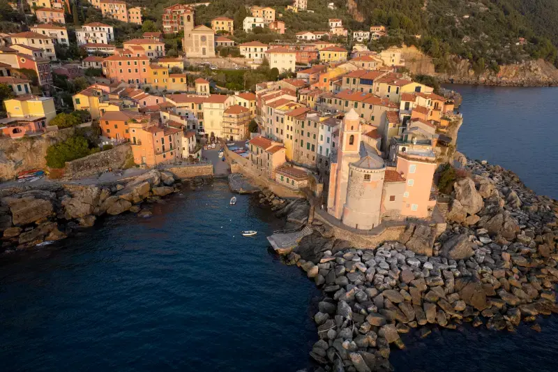
    Tellaro: Stone Alleys and Sea Views on the Edge of the Gulf. Tellaro is a compact stone village perched at the eastern edge of the Gulf of Poets. This guide is designed for travellers who would rather understand how a place works than rush between pretty photographs. The route, setting and attractions all deserve their own time, and the most useful plan is often a short list of worthwhile stops with room left for the unexpected.

    The aim is to explain what is genuinely worth seeing, where to stay, how to reach the place and how to avoid awkward transfers. Opening hours, rail and bus timetables, trail restrictions, entrance fees and seasonal facilities can change. Information researched in October 2026 should be checked again before travel, especially for journeys in 2028.

    Planning more than Tellaro? The Liguria travel guide compares the main areas and helps you put this stop into a manageable route.

    At a glance

    Settinga compact stone village perched at the eastern edge of the Gulf of Poets
    Getting thereArrive via Lerici by local bus, taxi or car where permitted; do not rely on unrestricted parking near the historic centre.
    Where to sleepLerici or nearby Fiascherino is usually a more convenient overnight base than the tiny historic core.
    Best lengthOne relaxed day for a first visit; add another day for the wider coast or inland countryside.
    Best seasonSpring and autumn are comfortable for walking; summer suits people who prioritise swimming and longer evenings.
    Before you goTellaro is steep and largely pedestrian; choose footwear for steps and avoid treating the rocks as a safe swimming platform.

    What makes Tellaro different

    Many itineraries treat Liguria as one unbroken chain of beaches and coloured buildings. In practice, the geography shapes every day: trains run along the main coast, headlands interrupt simple walks, historic centres climb above the sea, and villages just a few kilometres apart can take a surprisingly long time to connect. Tellaro rewards an itinerary that starts with its own identity rather than using it as a quick detour from a more famous postcard location.

    Begin by reading the street layout: where does the settlement face the water, where do the older buildings cluster, and which direction leads up toward residential lanes or natural scenery? That simple observation is often more useful than a checklist of ten monuments. If you have a full day, plan one substantial cultural stop, a slower neighbourhood walk and a generous pause for food. Make the optional excursion conditional on weather, transport and energy.
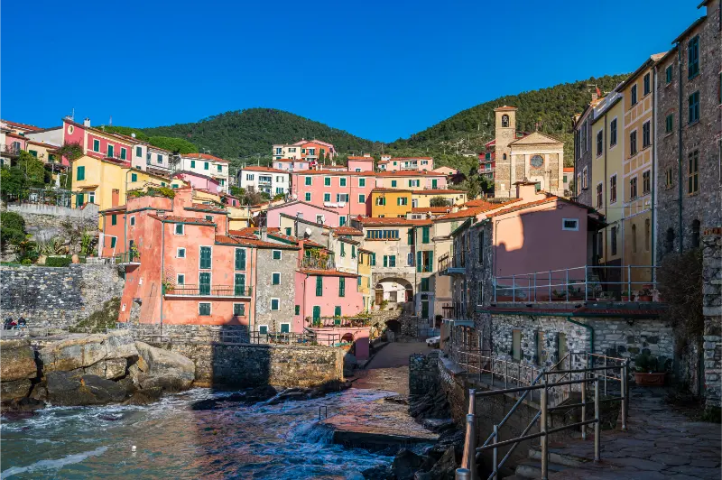
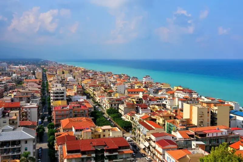
    Village Tellaro Italy

    Essential sights and experiences

    Church of San Giorgio

    The small church stands directly above the waves and forms the village’s most recognisable silhouette. It is worth approaching this stop as part of the wider fabric of Tellaro, not as a photograph to collect and leave. Notice the surrounding streets, views or daily routines and allow enough time to move through the area without rushing. In peak months, arrive earlier for cooler walking and less congestion; in the quieter seasons, confirm whether any interior attraction is actually open.

    Practical tip: connect this visit with the next stop geographically rather than automatically returning to the station. If the site is uphill, check the gradient before committing; if it is on the coast, consider wind and sea conditions. Photography, accessibility and opening permissions are not identical at public viewpoints, churches, gardens and private buildings. Respect posted rules, residents and any protected areas.

    Sea-facing alleys

    Short lanes, arches and stairways repeatedly open onto coastal viewpoints, but many are uneven. It is worth approaching this stop as part of the wider fabric of Tellaro, not as a photograph to collect and leave. Notice the surrounding streets, views or daily routines and allow enough time to move through the area without rushing. In peak months, arrive earlier for cooler walking and less congestion; in the quieter seasons, confirm whether any interior attraction is actually open.

    Practical tip: connect this visit with the next stop geographically rather than automatically returning to the station. If the site is uphill, check the gradient before committing; if it is on the coast, consider wind and sea conditions. Photography, accessibility and opening permissions are not identical at public viewpoints, churches, gardens and private buildings. Respect posted rules, residents and any protected areas.

    Harbour steps

    The little landing place rewards an unhurried look at fishing traditions rather than an expectation of a large beach. It is worth approaching this stop as part of the wider fabric of Tellaro, not as a photograph to collect and leave. Notice the surrounding streets, views or daily routines and allow enough time to move through the area without rushing. In peak months, arrive earlier for cooler walking and less congestion; in the quieter seasons, confirm whether any interior attraction is actually open.

    Practical tip: connect this visit with the next stop geographically rather than automatically returning to the station. If the site is uphill, check the gradient before committing; if it is on the coast, consider wind and sea conditions. Photography, accessibility and opening permissions are not identical at public viewpoints, churches, gardens and private buildings. Respect posted rules, residents and any protected areas.

    Fiascherino coves

    Small beaches nearby can turn the cultural stroll into a swimming day, depending on sea and weather. It is worth approaching this stop as part of the wider fabric of Tellaro, not as a photograph to collect and leave. Notice the surrounding streets, views or daily routines and allow enough time to move through the area without rushing. In peak months, arrive earlier for cooler walking and less congestion; in the quieter seasons, confirm whether any interior attraction is actually open.

    Practical tip: connect this visit with the next stop geographically rather than automatically returning to the station. If the site is uphill, check the gradient before committing; if it is on the coast, consider wind and sea conditions. Photography, accessibility and opening permissions are not identical at public viewpoints, churches, gardens and private buildings. Respect posted rules, residents and any protected areas.

    Village legends

    Local stories surrounding an octopus warning of danger are folklore, not verified historical events. It is worth approaching this stop as part of the wider fabric of Tellaro, not as a photograph to collect and leave. Notice the surrounding streets, views or daily routines and allow enough time to move through the area without rushing. In peak months, arrive earlier for cooler walking and less congestion; in the quieter seasons, confirm whether any interior attraction is actually open.

    Practical tip: connect this visit with the next stop geographically rather than automatically returning to the station. If the site is uphill, check the gradient before committing; if it is on the coast, consider wind and sea conditions. Photography, accessibility and opening permissions are not identical at public viewpoints, churches, gardens and private buildings. Respect posted rules, residents and any protected areas.

    Lerici Castle

    The larger town makes a sensible second stop for a castle panorama and restaurant options. It is worth approaching this stop as part of the wider fabric of Tellaro, not as a photograph to collect and leave. Notice the surrounding streets, views or daily routines and allow enough time to move through the area without rushing. In peak months, arrive earlier for cooler walking and less congestion; in the quieter seasons, confirm whether any interior attraction is actually open.

    Practical tip: connect this visit with the next stop geographically rather than automatically returning to the station. If the site is uphill, check the gradient before committing; if it is on the coast, consider wind and sea conditions. Photography, accessibility and opening permissions are not identical at public viewpoints, churches, gardens and private buildings. Respect posted rules, residents and any protected areas.

    An easy one-day itinerary

    Start after breakfast rather than arriving at lunchtime. Arrive via Lerici by local bus, taxi or car where permitted; do not rely on unrestricted parking near the historic centre. On reaching the centre, get your bearings before taking on the main cultural or scenic attraction. Reserve the late morning for Church of San Giorgio and nearby streets, since it sets the character of the visit. The goal is to keep the morning concentrated in one area rather than travelling back and forth.

    Choose a relaxed lunch and then visit Sea-facing alleys or Harbour steps, depending on the weather and what is open. Leave room for a café, a small shop or a shaded rest, especially in summer. Toward evening, use Fiascherino coves or an easy waterfront viewpoint as the final stop. If return buses are infrequent, work backward from the last reliable connection rather than extending dinner without a plan.

    How to spend two days without overplanning

    An overnight stay changes the experience: quiet morning light, a slower dinner and time to explore outside the most visited streets can be more memorable than adding two new destinations. On the first day follow the central circuit and linger over the most significant sights. On the second, choose either the surrounding countryside or the nearby coast. This approach avoids combining steep village streets, a long hike and a beach afternoon into a single tiring schedule.

    For a gentler second day, begin with Village legends and extend the visit only if conditions suit. Alternatively, make Lerici Castle the day’s focus. Do not treat a local bus as a guaranteed hourly service or a summer ferry as permanent public transport. Check the outward journey and the return before setting off, and keep a realistic backup such as a shorter walk or local museum.

    Where to stay and how to choose your base

    Lerici or nearby Fiascherino is usually a more convenient overnight base than the tiny historic core. The best accommodation is not automatically the one nearest the sea on a map. Look at the route from the station, the final climb with luggage, noise from busy roads, and whether restaurants stay open in the month you plan to travel. A centrally located guesthouse may beat a panoramic room that requires a long uphill walk after dinner.

    Visitors spending several days in Liguria should decide whether to change hotels or use one rail-connected base. Staying in a larger coastal town often gives more flexible transport, while a village overnight can create a quieter experience after day visitors have gone. If travelling as a family or with limited mobility, check lifts, stairs, hotel entrances and the precise distance to the nearest usable public-transport stop before booking.

    Transport, walking and accessibility

    Arrive via Lerici by local bus, taxi or car where permitted; do not rely on unrestricted parking near the historic centre. Ticketing, stops and connection patterns can change, so use current operator information for the exact date. Regional trains are particularly helpful along the Riviera, while smaller hill villages need additional ground transport. Driving can be useful in rural areas but difficult in restricted historic centres; check ZTL zones and parking rules before entering a village.

    Tellaro is steep and largely pedestrian; choose footwear for steps and avoid treating the rocks as a safe swimming platform. The apparent simplicity of a coastal map is misleading: there may be tunnels, stairs, railway crossings or streets that descend sharply toward the sea. For a stroller or wheelchair, distinguish a level seafront walk from the actual route to a monument or hilltop district. Ask accommodation providers about real door-to-door access rather than relying on a generic “central location” description.

    Food and the local rhythm

    A light seafood lunch or focaccia from the wider Lerici area is easier to plan than relying on many village restaurants. Regional cooking follows the seasons and varies between fishing harbours, agricultural valleys and larger city markets. A good meal does not have to be elaborate: a bakery stop and a sit-down dinner can tell different stories about the place. In small villages, restaurant options may be few, while popular beachfront addresses can require reservations on summer weekends.

    Look for seasonal produce and menus that reflect the area rather than assuming all Ligurian food revolves around pesto. Local olive oil, herbs, vegetable pies, farinata, fresh pasta and fish each have their own traditions. If you have allergies or dietary restrictions, ask directly about ingredients, including nuts, seafood and dairy; translations on informal menus may be incomplete.

    Best time to visit: seasons and practical trade-offs

    Late spring brings greenery and often comfortable conditions for steep streets or coastal walks. Summer has longer evenings and the strongest beach atmosphere, but also higher accommodation demand, brighter midday sun and pressure on narrow roads. Early autumn can be an excellent balance, although rain or rough seas may affect outdoor plans. Winter favours museums, architecture and a quieter pace, with more limited visitor facilities in smaller settlements.

    Plan by activity rather than merely by month. For beach-focused trips, confirm that bathing areas and beach services operate when you arrive. For hikes, review official trail notices after storms and use footwear suited to uneven ground. For religious sites, distinguish tourist entry from service times. For cultural events, always consult the organiser’s current programme: an annual festival does not imply identical dates every year.

    Families, slow travellers and common mistakes

    For families, choose one main activity in each half-day and leave space for shade, water and snacks. Children often enjoy short harbour walks and gardens more than a string of church interiors, while older travellers may value a clear route with plenty of places to sit. Check toilets and shade before setting off, particularly on coastal paths where facilities can be intermittent. A child-friendly beach does not necessarily mean a safe sea on a windy day.

    The most common mistake is trying to cover the entire Riviera in one day: a succession of quick stops loses the character of each town. Another is trusting a straight-line map distance rather than the real walking route. Finally, avoid leaving accommodation, parking or access rules to chance in high season. Make bookings where they are needed, but keep your sightseeing order flexible when weather or opening arrangements change.

    Extend the trip: useful Liguria connections

    Use these already published guides as practical complements, not as an instruction to visit all four destinations during the same holiday. Choose the part of the coast that best matches your interests, budget and travel time. Rail connections often make day trips easier than changing accommodation repeatedly, especially when you carry luggage.

    Official information and booking

    Check the official tourism portal for local information, and consult Trenitalia for railway planning. These are starting points, not guarantees that every attraction, ferry or trail is operating. Recheck access, prices and regulations close to departure; this guide was prepared in October 2026 for later publication.

    Frequently asked questions

    Is Tellaro worth visiting for one day?

    Yes, provided you give the centre and its signature sights adequate time. A slower one-day visit is generally more enjoyable than trying to combine several distant villages.

    How do I get to Tellaro without a car?

    Arrive via Lerici by local bus, taxi or car where permitted; do not rely on unrestricted parking near the historic centre.

    Where should I stay?

    Lerici or nearby Fiascherino is usually a more convenient overnight base than the tiny historic core.

    Is Tellaro suitable for families?

    Often yes, especially with a short central route and rest stops. Check steps, gradients, bathing conditions and suitable facilities for the age and mobility needs of your group.

    When is the best season to go?

    Spring and early autumn tend to suit walking and sightseeing; summer suits beach plans. Always verify seasonal services and access for your particular dates.

    Last updated: October 17, 2026
  • Lerici: Castles, Beaches and Quiet Corners of the Gulf of Poets

    Lerici: Castles, Beaches and Quiet Corners of the Gulf of Poets

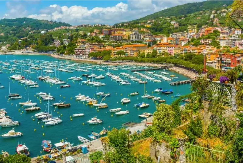
    Lerici: Castles, Beaches and Quiet Corners of the Gulf of Poets. Lerici is a harbour town on the eastern side of the Gulf of Poets. This guide is designed for travellers who would rather understand how a place works than rush between pretty photographs. The route, setting and attractions all deserve their own time, and the most useful plan is often a short list of worthwhile stops with room left for the unexpected.

    The aim is to explain what is genuinely worth seeing, where to stay, how to reach the place and how to avoid awkward transfers. Opening hours, rail and bus timetables, trail restrictions, entrance fees and seasonal facilities can change. Information researched in October 2026 should be checked again before travel, especially for journeys in 2028.

    To see where Lerici fits into a wider Liguria itinerary, use our Liguria travel guide for transport, bases and possible neighbouring stops.

    At a glance

    Settinga harbour town on the eastern side of the Gulf of Poets
    Getting thereReach La Spezia by rail, then use a local bus or seasonal boat; verify connections rather than assuming every ferry runs daily.
    Where to sleepThe compact Lerici waterfront suits a slow visit; San Terenzo offers another sea-facing base.
    Best lengthOne relaxed day for a first visit; add another day for the wider coast or inland countryside.
    Best seasonSpring and autumn are comfortable for walking; summer suits people who prioritise swimming and longer evenings.
    Before you goCoastal paths involve gradients and steps; ferries are seasonal and weather dependent.

    What makes Lerici different

    Many itineraries treat Liguria as one unbroken chain of beaches and coloured buildings. In practice, the geography shapes every day: trains run along the main coast, headlands interrupt simple walks, historic centres climb above the sea, and villages just a few kilometres apart can take a surprisingly long time to connect. Lerici rewards an itinerary that starts with its own identity rather than using it as a quick detour from a more famous postcard location.

    Begin by reading the street layout: where does the settlement face the water, where do the older buildings cluster, and which direction leads up toward residential lanes or natural scenery? That simple observation is often more useful than a checklist of ten monuments. If you have a full day, plan one substantial cultural stop, a slower neighbourhood walk and a generous pause for food. Make the optional excursion conditional on weather, transport and energy.

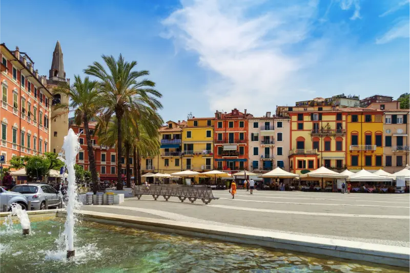
    Central Square City Lerici Italy

    Essential sights and experiences

    Lerici Castle

    The fortress crowns the headland above the harbour, and its terraces frame the gulf; check access before climbing. It is worth approaching this stop as part of the wider fabric of Lerici, not as a photograph to collect and leave. Notice the surrounding streets, views or daily routines and allow enough time to move through the area without rushing. In peak months, arrive earlier for cooler walking and less congestion; in the quieter seasons, confirm whether any interior attraction is actually open.

    Practical tip: connect this visit with the next stop geographically rather than automatically returning to the station. If the site is uphill, check the gradient before committing; if it is on the coast, consider wind and sea conditions. Photography, accessibility and opening permissions are not identical at public viewpoints, churches, gardens and private buildings. Respect posted rules, residents and any protected areas.

    San Terenzo

    The neighbouring village has a sandy bay, a castle near the shore and a literary connection with Percy and Mary Shelley. It is worth approaching this stop as part of the wider fabric of Lerici, not as a photograph to collect and leave. Notice the surrounding streets, views or daily routines and allow enough time to move through the area without rushing. In peak months, arrive earlier for cooler walking and less congestion; in the quieter seasons, confirm whether any interior attraction is actually open.

    Practical tip: connect this visit with the next stop geographically rather than automatically returning to the station. If the site is uphill, check the gradient before committing; if it is on the coast, consider wind and sea conditions. Photography, accessibility and opening permissions are not identical at public viewpoints, churches, gardens and private buildings. Respect posted rules, residents and any protected areas.

    Venere Azzurra

    This larger beach lies between Lerici and San Terenzo; check beach concessions and free sections before choosing a spot. It is worth approaching this stop as part of the wider fabric of Lerici, not as a photograph to collect and leave. Notice the surrounding streets, views or daily routines and allow enough time to move through the area without rushing. In peak months, arrive earlier for cooler walking and less congestion; in the quieter seasons, confirm whether any interior attraction is actually open.

    Practical tip: connect this visit with the next stop geographically rather than automatically returning to the station. If the site is uphill, check the gradient before committing; if it is on the coast, consider wind and sea conditions. Photography, accessibility and opening permissions are not identical at public viewpoints, churches, gardens and private buildings. Respect posted rules, residents and any protected areas.

    Fiascherino

    Small coves and a wooded coast offer a quieter contrast to the main promenade; access and parking can be awkward. It is worth approaching this stop as part of the wider fabric of Lerici, not as a photograph to collect and leave. Notice the surrounding streets, views or daily routines and allow enough time to move through the area without rushing. In peak months, arrive earlier for cooler walking and less congestion; in the quieter seasons, confirm whether any interior attraction is actually open.

    Practical tip: connect this visit with the next stop geographically rather than automatically returning to the station. If the site is uphill, check the gradient before committing; if it is on the coast, consider wind and sea conditions. Photography, accessibility and opening permissions are not identical at public viewpoints, churches, gardens and private buildings. Respect posted rules, residents and any protected areas.

    Harbour lanes

    The arc of buildings around the boats is best appreciated on foot, early or late in the day. It is worth approaching this stop as part of the wider fabric of Lerici, not as a photograph to collect and leave. Notice the surrounding streets, views or daily routines and allow enough time to move through the area without rushing. In peak months, arrive earlier for cooler walking and less congestion; in the quieter seasons, confirm whether any interior attraction is actually open.

    Practical tip: connect this visit with the next stop geographically rather than automatically returning to the station. If the site is uphill, check the gradient before committing; if it is on the coast, consider wind and sea conditions. Photography, accessibility and opening permissions are not identical at public viewpoints, churches, gardens and private buildings. Respect posted rules, residents and any protected areas.

    Tellaro

    The cliff-side village makes a natural follow-on, though narrow roads and seasonal buses require planning. It is worth approaching this stop as part of the wider fabric of Lerici, not as a photograph to collect and leave. Notice the surrounding streets, views or daily routines and allow enough time to move through the area without rushing. In peak months, arrive earlier for cooler walking and less congestion; in the quieter seasons, confirm whether any interior attraction is actually open.

    Practical tip: connect this visit with the next stop geographically rather than automatically returning to the station. If the site is uphill, check the gradient before committing; if it is on the coast, consider wind and sea conditions. Photography, accessibility and opening permissions are not identical at public viewpoints, churches, gardens and private buildings. Respect posted rules, residents and any protected areas.

    An easy one-day itinerary

    Start after breakfast rather than arriving at lunchtime. Reach La Spezia by rail, then use a local bus or seasonal boat; verify connections rather than assuming every ferry runs daily. On reaching the centre, get your bearings before taking on the main cultural or scenic attraction. Reserve the late morning for Lerici Castle and nearby streets, since it sets the character of the visit. The goal is to keep the morning concentrated in one area rather than travelling back and forth.

    Choose a relaxed lunch and then visit San Terenzo or Venere Azzurra, depending on the weather and what is open. Leave room for a café, a small shop or a shaded rest, especially in summer. Toward evening, use Fiascherino or an easy waterfront viewpoint as the final stop. If return buses are infrequent, work backward from the last reliable connection rather than extending dinner without a plan.

    How to spend two days without overplanning

    An overnight stay changes the experience: quiet morning light, a slower dinner and time to explore outside the most visited streets can be more memorable than adding two new destinations. On the first day follow the central circuit and linger over the most significant sights. On the second, choose either the surrounding countryside or the nearby coast. This approach avoids combining steep village streets, a long hike and a beach afternoon into a single tiring schedule.

    For a gentler second day, begin with Harbour lanes and extend the visit only if conditions suit. Alternatively, make Tellaro the day’s focus. Do not treat a local bus as a guaranteed hourly service or a summer ferry as permanent public transport. Check the outward journey and the return before setting off, and keep a realistic backup such as a shorter walk or local museum.

    Where to stay and how to choose your base

    The compact Lerici waterfront suits a slow visit; San Terenzo offers another sea-facing base. The best accommodation is not automatically the one nearest the sea on a map. Look at the route from the station, the final climb with luggage, noise from busy roads, and whether restaurants stay open in the month you plan to travel. A centrally located guesthouse may beat a panoramic room that requires a long uphill walk after dinner.

    Visitors spending several days in Liguria should decide whether to change hotels or use one rail-connected base. Staying in a larger coastal town often gives more flexible transport, while a village overnight can create a quieter experience after day visitors have gone. If travelling as a family or with limited mobility, check lifts, stairs, hotel entrances and the precise distance to the nearest usable public-transport stop before booking.

    Transport, walking and accessibility

    Reach La Spezia by rail, then use a local bus or seasonal boat; verify connections rather than assuming every ferry runs daily. Ticketing, stops and connection patterns can change, so use current operator information for the exact date. Regional trains are particularly helpful along the Riviera, while smaller hill villages need additional ground transport. Driving can be useful in rural areas but difficult in restricted historic centres; check ZTL zones and parking rules before entering a village.

    Coastal paths involve gradients and steps; ferries are seasonal and weather dependent. The apparent simplicity of a coastal map is misleading: there may be tunnels, stairs, railway crossings or streets that descend sharply toward the sea. For a stroller or wheelchair, distinguish a level seafront walk from the actual route to a monument or hilltop district. Ask accommodation providers about real door-to-door access rather than relying on a generic “central location” description.

    Food and the local rhythm

    Seafood, focaccia and Ligurian vegetable dishes are practical choices; menus and availability vary. Regional cooking follows the seasons and varies between fishing harbours, agricultural valleys and larger city markets. A good meal does not have to be elaborate: a bakery stop and a sit-down dinner can tell different stories about the place. In small villages, restaurant options may be few, while popular beachfront addresses can require reservations on summer weekends.

    Look for seasonal produce and menus that reflect the area rather than assuming all Ligurian food revolves around pesto. Local olive oil, herbs, vegetable pies, farinata, fresh pasta and fish each have their own traditions. If you have allergies or dietary restrictions, ask directly about ingredients, including nuts, seafood and dairy; translations on informal menus may be incomplete.

    Best time to visit: seasons and practical trade-offs

    Late spring brings greenery and often comfortable conditions for steep streets or coastal walks. Summer has longer evenings and the strongest beach atmosphere, but also higher accommodation demand, brighter midday sun and pressure on narrow roads. Early autumn can be an excellent balance, although rain or rough seas may affect outdoor plans. Winter favours museums, architecture and a quieter pace, with more limited visitor facilities in smaller settlements.

    Plan by activity rather than merely by month. For beach-focused trips, confirm that bathing areas and beach services operate when you arrive. For hikes, review official trail notices after storms and use footwear suited to uneven ground. For religious sites, distinguish tourist entry from service times. For cultural events, always consult the organiser’s current programme: an annual festival does not imply identical dates every year.

    Families, slow travellers and common mistakes

    For families, choose one main activity in each half-day and leave space for shade, water and snacks. Children often enjoy short harbour walks and gardens more than a string of church interiors, while older travellers may value a clear route with plenty of places to sit. Check toilets and shade before setting off, particularly on coastal paths where facilities can be intermittent. A child-friendly beach does not necessarily mean a safe sea on a windy day.

    The most common mistake is trying to cover the entire Riviera in one day: a succession of quick stops loses the character of each town. Another is trusting a straight-line map distance rather than the real walking route. Finally, avoid leaving accommodation, parking or access rules to chance in high season. Make bookings where they are needed, but keep your sightseeing order flexible when weather or opening arrangements change.

    Extend the trip: useful Liguria connections

    Use these already published guides as practical complements, not as an instruction to visit all four destinations during the same holiday. Choose the part of the coast that best matches your interests, budget and travel time. Rail connections often make day trips easier than changing accommodation repeatedly, especially when you carry luggage.

    Official information and booking

    Check the official tourism portal for local information, and consult Trenitalia for railway planning. These are starting points, not guarantees that every attraction, ferry or trail is operating. Recheck access, prices and regulations close to departure; this guide was prepared in October 2026 for later publication.

    Frequently asked questions

    Is Lerici worth visiting for one day?

    Yes, provided you give the centre and its signature sights adequate time. A slower one-day visit is generally more enjoyable than trying to combine several distant villages.

    How do I get to Lerici without a car?

    Reach La Spezia by rail, then use a local bus or seasonal boat; verify connections rather than assuming every ferry runs daily.

    Where should I stay?

    The compact Lerici waterfront suits a slow visit; San Terenzo offers another sea-facing base.

    Is Lerici suitable for families?

    Often yes, especially with a short central route and rest stops. Check steps, gradients, bathing conditions and suitable facilities for the age and mobility needs of your group.

    When is the best season to go?

    Spring and early autumn tend to suit walking and sightseeing; summer suits beach plans. Always verify seasonal services and access for your particular dates.

    Last updated: October 17, 2026
  • Capo Carbonara Marine Reserve: The Wilder Waters of Villasimius

    Capo Carbonara Marine Reserve: The Wilder Waters of Villasimius

    Capo Carbonara Marine Reserve rewards travellers who plan for the setting rather than simply following the busiest sightseeing checklist. This guide focuses on the individual place, including the approach, what deserves attention once there, practical limits and responsible ways to explore it.

    In Villasimius, south-eastern Sardinia, the best experience is rarely the fastest one. Conditions and access rules matter, and travellers benefit from separating enduring geographical or historical facts from regulations that can change each season. The information below makes that distinction explicit, with an official source to revisit before departure.

    For travel beyond Capo Carbonara Marine Reserve, consult our Sardinia travel guide; it explains how to choose a base and link nearby destinations.

    Plan your visit at a glance

    WhereVillasimius, south-eastern Sardinia
    Time to allowHalf a day for coastal viewpoints; a full day with an authorised marine excursion
    Suggested baseVillasimius or Cagliari
    How to approach itChoose shore access and sea activities based on the protected-area zone map
    Important limitationActivity permissions change between marine zones; diving and anchoring may require authorised operators

    Why the water is protected

    Capo Carbonara is more than a scenic cape near Villasimius. The protected marine area covers a complex system of islands, rocky shores, sandy beaches and underwater habitats where human activity is regulated to conserve biodiversity. The contrast between the busy holiday town and the protected seascape can be striking. A visit works best when you treat the reserve as a living ecosystem with permitted ways to explore it, rather than a limitless area for boats, snorkellers and divers.

    Understand the zones before you book

    Marine protected areas typically divide waters into zones with different rules, and Capo Carbonara is no exception. Navigation, anchoring, fishing, diving and other activities may be allowed in one sector and restricted in another. Consult the current official maps and ask any tour operator about its authorisation and exact route. The fact that someone else is swimming or mooring a boat nearby does not establish permission. Respecting zones protects sensitive seabeds and prevents costly misunderstandings.

    Capo Vaticano Coastal Cliffs Calabria Italy

    What lies around the cape

    The reserve includes the Capo Carbonara promontory, Isola dei Cavoli, Serpentara and underwater shoals of ecological interest. Offshore islands are not general-access playgrounds simply because they are visible from the beach. The coastline also features granite rock, coves and views toward the Villasimius bays. From land, slow exploration of viewpoints can reveal the geography that makes this stretch of Sardinia special. From an authorised boat, the relationship between islands and cape becomes clearer.

    Snorkelling and diving responsibly

    Underwater scenery is a major draw, but marine quality depends on conditions and the choice of location. Pick a qualified, authorised operator if you want a guided diving or snorkelling experience, especially in areas where activity is regulated. Do not touch sea fans, disturb wildlife or remove shells, stones and living organisms. Strong current or limited visibility can turn a beautiful site into an unsafe one. When seas are rough, a coastal walk or village day is a better plan than forcing an excursion.

    Land-based highlights near Villasimius

    Porto Giunco and the nearby Notteri lagoon offer an accessible introduction to the wider landscape, with sea, sand and wetland in close proximity. Flamingos and other birds may be seen in appropriate conditions, but they should be observed from a distance. Some routes towards viewpoints or historic towers contain steep or uneven terrain. Respect barriers and avoid entering fragile dunes. A land-based day does not require a boat ticket and can still communicate why protecting the area matters.

    Why history is part of this coastline

    The strategic position of southern Sardinia has left watchtowers and traces of maritime activity along the coast. Offshore shallows and changing weather also explain why wrecks form part of the local underwater story. That history is fascinating, but wreck sites may be protected and should not be explored casually or used as souvenir sources. Interpretive diving through a responsible operator can add depth to the experience, while shore visitors can appreciate the defensive geography through surviving coastal architecture.

    Combine sea and town sensibly

    Villasimius makes a logical base because accommodation and services are nearby. A satisfying day may start with a viewpoint walk, continue at a suitable beach and finish with dinner in town. If you add an authorised boat trip, allow enough time for the operator’s schedule and avoid stacking several activities that depend on calm water. Travelling from Cagliari is practical for a day trip, but the scenic road and peak-season traffic need a generous margin. Avoid judging trip feasibility solely by distance.

    Preservation begins with small choices

    Choose refillable water containers, remove litter and keep well clear of nesting or roosting wildlife. Do not feed fish to improve photographs and do not rent equipment from an operator who disregards protection rules. On land, use recognised trails and avoid crossing dunes for a shortcut. The reserve is beautiful partly because it preserves conditions that busy tourist coasts can easily lose. A thoughtful visitor leaves the sea and shoreline as undisturbed as possible.

    Getting there without an unrealistic schedule

    For this particular trip, the first planning task is to understand the protected-area zone boundaries and choice of authorised tour. A mapped distance does not tell you the condition of the final approach, the time needed to park, the availability of a guide or the possibility of having to change plans. Check directions to the actual visitor entrance, landing place or legal access path rather than navigating only to the nearest named town. When using a rental vehicle, respect restrictions on unpaved roads and arrange a return journey that does not depend on a last-minute detour.

    If you are staying in Villasimius or Cagliari, look at a full road route and the time of day you expect to travel. Public transport in Sardinia can be useful between larger towns but is not an automatic substitute for the final stage of a rural, beach or protected-site visit. Do not recommend a bus connection until you have checked the current service timetable and the distance from the final stop. Consider a licensed excursion where that genuinely solves a difficult access problem; it is not necessary for every attraction.

    The best time of day and year

    The right visiting window depends less on a generic “best month” than on wind, sea state and activity-specific permissions. For outdoor stops, strong midday sun can make interpretation and walking less enjoyable in July and August. In the shoulder seasons, cooler air can make a longer visit attractive, although services and transport may operate less frequently. For sites that depend on a boat or on staffed admission, a pleasant forecast does not override the booking conditions or the operator’s decision to close.

    Build the plan around daylight and the return trip as much as the main attraction. A late start can leave you rushing the most interesting part of the visit or driving unfamiliar rural roads after dark. Reserve a little unscheduled time for photographs, water, a meal or a change of route. When weather is unstable, have a lower-risk option ready; in Sardinia, the contrast between a sheltered town and an exposed coast or hillside can be substantial even on the same day.

    A sensible half-day or full-day plan

    Start with a confirmed access check, then allow a comfortable arrival margin. Give the main location enough time to justify the journey rather than treating it as a box to tick before driving elsewhere. In practice, this is a coastal nature visit where different marine zones have different limits. After the principal visit, decide whether energy and conditions justify a second stop. Keeping just one optional extra is often better than a rigid route in which a closed gate or changed boat time unravels the afternoon.

    For an easy second stage, consider Porto Giunco, the Notteri lagoon and Villasimius only when it fits the actual road and opening schedule. Pick a meal stop with parking or pedestrian access that you have checked in advance. If access proves impossible, a fallback such as Villasimius and a safe land-based viewpoint should be treated as an alternative experience, not a reason to cross barriers or disregard instructions. A good day trip should finish with time to return safely, not with a scramble to make up for delays.

    Packing, comfort and accessibility

    Shoes should suit the surface you will really cross, whether that means archaeological paving, loose stone, a beach approach or a marked natural trail. Water, sun protection, a charged phone and a small first-aid kit are sensible in most seasons. Carry an offline map when travelling outside towns, and take rubbish back with you. Do not depend on a café or restroom being open merely because an old review mentions it; check seasonal services whenever they matter to your group.

    Accessibility must be judged against a specific route, not the label “easy”. A short path can contain steps, sand, exposed roots or uneven ancient stone. If a companion uses a wheelchair, walking aid or stroller, contact the site or operator about parking, toilets, gradients, adapted entrances and any transport between the car park and destination. For children, agree where to meet and how to stay together. Avoid promising access to sections that have not been confirmed as suitable.

    Costs, tickets and accommodation choices

    Do not budget from an old ticket screenshot or an influencer’s timetable. Some Sardinian attractions use municipal reservations, some have separate guided-visit fees, and others are free to see but costly to reach. Check the official provider for the current charge, what the booking includes, cancellation terms, concessions for children and whether parking is separate. When deciding between two attractions, include transport and lost time in the comparison, not only the admission price.

    For a relaxed stay, Villasimius or Cagliari can be a useful search area, but the right location depends on your wider itinerary. Think about whether you prefer to be close to an early departure point, a town with restaurants or a road connection for the following day. Check your accommodation’s actual parking arrangements and cancellation conditions; do not assume every rural property can be reached easily at night. Staying near the site is worthwhile only if it improves the trip as a whole.

    A respectful visit and what to avoid

    The key local limitation is Activity permissions change between marine zones; diving and anchoring may require authorised operators. Take it seriously even when the attraction looks quiet or there is no one watching. Rules exist for visitor safety, conservation or the privacy of local communities, and they can apply differently on different days. Do not move archaeological stones, enter closed buildings, use unauthorised paths or approach wildlife for a photograph. A responsible visit gives future travellers the chance to encounter the same landscape and heritage.

    Treat social media videos and anonymous map pins as inspiration, not as access instructions. If official guidance has changed, the current operator or authority takes precedence over this article. The most valuable souvenir is an accurate memory of the place: the details you observed, the people you met respectfully and the choices that let the visit go smoothly. Planning and restraint often create a richer experience than a rushed attempt to reach every scenic spot.

    Useful packing and preparation checklist

    • Confirm official access, ticketing and cancellation conditions for your date
    • Check the full route and arrival point, not only the destination name
    • Carry water, appropriate footwear and sun or rain protection
    • Save offline directions and the provider’s contact information
    • Allow a flexible return journey and respect conservation rules

    Frequently asked questions

    Where exactly is this attraction?

    Villasimius, south-eastern Sardinia. Save the official visitor entrance or departure instructions before setting out; a regional map pin may not identify the appropriate approach.

    How long should I set aside?

    Half a day for coastal viewpoints; a full day with an authorised marine excursion. Add travel and parking time separately and leave a margin if access depends on a guide, boat or regulated entrance.

    Do I need to book in advance?

    Rules depend on the season and the operator. Choose shore access and sea activities based on the protected-area zone map. Do not assume that a parking space or third-party purchase automatically confirms admission.

    Can families visit?

    Often yes with the right planning, but assess the route, conditions and facilities for the specific children in your party. Activity permissions change between marine zones; diving and anchoring may require authorised operators.

    What if the weather is bad?

    Change to a safe alternative rather than pushing through restrictions. Consider Villasimius and a safe land-based viewpoint. Check the latest updates before leaving accommodation.

    Can I visit without a car?

    Some visitors can combine local transport and authorised trips, but practical connections vary. Verify the final stage from Villasimius or Cagliari before relying on a no-car itinerary.

    Explore more Sardinia guides

    Place this experience in a realistic wider route using Villasimius on the south-east coast, Cagliari city guide, Sardinia beach selection and Sardinia planning guide. Each link leads to a guide that was already published in the project’s reference database; the destinations and itineraries provide context for this more focused article.

    Official visitor information

    Before your trip, check the responsible official visitor information. Published opening details, admission procedures, marine or wildlife restrictions, and seasonal booking systems may change before a planned visit in 2028. This guide separates lasting character from the details that must be checked again. If you only have time for one final check, make it the official conditions for your exact day.

    Ultimately, the value of Capo Carbonara Marine Reserve lies in noticing what makes the place itself different. Arrive prepared, give the visit unhurried attention and leave room for Sardinia to surprise you without exceeding the limits of the landscape or the people who care for it.

    Last updated: October 17, 2026

  • Fordongianus Roman Baths: Hot Springs and History beside the Tirso

    Fordongianus Roman Baths: Hot Springs and History beside the Tirso

    Fordongianus Roman Baths rewards travellers who plan for the setting rather than simply following the busiest sightseeing checklist. This guide focuses on the individual place, including the approach, what deserves attention once there, practical limits and responsible ways to explore it.

    In Fordongianus in the Tirso valley, inland from Oristano, the best experience is rarely the fastest one. Conditions and access rules matter, and travellers benefit from separating enduring geographical or historical facts from regulations that can change each season. The information below makes that distinction explicit, with an official source to revisit before departure.

    Extend a visit to Fordongianus Roman Baths with the suggestions in our Sardinia travel guide, which covers regional transport and where to base yourself.

    Plan your visit at a glance

    WhereFordongianus in the Tirso valley, inland from Oristano
    Time to allowOne to two hours at the archaeology area, plus a village stop
    Suggested baseOristano or a Barigadu village
    How to approach itArrive during staffed visiting hours; distinguish the ruins from spa services
    Important limitationHistoric thermal water is hot and the archaeological pools are not for bathing

    Why the Romans came here

    The waters at Fordongianus emerge naturally hot, and the Romans developed a thermal establishment in what they knew as Forum Traiani. The site demonstrates how geography influenced ancient settlements: hot springs provided a resource for bathing, health rituals and social life, while the Tirso valley linked inland communities. Unlike a coastal amphitheatre or defensive tower, a bath complex invites visitors to think about daily routines. The remains make sense when viewed as part of a town and its water system.

    What survives in the archaeological zone

    The baths include structural remains of pools, rooms and hydraulic features that reveal engineering as well as social practice. Regional descriptions refer to multiple construction phases and surviving traces of decorations. Look for water channels and the relationships between spaces rather than concentrating only on the most photogenic pool. Some details require interpretation panels or a guide; original roofing and furnishings are not all intact. Do not assume every visible stone basin was used in the same way or at the same temperature.

    Roman Forum Rome Italy

    The difference between a Roman bath and a spa

    The archaeological baths are historic remains, not a public swimming facility. Modern wellness services may exist separately in the area and have their own opening schedules and admission terms. Do not enter ancient basins, touch exposed surfaces unnecessarily or test hot spring water as if it were a paddling pool. Some local waters can reach temperatures unsuitable for contact. If a thermal treatment interests you, investigate a contemporary licensed establishment instead of treating the monument as a wild bathing spot.

    The name Forum Traiani in context

    The Roman settlement became an important contact point between coastal-controlled areas and inland Sardinia. Its history reflects political geography as much as bathing culture. The ancient name is linked with the imperial period, but Roman activity here developed over time. Archaeological layers can include expansions and adaptations, so a modern plan of the baths should not be imagined as a single project finished in one year. Ask how the complex related to the surrounding Roman town and its routes.

    The stone architecture of Fordongianus

    Fordongianus is associated with local trachyte, a stone that gives buildings distinctive red, green and grey tones. The village itself offers a pleasing contrast to the Roman remains, including a historic Aragonese house and religious buildings. An hour exploring its streets can make the trip feel less like a remote excavation stop. Notice how building materials connect the natural landscape with different centuries of human use. These details tell a long history that cannot be captured by the headline word thermal.

    Planning from Oristano

    The location makes Fordongianus a logical inland excursion for travellers staying near Oristano, although road and public transport options must be checked separately. Driving gives the most flexibility if combining multiple Barigadu locations. Verify the exact entrance to the archaeological area rather than navigating only to the town name. A short stop for coffee, a museum or the river landscape can round out the experience, but leave enough time for the baths themselves if a guide is available.

    Photography and interpretation

    Bath remains often look quiet and fragmented in photographs, but they are rich in historical detail. Wide shots establish how the pools sit in the valley; closer views of masonry and surviving surfaces help tell the story of heating and water movement. Never cross fences or stand on fragile ruins to frame an image. Where explanatory panels reconstruct the ancient appearance, distinguish that reconstruction from what is physically visible. This approach produces a more accurate understanding than treating the bath complex as a picturesque modern wellness resort.

    Choosing the right season

    A visit to outdoor archaeological areas can be uncomfortable in the heat of a Sardinian summer afternoon. Spring and autumn are often pleasant for combining a historical stop with an inland drive. In winter, opening hours may shorten and rain can make stone or paths slippery. Bring water and sun protection when needed, but do not assume a large visitor centre will supply everything. Check the current access conditions before committing to a journey specifically for the baths.

    Getting there without an unrealistic schedule

    For this particular trip, the first planning task is to understand the archaeological entrance and the difference between ruins and a modern thermal spa. A mapped distance does not tell you the condition of the final approach, the time needed to park, the availability of a guide or the possibility of having to change plans. Check directions to the actual visitor entrance, landing place or legal access path rather than navigating only to the nearest named town. When using a rental vehicle, respect restrictions on unpaved roads and arrange a return journey that does not depend on a last-minute detour.

    If you are staying in Oristano or a Barigadu village, look at a full road route and the time of day you expect to travel. Public transport in Sardinia can be useful between larger towns but is not an automatic substitute for the final stage of a rural, beach or protected-site visit. Do not recommend a bus connection until you have checked the current service timetable and the distance from the final stop. Consider a licensed excursion where that genuinely solves a difficult access problem; it is not necessary for every attraction.

    The best time of day and year

    The right visiting window depends less on a generic “best month” than on heritage-site openings and outdoor shade. For outdoor stops, strong midday sun can make interpretation and walking less enjoyable in July and August. In the shoulder seasons, cooler air can make a longer visit attractive, although services and transport may operate less frequently. For sites that depend on a boat or on staffed admission, a pleasant forecast does not override the booking conditions or the operator’s decision to close.

    Build the plan around daylight and the return trip as much as the main attraction. A late start can leave you rushing the most interesting part of the visit or driving unfamiliar rural roads after dark. Reserve a little unscheduled time for photographs, water, a meal or a change of route. When weather is unstable, have a lower-risk option ready; in Sardinia, the contrast between a sheltered town and an exposed coast or hillside can be substantial even on the same day.

    A sensible half-day or full-day plan

    Start with a confirmed access check, then allow a comfortable arrival margin. Give the main location enough time to justify the journey rather than treating it as a box to tick before driving elsewhere. In practice, this is a historical visit built around Roman engineering, not a wild swimming stop. After the principal visit, decide whether energy and conditions justify a second stop. Keeping just one optional extra is often better than a rigid route in which a closed gate or changed boat time unravels the afternoon.

    For an easy second stage, consider Fordongianus old town, the Aragonese house and Tirso valley only when it fits the actual road and opening schedule. Pick a meal stop with parking or pedestrian access that you have checked in advance. If access proves impossible, a fallback such as a Fordongianus village walk and another accessible Barigadu attraction should be treated as an alternative experience, not a reason to cross barriers or disregard instructions. A good day trip should finish with time to return safely, not with a scramble to make up for delays.

    Packing, comfort and accessibility

    Shoes should suit the surface you will really cross, whether that means archaeological paving, loose stone, a beach approach or a marked natural trail. Water, sun protection, a charged phone and a small first-aid kit are sensible in most seasons. Carry an offline map when travelling outside towns, and take rubbish back with you. Do not depend on a café or restroom being open merely because an old review mentions it; check seasonal services whenever they matter to your group.

    Accessibility must be judged against a specific route, not the label “easy”. A short path can contain steps, sand, exposed roots or uneven ancient stone. If a companion uses a wheelchair, walking aid or stroller, contact the site or operator about parking, toilets, gradients, adapted entrances and any transport between the car park and destination. For children, agree where to meet and how to stay together. Avoid promising access to sections that have not been confirmed as suitable.

    Costs, tickets and accommodation choices

    Do not budget from an old ticket screenshot or an influencer’s timetable. Some Sardinian attractions use municipal reservations, some have separate guided-visit fees, and others are free to see but costly to reach. Check the official provider for the current charge, what the booking includes, cancellation terms, concessions for children and whether parking is separate. When deciding between two attractions, include transport and lost time in the comparison, not only the admission price.

    For a relaxed stay, Oristano or a Barigadu village can be a useful search area, but the right location depends on your wider itinerary. Think about whether you prefer to be close to an early departure point, a town with restaurants or a road connection for the following day. Check your accommodation’s actual parking arrangements and cancellation conditions; do not assume every rural property can be reached easily at night. Staying near the site is worthwhile only if it improves the trip as a whole.

    A respectful visit and what to avoid

    The key local limitation is Historic thermal water is hot and the archaeological pools are not for bathing. Take it seriously even when the attraction looks quiet or there is no one watching. Rules exist for visitor safety, conservation or the privacy of local communities, and they can apply differently on different days. Do not move archaeological stones, enter closed buildings, use unauthorised paths or approach wildlife for a photograph. A responsible visit gives future travellers the chance to encounter the same landscape and heritage.

    Treat social media videos and anonymous map pins as inspiration, not as access instructions. If official guidance has changed, the current operator or authority takes precedence over this article. The most valuable souvenir is an accurate memory of the place: the details you observed, the people you met respectfully and the choices that let the visit go smoothly. Planning and restraint often create a richer experience than a rushed attempt to reach every scenic spot.

    Useful packing and preparation checklist

    • Confirm official access, ticketing and cancellation conditions for your date
    • Check the full route and arrival point, not only the destination name
    • Carry water, appropriate footwear and sun or rain protection
    • Save offline directions and the provider’s contact information
    • Allow a flexible return journey and respect conservation rules

    Frequently asked questions

    Where exactly is this attraction?

    Fordongianus in the Tirso valley, inland from Oristano. Save the official visitor entrance or departure instructions before setting out; a regional map pin may not identify the appropriate approach.

    How long should I set aside?

    One to two hours at the archaeology area, plus a village stop. Add travel and parking time separately and leave a margin if access depends on a guide, boat or regulated entrance.

    Do I need to book in advance?

    Rules depend on the season and the operator. Arrive during staffed visiting hours; distinguish the ruins from spa services. Do not assume that a parking space or third-party purchase automatically confirms admission.

    Can families visit?

    Often yes with the right planning, but assess the route, conditions and facilities for the specific children in your party. Historic thermal water is hot and the archaeological pools are not for bathing.

    What if the weather is bad?

    Change to a safe alternative rather than pushing through restrictions. Consider a Fordongianus village walk and another accessible Barigadu attraction. Check the latest updates before leaving accommodation.

    Can I visit without a car?

    Some visitors can combine local transport and authorised trips, but practical connections vary. Verify the final stage from Oristano or a Barigadu village before relying on a no-car itinerary.

    Explore more Sardinia guides

    Place this experience in a realistic wider route using Oristano and the Sinis peninsula, Su Nuraxi at Barumini, Sardinia planning guide and best things to do in Sardinia. Each link leads to a guide that was already published in the project’s reference database; the destinations and itineraries provide context for this more focused article.

    Official visitor information

    Before your trip, check the responsible official visitor information. Published opening details, admission procedures, marine or wildlife restrictions, and seasonal booking systems may change before a planned visit in 2028. This guide separates lasting character from the details that must be checked again. If you only have time for one final check, make it the official conditions for your exact day.

    Ultimately, the value of Fordongianus Roman Baths lies in noticing what makes the place itself different. Arrive prepared, give the visit unhurried attention and leave room for Sardinia to surprise you without exceeding the limits of the landscape or the people who care for it.

    Last updated: October 17, 2026

  • Tavolara Island: Ferries, Beaches and a Mountain Rising from the Sea

    Tavolara Island: Ferries, Beaches and a Mountain Rising from the Sea

    Tavolara Island rewards travellers who plan for the setting rather than simply following the busiest sightseeing checklist. This guide focuses on the individual place, including the approach, what deserves attention once there, practical limits and responsible ways to explore it.

    In Off Porto San Paolo, north-eastern Sardinia, the best experience is rarely the fastest one. Conditions and access rules matter, and travellers benefit from separating enduring geographical or historical facts from regulations that can change each season. The information below makes that distinction explicit, with an official source to revisit before departure.

    Our Sardinia travel guide places Tavolara Island in the context of the wider region, including travel times and alternative bases.

    Plan your visit at a glance

    WhereOff Porto San Paolo, north-eastern Sardinia
    Time to allowMost of a day if taking a boat and enjoying the beach
    Suggested basePorto San Paolo, Olbia or San Teodoro
    How to approach itCheck authorised boat departures, return times and sea conditions
    Important limitationMarine protected area, restricted land and hazardous mountain routes

    The mountain that changes the horizon

    Tavolara rises abruptly from the sea as a vast limestone mass near Olbia. Its steep sides create a powerful impression from Porto San Paolo, and the island looks surprisingly different once you land on its more accessible western end. The contrast is the point: a tiny settlement and sandy landing area sit beneath a mountain that cannot be treated as an ordinary beach backdrop. This is one of north-eastern Sardinia’s most distinctive day trips because geology shapes every part of the experience.

    Where boats leave and what to book

    Porto San Paolo is the classic departure point, and operators may offer different combinations of landing, coastal cruise and snorkelling. Read the product description carefully: seeing Tavolara from a boat is not the same as having time ashore. Ask about the correct meeting pier, return schedule, luggage policy and the operator’s weather cancellation terms. Sea conditions can change quickly, and the smallest vessel may not be the most suitable choice for every family. Never assume a sightseeing cruise includes unrestricted access to private or protected parts of the island.

    Sardinia Holidays Azure Sea Island Tavolara Italy

    Spalmatore di Terra is the visitor focus

    The low western area called Spalmatore di Terra has the principal landing place, small beaches and seasonal services. A typical beach-oriented visitor will spend much of the day here rather than attempt to circumnavigate the island on foot. The narrow shore can feel busy when several boats arrive together, so set out with realistic expectations. Check the location and operating season of food services and take enough water to be independent if they are closed.

    The kingdom story is part of local identity

    Tavolara is celebrated in local stories as one of the world’s smallest kingdoms, connected with the Bertoleoni family and an encounter with the House of Savoy. It is an appealing narrative, but it should be described as local history and tradition rather than an internationally recognised sovereign state. The story adds a human dimension to a dramatic natural place. Visitors can enjoy it while respecting the privacy of residents and avoiding photography of homes or work areas without permission.

    A protected sea is not an open playground

    Tavolara lies within the Tavolara–Punta Coda Cavallo marine protected area, which uses different zones and controls for activities. Rules for anchoring, diving, fishing and navigation may differ by location and operator authorisation. That means you should ask exactly where a snorkelling excursion takes place rather than assuming the whole coastline is open to any activity. Do not handle marine wildlife, collect organisms or drop anchor independently without checking permission. The richness of the underwater environment depends on restraint.

    Why the summit is not a casual hike

    The sheer mountain attracts adventurous visitors, but reaching high ground is fundamentally different from following a beach path. Exposed scrambling and routes requiring specialist support should never be suggested to someone arriving on a simple ferry ticket. If you are interested in mountaineering, research current authorised guided options and assess fitness, exposure and weather independently. For the ordinary day trip, the best approach is to admire the cliffs from below and enjoy the light moving across them.

    What to do on a windy day

    Wind can alter both boat comfort and what is possible in the water. Ask the operator about forecast conditions before travelling to the pier, and have a mainland alternative ready if the trip is cancelled. A different beach near San Teodoro or a visit to Olbia may be more sensible than improvising a risky private crossing. Even on a calm morning, respect the return departure time; missing the last boat would create an unnecessary problem on an island with limited visitor infrastructure.

    Build a day that does not feel rushed

    Plan one boat journey, time on the landing-side beach and, where suitable, a guided marine activity rather than cramming Tavolara into an already crowded driving day. Bring reef-conscious sun protection, a reusable water bottle and footwear for mixed sand and rock. Choose accommodation in Porto San Paolo if you want a relaxed early departure, or use Olbia for broader transport links. A well-planned trip balances close-up shoreline details with the magnificent mountain view from the sea.

    Getting there without an unrealistic schedule

    For this particular trip, the first planning task is to understand boat operator instructions, the landing point and the final return departure. A mapped distance does not tell you the condition of the final approach, the time needed to park, the availability of a guide or the possibility of having to change plans. Check directions to the actual visitor entrance, landing place or legal access path rather than navigating only to the nearest named town. When using a rental vehicle, respect restrictions on unpaved roads and arrange a return journey that does not depend on a last-minute detour.

    If you are staying in Porto San Paolo, Olbia or San Teodoro, look at a full road route and the time of day you expect to travel. Public transport in Sardinia can be useful between larger towns but is not an automatic substitute for the final stage of a rural, beach or protected-site visit. Do not recommend a bus connection until you have checked the current service timetable and the distance from the final stop. Consider a licensed excursion where that genuinely solves a difficult access problem; it is not necessary for every attraction.

    The best time of day and year

    The right visiting window depends less on a generic “best month” than on sea state, marine-zone rules and ferry reliability. For outdoor stops, strong midday sun can make interpretation and walking less enjoyable in July and August. In the shoulder seasons, cooler air can make a longer visit attractive, although services and transport may operate less frequently. For sites that depend on a boat or on staffed admission, a pleasant forecast does not override the booking conditions or the operator’s decision to close.

    Build the plan around daylight and the return trip as much as the main attraction. A late start can leave you rushing the most interesting part of the visit or driving unfamiliar rural roads after dark. Reserve a little unscheduled time for photographs, water, a meal or a change of route. When weather is unstable, have a lower-risk option ready; in Sardinia, the contrast between a sheltered town and an exposed coast or hillside can be substantial even on the same day.

    A sensible half-day or full-day plan

    Start with a confirmed access check, then allow a comfortable arrival margin. Give the main location enough time to justify the journey rather than treating it as a box to tick before driving elsewhere. In practice, this is an island day where independent mountain hiking is not an appropriate add-on. After the principal visit, decide whether energy and conditions justify a second stop. Keeping just one optional extra is often better than a rigid route in which a closed gate or changed boat time unravels the afternoon.

    For an easy second stage, consider Porto San Paolo, Molara and the protected Punta Coda Cavallo coast only when it fits the actual road and opening schedule. Pick a meal stop with parking or pedestrian access that you have checked in advance. If access proves impossible, a fallback such as a mainland coastal outing near Porto San Paolo or Olbia should be treated as an alternative experience, not a reason to cross barriers or disregard instructions. A good day trip should finish with time to return safely, not with a scramble to make up for delays.

    Packing, comfort and accessibility

    Shoes should suit the surface you will really cross, whether that means archaeological paving, loose stone, a beach approach or a marked natural trail. Water, sun protection, a charged phone and a small first-aid kit are sensible in most seasons. Carry an offline map when travelling outside towns, and take rubbish back with you. Do not depend on a café or restroom being open merely because an old review mentions it; check seasonal services whenever they matter to your group.

    Accessibility must be judged against a specific route, not the label “easy”. A short path can contain steps, sand, exposed roots or uneven ancient stone. If a companion uses a wheelchair, walking aid or stroller, contact the site or operator about parking, toilets, gradients, adapted entrances and any transport between the car park and destination. For children, agree where to meet and how to stay together. Avoid promising access to sections that have not been confirmed as suitable.

    Costs, tickets and accommodation choices

    Do not budget from an old ticket screenshot or an influencer’s timetable. Some Sardinian attractions use municipal reservations, some have separate guided-visit fees, and others are free to see but costly to reach. Check the official provider for the current charge, what the booking includes, cancellation terms, concessions for children and whether parking is separate. When deciding between two attractions, include transport and lost time in the comparison, not only the admission price.

    For a relaxed stay, Porto San Paolo, Olbia or San Teodoro can be a useful search area, but the right location depends on your wider itinerary. Think about whether you prefer to be close to an early departure point, a town with restaurants or a road connection for the following day. Check your accommodation’s actual parking arrangements and cancellation conditions; do not assume every rural property can be reached easily at night. Staying near the site is worthwhile only if it improves the trip as a whole.

    A respectful visit and what to avoid

    The key local limitation is Marine protected area, restricted land and hazardous mountain routes. Take it seriously even when the attraction looks quiet or there is no one watching. Rules exist for visitor safety, conservation or the privacy of local communities, and they can apply differently on different days. Do not move archaeological stones, enter closed buildings, use unauthorised paths or approach wildlife for a photograph. A responsible visit gives future travellers the chance to encounter the same landscape and heritage.

    Treat social media videos and anonymous map pins as inspiration, not as access instructions. If official guidance has changed, the current operator or authority takes precedence over this article. The most valuable souvenir is an accurate memory of the place: the details you observed, the people you met respectfully and the choices that let the visit go smoothly. Planning and restraint often create a richer experience than a rushed attempt to reach every scenic spot.

    Useful packing and preparation checklist

    • Confirm official access, ticketing and cancellation conditions for your date
    • Check the full route and arrival point, not only the destination name
    • Carry water, appropriate footwear and sun or rain protection
    • Save offline directions and the provider’s contact information
    • Allow a flexible return journey and respect conservation rules

    Frequently asked questions

    Where exactly is this attraction?

    Off Porto San Paolo, north-eastern Sardinia. Save the official visitor entrance or departure instructions before setting out; a regional map pin may not identify the appropriate approach.

    How long should I set aside?

    Most of a day if taking a boat and enjoying the beach. Add travel and parking time separately and leave a margin if access depends on a guide, boat or regulated entrance.

    Do I need to book in advance?

    Rules depend on the season and the operator. Check authorised boat departures, return times and sea conditions. Do not assume that a parking space or third-party purchase automatically confirms admission.

    Can families visit?

    Often yes with the right planning, but assess the route, conditions and facilities for the specific children in your party. Marine protected area, restricted land and hazardous mountain routes.

    What if the weather is bad?

    Change to a safe alternative rather than pushing through restrictions. Consider a mainland coastal outing near Porto San Paolo or Olbia. Check the latest updates before leaving accommodation.

    Can I visit without a car?

    Some visitors can combine local transport and authorised trips, but practical connections vary. Verify the final stage from Porto San Paolo, Olbia or San Teodoro before relying on a no-car itinerary.

    Explore more Sardinia guides

    Place this experience in a realistic wider route using Olbia city guide, San Teodoro guide, Sardinia planning guide and best things to do in Sardinia. Each link leads to a guide that was already published in the project’s reference database; the destinations and itineraries provide context for this more focused article.

    Official visitor information

    Before your trip, check the responsible official visitor information. Published opening details, admission procedures, marine or wildlife restrictions, and seasonal booking systems may change before a planned visit in 2028. This guide separates lasting character from the details that must be checked again. If you only have time for one final check, make it the official conditions for your exact day.

    Ultimately, the value of Tavolara Island lies in noticing what makes the place itself different. Arrive prepared, give the visit unhurried attention and leave room for Sardinia to surprise you without exceeding the limits of the landscape or the people who care for it.

    Last updated: October 17, 2026
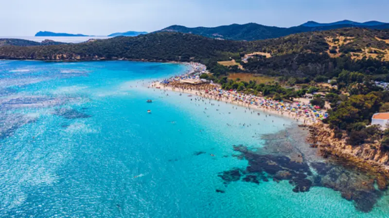
  • Tuerredda Beach: A Booking-Smart Day on Sardinia’s South Coast

    Tuerredda Beach: A Booking-Smart Day on Sardinia’s South Coast

    Tuerredda Beach rewards travellers who plan for the setting rather than simply following the busiest sightseeing checklist. This guide focuses on the individual place, including the approach, what deserves attention once there, practical limits and responsible ways to explore it.

    In Teulada municipality between Capo Malfatano and Capo Spartivento, the best experience is rarely the fastest one. Conditions and access rules matter, and travellers benefit from separating enduring geographical or historical facts from regulations that can change each season. The information below makes that distinction explicit, with an official source to revisit before departure.

    You can pair Tuerredda Beach with other places in Sardinia; the Sardinia travel guide gives an overview of realistic connections and where to stay.

    Plan your visit at a glance

    WhereTeulada municipality between Capo Malfatano and Capo Spartivento
    Time to allowA full beach day, or a shorter carefully timed visit
    Suggested baseTeulada, Chia or Pula; Cagliari for a longer trip
    How to approach itCheck the official reservation process before driving to the beach
    Important limitationAccess rules are seasonal and may change in 2027–2028; never assume walk-in admission

    Why this cove feels different

    Tuerredda sits in a sheltered sweep of the Teulada coast, framed by Mediterranean greenery and a small island offshore. Its fine sand and striking water colour explain the beach’s fame, but those same qualities bring very high demand. The most successful visit begins with realistic expectations about space and access rather than simply arriving with a car full of beach gear. It is possible to appreciate the scene from the surrounding coast even when conditions or visitor limits make a long beach day impractical.

    The reservation issue cannot be ignored

    For the 2026 season, Visit Teulada states that advance online reservations are required during a defined summer window, with a dedicated beach-booking website and an entry procedure. Those are verified 2026 rules, not promises about 2028. Before visiting in a later year, check the current municipal announcement for the dates, eligibility of children, permitted groups, applicable charges and how the QR or ticket must be presented. Never rely on a third-party message offering a guaranteed pass outside the official process.

    Beach di Tuerredda In Sardinia Italy

    How to choose your arrival time

    Even when you have secured the necessary access, coastal approach roads and parking can be busy in high summer. Plan the day around your confirmed entry instructions and allow a buffer for finding the correct parking area. Do not park on vegetation, along prohibited shoulders or across access tracks. For a calm experience, avoid scheduling a strict afternoon appointment elsewhere on the island. A Tuerredda visit can take longer than the map suggests once congestion, beach preparation and the return journey are counted.

    Sand, shade and the small island

    The cove is famous for clear water and a compact offshore island, but its appeal is not permission to ignore local rules. Swim only in safe conditions, avoid crossing boat lanes or protected waters and never push children to reach the island as a personal challenge. Bring sun protection and drinking water: low vegetation by the shore does not necessarily offer usable shade. Where the municipality requires mats beneath towels to protect the sand, comply carefully and carry everything out when leaving.

    Understanding different beach areas

    Commercial services and free beach sectors may operate under different arrangements, which should be checked in the current official notices. Booking a sunbed does not automatically exempt a visitor from every public access rule, and a parking ticket is not the same as a reservation for the beach. Ask the operator what is included before paying. If you seek a quieter stretch, read the signage and respect the separation of access routes rather than inventing a shortcut through dunes and shrubs.

    Good alternatives when it is full

    A fully booked day need not become a lost holiday. This coastal region offers scenic drives and other beaches, although their own rules and parking conditions may vary. The Teulada village area provides a less weather-dependent stop, while Chia and the wider south coast can be considered with a fresh conditions check. Avoid merely moving a congestion problem to the next cove: check access, wind direction and travel time before committing to an alternative.

    Who will enjoy Tuerredda most

    Travellers who want a classic Sardinian swimming day and are willing to organise ahead will appreciate Tuerredda. Those seeking unplanned seclusion may prefer a less famous destination or a cooler-season scenic visit. Families should plan food, shade, toilets and a clear meeting point before spreading out on the sand. Guests with mobility limitations need current information on parking position, accessible approaches and service availability rather than general claims based on the appearance of a photograph.

    Practical changes to recheck

    The official Teulada website publishes the access scheme, which can change in dates, reservation release time, fees and exclusions from season to season. Weather-related hazards and daily beach operations can also vary. Treat old forum posts as historical anecdotes, not final authority. Save the current official confirmation on your phone and verify cancellations or changes directly with the official issuer. A few minutes checking that information protects a whole day of the holiday.

    Getting there without an unrealistic schedule

    For this particular trip, the first planning task is to understand booking confirmations, parking arrangements and limits on daily entry. A mapped distance does not tell you the condition of the final approach, the time needed to park, the availability of a guide or the possibility of having to change plans. Check directions to the actual visitor entrance, landing place or legal access path rather than navigating only to the nearest named town. When using a rental vehicle, respect restrictions on unpaved roads and arrange a return journey that does not depend on a last-minute detour.

    If you are staying in Teulada, Chia or Pula; Cagliari for a longer trip, look at a full road route and the time of day you expect to travel. Public transport in Sardinia can be useful between larger towns but is not an automatic substitute for the final stage of a rural, beach or protected-site visit. Do not recommend a bus connection until you have checked the current service timetable and the distance from the final stop. Consider a licensed excursion where that genuinely solves a difficult access problem; it is not necessary for every attraction.

    The best time of day and year

    The right visiting window depends less on a generic “best month” than on the official annual regulation, wind conditions and sunshine exposure. For outdoor stops, strong midday sun can make interpretation and walking less enjoyable in July and August. In the shoulder seasons, cooler air can make a longer visit attractive, although services and transport may operate less frequently. For sites that depend on a boat or on staffed admission, a pleasant forecast does not override the booking conditions or the operator’s decision to close.

    Build the plan around daylight and the return trip as much as the main attraction. A late start can leave you rushing the most interesting part of the visit or driving unfamiliar rural roads after dark. Reserve a little unscheduled time for photographs, water, a meal or a change of route. When weather is unstable, have a lower-risk option ready; in Sardinia, the contrast between a sheltered town and an exposed coast or hillside can be substantial even on the same day.

    A sensible half-day or full-day plan

    Start with a confirmed access check, then allow a comfortable arrival margin. Give the main location enough time to justify the journey rather than treating it as a box to tick before driving elsewhere. In practice, this is a reserved beach day whose entry can be refused if the conditions are not met. After the principal visit, decide whether energy and conditions justify a second stop. Keeping just one optional extra is often better than a rigid route in which a closed gate or changed boat time unravels the afternoon.

    For an easy second stage, consider Capo Malfatano, the Chia area and Teulada only when it fits the actual road and opening schedule. Pick a meal stop with parking or pedestrian access that you have checked in advance. If access proves impossible, a fallback such as a permitted alternative beach or a slower visit to Teulada should be treated as an alternative experience, not a reason to cross barriers or disregard instructions. A good day trip should finish with time to return safely, not with a scramble to make up for delays.

    Packing, comfort and accessibility

    Shoes should suit the surface you will really cross, whether that means archaeological paving, loose stone, a beach approach or a marked natural trail. Water, sun protection, a charged phone and a small first-aid kit are sensible in most seasons. Carry an offline map when travelling outside towns, and take rubbish back with you. Do not depend on a café or restroom being open merely because an old review mentions it; check seasonal services whenever they matter to your group.

    Accessibility must be judged against a specific route, not the label “easy”. A short path can contain steps, sand, exposed roots or uneven ancient stone. If a companion uses a wheelchair, walking aid or stroller, contact the site or operator about parking, toilets, gradients, adapted entrances and any transport between the car park and destination. For children, agree where to meet and how to stay together. Avoid promising access to sections that have not been confirmed as suitable.

    Costs, tickets and accommodation choices

    Do not budget from an old ticket screenshot or an influencer’s timetable. Some Sardinian attractions use municipal reservations, some have separate guided-visit fees, and others are free to see but costly to reach. Check the official provider for the current charge, what the booking includes, cancellation terms, concessions for children and whether parking is separate. When deciding between two attractions, include transport and lost time in the comparison, not only the admission price.

    For a relaxed stay, Teulada, Chia or Pula; Cagliari for a longer trip can be a useful search area, but the right location depends on your wider itinerary. Think about whether you prefer to be close to an early departure point, a town with restaurants or a road connection for the following day. Check your accommodation’s actual parking arrangements and cancellation conditions; do not assume every rural property can be reached easily at night. Staying near the site is worthwhile only if it improves the trip as a whole.

    A respectful visit and what to avoid

    The key local limitation is Access rules are seasonal and may change in 2027–2028; never assume walk-in admission. Take it seriously even when the attraction looks quiet or there is no one watching. Rules exist for visitor safety, conservation or the privacy of local communities, and they can apply differently on different days. Do not move archaeological stones, enter closed buildings, use unauthorised paths or approach wildlife for a photograph. A responsible visit gives future travellers the chance to encounter the same landscape and heritage.

    Treat social media videos and anonymous map pins as inspiration, not as access instructions. If official guidance has changed, the current operator or authority takes precedence over this article. The most valuable souvenir is an accurate memory of the place: the details you observed, the people you met respectfully and the choices that let the visit go smoothly. Planning and restraint often create a richer experience than a rushed attempt to reach every scenic spot.

    Useful packing and preparation checklist

    • Confirm official access, ticketing and cancellation conditions for your date
    • Check the full route and arrival point, not only the destination name
    • Carry water, appropriate footwear and sun or rain protection
    • Save offline directions and the provider’s contact information
    • Allow a flexible return journey and respect conservation rules

    Frequently asked questions

    Where exactly is this attraction?

    Teulada municipality between Capo Malfatano and Capo Spartivento. Save the official visitor entrance or departure instructions before setting out; a regional map pin may not identify the appropriate approach.

    How long should I set aside?

    A full beach day, or a shorter carefully timed visit. Add travel and parking time separately and leave a margin if access depends on a guide, boat or regulated entrance.

    Do I need to book in advance?

    Rules depend on the season and the operator. Check the official reservation process before driving to the beach. Do not assume that a parking space or third-party purchase automatically confirms admission.

    Can families visit?

    Often yes with the right planning, but assess the route, conditions and facilities for the specific children in your party. Access rules are seasonal and may change in 2027–2028; never assume walk-in admission.

    What if the weather is bad?

    Change to a safe alternative rather than pushing through restrictions. Consider a permitted alternative beach or a slower visit to Teulada. Check the latest updates before leaving accommodation.

    Can I visit without a car?

    Some visitors can combine local transport and authorised trips, but practical connections vary. Verify the final stage from Teulada, Chia or Pula; Cagliari for a longer trip before relying on a no-car itinerary.

    Explore more Sardinia guides

    Place this experience in a realistic wider route using Sardinia planning guide, Sardinia beach selection, Cagliari city guide and ten-day Sardinia itinerary. Each link leads to a guide that was already published in the project’s reference database; the destinations and itineraries provide context for this more focused article.

    Official visitor information

    Before your trip, check the responsible official visitor information. Published opening details, admission procedures, marine or wildlife restrictions, and seasonal booking systems may change before a planned visit in 2028. This guide separates lasting character from the details that must be checked again. If you only have time for one final check, make it the official conditions for your exact day.

    Ultimately, the value of Tuerredda Beach lies in noticing what makes the place itself different. Arrive prepared, give the visit unhurried attention and leave room for Sardinia to surprise you without exceeding the limits of the landscape or the people who care for it.

    Last updated: October 17, 2026

  • Sant’Anastasia Sacred Well: Discovering Nuragic Sardara

    Sant’Anastasia Sacred Well: Discovering Nuragic Sardara

    In the centre of Sardara, the Nuragic sanctuary of Sant’Anastasia reveals carefully built sacred wells, a settlement and centuries of changing traditions around water.

    Some of Sardinia’s most memorable prehistoric places are not hidden in remote mountains. Sant’Anastasia occupies part of the modern village of Sardara, where a church and an archaeological sanctuary share the same historic setting. The main sacred well is architecturally striking, but the surrounding huts, a second well and finds preserved in the local museum help explain why this was a much larger community and ritual landscape.

    Planning more than Sant’Anastasia Sacred Well? The Sardinia travel guide compares the main areas and helps you put this stop into a manageable route.

    Plan your visit at a glance

    WhereUpper part of Sardara, in the Medio Campidano area of southwestern-central Sardinia
    AllowOne to two hours at the archaeological area, with longer time for the local museum
    Best approachFind the signed archaeological entrance in Sardara and verify the current admission and opening rules
    Good to knowHistoric steps and excavated features; do not assume all parts are wheelchair-accessible
    Suggested baseSardara, Sanluri or Cagliari as part of a wider heritage journey

    The recommendations below distinguish the permanent character of the place from rules that may change by season. Check the official visitor information shortly before your trip, particularly if a permit, guided departure or protected-area access is involved.

    A sacred well in the heart of a village

    The sanctuary is unusual partly because the archaeology sits within Sardara rather than in an isolated field. The central sacred well, known as Funtana de is Dolus, has a stairway leading into a stone-built underground chamber. Its architectural form belongs to the Nuragic tradition of carefully constructed water sanctuaries and demonstrates sophisticated stoneworking as well as the importance of water in local beliefs.

    Look at the arrangement before descending or approaching the entrance: the forecourt, stair passage and underground chamber form a purposeful sequence. Such structures should not be treated as ordinary household wells. Their design and associated finds suggest religious and communal practices, though the exact details of prehistoric ceremonies cannot be reconstructed with certainty.

    Statue Park Monsters Bomarzo Also Called Sacred Grove Manieristic Garden Italy

    How the well was built

    The sanctuary uses basalt and limestone blocks in a carefully organised composition, including a circular subterranean chamber with a corbelled covering. The descending steps are an essential architectural feature rather than a modern visitor convenience. Their alignment helps explain how ancient people approached the water and the chamber beneath the ground.

    A guided explanation is particularly helpful here, since the spaces are compact and can be difficult to interpret from photographs alone. Remain on the permitted route and avoid touching or stepping onto ancient masonry. Even seemingly robust stones have survived through fragile relationships of balance and conservation that repeated visitor pressure can undermine.

    The larger Nuragic settlement

    Sant’Anastasia was not just a well standing by itself. Excavations have revealed other structures, including a second sacred well, hut remains and a large enclosure associated with a more extensive Nuragic settlement. Some buildings have been interpreted as meeting or communal spaces. Those features help connect ritual practices with the everyday life of people who lived here.

    The archaeological story is still dependent on research. When comparing the ruins with reconstruction illustrations, distinguish observed features from scholars’ hypotheses. The low stone walls visible today represent only parts of structures whose organic materials have disappeared, and modern houses cover other portions of the former settlement.

    Bronze objects and the Villa Abbas Museum

    Finds from the area help make the distant past tangible. Bronze pieces, metalworking evidence, pottery and other material recovered from the village tell a story about skilled production and organised social activity. The nearby Villa Abbas archaeological museum provides a useful second stop for understanding material that cannot be fully appreciated from an excavation trench alone.

    Do not treat the museum as an unrelated optional extra if your interest is the Nuragic world. Seeing objects after studying the architectural layout is often what makes a site come alive. Check museum hours separately from archaeological-site hours and ask whether any combined ticket exists for the day of your visit.

    The Christian church and changing sacred places

    The church of Sant’Anastasia, associated with a later phase of the site’s history, reminds visitors that places can acquire new meanings across centuries. Evidence from Punic, Byzantine and later periods helps demonstrate continuity and change rather than a single unbroken ritual. The medieval and later church does not mean its worship practices were identical to Bronze Age ceremonies.

    Observe how modern Sardara has grown around remains that predate the present town by thousands of years. This is a striking form of historical layering, and one reason the sanctuary differs from isolated monuments in the countryside. Respect the church as a living cultural or religious space when accessible, alongside the archaeological regulations.

    Planning the journey and enjoying Sardara

    Sardara lies inland, making it a feasible stop on a route through southern and central Sardinia. A car offers flexibility, but the actual journey depends on where you are staying. Visitors can combine the site and museum with a relaxed lunch or a walk around the village. Other attractions in the area include historical buildings and the wider thermal traditions for which Sardara is known.

    If starting from Cagliari, allow enough time for return traffic and do not force multiple distant nuraghi into the same afternoon. Barumini or other inland cultural landmarks can be part of a wider trip, but each deserves proper attention. A compact day built around the sacred well is perfectly worthwhile.

    Weather, accessibility and conservation

    The site includes historic stone steps and excavated ground, so do not assume an entirely level route. Ask the manager what visitors with reduced mobility can see safely, including alternative viewpoints. A family visit can work well with supervision, but open excavations and narrow passages require attention around younger children.

    Confirm current entrance prices and hours shortly before travel rather than copying figures from an old cultural listing. Summer afternoons can be hot even for a relatively small site; a museum visit can provide contrast. Protect the archaeological features by staying out of closed sections and leaving the stonework untouched.

    What to look for at the sacred well

    Stand outside the entrance and consider the sequence of spaces: the place where people approached, the stair passage and the enclosed chamber containing water. That procession is one reason archaeologists understand this as a carefully planned sacred structure rather than an everyday hole for collecting water. The masonry works not only to support the chamber but to shape a visitor’s relationship with darkness, depth and a vital resource. The experience can be especially moving when explained by someone familiar with Sardinian Nuragic architecture.

    Compare the building with photographs of other sacred wells on the island. Santa Cristina is celebrated for its precise geometric stairway, and Santa Vittoria at Serri is part of a much larger sanctuary landscape. Sant’Anastasia has its own character because excavations lie within a living village. These sites are not interchangeable, and seeing two on separate days helps visitors notice the differences in design and context.

    After exploring the remains, the Villa Abbas museum can change how you imagine the sanctuary. Excavated artefacts offer clues about craft skills, exchange and the communities that maintained the site. If children are travelling with you, invite them to connect a bronze object to a person who might have used it, while explaining that archaeologists study traces rather than read ancient people’s thoughts. A careful, grounded imagination is the best companion to the stones.

    A realistic visit: three ways to organise your day

    Sanctuary and museum morning

    Begin at Sant’Anastasia when open, study the sacred well and associated village features, then visit the Villa Abbas museum to see how finds help reconstruct the community.

    A heritage-focused inland day

    Combine Sardara with one carefully chosen nearby heritage stop rather than several distant sites. Allow time for lunch and a walk in the town itself.

    Travelling with children

    Focus on the descending well stairs, the idea of water as a precious resource and the original objects in the museum. Follow site boundaries carefully and avoid treating the excavation as a playground.

    Practical details people often overlook

    Verify archaeology and museum opening times independently; older official pages sometimes list schedules that may have changed.

    The historic well includes steps. Ask about mobility access, slippery stone and whether visitors can approach the chamber on your chosen day.

    Use the Villa Abbas museum to contextualise finds such as metalworking objects and pottery rather than relying on the ruins alone.

    Where to stay and what to combine nearby

    Sardara offers a quieter inland base and local food stops; Sanluri and Cagliari provide additional accommodation options for broader journeys.

    The sanctuary can be compared with Santa Cristina or Santa Vittoria on separate days to understand how Sardinia’s water-related sacred architecture varied.

    Questions travellers ask

    Is Sant’Anastasia in Sardara or Serri?

    Sant’Anastasia is in Sardara. Santa Vittoria is a different Nuragic sanctuary near Serri.

    What is the main attraction?

    The carefully built Nuragic sacred well and the wider settlement and ritual complex.

    Is the site accessible without stairs?

    Not in all areas. The ancient well includes steps and visitors should ask about current alternative access.

    Should I visit the Villa Abbas museum?

    Yes if possible; artefacts and local interpretation help explain what the excavation reveals.

    Do I need to book?

    Admission and opening rules may change. Verify the current site operator’s instructions before travel.

    Further reading on My Italy Experience

    Build a wider Sardinian route with the Su Nuraxi archaeology guide, our seven-day Sardinia itinerary, the best things to do in Sardinia, our Sardinia travel guide. These guides were already published when this article was prepared; they provide the region-level context rather than repeating this specific visit.

    Official information and final advice

    For the latest visitor rules and practical notices, consult the Sardegna Turismo Sant’Anastasia sanctuary guide. Use the official source to confirm dates and booking conditions, then keep your daily plan flexible for weather, traffic and any local restrictions.

    Sant’Anastasia shows that some of Sardinia’s deepest historical layers remain woven into ordinary towns. See the well, understand the village around it and allow the museum objects to give the people behind the stones a stronger voice.

    Last updated: October 17, 2026
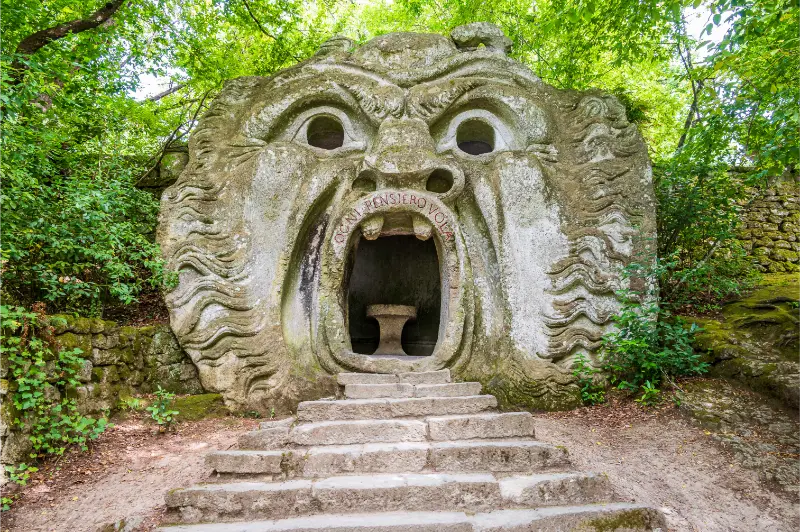
  • Su Mannau Cave: Underground Rivers and Ancient Rituals near Fluminimaggiore

    Su Mannau Cave: Underground Rivers and Ancient Rituals near Fluminimaggiore

    Su Mannau near Fluminimaggiore brings together spectacular limestone formations, subterranean water and archaeological traces connected with ancient ritual life.

    The beaches and mining history of southwestern Sardinia attract travellers to the Iglesiente, but the region also conceals remarkable karst landscapes. Su Mannau is one of the most evocative caves to visit because its geological chambers and archaeology connect the natural history of limestone with people’s long fascination with underground water. The ordinary tourist visit is a managed experience; deeper speleological routes are something else entirely, requiring specialist preparation and permission.

    Extend a visit to Su Mannau Cave with the suggestions in our Sardinia travel guide, which covers regional transport and where to base yourself.

    Plan your visit at a glance

    WhereFluminimaggiore municipality, southwestern Sardinia, in the Iglesiente
    AllowAllow a half-day for travel and the managed cave tour; verify actual tour duration
    Best approachFollow signs from Fluminimaggiore toward Su Mannau and reserve or confirm the tourist visit
    Good to knowUnderground steps, damp surfaces and potentially limited departures; advanced cave routes are separate
    Suggested baseFluminimaggiore or Iglesias, with Buggerru for coastal exploration

    The recommendations below distinguish the permanent character of the place from rules that may change by season. Check the official visitor information shortly before your trip, particularly if a permit, guided departure or protected-area access is involved.

    A cave carved by ancient water

    Su Mannau is a large karst system developed in limestone in the Iglesiente. Water has shaped its chambers over vast spans of geological time, leaving pools, mineral deposits and complex passages. Official descriptions distinguish different branches of the cave system, some linked with underground streams. The tourist section offers a controlled introduction; it is only a small part of the total underground environment.

    The colours in the chambers can range from white crystal growths to reddish stone surfaces, with pools adding reflections that change under artificial lighting. The best way to appreciate the cave is to look slowly at how the walls, ceiling and floor relate to one another. Not every extraordinary formation has an easy nickname, and not every chamber is accessible on a standard ticket.

    Grotta di Fornillo Cave Attraction Positano Italy

    The archaeological significance of the entrance

    Su Mannau has more than geological interest. Finds associated with lamps and ancient human activity suggest that parts of the cave were used for ritual practices, including traditions connected with water. The nearby Temple of Antas belongs to a broader landscape of sacred places whose histories stretch across different periods. It would be misleading to describe every decoration in the cave as a deliberately constructed temple.

    Ask guides how archaeologists distinguish artefacts, deposits and natural features. Even simple oil lamps become important evidence when considered in their location and date. The cave’s history invites a larger question: why have people in so many cultures regarded springs and underground waters as special? Observing the real evidence is more satisfying than inventing an answer.

    What the standard tourist route offers

    The visitor route follows equipped passages into selected chambers, with stairs and controlled lighting where required. It is not an unrestricted walk through the full cave network. Each operator determines the current guided sections, the duration and the size of the group. Verify those details before arrival, particularly if travelling outside the main season.

    On a managed tour, remain with the group, keep to the designated path and avoid entering side passages. Do not touch formations or lean across barriers to obtain a photograph. Calcite features grow extremely slowly and can be damaged by a careless hand or by constant contact over time. The guide’s explanations are part of the value of the ticket.

    Tourism versus speleology

    Accounts of the Su Mannau system often mention deep sections, rivers, dramatic chambers and long passage networks. Many of these lie beyond the ordinary public route. Speleological experiences, if offered, are separate activities requiring fitness, helmets, specialised gear, qualified leaders and permission. A standard cave visit should never be interpreted as authorisation to explore an unlit branch.

    Travellers sometimes choose a cave primarily because of a photograph taken by an expert expedition. Before booking, identify whether that image shows the tourist route or a specialist section. Honest expectations matter: the normal visit can be fascinating without promising every part of the vast underground system.

    Combining Su Mannau with the Temple of Antas

    The nearby Temple of Antas provides a particularly interesting contrast: above-ground ritual architecture within the green hills of the Iglesiente and an underground environment with traces of ancient worship. Check the actual access, opening hours and travel route for both attractions. A relaxed archaeology-and-cave day leaves time to understand their different historical layers.

    Another option is to remain in Fluminimaggiore for food and local exploration, or combine the cave with a modest viewpoint on the road toward the Costa Verde. Avoid driving all the way to the far northeast of the island for another major attraction the same afternoon. The mountain roads of western Sardinia are beautiful but demand attention and time.

    Clothing, seasons and safe expectations

    Underground temperatures feel cool after a Mediterranean summer day. Wear a light layer, closed shoes with grip and clothes that can handle occasional moisture. Be especially cautious on steps and uneven surfaces; wet limestone is not comparable to a shopping-centre floor. The cave may not be suitable for visitors who cannot manage the present route without assistance.

    Rainfall can influence underground conditions and the operator may modify visits for safety. Seasonal opening, tour language, permitted photography and ticket arrangements can change. Check current information close to departure and leave a backup plan. A well-organised visit should feel like an encounter with a fragile natural archive, not a test of how far you can wander from the guide.

    The difference between cave images and the visitor route

    Online collections of Su Mannau photographs can include chambers explored by speleologists rather than ordinary visitors. It is useful to distinguish the public itinerary from deep technical areas before purchasing tickets. Ask the operator about the length of the route, the number of steps, any physical requirements and whether guides speak a language your group understands. Do not assume that a visitor wearing ordinary trainers can reach a giant crystal chamber shown in an expedition photograph.

    The cave’s archaeological dimension is another reason to visit slowly. Oil lamps found in subterranean settings evoke human movement through darkness long before electric lighting. They also remind us how much preparation such a visit required in the past. A modern guided walk is safer, but it should retain some of that sense of respect for underground space. Touching rock formations or disturbing water is particularly harmful in environments that change only slowly.

    Fluminimaggiore gives the trip a distinctive location within southwestern Sardinia. Consider spending an afternoon connecting the cave to nearby ancient sites or the landscape of the Iglesiente, rather than treating the experience as an isolated attraction with nothing around it. A careful combination of cave and village can be both manageable and educational, particularly when the coast is windy and beach plans need to remain flexible.

    A realistic visit: three ways to organise your day

    A cave-focused excursion

    Confirm the standard guided visit and arrive with closed shoes, a light jacket and enough time for a calm orientation. Have lunch in Fluminimaggiore afterward and resist squeezing in a distant beach.

    Cave and Temple of Antas

    Check both venues’ hours before departure, then experience the underground site and the temple as complementary examples of geology and changing human beliefs. Allow generous driving time.

    A southwest Sardinia itinerary

    Use Iglesias or Fluminimaggiore as a base and dedicate separate days to coastal mining heritage, caves and village life. This is more rewarding than treating every road junction as another obligatory stop.

    Practical details people often overlook

    Do not confuse tourist tours with specialist speleology. Ask specifically what is included in an ordinary admission.

    Cave paths can include stairs and damp stone. Proper grip and a light insulating layer matter even in very hot weather.

    The operator may alter departures after heavy rain or during quieter seasons. Verify the exact time and reservation method rather than assuming continuous entry.

    Where to stay and what to combine nearby

    Iglesias provides urban services and a wider accommodation choice; Fluminimaggiore suits travellers who want to stay close to rural landscapes. Buggerru and the Costa Verde can be explored on separate coastal days.

    The Temple of Antas is a logical heritage pairing. The mining settlements and landscapes farther west tell another side of the region’s history, but require a realistic driving plan.

    Questions travellers ask

    Can anyone explore the whole Su Mannau cave?

    No. The managed tourist route is distinct from restricted or specialist speleological sections.

    Do I need warm clothes?

    A light layer and grippy shoes are useful because underground conditions are cooler and damper than the coast.

    Is it connected to ancient rituals?

    Archaeological finds, including lamps, point to past activity and water-related religious traditions; interpretations should be based on the site evidence.

    Can I combine it with the Temple of Antas?

    Yes, it is a logical local pairing if both sites are open and the timings work.

    Will a summer storm affect the visit?

    Water conditions can affect cave access. Follow the current operator announcements and keep a backup plan.

    Further reading on My Italy Experience

    Build a wider Sardinian route with the Sardinia overview, the best things to do in Sardinia, our ten-day island route, where to stay in Sardinia. These guides were already published when this article was prepared; they provide the region-level context rather than repeating this specific visit.

    Official information and final advice

    For the latest visitor rules and practical notices, consult Sardegna Turismo’s Su Mannau description. Use the official source to confirm dates and booking conditions, then keep your daily plan flexible for weather, traffic and any local restrictions.

    Su Mannau makes the Iglesiente landscape feel deeper in every sense. Understanding the cave’s natural chambers and human traces enriches the entire journey through southwestern Sardinia.

    Last updated: October 17, 2026
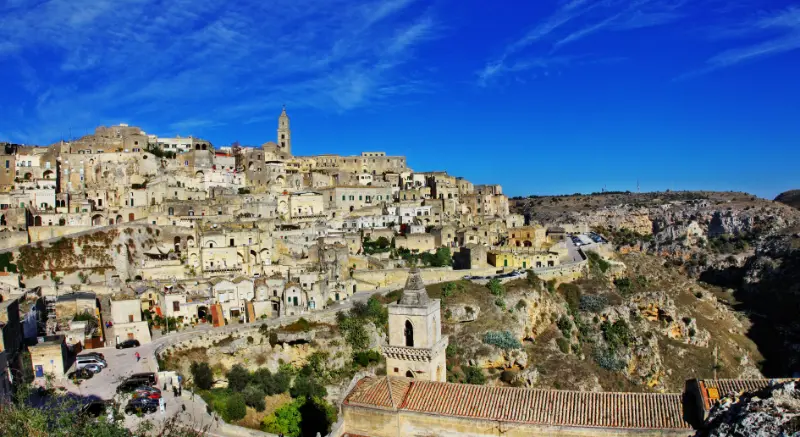
  • Garibaldi’s House on Caprera: Visiting the Compendio and Memorial

    Garibaldi’s House on Caprera: Visiting the Compendio and Memorial

    The Garibaldi museums on Caprera tell two complementary stories: the private life of the Italian unification hero at his historic house, and his public legacy at Forte Arbuticci.

    Caprera is more than a place for granite scenery and hidden coves. Giuseppe Garibaldi spent the final decades of his life here, and today two distinct museums help visitors understand the person and the historical figure. This is not a single admission gate with two identical exhibits: the Compendio Garibaldino and the Memorial have different locations and potentially different schedules. Planning both carefully avoids a frustrating arrival after the relevant ticket window has closed.

    For a broader Sardinia itinerary, see the Sardinia travel guide before deciding which destinations to combine with Garibaldi’s House on Caprera.

    Plan your visit at a glance

    WhereIsland of Caprera, connected by bridge to La Maddalena
    AllowAllow a half-day for one museum; a longer visit if including both and transfer time
    Best approachReach La Maddalena by ferry from Palau, cross to Caprera and reserve the official museum admission
    Good to knowTimed entry and museum-specific opening arrangements; reservations strongly recommended
    Suggested baseLa Maddalena town or Palau

    The recommendations below distinguish the permanent character of the place from rules that may change by season. Check the official visitor information shortly before your trip, particularly if a permit, guided departure or protected-area access is involved.

    The White House and the everyday Garibaldi

    The Compendio Garibaldino centres on the small estate and the White House where Garibaldi lived with his family. Furniture, personal belongings, rooms and farm buildings illuminate his interests and daily routines beyond the battlefield. These spaces are particularly valuable because famous historical figures often disappear behind grand monuments; here, ordinary domestic detail helps restore human scale.

    Garibaldi was active in agriculture and the development of the island property, and the surrounding estate preserves features associated with that life. Explore the permitted grounds slowly and consider how isolated Caprera once felt compared with the ferry-connected island of today. The visit also includes a solemn family burial area, which deserves the same respectful behaviour as a historic cemetery.

    House Colorful Old Riviera Italy

    The Memorial at Forte Arbuticci

    The Memorial Giuseppe Garibaldi occupies Forte Arbuticci, a separate location on Caprera, and interprets the figure’s wider historical importance through documents and multimedia presentations. It is not a replica of the farmhouse. The contrast between a domestic estate and a fort-based exhibition helps visitors connect private biography with broader nineteenth-century political history.

    Read the museum’s introductory material rather than assuming every exhibition will be self-explanatory in every language. If travelling with people unfamiliar with the Risorgimento, a short introduction to the unification of Italy will make the visit much more meaningful. The two locations can complement each other beautifully but should not be squeezed into a gap between boat excursions.

    Booking without confusing the two museums

    The current official museum service lists the two venues separately and recommends booking, with timed or controlled admission at the Compendio. Tickets, schedules and entry methods may differ. A combined ticket, when offered, may have specific sales rules. Check the official Musei Garibaldini site and the Musei Italiani platform for the exact day rather than trusting a screenshot from a previous season.

    The Compendio has a limited number of entries per time window, making punctuality important. Keep digital confirmations available offline and allow time to reach the correct entrance. If you want both museums, schedule the transfer and confirm the Memorial’s actual hours, which can change in response to staffing or season. A booking for one venue is not necessarily a booking for both.

    Getting to Caprera

    Most visitors approach via the ferry between Palau and La Maddalena, then continue across the bridge to Caprera. The transfer from port to museum adds time, particularly if you rely on local buses, cycling or limited parking. Check practical transport arrangements before buying a strict timed admission. The island’s roads and the museum locations make planning worthwhile.

    If you are staying in La Maddalena, the visit is easier to integrate with an afternoon elsewhere on the island. Travellers based on mainland Sardinia should account for driving to Palau, finding parking, ferry frequency and the onward transfer. When schedules are tight, visiting one museum well is better than sprinting through two without context.

    What makes the visit culturally worthwhile

    Garibaldi remains a fascinating and sometimes contested figure in Italian and international history. He is remembered as a military leader, activist and key participant in the Risorgimento. A museum visit benefits from recognising that Italy’s unification had varied regional experiences, rather than accepting a simple tale of heroes and villains as the only interpretation.

    At the Compendio, look at domestic objects as evidence of personal life, not merely relics. At the Memorial, consider how public memory constructs an image of an individual through documents and display choices. Questions about nationalism, politics, family and the sea all fit naturally into a thoughtful visit without requiring a specialist background.

    Families, accessibility and a slower afternoon

    The museum grounds and historic rooms do not share the same circulation conditions as a new purpose-built gallery. Ask staff about accessible routes, facilities, seating and whether the visit is practical with a stroller or wheelchair. Children may find the farm buildings, living spaces and personal objects more relatable than dense historical panels; help them connect each room to a daily task.

    After the museums, explore permitted viewpoints on Caprera rather than assuming every protected beach is open to casual access. Pack a water bottle and be ready for seasonal changes in services. A day on the island can contain beautiful landscape and serious history without compromising either one.

    A useful way to interpret Garibaldi’s life

    Before visiting, it helps to know why Garibaldi is called a hero of Italian unification. He became known internationally through military and political activity in South America and Italy, and played a significant role in the Risorgimento. The museums are best enjoyed as spaces to ask questions about a complicated nineteenth-century life, rather than places that require visitors to share any particular political viewpoint. The White House is especially revealing because it contrasts public reputation with farming, family relationships and everyday possessions.

    Pay attention to which objects are originals and which are interpretive materials. Domestic rooms preserve proportions that are easy to miss when viewing Garibaldi only through statues and paintings. The Memorial then places the life within a wider public narrative, using documents and exhibition design. Seeing both can prompt reflection on how a historical figure’s public image changes after death. Families may enjoy choosing three ordinary objects in the home and asking what they reveal about living on Caprera.

    Because the venues are separated geographically, ticket logistics matter as much as historical preparation. The official museum website currently offers practical booking information and controlled admission for the Compendio, but schedules can change. Check the precise day, identify both entrances and allow for a quiet walk through permitted grounds. The cemetery area is not simply another photograph stop: it is a place for thoughtful and respectful behaviour.

    A realistic visit: three ways to organise your day

    The focused Compendio visit

    Reserve the White House entrance in the official time slot, arrive early and take time with the farmhouse, surrounding structures and cemetery. Finish with an unhurried meal on La Maddalena.

    Both museums in one day

    Check each venue’s hours before purchasing, leave adequate driving or transport time between the estate and Forte Arbuticci, and plan a relaxed afternoon rather than another tightly timed excursion.

    An island weekend

    Stay on La Maddalena for two nights. Reserve the museums on one day and keep a second day for authorised beaches, a boat trip or quiet exploration. This adds weather flexibility.

    Practical details people often overlook

    Use the current Musei Garibaldini portal rather than outdated opening hours displayed on old cultural listings. Each venue has its own schedule.

    Timed Compendio admissions can fill; advance booking and punctual arrival are sensible, particularly in busy periods.

    Caprera is connected by road to La Maddalena, which is normally reached by ferry from Palau. Allow for every stage of the transfer.

    Where to stay and what to combine nearby

    La Maddalena offers the easiest base for a history-and-nature stay, with Palau convenient on the mainland. Choose accommodation based on your travel mode and morning admission time.

    The island’s coves and viewpoints can form a complementary outing, but check national park rules for each location. The archipelago deserves more than an improvised thirty-minute visit after the museum.

    Questions travellers ask

    Are the Compendio and Memorial the same museum?

    No. They are two separate museums on Caprera with different exhibits, locations and sometimes different opening schedules.

    Should I book tickets in advance?

    Yes. The official museum website recommends booking and the Compendio operates controlled admission windows.

    Can I visit both in one day?

    Often possible with suitable opening times, but leave transfer time between the venues and check schedules first.

    How do I reach Caprera?

    Travel to La Maddalena, typically by ferry from Palau, then cross the road bridge to Caprera.

    Is this suitable for children?

    It can be rewarding, especially the historic home; tailor the experience to their interests and check accessibility needs.

    Further reading on My Italy Experience

    Build a wider Sardinian route with the Maddalena Archipelago guide, our main Sardinia travel guide, the best things to do in Sardinia, the Sardinia accommodation guide. These guides were already published when this article was prepared; they provide the region-level context rather than repeating this specific visit.

    Official information and final advice

    For the latest visitor rules and practical notices, consult the official Musei Garibaldini booking and visitor portal. Use the official source to confirm dates and booking conditions, then keep your daily plan flexible for weather, traffic and any local restrictions.

    Caprera’s Garibaldi museums reward careful scheduling and curiosity. The historic rooms and the Memorial reveal different sides of a life that shaped modern Italy; together they make an unforgettable cultural counterpoint to the island’s sea and stone.

    Last updated: October 17, 2026

  • Sella del Diavolo: Hiking Cagliari’s Legendary Sea Promontory

    Sella del Diavolo: Hiking Cagliari’s Legendary Sea Promontory

    Sella del Diavolo rises between Poetto and Calamosca, offering a rocky coastal walk and one of the finest broad views over Cagliari’s Gulf of Angels.

    Cagliari has streets, museums and markets, but its most instantly recognisable landmark is a hill shaped like a saddle. Sella del Diavolo, the Devil’s Saddle, is close enough to the city for a half-day escape yet rugged enough to demand sensible footwear, weather awareness and respect for the trails. The attraction is not a single platform; it is the combination of sea views, Mediterranean vegetation, traces of history and a legend that gives the promontory its name.

    Our Sardinia travel guide places Sella del Diavolo in the context of the wider region, including travel times and alternative bases.

    Plan your visit at a glance

    WhereSant’Elia promontory between Poetto and Calamosca, Cagliari
    AllowPlan roughly two to three hours for an unhurried hike and viewpoints
    Best approachStart from an established signed route near Calamosca or Marina Piccola after checking local conditions
    Good to knowUneven, exposed trails; avoid heat, wind and slippery rocks
    Suggested baseCagliari, particularly Marina, Poetto or the Sant’Elia side

    The recommendations below distinguish the permanent character of the place from rules that may change by season. Check the official visitor information shortly before your trip, particularly if a permit, guided departure or protected-area access is involved.

    Why Cagliari’s skyline has a saddle

    Seen from Poetto beach, the profile of Sella del Diavolo creates a distinctive notch above the sea. It is part of the Sant’Elia hill system and looks over the Golfo degli Angeli, the Gulf of Angels. The geological outline inspired tales that combine a heavenly battle with Lucifer losing his saddle. Like many landscape legends, the story is memorable without being an explanation of how the rock actually formed.

    The walk has a very real physical setting: limestone, low Mediterranean scrub, fan palms and exposed coastal slopes. On clear days, viewpoints encompass Poetto, the saltwater landscape toward Molentargius and distant stretches of the southeastern shore. Conditions can change quickly in wind or heat, so treat a panoramic hike as an outdoor activity rather than a sightseeing queue.

    Winter Mountain Ski Lift Snow Screen Slope Sella Pass Italy

    Choosing a practical trailhead

    Common approaches begin around Calamosca or Marina Piccola, but the exact route, path condition and any restrictions can evolve. Choose a signposted and currently open trail, consult a reliable map and be ready to turn back if the surface is more technical than expected. Do not follow unmarked shortcuts simply because other hikers appear to be using them.

    The route is not uniformly flat. Expect rock, loose gravel, short steeper sections and places where the sea below makes exposed edges feel dramatic. Walking shoes with traction are more appropriate than beach slides. A small backpack with water and protection from the sun allows you to keep your hands free on awkward sections.

    The views worth slowing down for

    The strongest reason to hike is the changing perspective. First the city remains close, then the shoreline of Poetto becomes a long pale arc, and finally the Gulf of Angels fills the horizon. From certain viewpoints, you can recognise the relation between Cagliari’s beach district and the wetlands behind it. Each bend feels different; take enough time to appreciate the route rather than sprint toward a supposed single perfect summit photo.

    Photographers should keep well back from edges and avoid walking backwards while framing a shot. Evening light is appealing, but a late start can result in returning on dark, rocky paths. If planning a sunset walk, know the trail and bring a dependable light; for most visitors, daylight is the more sensible choice.

    History beneath the legend

    The promontory has been used and observed in different periods of history, and traces of old human presence are part of its appeal. Interpretive accounts mention ruins and past coastal installations. Some remains can be difficult to identify without a guide and are not invitations to crawl into blocked structures or walk over unstable masonry.

    It is easy to romanticise the name, but a good visit separates geological scenery, folklore and archaeological evidence. Ask locally about guided walks if you want to understand the promontory’s older stories. Even without detailed historical interpretation, the strategic view over the gulf explains why the high ground mattered to generations before modern tourists.

    Hiking safely in Mediterranean weather

    Sardinian summer heat can be severe on exposed rock. Choose the cooler part of the day, carry more water than you expect to drink and wear a hat. A sea breeze can feel refreshing while masking dehydration; strong wind also makes cliff edges more dangerous. After rain, polished rocks and loose stones may be slippery.

    Do not hike when thunderstorms threaten or when conditions are beyond your group’s experience. A phone with an offline map helps, but battery life is not a replacement for judgement. Children should stay close to an adult and away from steep drops. The most satisfying day ends at a café in Cagliari, not with an avoidable emergency on the trail.

    Completing the day at Poetto or Calamosca

    A walk can be paired with a beachside meal or a relaxed stroll along Poetto, depending on your chosen start point and return. Calamosca is visually close, but do not assume every path connects directly to every cove. Follow authorised tracks and roads. The nearby Marina Piccola area is convenient for refreshment after a hike, though services vary seasonally.

    To understand a different side of Cagliari’s coast, add a visit to the Molentargius wetlands on another outing. That ecosystem is distinct from the rocky promontory but visible from its heights. Combining both within a multi-day city break gives context to the area’s remarkable natural diversity.

    Choosing a viewpoint over a summit photograph

    A satisfying visit does not require standing at the very edge of a cliff. From safer viewpoints on the established routes, you can read the coastline in layers: the sweep of Poetto, Marina Piccola below, distant shorelines across the gulf and the geometric relationship between city blocks and wetland basins. If visibility is poor, slow down and look at the plants and limestone instead of chasing the perfect horizon shot. Sea mist, glare and wind can change the view even in the same hour.

    For walkers used to urban parks, the exposed rock and loose surface are the main surprise. Hiking poles may be useful for some people, but only if they know how to use them safely. A lightweight pack and shoes with suitable tread are better investments than elaborate photography gear. Keep a charged phone, but do not follow a navigation app through a cliffside shortcut merely because the screen displays a line that appears shorter.

    The hike also helps explain why Cagliari can be a good base even for visitors primarily interested in nature. You do not need to drive to a far-flung part of the island to encounter wild vegetation and dramatic coastline. Combine a carefully chosen walking route with a relaxed meal near Poetto, and a single day can give a convincing sense of the city’s distinctive relationship with the sea.

    A realistic visit: three ways to organise your day

    A morning viewpoint hike

    Choose a signed route, begin before the harsh midday heat, stop at the main panoramas and return while everyone still has energy. Save lunch and a stroll at Poetto for afterward.

    A city-and-nature weekend

    Spend one day discovering historic Cagliari and another morning on Sella del Diavolo. Leave room for the nearby wetlands and a beach walk without rushing from one neighbourhood to another.

    An easier coastal day

    If rough terrain is unsuitable, appreciate the promontory from Poetto or Marina Piccola rather than forcing a hike. The silhouette and sea views are rewarding from below too.

    Practical details people often overlook

    Starting near Calamosca or Marina Piccola is common, but find the current authorised route rather than assuming that every visible track is safe.

    Carry water and proper walking shoes. Barely shaded limestone can become hot, and occasional loose gravel changes footing.

    Plan a daylight return and avoid cliff-edge posing. If hiking with children or anyone with limited mobility, assess the route in advance.

    Where to stay and what to combine nearby

    Cagliari is the obvious base, with a wide range of restaurants and accommodation. Poetto is practical for beach access; central neighbourhoods offer easier city sightseeing and public transport connections.

    Combine the hike with the city’s historic Castello district or a calm visit to Poetto. The Molentargius-Saline wetlands give a separate view of the ecological setting behind the beach.

    Questions travellers ask

    Is Sella del Diavolo difficult?

    It is a relatively accessible coastal hike for prepared walkers, but the paths are rocky, uneven and exposed. Difficulty depends on the route and conditions.

    Where does the hike start?

    Popular trail approaches are around Calamosca and Marina Piccola; check current signs and access.

    Is there an entry ticket?

    The hill is an outdoor landscape rather than a standard ticketed attraction; check any current local access restrictions.

    Can I see it without hiking?

    Yes. The silhouette is clearly visible from Poetto and other coastal viewpoints.

    Is sunset a good idea?

    The light can be wonderful, but a rocky descent after dark is unsuitable without proper planning and equipment.

    Further reading on My Italy Experience

    Build a wider Sardinian route with the Cagliari city guide, the best Sardinian beaches, our seven-day Sardinia itinerary, the main Sardinia guide. These guides were already published when this article was prepared; they provide the region-level context rather than repeating this specific visit.

    Official information and final advice

    For the latest visitor rules and practical notices, consult the regional Sella del Diavolo description. Use the official source to confirm dates and booking conditions, then keep your daily plan flexible for weather, traffic and any local restrictions.

    Sella del Diavolo shows how much wilderness can exist beside a major city. Pick a safe route, read the coastline from above and let Cagliari’s legendary saddle become more than a silhouette.

    Last updated: October 17, 2026
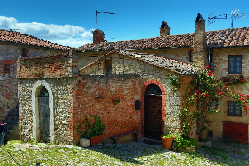
  • Ispinigoli Cave: The Giant Limestone Column Beneath Dorgali

    Ispinigoli Cave: The Giant Limestone Column Beneath Dorgali

    Ispinigoli, just outside Dorgali, is famous for an immense limestone column and a steep stairway into a cathedral-like chamber deep in the Supramonte.

    Sardinia’s east coast is known for bright blue coves, but some of its most extraordinary scenery sits underground. The visit to Ispinigoli is compact, concentrated and unusually physical: you descend numerous steps, see a remarkable single chamber and climb back into the sunlight. Understanding the stairs, low temperatures and tour arrangements in advance makes the experience more satisfying than arriving as though it were a leisurely indoor museum.

    For travel beyond Ispinigoli Cave, consult our Sardinia travel guide; it explains how to choose a base and link nearby destinations.

    Plan your visit at a glance

    WhereSupramonte di Dorgali, inland from Cala Gonone in the Nuoro province
    AllowAllow roughly one to two hours including arrival and the organised cave visit
    Best approachDrive from Dorgali toward the signed Ispinigoli site and follow visitor arrangements
    Good to knowApproximately 280 steps down and back up; not a step-free cave
    Suggested baseDorgali or Cala Gonone; Orosei is useful for a wider trip

    The recommendations below distinguish the permanent character of the place from rules that may change by season. Check the official visitor information shortly before your trip, particularly if a permit, guided departure or protected-area access is involved.

    What makes Ispinigoli exceptional

    The main attraction is a vast underground chamber approximately eighty metres across, where a limestone column about thirty-eight metres high links floor and roof. This is not a stalactite brought into a museum: it is a geological formation created slowly by mineral-rich water over extremely long periods. Standing beneath it gives the room a sense of vertical scale that a close-up photograph rarely captures.

    The chamber also reveals smaller formations and an interplay of shadows, stone colour and water-shaped surfaces. It is tempting to view it only as a record-breaking attraction, but the changing proportions as you descend make the cave memorable. Listen to the guide’s explanation of what is natural, what has been studied archaeologically and what visitors are forbidden to touch.

    Grotta di Fornillo Cave Attraction Positano Italy

    The stairway is the main practical challenge

    The tourist route descends roughly 280 steps into the cave and requires visitors to climb them again to exit. That matters more than the total time shown on a booking page. The air is cool, typically around fifteen degrees Celsius, and steps can be damp. Wear shoes with real grip and avoid carrying a large bag that interferes with balance or handrails.

    Anyone with knee problems, reduced stamina or difficulty on steep flights of stairs should evaluate the route carefully before buying tickets. The cave is not equivalent to an elevator-accessed exhibition, and a visitor who can walk around town for an hour may still find the return climb demanding. Ask the site team about their current visiting conditions and restrictions for children.

    Reading the cave’s geological story

    Limestone caves form as water moves through soluble rock, enlarging fractures and depositing calcite when mineral-bearing droplets release carbon dioxide. Columns eventually form where stalactites and stalagmites meet. The scale of the Ispinigoli column is unusual, but the underlying processes are the same delicate processes that create smaller formations in many caves.

    Touching a calcite formation can leave oils and contamination that interfere with its surface. Avoid reaching into areas marked off for protection. Photographs are appealing, yet flash restrictions may apply and bright screens can disturb the group. Allow your eyes to adjust and follow the guide’s instructions instead of trying to photograph every feature.

    The archaeological layer

    Caves in the Dorgali region are not merely geological voids. Ispinigoli has also attracted archaeological interest, including traces associated with human use over long periods. The nearby karst system and the passage often called the Abyss of the Virgins have generated local legends; a good interpretation distinguishes evidence from story rather than presenting every tale as historical fact.

    Ask how the tourist portion relates to deeper systems that are not open to casual exploration. Caving beyond the managed visitor route requires different qualifications, equipment and permissions. A purchased entrance ticket is not an invitation to explore off-path chambers, and a powerful phone torch is no substitute for a trained speleological team.

    What to do before and after the descent

    The Ispinigoli excursion is particularly easy to combine with a Dorgali day: start with the cave while everyone is fresh, have lunch nearby if services are operating and then explore the village or drive toward Cala Gonone for sea views. Avoid scheduling a strenuous Supramonte hike immediately afterward if the stair climb is likely to tire your group.

    Other cave experiences around the Gulf of Orosei have different access models. The Bue Marino caves are typically connected with boat excursions and marine conditions; Ispinigoli is a land-based destination, but its steep interior changes who can comfortably visit it. The two should not be treated as interchangeable simply because both have stalactites.

    When to go and what to bring

    A cave can be a welcome contrast to the heat of a Sardinian summer, yet the car park and approach are still outdoors. Confirm tour times, ticket arrangements and any seasonal closure. In shoulder season, organised departures may be less frequent; an empty car park does not necessarily mean you can enter independently.

    Carry a light extra layer, grippy shoes and only essential belongings. Do not rely on a fixed visit duration if there is a queue or a guided group must move at a measured pace. The most worthwhile experience is a careful descent with enough energy left to look around, not a race to complete the staircase.

    Is the descent right for your group?

    The simplest way to assess Ispinigoli is to imagine descending a staircase of roughly 280 steps and then returning up the same amount while the air is cooler and damp. If someone has reduced balance, breathlessness, a knee injury or an issue with enclosed places, contact the operator before paying. The impressive size of the chamber does not remove the physical effort required to get there. A guided group may have a fixed pace, and pausing for a photograph is not the same as sitting down to rest.

    Younger children may love the cave’s dramatic scale but can become uncomfortable with the temperature shift, darkness or steep stairway. Explain that they will be walking underground with a guide and that the formations are not to be touched. With teenagers, the geology provides an interesting alternative to another beach morning, especially if you point out how mineral-rich drops build enormous structures slowly. Avoid promising that the cave visit will include an underground boat ride or access to the entire natural system.

    If you decide the descent is inappropriate, that is a useful decision, not a failure. Dorgali and Cala Gonone provide scenic alternatives for travellers who cannot manage the steps. Groups can sometimes split for a short period if transport and supervision allow. Whatever you choose, confirm up-to-date access and try not to make cave admission the hinge of a non-refundable long journey through eastern Sardinia.

    A realistic visit: three ways to organise your day

    A cave-focused morning

    Book or verify the next organised visit, arrive early enough to use facilities and descend without rushing. Give your legs a rest after returning to the surface, then have lunch in the Dorgali area.

    Cave and coast contrast

    Spend the morning underground at Ispinigoli and the afternoon taking an easy scenic drive toward Cala Gonone. Do not promise a boat cave cruise on the same day unless departure times fit and the weather is stable.

    Families and mixed-mobility groups

    Check who can safely manage the stairs before travel. One adult may choose a different nearby attraction with anyone unable to descend rather than pressuring the whole group to complete the route.

    Practical details people often overlook

    The approximately 280-step descent implies a climb of similar magnitude; remember this when assessing the route. Steps and handrails may be damp.

    The cave temperature differs markedly from a beach day. A light layer and footwear with traction are useful even in August.

    Use an actual site or recognised local tourism source for guided visit times. Third-party maps sometimes show access even during seasonal closures.

    Where to stay and what to combine nearby

    Dorgali is a logical base for caves, archaeology and Supramonte landscapes. Cala Gonone suits travellers who also want boat trips on the Gulf of Orosei; Orosei offers another beach-oriented alternative.

    Allow time for the historic centre of Dorgali or a moderate coastal viewpoint if your legs are tired. Do not combine the stairs with an ambitious mountain trek merely to make the day look efficient.

    Questions travellers ask

    How many steps are at Ispinigoli?

    The tourist descent is commonly described as roughly 280 steps; visitors must climb back out.

    How cold is the cave?

    The environment is cool, commonly described at around 15°C, so bring a light layer.

    Can I visit without a guide?

    Follow the managed visitor arrangements and do not enter closed sections. Confirm whether guided departures are required for your visit.

    Is it suitable for a stroller or wheelchair?

    The steep stepped route is not a step-free attraction.

    Can I combine it with the Bue Marino cave?

    Possibly, but the latter usually involves maritime scheduling. Keep enough time and a weather contingency.

    Further reading on My Italy Experience

    Build a wider Sardinian route with the Gulf of Orosei, Nuoro and Barbagia, the ten-day Sardinia itinerary, the main Sardinia guide. These guides were already published when this article was prepared; they provide the region-level context rather than repeating this specific visit.

    Official information and final advice

    For the latest visitor rules and practical notices, consult Sardegna Turismo’s Ispinigoli listing. Use the official source to confirm dates and booking conditions, then keep your daily plan flexible for weather, traffic and any local restrictions.

    Ispinigoli rewards visitors who respect its scale and their own limits. The giant column is astonishing, but the quieter memory is the gradual transformation of light as the staircase leads underground.

    Last updated: October 17, 2026

  • Cala Sisine: The Pebble Cove Between Baunei’s Cliffs

    Cala Sisine: The Pebble Cove Between Baunei’s Cliffs

    Cala Sisine is a quieter name on the Gulf of Orosei, but its white-pebble shoreline and immense limestone walls make it one of Baunei’s unforgettable coastal destinations.

    Some visitors arrive expecting a simple beach: in reality, reaching Cala Sisine is a journey through one of Sardinia’s most dramatic landscapes. The boats, the broad opening of the gorge behind the shore, and the difficult inland approaches all shape the experience. This guide explains what can be planned in advance, what depends on the weather and why a relaxed stay is often better than collecting several coves in a hurry.

    To see where Cala Sisine fits into a wider Sardinia itinerary, use our Sardinia travel guide for transport, bases and possible neighbouring stops.

    Plan your visit at a glance

    WhereBaunei municipality, Ogliastra, on the southern Gulf of Orosei
    AllowA substantial half-day or full beach day, depending on boat schedules
    Best approachUse an authorised boat excursion with a confirmed beach landing and return
    Good to knowSea conditions can cancel landings; inland routes are not casual walks
    Suggested baseSanta Maria Navarrese, Baunei, Cala Gonone or Arbatax

    The recommendations below distinguish the permanent character of the place from rules that may change by season. Check the official visitor information shortly before your trip, particularly if a permit, guided departure or protected-area access is involved.

    A beach shaped by a river gorge

    Cala Sisine sits at the mouth of a codula, a limestone ravine descending from the Golgo plateau. Rather than a small rocky pocket, the bay opens into a generous band of bright, rounded pebbles and coarse, pale material. The wooded gorge behind the beach is almost as striking as the shore; carob and holm oak contrast with sheer walls of stone. That combination of inland and marine scenery explains why the approach feels different from a conventional resort beach.

    The water can appear turquoise or deep blue according to light, depth and wind. A pebbly entrance may be uncomfortable for bare feet, while the seabed becomes deeper in places. Pack footwear suitable for rounded stones and do not assume every part of the cove is equally suitable for small children. Cliffs provide a grand backdrop but should never be treated as safe jumping platforms or improvised climbing walls.

    Cala Sinzias Villasimius Italy

    Reaching Sisine by sea

    Excursion boats can depart from ports such as Santa Maria Navarrese, Arbatax and Cala Gonone, although the actual itinerary changes between operators and seasons. Some tickets include landing time at Sisine, while others merely pass the bay or prioritise a different set of beaches. Before paying, look for a written explanation of the stops, their durations, the embarkation point and the return arrangements.

    A calm sea at departure does not guarantee a landing on every stretch of this open coast. The skipper may amend the itinerary because of swell, wind or safety instructions. A good booking is one you would still enjoy if Sisine became a view from the boat rather than a stop on the sand. Confirm whether there are steps to board and how passengers are transferred to the beach.

    Hiking and the Golgo approach

    Descriptions of Sisine as accessible by foot can be misleading. Inland trails pass through rugged Ogliastra terrain, with tracks, exposed stone, route choices and potential heat. Some approaches use the Golgo plateau, where the road itself may be rough and seasonal vehicle restrictions can apply. Hiking time varies significantly with starting point, experience and conditions; it would be irresponsible to promise one universal duration.

    If you intend to walk, consult a local hiking specialist and obtain current information about route status, weather, water and the final descent. Do not arrange a one-way walk unless your sea collection is firmly agreed and there is an independent contingency. A phone map and an attractive aerial photograph cannot replace navigation skills, especially after a tiring swim under the midday sun.

    Swimming, snorkelling and beach comfort

    The colour of the sea invites long swims, but visibility and safety are separate questions. Move away from boat traffic, assess currents and avoid rockfall areas at the foot of the cliffs. The rounded stones make the cove beautiful in photographs yet can make lying down without a mat uncomfortable. Bring enough water and shade for the planned stay; a seasonal kiosk, if present, should be treated as a bonus.

    Snorkellers may enjoy contrasts between rocks and pale seabed near safe sections of the bay. Stay in areas appropriate for your ability, avoid disturbing marine life and do not pursue fish or underwater photographs into exposed water. Families with young children can find a boat excursion more manageable than a hike, provided boarding and the stony shore fit everyone’s mobility needs.

    How Sisine compares with the famous neighbours

    Cala Goloritzé is closely associated with a protected land entrance and a distinctive rock pinnacle; Cala Mariolu is famous for its exceptional small-pebble shore; Cala Luna has vast cave-like recesses. Sisine instead combines a wider gorge mouth with a sense of rugged mountain landscape. The choice between them should depend on your preferred activity and access arrangements, not a supposedly definitive ranking of water colours.

    A cruise advertising four beaches may leave little time to appreciate any one. If the aim is swimming and unwinding, choose a tour with a meaningful stay at a cove. If the goal is landscape photography, a longer boat route may be appropriate even without many landings. Read the actual itinerary rather than relying on the name of the cruise alone.

    Season, wind and responsible visiting

    Late spring and early autumn often offer appealing temperatures, but a less crowded beach is not automatically accessible: boat services and calm-water days may be fewer. In midsummer, the boat timetable can be fuller, the sun intense and shore space busier. Pack for exposure even if you expect to find shade from the gorge or cliffs.

    Do not take stones home or leave plastic, cigarette ends or food waste. The pebble beach and the vegetation lining its ravine are part of the same environment. Arrive with realistic expectations: protected coastal places are at their best when people give them enough time, keep within permitted areas and accept that natural conditions sometimes change the day’s plan.

    The questions to ask before you pay for a boat

    Does the fare include a real landing at Cala Sisine? How many minutes ashore are expected? Is there an alternative itinerary if the sea becomes rough? These questions matter more than whether a promotional page uses the words “best” or “exclusive”. A budget cruise that offers five views from offshore is not equivalent to a boat that lets you spend three hours swimming. Clarify the meeting point and whether the vessel departs from Santa Maria Navarrese, Arbatax or Cala Gonone, since those starting points imply different road journeys.

    If you bring your own snorkelling equipment, ask whether the boat permits its storage and whether the operator provides a ladder suitable for your group. Some tours use small dinghies for transfers, and disembarkation can be inconvenient for someone with limited balance. Read cancellation conditions and what happens if only one of several advertised stops becomes impossible. Hold onto the captain’s return instructions: the final pick-up time is more important than a beautiful photo of the empty boat disappearing around the headland.

    One practical trap is planning too much after the cruise. Children may be exhausted, sun exposure can be intense and a late return can affect restaurants or onward drives. Leave the evening open. With a cove this beautiful, success is not measured by how many other beaches you managed to fit into the day. It is measured by whether you arrived safely, had time to appreciate the cliffs and got back without stress.

    A realistic visit: three ways to organise your day

    A relaxed beach day

    Choose a boat with a confirmed extended landing at Sisine. Eat before departure or bring permitted provisions, pack reef-safe protection and allow time after arrival to settle rather than immediately running for photographs. Return on the operator’s stated departure, not an assumed later boat.

    An Ogliastra coast sampler

    Use Santa Maria Navarrese or Arbatax as a base, take a boat route that shows the contrasting cliffs, and accept that visiting several coves reduces time in the water. Save the evening for a simple meal ashore instead of another ambitious drive.

    An experienced walkers’ route

    Discuss the current Golgo approach with a local outdoor guide, assess terrain and heat, and carry independent navigation equipment. Prepare a land-based return option and never assume an unscheduled passenger boat will collect you.

    Practical details people often overlook

    There is no guarantee that a particular tour stops at the bay, even when Cala Sisine appears in promotional imagery. Confirm actual landing time and the latest point at which cancellations are notified.

    A water-resistant bag is useful at beach landings. Keep medication, a charged phone and drinking water protected from spray. Footwear suitable for pebbles is more useful here than a new outfit for photographs.

    If travelling with children or limited mobility, ask the boat operator about vessel steps, boarding assistance and the exact landing surface. The sea and shingle are not equivalent to an accessible promenade.

    Where to stay and what to combine nearby

    Stay in Santa Maria Navarrese for Ogliastra excursions or choose Cala Gonone for departures from the northern side of the gulf. Arbatax has other transport connections, while Baunei is appealing for mountain scenery and a village atmosphere.

    Sisine pairs naturally with learning about the Gulf of Orosei rather than trying to visit unrelated parts of Sardinia the same day. A second quiet day around Baunei can make the travel more worthwhile.

    Questions travellers ask

    Can you drive directly to Cala Sisine?

    Do not expect ordinary road access to the beach. Overland approaches require specific local route planning; boats are generally the easier option for most visitors.

    Is Cala Sisine sandy?

    Its shore is especially known for rounded pale pebbles and coarse beach material rather than uniform soft resort sand.

    Do boat tours always stop here?

    No. Stops depend on the ticket, sea conditions and operator decisions. Check your itinerary before purchase.

    Is the hike suitable for small children?

    The rugged trails should not be described as family strolls. Consult local specialists and choose the boat option where practical.

    When is the best season?

    Look for a period with reliable boat services and comfortable temperatures; evaluate actual marine conditions close to departure.

    Further reading on My Italy Experience

    Build a wider Sardinian route with the Gulf of Orosei overview, a seven-day Sardinia route, the island’s best beaches, our wider Sardinia guide. These guides were already published when this article was prepared; they provide the region-level context rather than repeating this specific visit.

    Official information and final advice

    For the latest visitor rules and practical notices, consult the Sardegna Turismo Cala Sisine page. Use the official source to confirm dates and booking conditions, then keep your daily plan flexible for weather, traffic and any local restrictions.

    Cala Sisine does not require a checklist of activities. The meeting of forest, ravine, limestone and sea is the experience; organise the journey well and leave enough time to notice it.

    Last updated: October 17, 2026