My Italy Experience

Author: admin

  • Portonovo Bay Guide: Conero Beaches, Trails and Practical Access

    Portonovo Bay Guide: Conero Beaches, Trails and Practical Access

    Portonovo is one of the most distinctive places to enjoy the sea on the Conero Riviera. A wooded slope runs down toward a bay of pebbly beaches, clear-looking water, historic buildings, and places to eat near the shore. Unlike a conventional resort town, Portonovo is a compact coastal environment whose limited road access and busy summer demand require advance planning. Its attraction is the relationship between mountain and sea, not a long promenade of shops. Visitors who prepare for beach surfaces, seasonal transport, and protected natural surroundings often enjoy it more than those who arrive expecting limitless parking and an uninterrupted strip of soft sand.

    In this guide

    Understand Portonovo's coastal setting

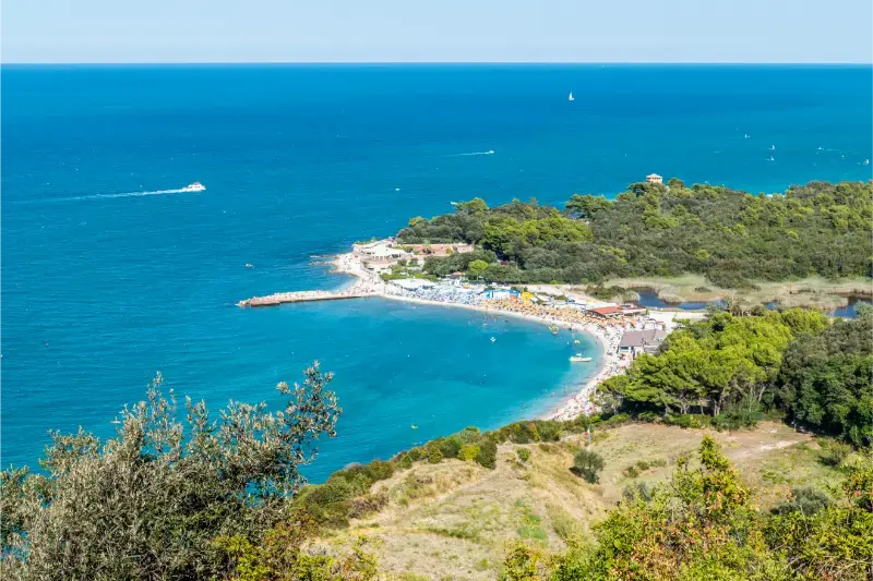
    Portonovo sits below Monte Conero, where the headland changes the feel of the Adriatic coast. The wooded hillside appears unusually close to the beach, creating a strong contrast between the green slope and pale stones at the waterline. This setting also limits space for roads, parking, and development. It is why the bay can feel atmospheric outside peak hours yet crowded on busy summer days. Decide before arriving whether you primarily want a beach day, a short cultural walk, or a meal beside the water. Combining everything is possible when conditions are favorable, but the logistics differ from a larger seaside town.

    For travel beyond Portonovo Bay, consult our Marche travel guide; it explains how to choose a base and link nearby destinations.

    The bay is part of the wider Conero landscape and must be treated as a real coastal environment. Weather, wind, currents, and the state of the sea matter even when the water looks inviting in a photograph. The distinction between managed beach facilities and freely accessible sections can vary with the season. Check posted signs and do not assume that a quiet corner is safe for swimming or that you may walk across private or protected areas. Portonovo is most rewarding when visitors accept its physical limits instead of trying to force a resort-style itinerary onto a small bay.
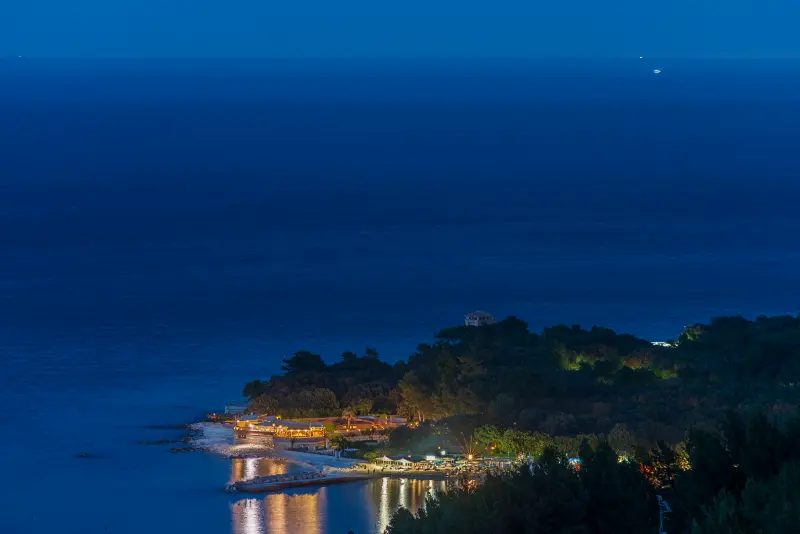
    Portonovo Village Night Illuminated Restaurants Beach Resort Reflection Blue Sea Italy

    Choose the right stretch of beach

    The beaches at Portonovo are generally characterized by pebbles and coarse stones rather than fine sand. That affects the entire day: footwear suitable for stones can help, and a thick beach mat may be more comfortable than a thin towel. The shore's composition and slope can change after storms, so do not rely on a picture from a different year to assess the exact water entry. Visitors who need very gradual access should investigate the specific managed section and its facilities before traveling. A generic claim that the beach is "family friendly" is not enough for every family.

    Arrive early in busy periods if you need a particular facility or a convenient place to settle. Paid beach establishments may offer loungers, shade, and services, while public stretches require more self-sufficiency. Ask about reservations and what is included rather than assuming that a booking covers everything. If traveling with children, establish an easily recognizable meeting point and keep a close eye on them near the water and at the edge of busier paths. The compact bay can feel relaxed, but a crowded shore changes how carefully a day must be managed.

    Visit Santa Maria di Portonovo

    The Romanesque Church of Santa Maria di Portonovo is a compelling reason to step away from the beach for a while. The building preserves a link to a Benedictine religious presence that developed in this coastal setting around the medieval period. Its stone form is particularly striking because it seems so close to the mountain and sea. Walking toward the church gives visitors a different view of Portonovo: once a remote place of religious life and coastal vulnerability, not a destination created primarily for swimming and restaurants.

    Check the church's official seasonal visiting arrangements before setting out. The Ancona tourism service publishes dates and access details, which can change from year to year; a timetable from 2026 should not be quoted as certain for 2028. If a service or religious activity is taking place, behave as a respectful visitor. Photography may be restricted inside. Even when access to the interior is unavailable, seeing the surrounding setting from permitted paths can add historical depth to the day. Avoid crossing private land or conservation boundaries to reach an unconventional viewpoint.

    Understand the Napoleonic Fort

    Portonovo also contains a fortified structure associated with the Napoleonic period. The Napoleonic Fort was built as part of the coastal defense system during the early nineteenth century. Its position illustrates why the bay was strategic: a landing place with access to water mattered in an era when naval conflict and shore defenses shaped life along the Adriatic. The building has since been restored and adapted to other uses. It should not be described as a conventional public military museum with unrestricted rooms and fixed admission.

    The most useful approach is to learn the history from official tourism information, then enjoy lawful views of the exterior. Where parts of a building are operated as accommodation or dining space, ordinary commercial and private-use rules apply. A visitor is not automatically entitled to enter because a guide mentions an important historic structure. Nearby, coastal defensive remains from different centuries help show that Portonovo's history extends beyond its beach appeal. A short cultural detour can make the bay more memorable without requiring a formal museum circuit.

    Locate the Clementine Tower and historic landmarks

    The Clementine Tower is another reminder of Portonovo's need for coastal observation and protection. It is generally associated with the eighteenth century, earlier than the Napoleonic fort. The relationship between the tower, church, and later fort tells a layered story: religious settlement, coastal security, and changing maritime strategy all left traces within a small area. Viewing them as one historical landscape is more meaningful than treating each as an isolated photo opportunity. Use established public routes and notice how the buildings occupy different positions relative to the beach and slope.

    Because Portonovo is compact, some visitors assume they can see every landmark in a few minutes. In practice, the terrain, weather, and access restrictions can slow a walk. Set aside enough time to enjoy the approach and to read any interpretation available. If you are mobility-limited, verify the surface and gradient of the desired paths before leaving the parking area. A coastal itinerary is not necessarily step-free merely because its overall distance is short. It is reasonable to choose one or two accessible viewpoints rather than attempt the entire historic circuit.

    Enjoy the bay's food culture responsibly

    One of Portonovo's gastronomic associations is the wild mussel known locally as mosciolo, connected with the waters of the Conero coast. This is a useful cultural detail, but it comes with an important distinction: wild marine resources are managed and subject to environmental conditions, regulations, and seasonal availability. Do not collect shellfish yourself because you have read that they are a local specialty. Choose reputable restaurants or authorized suppliers, and respect any posted restrictions on fishing and harvesting.

    If you want to try local seafood, book a table during high season and ask what is genuinely available that day. A menu featuring mussels does not mean that every portion comes from the same source or that the wild local product is offered year-round. Restaurants may have limited parking nearby, making arrival logistics part of the dining plan. A relaxed lunch can be an excellent way to divide a beach day, but avoid drinking and then taking a long swim or driving when impaired. The atmosphere is best enjoyed without turning the meal into another hurried attraction.

    Arrange parking and seasonal transport

    Portonovo's limited space means that transportation choices are central to a successful visit. Ancona tourism publishes information about seasonal buses and shuttle connections from the upper parking area to the bay, including route details that apply to particular travel periods. These services should be checked for the actual year, day of week, and time you plan to travel. A shuttle schedule from a previous summer cannot be treated as a guaranteed service in 2028. The final return time matters as much as the outbound trip.

    If driving, follow the designated signs and be prepared for parking to fill in popular periods. Do not park along roadsides where prohibited or obstruct emergency access. If a lower lot is full, use legal alternatives rather than expecting to find a hidden roadside space. Walking down to the bay is not the same as walking back up after hours in the heat, particularly with beach equipment and children. Assess the slope and available transit before committing. Coming by bus from Ancona may be convenient, but only when connections and service frequency support your intended schedule.

    Plan for safety in the sea and on paths

    Sea conditions at Portonovo can change quickly, and the rocky or pebbly shore requires attention underfoot. If lifeguards and warning flags are present, follow their instructions. Do not swim beyond designated areas or enter the water during unsafe conditions merely because it appears clear. Children need supervision close enough to respond immediately, not from a distant café table. If you are unfamiliar with the beach, enter cautiously and stay within your ability. Water shoes help with stones but do not replace safe judgment about waves or currents.

    The wooded slopes and coastal paths around Monte Conero have their own hazards. Some tracks can be steep or restricted for environmental reasons, and there may be rockfall or erosion concerns in coastal sections. Use official park information for trail status instead of following a random social-media route. Keep to marked paths and avoid closed descents. For an easy day, do not try to link the bay to multiple distant beaches on foot unless you know the approved route and its demands. A short authorized walk with good views is preferable to an improvised and potentially unsafe shortcut.

    Decide when to visit

    Late spring and early fall can offer a pleasant balance between manageable temperatures and a less intense beach atmosphere, though some services may operate only seasonally. Summer brings the fullest beach experience and the greatest demand for parking, dining, and loungers. Arriving early or on a weekday can help, but it does not guarantee solitude. If you primarily want to see the church and the landscape, cooler months may be appealing, provided visitor access and road conditions are confirmed. Swimming is not the only way to appreciate Portonovo.

    Weather is important in every season. A windy day may make the beach uncomfortable while leaving other cultural attractions in Ancona suitable for a visit. Rain can make wooded paths slippery, and storm damage may change which sections of the shore are accessible. Keep an alternative plan rather than treating any particular beach as mandatory. If the church or a restaurant has a separate seasonal calendar, verify those times alongside the transport schedule. The most common planning mistake is assuming every part of Portonovo operates according to the same hours.

    Combine Portonovo with Ancona or the wider Conero

    Portonovo fits naturally into a trip based in Ancona or along the Conero Riviera, but the best pairing depends on how long you intend to stay on the beach. A half-day visit may allow time for a short coastal walk and lunch; a full beach day deserves space without a second distant destination. Ancona provides museums, the cathedral, urban services, and transport connections for a complementary city experience. Travelers staying in Sirolo or Numana can also visit the bay, but should account for summer traffic and parking rather than comparing distances alone.

    Overnight accommodation in the immediate area can be limited or costly compared with broader options in Ancona and nearby settlements. Compare parking, access, and evening transport before booking. A hotel advertising the Conero Riviera may not be within walking distance of Portonovo's beach. For families, practical matters—shade, beach surface, restrooms, and the return journey—should carry more weight than a dramatic photo. Portonovo is at its best as a carefully planned encounter with an unusual stretch of coast, where landscape, history, and food all contribute to the experience.

    Quick planning reference

    Best use of timeTreat Portonovo Bay Guide as a focused day or overnight stop rather than adding it as a rushed detour.
    ArrivalConfirm the current road or transit options for Portonovo, Ancona, Italy before departure.
    ReservationsCheck official opening and reservation notices for interior visits, activities and special-access sites.
    Footwear and mobilityExpect uneven paving or terrain; confirm step-free routes with the relevant venue.
    WeatherKeep an indoor or shorter backup plan if conditions change.

    Continue planning your Marche trip

    Official resources and final checks

    Before departure, check the official sources below for the latest museum hours, access rules, trail notices and any seasonal services. Their current information should take precedence over older guides, especially for visits planned in 2028.

    If you prefer to stay overnight rather than return after a long drive, compare accommodations and read recent guest reviews before booking.

    Compare places to stay near Portonovo, Ancona, Italy

    Frequently asked questions

    Is Portonovo a sandy beach?

    Portonovo is known for pebble and stony beaches. Bring appropriate footwear and check the specific shore conditions where you plan to settle.

    Can I reach Portonovo by bus?

    Seasonal services and a shuttle have operated from the Ancona area, but exact routes and dates need checking for the year of travel.

    What historic sites can I see in the bay?

    The Church of Santa Maria, the Napoleonic Fort, and the Clementine Tower help explain the bay’s religious and maritime history.

    Are Portonovo restaurants open all year?

    Some services are seasonal. Check current opening days, table reservations, and whether parking or shuttle access affects arrival.

    Is swimming always safe at Portonovo?

    No. Follow lifeguard advice and warning flags; rocks, waves, and changing conditions require care even in clear-looking water.

    Last updated: October 17, 2026
  • Corinaldo Travel Guide: Medieval Walls, Piaggia and the Polenta Well

    Corinaldo Travel Guide: Medieval Walls, Piaggia and the Polenta Well

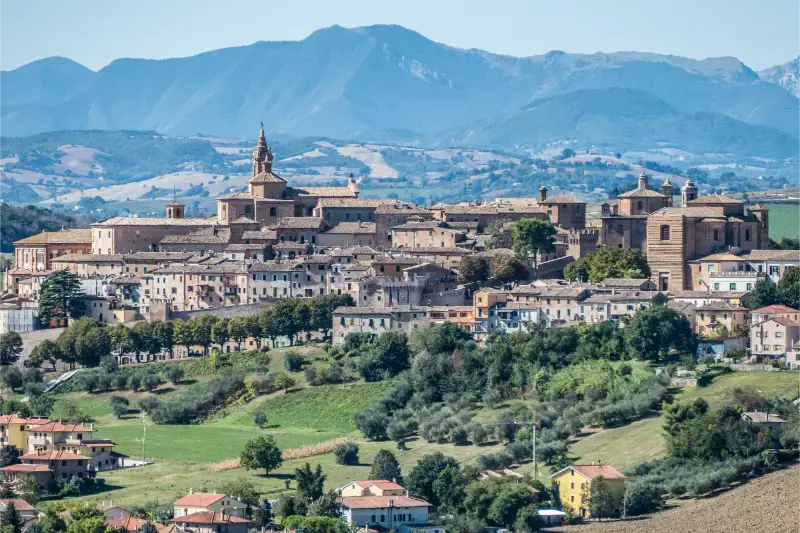
    Corinaldo is not a place where one monument explains everything. Its appeal comes from the relationship between a fortified hilltop, an unusually coherent circuit of walls, steep lanes and a lively local tradition built around the Piaggia staircase. In northern Marche, within reach of the Adriatic resorts around Senigallia, it offers a genuinely different day from the beach: an old town to explore at walking pace rather than a list of famous rooms to rush through. The recommended first visit is a loop of the walls followed by the staircase and central streets, with a stop for local food. Check museum access separately instead of assuming the whole heritage circuit uses one ticket.

    In this guide

    Start with the defensive geography

    Corinaldo's position matters as much as its buildings. Looking from the surrounding countryside, you can understand why a settlement on high ground needed a substantial belt of protection: approaching forces would have been visible across the rolling agricultural landscape long before reaching the gates. The town's fortifications still give a readable outline of that defensive purpose. Begin outside or near a surviving gateway, where the slope and relationship between wall and road are easier to appreciate, rather than immediately climbing to the busiest square. What seems like a picturesque brick boundary from one angle becomes a designed military barrier when viewed from below.

    For travel beyond Corinaldo Travel, consult our Marche travel guide; it explains how to choose a base and link nearby destinations.

    Walk the permitted stretches slowly and notice interruptions in the masonry, projecting towers and changing views between town and countryside. A medieval circuit was not intended as a continuous panoramic walkway for tourists, so do not assume every tower or parapet is open. A short circuit on public streets is usually more rewarding than hunting for a complete elevated loop that may not exist. For photography, the transition from a fortified gate to an ordinary residential lane captures Corinaldo better than a wide shot with no recognizable details. Keep respectful distance from private doors and driveways, particularly where homes back directly onto the historic walls.

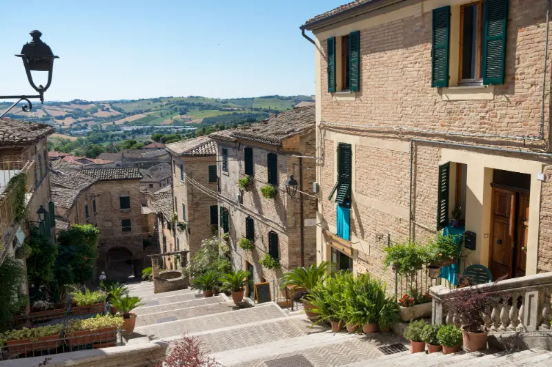
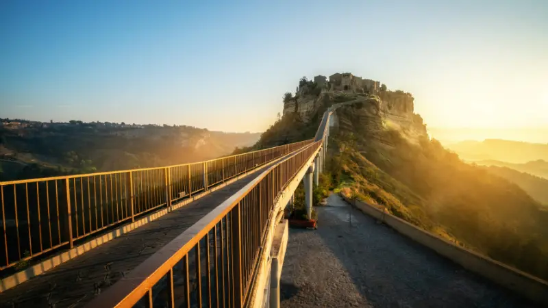
    Corinaldo Medieval Walled Town Marche Italy

    Make the Piaggia staircase the centerpiece

    The Piaggia is the scene most visitors remember: a long, sloping staircase lined with buildings and the well at its center. It is tempting to treat it as a photographic prop, but its importance is spatial. The climb connects different levels of Corinaldo and reveals how daily movement through the town depended on gradients, steps and small landings. Walk down once, then turn and climb back in stages. The change of perspective helps you see the houses, doorways and view lines that are almost invisible when concentrating on your footing. Comfortable shoes with traction are much more useful here than elegant but slippery soles.

    The well is commonly associated with the local legend of the Polenta Well. According to the story, a sack of cornmeal fell into the water and an implausible sequence of events produced jokes about someone eating polenta inside the well. The story is folklore, not a documented account of actual communal cooking. The tourist office explains that the well's historical predecessor was built in the late fifteenth century and that the present feature was reconstructed in the twentieth century. This distinction makes the stop more interesting: visitors see a physical place through which Corinaldo has chosen to remember and perform its local identity.

    Understand the walls rather than just counting towers

    Look for the differences between the older eastern defenses and later Renaissance extensions. The official town account distinguishes gateways and sections built or altered in different periods; the wall circuit was not created in one uninterrupted construction campaign. At certain points an angular approach or projecting tower makes sense only when you imagine a former entry road. You do not need specialist architectural vocabulary to read this landscape. Ask a simple question at each surviving entrance: how would someone have arrived here before the ring roads and car parks existed?

    The wall is also the best introduction to the town's modest scale. Corinaldo can be explored in a half day without sacrificing the places that make it distinctive. Rushing to add several more hill towns in the same morning usually reduces them to similar photographs. A better approach is to pair Corinaldo with a slower afternoon at Senigallia or another nearby stop. That contrast—brick fortification inland, flat sandy coast on the Adriatic—helps explain why northern Marche offers a varied itinerary even over a short stay.

    Add the central streets and churches

    Once you have seen the defensive ring, move inward. The town's small squares and parish buildings reveal a later layer of civic and religious life that is not always obvious from the walls. You may encounter churches that open only for worship, volunteer-led visits or limited hours. If interiors are important, check locally in advance; an attractive doorway does not guarantee access. Even when a church is closed, look at its placement along a route or at the edge of a square. Such buildings often mark the places where people met, traded and organized town life.

    Give some time to unplanned exploration between the staircase and central streets. Ordinary details—the width of a lane, an old lintel, a shop with seasonal produce, a small view over fields—allow Corinaldo to feel inhabited rather than staged. The town can be quiet on weekdays outside the summer season, and that quiet is a feature, not a defect. There is no need to fill every minute with scheduled attractions. If you are traveling with children, the changes in level and sightlines can become a game of spotting gates and towers; however, supervise them closely on steps, steep edges and road crossings.

    Build a half-day walking route

    For a first visit of three or four hours, park legally outside the most constrained old-town streets and approach through a recognizable gate. Spend the first part of the morning reading the defensive perimeter, then enter the center and walk the Piaggia with enough time to stop at the well. Continue to a small square for coffee or lunch and use the last portion for a church or museum whose opening has been confirmed. This sequence reduces unnecessary backtracking, although the exact entry gate will depend on where parking is available.

    A slower full day changes the emphasis. Rather than adding artificial checklist items, linger over lunch and take another wall-side stroll in different light. A visitor interested in fortifications may spend longer studying towers; someone drawn by folklore may arrange a local guided visit that explains the historical reenactment tradition. In either case leave space for delays. Historic centers can have temporary works, market restrictions or festivals that change pedestrian routes. Save the official town map offline when possible and treat online driving directions through old lanes with skepticism.

    Arrive from the coast or inland

    A car generally makes Corinaldo easier to combine with rural viewpoints, vineyards or another small hill town. The town is inland from Senigallia rather than on the railway, so the last leg requires road transport. Public bus connections may exist, but services on weekends, public holidays and school-free days can differ considerably. Check the current operator timetable both ways, especially the return trip; do not rely on an app's estimate that ignores a midday gap. For a car journey, navigate to a confirmed visitor car park or city entrance rather than typing the name of a staircase into the satnav.

    Those staying in Urbino or Ancona should think of the visit as one part of a longer regional route and not assume that a rail journey to the coast puts them within walking distance. Allow time for winding approaches through the hills and for finding a legal parking space. If you have limited mobility, ask the tourism office which entry point minimizes steps. Corinaldo's layout includes slopes and stairs, and there is no truthful way to promise a completely step-free experience across the historic center.

    Food, festivals and the season that suits you

    The Polenta Well story makes local food part of the town's visitor identity, but it would be a mistake to assume every restaurant serves the same special dish year-round. Regional menus may feature fresh pasta, seasonal vegetables, cured meats and wines from the surrounding hills. Choose a restaurant by its current menu and opening day rather than by a list published years earlier. If you plan to visit during a town festival, reserve food and lodging earlier and be prepared for road restrictions, noise and crowds around the staircase.

    Spring and early fall are often comfortable for walking because the sun is less punishing on open paving. High summer brings a lively holiday atmosphere, but the climb up the Piaggia can feel more strenuous in midday heat. In winter, cold wind and wet stone make footwear and daylight more important. Families may enjoy a festive reenactment if the dates align, while travelers seeking architectural details and quiet photographs may prefer an ordinary weekday. Before fixing plans, verify the official event calendar rather than assuming an annual celebration always falls on the same weekend.

    Decide whether to sleep in Corinaldo

    A night in town works especially well for couples, slow-travel photographers and travelers following a route through the lesser-known Marche hills. After day visitors have left, the streets regain a very local rhythm, and an early-morning walk can be more memorable than an additional museum. Check whether your chosen accommodation is inside the walls and whether it provides practical luggage instructions. A room with character may involve stairs, limited vehicle access and no elevator; accessibility claims should be checked at the room level, not just the property's entrance.

    For a beach-based holiday, however, a Senigallia hotel may be the more efficient choice. You can spend the afternoon inland without moving suitcases, and the coast offers simpler rail connections. Corinaldo's value is not measured by whether it deserves a hotel reservation for everyone. It earns a place in an itinerary because it reveals a defended rural Marche that feels different from the region's better-known seaside towns. Use it as a purposeful contrast, not an interchangeable stop added to an overstuffed road trip.

    Small mistakes that change the visit

    The most common mistake is underestimating the slope. A traveler who arrives in sandals, hurries straight up the Piaggia and immediately leaves may find the town tiring rather than interesting. Another is treating the Polenta Well story as literal medieval history. Distinguish the surviving fortifications, the rebuilt feature and the folklore around it, and the visit becomes richer. A third mistake is expecting a timetable-driven museum experience in a small town where some sites operate only on designated days or during events.

    Finally, do not confuse proximity on the map with effortless travel by public transportation. A town only a short distance inland can require careful planning if your itinerary relies on infrequent buses. Confirm opening days and transport first; once those constraints are solved, Corinaldo is one of the easiest hill towns in northern Marche to enjoy without an elaborate schedule. Leave with a memory of the walls, the stairs and the surrounding countryside rather than the feeling that you missed a long list of attractions.

    Quick planning reference

    Best use of timeTreat Corinaldo Travel Guide as a focused day or overnight stop rather than adding it as a rushed detour.
    ArrivalConfirm the current road or transit options for Corinaldo, Marche, Italy before departure.
    ReservationsCheck official opening and reservation notices for interior visits, activities and special-access sites.
    Footwear and mobilityExpect uneven paving or terrain; confirm step-free routes with the relevant venue.
    WeatherKeep an indoor or shorter backup plan if conditions change.

    Continue planning your Marche trip

    Official resources and final checks

    Before departure, check the official sources below for the latest museum hours, access rules, trail notices and any seasonal services. Their current information should take precedence over older guides, especially for visits planned in 2028.

    If you prefer to stay overnight rather than return after a long drive, compare accommodations and read recent guest reviews before booking.

    Compare places to stay near Corinaldo, Marche, Italy

    Frequently asked questions

    How much time should I allow for Corinaldo?

    A relaxed half day is usually enough for the walls, the Piaggia staircase, and an unhurried meal. Allow longer if you have confirmed a museum or guided visit.

    Can I walk on all of Corinaldo’s walls?

    Do not assume the entire medieval wall circuit is open at parapet level. Follow designated public routes and current local access information.

    What is the Polenta Well?

    The well by the Piaggia staircase is associated with a local story celebrated in Corinaldo. Learn the tradition, but distinguish folklore from verified history.

    Is Corinaldo a good trip from the Adriatic coast?

    Yes, it can be paired with a stay around Senigallia if you arrange road travel. Check parking and allow extra time for the hilltop approach.

    Is the town easy with a stroller?

    Some central streets are steep, stepped, or uneven. Choose a shorter route and check alternatives to the Piaggia staircase.

    Last updated: October 17, 2026
  • What to Eat in Calabria: Pasta, ‘Nduja, Seafood and Regional Sweets

    What to Eat in Calabria: Pasta, ‘Nduja, Seafood and Regional Sweets

    Calabrian food deserves a more careful introduction than the familiar equation of red chili, ‘nduja and everything ‘spicy.’ Calabria stretches from the Ionian to the Tyrrhenian Sea, from citrus-growing plains to mountain forests, and its food follows those different environments. Fish, legumes, pasta, wild greens, olive oil, cheeses and slow-cooked meat sit alongside bold preserved products. The region’s Greek, Byzantine, Albanian and wider Mediterranean cultural connections are reflected in recipes and celebrations, but no single dish can represent every town. This guide is for travelers who want to order with confidence, recognize specialties in markets and understand where to look for them. It also explains how to distinguish protected geographical products from loose marketing claims and how to experience local food without assuming every small kitchen serves the same menu.

    In this guide

    Understanding Calabria through geography rather than stereotypes

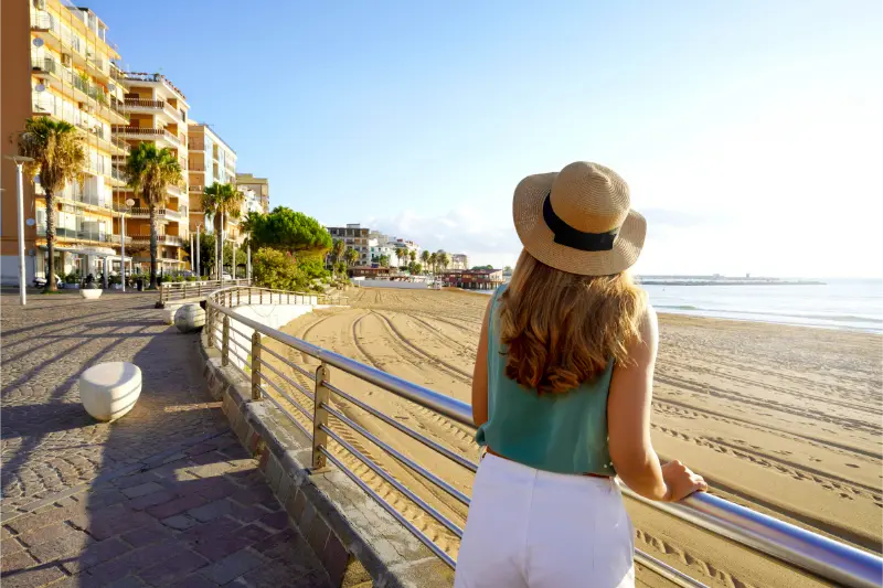
    The simplest food map divides the region into coasts, agricultural plains and mountains. Along the Tyrrhenian and Ionian shores, menus often reflect fishing traditions and seasonal vegetables. In hill towns, preserved meat, beans, pasta and bread have historically played an important role, while mountain environments support cheeses, mushrooms and different meat preparations. These are tendencies, not rigid boundaries: ingredients move, families migrate and restaurants innovate. A coastal trattoria can offer a substantial meat dish, and a mountain town may serve fish. What matters is to ask what comes from the surrounding area and what is cooked well that day. If you only seek dishes labeled ‘very hot,’ you will miss sweetness from red onions, richness from olive oil, tang from citrus and the careful use of herbs. Calabria’s cuisine is vivid because ingredients contrast, not because every plate burns.

    Calabria Back Young Woman Crotone Promenade Coast Italy

    Extend a visit to What to Eat in Calabria with the suggestions in our Calabria travel guide, which covers regional transport and where to base yourself.

    ‘Nduja and other cured meats: how to taste them properly

    ‘Nduja is a soft, spreadable pork salume famous for its use of chili and its strong connection to Spilinga and the Vibo area. It is often spread sparingly on warm bread, added to sauces or used as an accent rather than eaten by the spoonful. Heat levels can vary by producer and recipe. Ask for a small taste if you are uncertain and pair it with bread or other food instead of judging it on an empty palate. Calabria also produces protected cured meats, including capocollo, soppressata, salsiccia and pancetta with recognized regional specifications. A tasting plate provides a useful comparison of textures and seasoning, but do not assume every cured meat labeled ‘Calabrese’ carries the same certification. Read the actual designation and producer information. The best way to appreciate these products is in moderation alongside vegetables, cheese and bread, not as a challenge to tolerate the highest possible spice level.

    Red onions from Tropea: sweet, versatile and widely imitated

    Cipolla Rossa di Tropea Calabria IGP is one of the region’s most recognizable ingredients. The protected designation relates to a defined product and geographical production area, not simply any red onion sold in the town of Tropea. Its characteristic sweetness makes it suitable for salads, slow cooking, preserves and accompaniments to meat or cheese. When shopping, look for appropriate product labeling rather than assuming that red color alone proves origin. Restaurant menus may use the name loosely, so ask how the onion is prepared if its flavor is central to your order. The growing landscape along the Costa degli Dei is part of the story; the product belongs to agriculture as much as tourism. A dish using onion well can be more revealing than a heavily spiced plate because it shows how regional cooks balance acidity, sweetness and savory flavors.

    Fileja, lagane and the diversity of Calabrian pasta

    Calabria has a strong tradition of handmade pasta, with local names and shapes changing from one area to another. Fileja, associated especially with the Vibo area, is often shaped by rolling dough around a thin rod and may be served with tomato-based sauces, meat or vegetables. Lagane are broader pasta strips sometimes paired with legumes, particularly chickpeas, in hearty traditional dishes. Other hand-formed varieties appear in the Pollino, the Ionian towns and Arbëreshë communities. Do not expect one uniform spelling or recipe across restaurants; oral traditions and family habits vary. Ask what pasta is made fresh and what sauce the kitchen recommends. A modest dish of pasta and beans can tell as much about inland daily life as an elaborate festival specialty. For travelers attending a cooking class, learning to shape the dough is often more memorable than collecting an ambitious number of recipes.

    Cheese, mountain products and the important role of pastoralism

    Cheese connects the region’s mountainous and rural landscapes with everyday cooking. Caciocavallo Silano DOP, Pecorino Crotonese DOP and Pecorino del Monte Poro DOP are among the products whose names carry protected designations. They differ in milk, production methods and flavor, so they are not interchangeable simply because they appear on a cheese board. Ask a producer or shop how mature a cheese is and which local bread or vegetable preparation pairs well with it. In the Sila and Pollino areas, pastoral traditions and mountain agriculture make dairies and rural restaurants especially interesting, but any tasting visit should be arranged around actual opening hours. Buy chilled dairy products with transport and storage in mind, particularly in summer. The larger lesson is that cheese reflects working landscapes and seasonal labor, not only a list of names to memorize before entering a deli.

    Fish traditions: swordfish, stockfish and coastal variety

    Swordfish is a distinctive part of the culinary identity of the Strait of Messina and Costa Viola areas, especially around Scilla and Bagnara Calabra. Recipes may include grilled fish or preparations with vegetables and regional seasonings. Stockfish has a separate history, strongly associated with communities such as Mammola, where imported dried fish became rooted in local cuisine through particular methods of soaking and cooking. These traditions show that ‘local food’ is not limited to ingredients caught or grown a few kilometers away; historical trade routes and techniques matter. Fish availability and provenance vary, so ask restaurants what they are serving rather than accepting the claim that everything is caught that morning. On the Ionian coast, different seasonal fish and seafood dishes appear. Travelers who do not eat fish can still explore the region through vegetables, beans, pasta and olive oil without missing the broader culinary story.

    Citrus, bergamot, licorice and what to take home

    Bergamot from the Reggio Calabria area is especially important for aromatic products and has a recognized protected origin for its essential oil. The fruit’s fragrance connects local agriculture with perfumery and flavorings, although not every bergamot-themed sweet or drink is identical in quality. Calabria is also known for protected licorice products, particularly in the Rossano area, and for clementines and other citrus crops. Look for responsibly labeled syrups, candies, teas or preserves that will travel well. Avoid buying a liquid simply because the label features a famous regional place name; read ingredients and provenance. If you are carrying gifts on a flight, remember liquid limits and temperature sensitivity. A small well-made product from a reputable producer is usually a better souvenir than a collection of anonymous bottles with decorative maps of Calabria.

    Chiles and condiments: bold flavor without flattening everything

    Peperoncino is a widely recognized part of Calabrian food culture, and the town of Diamante is particularly associated with chili-themed celebrations. Yet heat serves many purposes: seasoning preserved meat, sharpening a vegetable dish and balancing rich flavors. It should not overwhelm every ingredient. Regional condiments include spreads and preserved vegetables whose recipes vary by town and household. Sardella, a spicy spread traditionally linked to the Ionian side, also raises an important point: ingredients and modern commercial preparations may differ, and food labeling or fishing regulations affect what can legally be sold. Ask a vendor what is in a product instead of assuming a traditional name guarantees the historical recipe. If you are sensitive to heat, request a small portion or ask for chili served separately. Many restaurants can provide satisfying Calabrian meals based on olive oil, pasta, greens and cheese without requiring a fiery sauce.

    Desserts: tartufo di Pizzo, nougat and festival sweets

    Tartufo di Pizzo is a celebrated gelato specialty, typically made as a rounded combination of ice cream flavors with a rich center. Its name can confuse visitors expecting a truffle fungus: this is a dessert, not a mushroom dish. Try it at a reputable Pizzo establishment and compare texture and filling rather than assuming all versions are identical. Bagnara Calabra is renowned for Torrone di Bagnara, a protected geographical specialty, while towns across Calabria have their own pastries linked to religious festivals, almonds, honey and family recipes. Some sweets appear only at particular times of year, so the absence of a named festival pastry in June does not mean the bakery is inauthentic. Ask for the day’s specialty and how it should be stored. A regional dessert crawl is most enjoyable when it includes a few good stops and time to appreciate each rather than a single afternoon of nonstop sugar.

    Olive oil, wine and the agricultural foundation of meals

    Protected Calabrian olive oils, including areas associated with Lametia and other regional designations, reveal how important olive trees are to the landscape. A good extra-virgin olive oil can transform simple bread, legumes or grilled vegetables. Instead of asking whether an oil is simply ‘strong,’ try to notice fruitiness, bitterness and peppery sensations in balance. Calabria also has distinctive wines, including Cirò DOC, associated with the area around Crotone, and other local varieties. Wine experiences are best arranged with recognized producers and a designated driver or transport plan. Not every vineyard is open to visitors without a booking. If you do not drink alcohol, the region’s citrus drinks, mineral water and food traditions still offer a broad sensory journey. The most revealing meals often begin with excellent bread and oil rather than with a long sequence of expensive courses.

    A regional food route without racing between provinces

    Build food-focused travel around geography. In the Vibo and Costa degli Dei area, combine Tropea onions, fileja, ‘nduja, cheeses and Pizzo’s famous dessert over several meals. Around Reggio and the Costa Viola, look for swordfish traditions, bergamot and Bagnara nougat. In the Sila, allow time for rural food, mountain cheeses and seasonal mushrooms from reputable sources. In Cosenza and Rossano, seek out pasta, sweets, licorice and citrus traditions. These areas are not all a short drive apart, and each deserves more than a shopping stop. A three-day culinary trip should concentrate on one or two neighboring zones, not promise the entire region. Book any special tasting directly and distinguish public markets from private farms that require appointments. Traveling slowly reduces mileage and gives you more chances to meet producers and understand what they make.

    Ordering respectfully, dietary needs and shopping tips

    Many local menus are written in Italian, and regional dialect names can make unfamiliar dishes harder to decode. A friendly question about ingredients is better than pretending to recognize everything. Travelers with allergies or dietary restrictions should clearly explain them, because products such as cured meats, cheeses, nuts or seafood may appear in preparations where the name gives little away. Vegetarian travelers can enjoy vegetable sides, legumes, pasta and breads, but should check stocks, sauces and traditional recipes that may include animal products. Buy food souvenirs from reputable shops, check packaging and temperature requirements, and confirm whether products can legally enter your home country. Above all, avoid demanding that every kitchen produce a ‘traditional’ dish on command. Food cultures change with season, family and availability. Curiosity and respect will lead to more memorable meals than a rigid checklist.

    At a glance

    Suggested timeHalf a day to a full day, depending on your focus
    TransportVerify current rail, road or local transfers before travel
    Best approachChoose a realistic route and prioritize safety or access notices
    Base or visitCalabria, Italy

    Related Calabria guides

    Official sources and planning links

    Schedules, access restrictions and services can change. Use these official or primary sources to check details before visiting:

    Frequently asked questions

    Is all Calabrian food very spicy?

    No. Chili is important in some preparations, but the cuisine also features mild cheeses, sweet onions, fish, beans, pasta, vegetables and citrus.

    What should I try first on a short visit?

    Choose a local pasta dish, a regional cheese or vegetable plate, one well-made cured meat preparation if you eat pork, and a dessert linked to the town you are visiting.

    Is ‘nduja from every part of Calabria?

    It is closely associated with Spilinga and the wider Vibo region, although it is sold and used across Calabria and far beyond.

    Where should I try tartufo ice cream?

    Pizzo is the destination most closely associated with the specialty. Choose a reputable gelateria rather than assuming every tourist version is the same.

    How do I recognize protected products?

    Look for the correct DOP or IGP designation and reputable labeling, rather than relying only on a place name or a generic ‘Calabrian’ claim.

    Last updated: October 17, 2026

  • Altomonte: Gothic Art, Medieval Streets and Slow Calabrian Food

    Altomonte: Gothic Art, Medieval Streets and Slow Calabrian Food

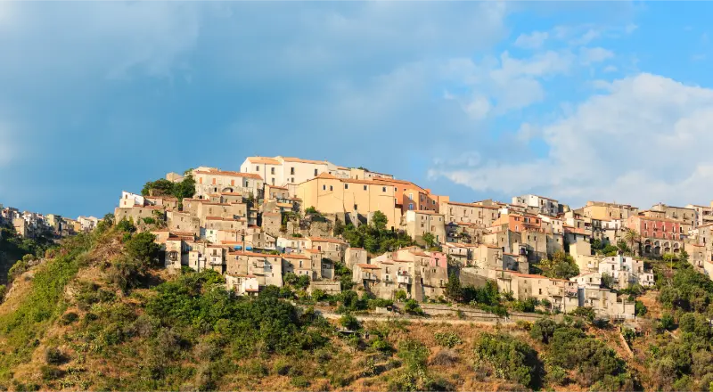
    Altomonte is one of Calabria’s most rewarding hill towns for travelers who want art and architecture without leaving the northern countryside. The village is set above the Esaro valley, where layers of medieval streets lead to an imposing church whose Gothic character feels unexpectedly different from the more familiar Baroque churches of southern Italy. It is sometimes described as a town of bread, food and slow travel, but its heritage deserves more than a lunch reservation. The castle, the Church of Santa Maria della Consolazione, the former Dominican convent and the views over fields below can fill an unhurried day. Altomonte is best approached as a lived-in community rather than a museum with a single entrance and closing time.

    In this guide

    Start with the shape of the medieval town

    Altomonte’s historic center has developed across a raised settlement whose lanes weave between old houses, open squares, churches and the castle. From a viewpoint outside or below the old town you can appreciate its compact form; inside it, turns reveal changing views of the countryside. The hilltop setting connects the village to the long history of landowners, farmers, religious orders and traders in northern Calabria. You do not need to memorize each period to enjoy the walk, but recognizing the relationship between valley agriculture and fortified upper settlement makes the architecture more meaningful. Use sensible shoes because old paving and gradients can be uneven, and set aside time for an unscripted detour down a quiet lane. The most interesting views are often between ordinary buildings, not from a terrace advertised as the ‘official’ viewpoint.

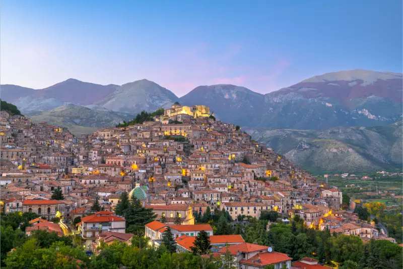
    Old Traditional Houses Altomonte Village Calabria Region Italy

    For travel beyond Altomonte, consult our Calabria travel guide; it explains how to choose a base and link nearby destinations.

    Santa Maria della Consolazione: Calabria’s Angevin Gothic side

    The Church of Santa Maria della Consolazione is the architectural highlight of Altomonte. Its forms reflect medieval Gothic influences associated with the Angevin period, showing a side of Calabria that visitors who know only coastal Byzantine churches might not expect. Pay attention to the lines of the façade, the proportions of the interior and the way religious patronage shaped the settlement. Later additions and conservation work complicate the simple idea of a church frozen in a single century. If worship is underway, refrain from photographing or circulating among the pews like a gallery visitor. Opening hours can change, and an occasional closure does not make the trip pointless: the church remains a significant element of the townscape, and the nearby convent and castle deepen the experience. Travelers fascinated by medieval art can spend far longer here than the modest size of the village might suggest.

    The Dominican convent and Altomonte’s civic collections

    The former Dominican convent has hosted civic cultural collections, including a museum and library spaces. These help connect the architecture of a religious complex with the development of local culture, collecting and public learning. Museums in smaller municipalities can occasionally change operating arrangements or close rooms for restoration, so check the current status of individual exhibitions before arriving. When galleries are open, make time to read labels rather than rushing through as though the only purpose were to confirm that an institution exists. The complex also gives visitors a reason to linger in the central area after admiring the church. A museum visit is especially valuable on a hot afternoon when a shaded indoor stop provides relief. If the collection is inaccessible, structure the day around the church, castle surroundings and the historical street network instead of inventing alternative attractions.

    The castle and the Sanseverino legacy

    Altomonte’s castle, with medieval origins and later rebuilding, is a reminder of the strategic and political significance of towns overlooking agricultural valleys. Its long history is connected with noble families, including the Sangineto and Sanseverino, and with changes in the balance of local power. Today, how much of the building can be entered may depend on its use, management and events. Do not mistake a private or event-operated interior for a public monument with unrestricted daily admission. Even from outside, its mass and relationship to adjacent lanes explain the medieval town plan. Instead of repeating unverified romantic legends, connect the building to the practical questions of defense, administration and land control. The surrounding square is a good place to pause and identify the route you have already walked. A castle need not offer a tower climb to contribute meaningfully to a visit.

    Altomonte as a ‘City of Bread’ and a food destination

    Food is part of Altomonte’s identity, with bread and traditional Calabrian products receiving particular attention. The broader Esaro landscape supports cereal cultivation, olive growing and rural food traditions. Look for locally baked bread, seasonal vegetables, cheese and simple preparations that reflect available produce. Do not expect a standard tasting menu with the same items at every restaurant. Some kitchens emphasize old recipes; others reinterpret familiar ingredients. Ask about locally produced olive oil and what the establishment bakes or prepares on site. Bread is at its most interesting when you learn what it accompanies, how families serve it and why it matters in regional meals, not when you collect a loaf simply because the destination has a nickname. An unhurried lunch helps justify the journey and supports small businesses that keep the village active outside short tourist visits.

    The best walking itinerary for an independent visitor

    Arrive in the morning, park legally outside the narrowest lanes and enter the historic center on foot. Spend the first part of the visit walking toward Santa Maria della Consolazione, noticing how the church dominates the built environment. If access permits, visit the former Dominican convent and any open civic collection before lunch. Afterward, wander toward the castle and explore the surrounding streets, stopping for countryside views. This order avoids treating the village as a five-minute photo stop; it also provides flexibility if a venue is closed or a religious service changes the schedule. Photographers may prefer a second exterior view in the afternoon, but do not crowd residents’ front doors. Families can shorten the climb with carefully selected parking and a midroute break. There is no need to add several other villages merely to justify a rental car; Altomonte merits its own pace.

    How to reach Altomonte and where to park

    Altomonte lies in the province of Cosenza in inland northern Calabria. A car is the most flexible option for a regional itinerary, although narrow historic lanes and possible traffic restrictions mean navigation should not lead you directly to the church door. Follow local signs to designated parking and carry luggage only if you are staying within the older center. Public buses may be limited, especially on Sundays or school holidays; travelers without a car should confirm actual services and return options. Remember that regional roads are not equivalent to motorway travel, and allow time for curves and junctions as you leave the main north-south routes. The town is easiest to combine with a broader stay in the Cosenza or Pollino area. Plan a sensible number of kilometers each day instead of drawing a straight line between unrelated destinations.

    Where to stay: village atmosphere versus road-trip convenience

    A guesthouse within the historic center is ideal if you want early morning walks, evening views and the pleasure of staying where day visitors seldom linger. Check whether it involves stairs, restricted car access or a walk from parking. A rural accommodation outside town may offer easier luggage handling, more outdoor space and parking, making it suitable for families exploring the valley. Travelers moving every night should compare the benefit of one night in Altomonte with using a single base for northern Calabria. A lower nightly rate may be offset by an inconvenient position or limited dining options. Ask whether breakfast and dinner are available nearby on the dates of your stay; smaller places can be quiet midweek. The most appealing stay is not necessarily the one nearest the church but the one that fits how you will actually move.

    Nearby destinations: the Esaro, Sibari and the Pollino area

    Altomonte sits in a region with several distinct types of excursion. The Sibari plain provides an archaeological story linked to ancient Greek settlement, while the Pollino foothills offer mountain villages and access to nature. Morano Calabro has its stacked historic skyline, and Civita preserves Arbëreshë culture; neither should be presented as a mere extension of Altomonte’s medieval art. If you want a two-day trip, pair a focused cultural village day with either archaeology or the mountains instead of visiting three superficially similar historic centers in a row. Inland drives take time, and mountain conditions can differ from those of the plain. It is sensible to make restaurant and museum plans before setting off, especially if traveling in the shoulder seasons when opening days can vary. Altomonte can be a quiet centerpiece of a regional itinerary, not just a stop between larger attractions.

    When to visit and what to know about accessibility

    Spring and fall often bring pleasant conditions for walking and photography; in summer, begin early and use shaded indoor stops or lunch during the hottest part of the afternoon. Winters can be quiet and atmospheric but bring cooler temperatures and occasional service changes. The historic fabric is uneven, and not every church or museum entrance is step-free. If mobility is a concern, contact venues in advance and prioritize the central public squares over extended climbs. On festival days, parking and restaurant availability may be very different from a normal weekday. Check the official tourism or municipal calendar, but do not rely on an old event listing as a guarantee. Respect local residents, particularly when photographing homes and religious buildings. Altomonte is a place where an intelligent, gentle itinerary reveals far more than a hurried ranking of ‘top sights.’

    At a glance

    Suggested timeHalf a day to a full day, depending on your focus
    TransportVerify current rail, road or local transfers before travel
    Best approachChoose a realistic route and prioritize safety or access notices
    Base or visitAltomonte, Calabria

    Related Calabria guides

    Official sources and planning links

    Schedules, access restrictions and services can change. Use these official or primary sources to check details before visiting:

    Frequently asked questions

    What is Altomonte famous for?

    Its medieval hill-town setting, the Angevin Gothic Church of Santa Maria della Consolazione, cultural collections and strong local food traditions.

    How long do I need?

    Allow at least half a day for the church, lanes and a relaxed meal; a full day is worthwhile if museums are open and you enjoy slow travel.

    Is Altomonte a useful place to stay overnight?

    Yes, particularly for a quiet village evening and access to nearby northern Calabrian excursions, provided you verify parking and dining.

    Can I visit without a car?

    It may be possible with planned transfers, but public transportation can be limited. Confirm actual routes and times before booking.

    Are the museums always open?

    No. Individual museums and former convent spaces may change schedules or close for work; check locally before your trip.

    Last updated: October 17, 2026
  • Civita: Arbëreshë Culture, Talking Houses and Raganello Safety

    Civita: Arbëreshë Culture, Talking Houses and Raganello Safety

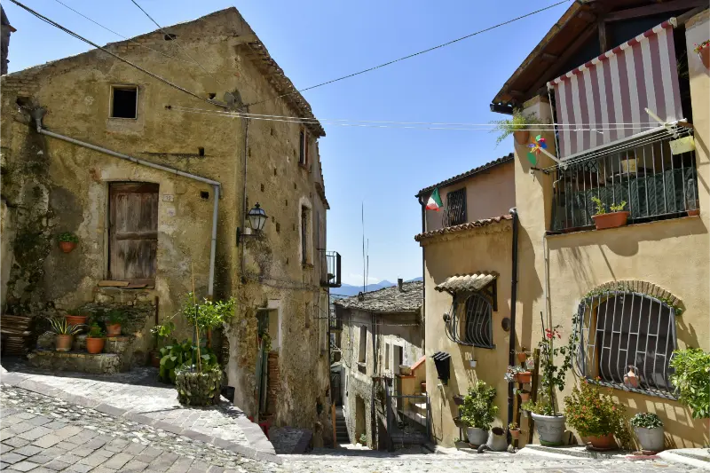
    Civita is not just a gateway to a dramatic canyon. This small village in Calabria’s Pollino National Park is one of the most vivid places in southern Italy to encounter Arbëreshë culture—the heritage of Albanian-speaking communities whose ancestors settled in parts of Italy centuries ago. Its lanes are arranged around close-knit neighborhoods, some houses appear to have faces, and the Byzantine liturgical tradition gives local churches a character different from many visitors’ expectations. The Raganello gorge lies immediately below, but this landscape has also witnessed fatal flash flooding and strict access measures. The responsible way to visit is to put village culture first and treat any canyon activity as a separately regulated, high-risk excursion rather than a casual add-on.

    In this guide

    The Arbëreshë story behind Civita’s identity

    The Arbëreshë are historic Italo-Albanian communities established in parts of southern Italy after migrations linked to upheavals in the Balkans during the late medieval and early modern periods. In Civita, this heritage is visible in language, religious practice, family history, food and local identity. It is not a theme invented for tourists or a costume worn during summer festivals. Listen respectfully when you hear an unfamiliar language in the street; the community has preserved its own traditions while belonging fully to Calabria and Italy. Local museums and cultural displays, when open, can provide essential context, but conversations with residents should never be treated as free performances. One of the best reasons to stay overnight is to experience the village outside the busiest visiting hours, when neighborhood life is more evident and cultural differences feel less like an exhibit.

    Civita di Bagnoregio Beautiful Old Town Italy

    Planning more than Civita? The Calabria travel guide compares the main areas and helps you put this stop into a manageable route.

    Gjitonia: how traditional neighborhoods organize village life

    Civita’s historic lanes are associated with the idea of the gjitonia, a neighborhood pattern built around shared space and close social relations. Small houses, entrances and little squares form clusters that helped people interact in their daily lives. A visitor can see the physical arrangement without claiming to understand every family tradition after one walk. Wander slowly and imagine how water collection, food preparation, conversations and celebrations once spilled into these communal spaces. Some houses are private homes today, and photographing through open doors is inappropriate. The architectural experience is subtly different from Morano Calabro’s cascade of roofs: Civita’s distinctiveness lies in intimate neighborhood units and the cultural life that links them. A small-group local heritage walk is worthwhile if you want to understand terms and customs without reducing them to vague stories about ‘ancient Albania.’

    The talking houses and the sculptural chimneys

    Civita’s best-known architectural curiosity is the group of buildings nicknamed the talking or Kodra houses. Windows and doors can resemble eyes and mouths, creating faces in the façades; the nickname honors Albanian painter Ibrahim Kodra. Look for these forms as you walk rather than expecting a single fenced attraction with a ticket booth. The town’s unusual chimneys are another feature, varying in form and carrying local symbolism and stories. The designs are not simply decorative props placed for an Instagram circuit. They belong to the settlement’s local building practices and cultural imagination. Visit with enough time to notice smaller features in ordinary lanes, and keep your camera directed away from residents’ intimate spaces. A photographed house may still be someone’s home. Architectural curiosity should never become an excuse to block a doorway or peer into a window.

    Santa Maria Assunta and the Byzantine rite

    The Church of Santa Maria Assunta offers an insight into the community’s Greek-Byzantine religious identity. Icons, liturgical orientation and the organization of sacred space may be different from the Latin-rite churches that dominate many Italian itineraries. Religious services are living expressions of faith, not re-enactments scheduled for visitors. If the church is open outside worship, dress and behave appropriately; if a ceremony is taking place, ask whether tourist entry and photography are permitted. The calendar of feasts may not match a simplified assumption about ‘Orthodox Easter’: the actual parish schedule and liturgical practice should be confirmed locally. Beyond Santa Maria Assunta, smaller chapels testify to community devotion and centuries of change. This religious dimension deserves as much attention as the cliff-top views because it explains why Civita is culturally distinctive rather than merely scenic.

    Devil’s Bridge: a viewpoint, not a permit to enter the gorge

    The Ponte del Diavolo, or Devil’s Bridge, spans the Raganello below the village and is surrounded by traditional legends. From approved public viewpoints, the bridge and steep-sided valley produce spectacular scenes. However, access routes, bridge conditions and paths can be affected by closures and safety work. Most importantly, reaching a viewpoint does not mean you have permission to descend into the watercourse. In 2018, a sudden flood in the gorge killed ten people. More recent local measures have sought to prevent unauthorized entries, including stricter barriers and controls reported in 2026. Treat any fence, closure or warning as binding, regardless of what an old travel article, tour listing or map says. Never climb around a barrier to recreate a photograph. The best visit may consist entirely of seeing the canyon from above and returning safely to the village.

    Raganello Gorge: regulations, flash floods and guided activities

    The Raganello is a steep, confined river environment where weather upstream can produce a dangerous flash flood even when skies near the village appear calm. Access rules have changed over time, and tourist promotion materials can lag behind restrictions. Do not assume canyoning, river trekking, rafting or the famous gorge approach is currently allowed. Before planning any activity, consult the municipality, managing authorities and current written ordinances; ask whether the exact route is legally open, under what conditions, and which operators are properly authorized. A private guide’s advertisement is not proof of permission. If the gorge is closed, choose alternative marked trails outside restricted zones. Never enter independently or use an improvised route, even in dry weather. The 2018 tragedy is a reason to foreground genuine safety rather than burying a warning below enticing photographs.

    Museums, crafts and the stories worth seeking out

    An Arbëreshë cultural or ethnographic display is a valuable stop where available, because clothing, domestic objects, textiles and written material can connect the village’s buildings with daily life. Other small heritage sites have included displays about traditional milling and the Raganello valley; opening hours and access are not guaranteed. Contact the municipality or local visitor service before planning around a particular collection. Handmade garments, instruments, food traditions and language are worth understanding in context, not shopping for as ‘exotic’ souvenirs. If you meet a local artisan, ask about production methods and prices rather than bargaining as if craftsmanship had no value. Civita’s best cultural experiences depend on respectful curiosity and on residents choosing to share their knowledge. An afternoon centered on heritage can be deeply rewarding even if the canyon cannot be entered.

    What to eat: Arbëreshë flavors, not a generic chili menu

    Local specialties reflect the food traditions of Arbëreshë families and the Pollino countryside. Dromësat, a traditional small pasta preparation, is worth looking for on a regional menu; other dishes can feature slowly cooked meat, herbs, cheese and seasonal vegetables. Sweets associated with community feasts may appear at particular times rather than year-round. Ask the restaurant what it makes itself and how a dish is usually served. A strong pepper flavor may occur, but not every Calabrian meal is defined by chili. Book lunch during busy holidays if your schedule is tight, and avoid demanding a specific ‘traditional’ plate that a small kitchen does not prepare that day. Food is a practical way to support the village economy, especially when you choose a family-run business instead of arriving for a photograph and leaving before spending any time there.

    A half-day cultural route around Civita

    Begin with the village center and its small neighborhood spaces. Explore the talking houses and chimneys without peering into private properties, then visit Santa Maria Assunta if open. Pause at a cultural display or museum if the local schedule permits, and choose a restaurant for a leisurely lunch. In the afternoon, consider an authorized public lookout over the Raganello landscape only after confirming safe access that day. Do not let the desire for a bridge photograph dictate the entire itinerary. Families with young children should be especially conservative near steep drops, stairs and any riverside approaches. A half-day is enough to see the main cultural features, but one night gives time to enjoy the atmosphere after groups depart. Pairing this village with a strenuous canyon activity is neither necessary nor advisable unless the activity is explicitly lawful and professionally arranged.

    Getting to Civita and pairing it with Pollino villages

    Civita is in northern Calabria, within the broad Pollino area. A car is generally the most flexible way to reach it, but the approach requires attention to winding roads and local parking guidance. Public transport options may be limited or depend on particular days; confirm a return connection rather than assuming buses run frequently. Nearby Morano Calabro and Castrovillari have their own distinct identities and can be incorporated into a multi-day trip. Morano is known for its hillside skyline, ruined fortress and churches, while Castrovillari offers more urban services and architecture. Avoid promising travelers that a scenic drive through the region will take only a few minutes: road distances and driving conditions are not captured by straight lines on a map. If combining two villages in one day, give each enough time for a walk and a meal.

    Best time to go, weather and accessibility

    Spring and early fall provide comfortable conditions for walking through village streets and enjoying views without the heaviest heat. Summer can be lively, especially around cultural events, but strong sun and crowds call for an early start. Winter weather in the Pollino can be colder and less predictable than on Calabria’s beaches. Steep lanes and steps limit wheelchair or stroller access on some routes; travelers with mobility needs should ask local hosts about practical paths. Plan outdoor viewpoints with local conditions in mind and stay clear of any closed cliff-edge or watercourse routes. Even a beautiful clear day does not cancel the danger of upstream thunderstorms in a narrow gorge. Civita’s lasting attraction is its living community, not an adrenaline itinerary. Give that community time and attention, and you have an excellent visit even without setting foot inside the canyon.

    At a glance

    Suggested timeHalf a day to a full day, depending on your focus
    TransportVerify current rail, road or local transfers before travel
    Best approachChoose a realistic route and prioritize safety or access notices
    Base or visitCivita, Calabria

    Related Calabria guides

    Official sources and planning links

    Schedules, access restrictions and services can change. Use these official or primary sources to check details before visiting:

    Frequently asked questions

    Can tourists enter the Raganello Gorge today?

    Do not assume so. Local closures and controls have been imposed, including reported restrictions in 2026. Verify the exact current ordinance with the municipality before considering any visit below the viewpoints.

    What is an Arbëreshë village?

    It is an Italian community preserving heritage from historical Albanian-speaking migrations, reflected in language, traditions, religious life and food.

    Are the talking houses a single museum?

    No. They are distinctive façades within the lived-in village; observe them respectfully from public streets.

    Is Civita suitable for children?

    The cultural village walk can be enjoyable with children, but steep paths and canyon edges require careful supervision and conservative route choices.

    Should I book a guide?

    A local cultural guide adds value for heritage interpretation. A canyon guide should never be booked without first confirming that the particular route is legally open and authorized.

    Last updated: October 17, 2026

  • Morano Calabro: The Mountain Village Beneath the Pollino

    Morano Calabro: The Mountain Village Beneath the Pollino

    Morano Calabro appears to be stacked rather than built. On a hillside at the edge of Pollino National Park, roofs, church towers and narrow lanes climb toward a ruined fortress, with high mountain slopes forming the backdrop. It is easy to photograph the village from a distance and believe you have seen its essence. The better experience begins when you enter the maze of streets and discover how art, pastoral life, medieval defense and mountain geography fit together. Morano is not a substitute for a serious hike in the Pollino, nor merely a roadside stop on the way north. It works beautifully as a slow cultural day, with the option to add a carefully planned nature excursion on another day.

    In this guide

    Why Morano Calabro looks like a mountain nativity scene

    The village’s popular nickname, the ‘nativity scene of the Pollino,’ describes the way houses cluster tightly over the hillside. From a distance, the compact roofs, tall church silhouettes and castle ruins form a single composition; from inside, every bend interrupts your line of sight. Choose at least one view from outside the historic nucleus before entering it, preferably in soft morning or late-afternoon light. Do not rely on one particular roadside pull-off, since parking restrictions and visibility can change. The landscape also explains why the location developed: routes across and around the mountains needed settlements able to control nearby movement and agricultural land. This is a place where geography creates architecture. Expect steep passages, cobbles and steps, and allow plenty of time even for a route that seems short on a map. The village is most memorable when you experience both its distant silhouette and the intricate interior.

    Morano Calabro Italy Hilltop Town Calabria Region

    To see where Morano Calabro fits into a wider Calabria itinerary, use our Calabria travel guide for transport, bases and possible neighbouring stops.

    Walk uphill through the medieval street network

    There is no single straight tourist boulevard through Morano’s older quarters. Small stairs, arches, covered passages and compact squares connect different levels and make wandering part of the attraction. Rather than chasing a rigid monument list, identify the castle as a general uphill direction and explore side lanes when they are public and safe. You will notice older stone construction alongside repaired façades and homes still used by residents. Some alleys end in private courtyards, so turn around politely rather than treating the village as an open-air museum. A helpful route begins lower down, crosses the inhabited center, pauses near churches and ends at a viewpoint below or near the fortress when the approach is available. The climb can be strenuous in summer; take breaks and avoid wearing smooth-soled shoes. Morano’s charm is not produced by perfect restoration but by the practical way people adapted buildings to steep land.

    The Norman-Swabian castle: a fortress in ruins

    The ruined castle represents Morano’s long strategic importance. Its medieval fabric was modified through later periods, including major interventions associated with the Sanseverino family, before military damage and neglect reduced the fortress to its present outline. From around the hilltop you can understand why defenders favored this commanding location. Yet do not promise yourself a fully furnished castle tour: access to terraces, towers and interior spaces may vary with conservation work and local events. Check municipal or tourism information, and respect any restricted zones, unstable walls or scaffolding. If the interior is closed, the castle remains meaningful as part of the village panorama, particularly from the lanes below. Avoid inventing tales of dungeons and secret passageways simply because they would make dramatic captions. The real story—centuries of power, rebuilding and changing military needs—is more than enough.

    Santa Maria Maddalena and the town’s religious art

    The Collegiate Church of Santa Maria Maddalena is a defining landmark, with its dome and bell tower standing out against the closely packed roofs. Inside, where public access allows, look for the interaction of religious art, marble sculpture and later decorative changes. Works associated with Pietro Bernini help connect this mountain town with broader Italian artistic currents; the church is not merely a picturesque exterior for photographs. Respect worship, services and private ceremonies: visiting hours can differ from the schedule of a ticketed museum. Other churches and convent buildings enrich the route, but checking whether their doors are open is wiser than assuming every building on a tourist map will admit visitors. The pleasure lies in recognizing several historic layers within a town of modest size. Give one or two open buildings adequate attention rather than trying to collect all of them in a rushed hour.

    Agricultural and pastoral traditions behind the postcard view

    The Pollino was shaped not only by fortifications and religious patrons but by people growing food, herding animals and adapting to mountain seasons. Exhibitions connected with agricultural or pastoral history, when available, make the historic street pattern feel more like a lived environment. Look for traditional tools, photographs, farming references and local food products that explain the relationship between highland pastures and the valley below. Don’t assume every workshop is a permanent visitor attraction; many are ordinary businesses that operate around the owners’ schedules. At lunch, seasonal vegetable dishes, local cheese and cured meats can offer a more personal introduction than a generic ‘Calabrian tasting menu.’ Ask for house specialties and remember that authenticity does not require everyone to cook the same centuries-old recipe. The village’s past survives through work and food as much as through the castle walls.

    How Morano fits into a Pollino National Park trip

    Morano provides a cultural gateway to the Pollino, but mountain hikes must be planned separately. The national park covers a large cross-regional landscape with forests, ridges, deep valleys and routes whose difficulty varies considerably. Do not infer that a walk beginning close to town automatically reaches a famous summit or ancient Bosnian pine grove. Choose a marked trail based on official maps, season, weather, daylight and your ability. Higher elevations can remain cold and exposed when the village is warm. For a first taste of the area, nearby viewpoints and short authorized walks may be preferable to a long remote hike. Experienced walkers can arrange guided outings to more challenging environments, but should not treat road access as a guarantee of mountain safety. Morano makes a pleasant overnight base if you want a village evening followed by a carefully organized nature day.

    A one-day Morano itinerary that leaves room to breathe

    Arrive in the morning and spend your first minutes viewing the village from outside the historic center. Park only where permitted and walk into the lower lanes. Climb gradually, pausing at Santa Maria Maddalena if it is open, then continue toward the upper town and castle approaches. Allow a relaxed lunch below the steepest quarter, not just a hurried sandwich on a stairway. Spend the afternoon exploring another church, a small collection or additional lanes, depending on access and your energy. The golden-hour skyline is worth planning around if your schedule permits. For families, adapt the climb to children’s stamina and turn back before fatigue makes the descent unpleasant. If you are already doing a demanding hike in the morning, do not force the entire village circuit afterward. An itinerary that includes one substantial walk and one good meal is more satisfying here than a race between pins.

    Getting there and parking with realistic expectations

    Morano is near the important north-south road corridor through Calabria, but the upper historic center is not designed for visiting cars to thread through its narrow passages. Use designated parking, verify local traffic restrictions and continue on foot. Public transportation exists in the wider area, yet services may be limited on weekends, holidays and outside school periods. A car gives flexibility to combine Morano with other Pollino villages, but if you are not driving, arrange your transfer and return before committing to the day. Visitors approaching from coastal Calabria should not compare the mountain road with a flat motorway journey. Mountain weather, bends and occasional roadworks can change your plan. Check fuel and navigation in advance; mobile service can be inconsistent in more remote park areas. It is worth arriving early rather than trying to park during a popular festival or summer evening.

    Where to stay and what to expect after dark

    Accommodation in and around Morano ranges from small guesthouses in historic buildings to rural properties with parking and mountain views. The historic core is appealing if you enjoy an atmospheric evening and are happy to carry bags over steps. A property outside town may be more practical for families, luggage or a hiking itinerary with an early car departure. Check whether your room is accessible without extensive stairs and whether the host can advise on parking. Dining options in smaller mountain communities may have days off and limited late-night service. If you stay overnight, reserve dinner when needed, especially outside weekends, and enjoy the calmer character of the town once day-trippers have left. Morano is not a nightlife resort. Its value is an evening where the illuminated lanes and the darkening mountains take the place of seaside entertainment.

    Nearby stops: Civita, Castrovillari and the wider mountain landscape

    Civita offers a different cultural perspective through its Arbëreshë heritage and the views toward the Raganello gorge. Castrovillari is a larger town with more services and an additional layer of architecture and history. Both can fit into a two- or three-day Pollino exploration, but they should not be presented as identical ‘pretty villages.’ Civita’s canyon has significant access and safety restrictions that must be checked locally; Morano’s appeal does not depend on attempting a canyon excursion. If you prefer an easier day, combine one village with a local meal and a viewpoint rather than three stops. Travelers using Morano as a gateway from northern Italy can also plan the broader road journey with a genuine overnight break. This is where a slow itinerary produces a better understanding of the landscape than a rushed scenic drive.

    Seasonality, accessibility and photography

    Spring brings fresh green slopes, fall brings softer light and potential food events, and summer offers long days but hot stone streets. Winter can transform the mountain setting and require caution on slippery steps or roads. Take water, a light layer even in warmer months, and sturdy footwear. Historic buildings may lack step-free entry; travelers with mobility limitations should contact hosts and venues before arriving. When photographing from the village, avoid private entrances and keep religious spaces respectful. Drones may be subject to aviation, privacy and park restrictions—do not assume permission merely because the skyline looks irresistible. Allow time to visit beyond the most famous panorama. Morano stays with you because the castle, churches and everyday houses appear to grow from the same hillside, not because it has a long list of paid attractions.

    At a glance

    Suggested timeHalf a day to a full day, depending on your focus
    TransportVerify current rail, road or local transfers before travel
    Best approachChoose a realistic route and prioritize safety or access notices
    Base or visitMorano Calabro, Calabria

    Related Calabria guides

    Official sources and planning links

    Schedules, access restrictions and services can change. Use these official or primary sources to check details before visiting:

    Frequently asked questions

    Is Morano Calabro worth a detour from the highway?

    Yes, if you can allow several hours. A quick photo gives you the silhouette; a walk through the lanes reveals why the village is special.

    Can I enter Morano’s castle?

    Access may vary with restoration, local activities and safety restrictions. Confirm current visiting arrangements instead of assuming the ruined interiors are open.

    Is the village easy with a stroller?

    Many routes are steep, stepped or paved unevenly. A stroller-friendly visit requires a limited, carefully chosen route.

    Is Morano a good base for hiking?

    It can be, provided you plan trails separately with official park information and transport rather than treating the village walk as a mountain itinerary.

    How is Morano different from Civita?

    Morano is known for its hillside skyline, castle and churches; Civita has a distinctive Arbëreshë culture and overlooks the Raganello landscape.

    Last updated: October 17, 2026
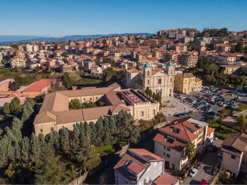
  • Vibo Valentia: Ancient Hipponion, Hilltop Castle and the Coast

    Vibo Valentia: Ancient Hipponion, Hilltop Castle and the Coast

    Vibo Valentia is a rare Calabrian city where an ancient Greek colony, a medieval castle, a modern provincial center and the dramatic Tyrrhenian coastline can be read together without leaving a small geographic area. Most visitors race through the province on their way to Tropea, Pizzo or Capo Vaticano. That is a missed opportunity if history interests you. The city’s identity grew from ancient Hipponion, later Roman Valentia; its archaeological museum occupies a fortified hilltop position, and the old streets connect civic life with unusually broad views toward the sea. The coastal district, Vibo Marina, offers a completely different setting. The best way to visit is to understand the relationship between the elevated city and the shore rather than to confuse the two on a map.

    In this guide

    From Hipponion to Valentia: know what you are looking at

    The ancient city of Hipponion was part of the network of Greek settlements in southern Italy and later became the Roman community of Valentia. Ancient city walls, funerary objects, inscriptions and cult material help historians reconstruct a place that traded and competed with the other settlements of Magna Graecia. Today’s streets do not display a perfectly preserved archaeological grid. Instead, you encounter fragments in museums and landscapes whose later buildings obscure earlier layers. The most useful strategy is to begin with the collections at the hilltop castle and then look at the city’s topography. That sequence gives context to artifacts that otherwise seem isolated behind glass. Avoid presenting Vibo merely as a medieval town with a fortress. Its pre-Roman and Roman past is the foundation of its identity, and the material evidence explains why this strategic height above the Tyrrhenian mattered for centuries.

    Cathedral di Santa Maria Maggiore O San Leoluca Vibo Valentia Italy

    Extend a visit to Vibo Valentia with the suggestions in our Calabria travel guide, which covers regional transport and where to base yourself.

    The castle and the Vito Capialbi Archaeological Museum

    The monumental castle traditionally linked to Frederick II occupies one of the highest positions over Vibo Valentia. It houses the National Archaeological Museum ‘Vito Capialbi,’ named for the local scholar and collector who helped document the region’s past. The collections provide the best introduction to ancient Hipponion, including objects connected with civic, religious and funerary life. Some of the most rewarding pieces are modest rather than monumental: small objects communicate how people lived, traded and expressed beliefs. Allow enough time to read labels, and do not expect every exhibit mentioned in an older travel blog to be in exactly the same gallery. Archaeological displays, loans and visiting arrangements change. The building is also a viewpoint, yet it must be treated first as a protected museum and monument. Check official visitor information before setting out, particularly if traveling on a holiday or hoping to see a specific collection.

    Walking the upper city without rushing

    After the museum, continue through the historic center where churches, civic buildings and daily shops occupy a web of streets shaped by centuries of rebuilding. Piazza San Leoluca and the Duomo area provide useful reference points for a relaxed walk; the cathedral is associated with the town’s patron and offers a change of scale after the fortress. Notice the transition between formal squares and narrower streets rather than trying to turn every old doorway into a named attraction. An upper city with functioning schools, businesses and public services has a different rhythm from a coastal holiday village. A late morning visit provides good light for the buildings and time for a seated lunch. Uphill approaches and occasional uneven paving mean that footwear matters. Travelers who need step-free access should confirm individual venues rather than assuming that proximity on a map guarantees easy entry.

    Ancient walls and archaeological fragments beyond the museum

    Evidence of Hipponion survives outside the museum in stretches of ancient fortifications and areas explored by archaeologists, although access and visibility are not always straightforward. Such remains may be in protected or partially accessible zones rather than landscaped parks with daily ticket offices. If you want an archaeological walk beyond the castle, check with the municipality or museum about current public access and whether an authorized guided visit is possible. Do not enter fenced land or search for ruins across private property based on a satellite image. The intellectual reward comes from understanding the defensive position and how Greek and later Roman occupation reshaped the landscape. Consider also a visit to the archaeological site of Locri or the museum at Reggio Calabria on another day, but do not imply they are quick stops next door: Calabria’s archaeological story is spread across an extensive region.

    Vibo Marina is a separate coastal experience

    The municipal coastal area known as Vibo Marina should be understood as a port and seaside district, not as the same neighborhood as the hilltop city. Its waterfront, harbor activity and connections along the Tyrrhenian coastline contrast with the castle and old-town piazzas above. Depending on your interests, Vibo Marina may be somewhere to have a meal by the sea, observe a working harbor or begin a drive along the Costa degli Dei. Beach conditions, public access and bathing quality depend on the exact stretch of coast and the season. It is important not to use the entire port area as shorthand for a conventional swimming beach. For a full beach day, compare nearby designated bathing areas and check water notices locally. To make both Vibo and the marina work in one itinerary, factor in the road transfer and parking rather than assuming an effortless walk downhill and back.

    Choosing between Vibo, Tropea and Pizzo as a base

    Vibo Valentia is a sensible base for travelers who want civic life, archaeology and inland access, especially with a car. Tropea is the better-known choice if swimming, postcard viewpoints and summer restaurants are the main priorities. Pizzo is attractive for a compact historic town and food-focused day, while Vibo Marina can serve people who specifically need the port district. These places are related but not interchangeable. Where to sleep depends on your intended evenings as much as your daytime sightseeing: an elevated city hotel does not provide direct beach access, and a seaside property is not automatically convenient for the archaeological museum. Compare accommodation on a map, look at genuine parking and transit conditions, and consider how much time you will spend commuting. It is often better to choose one base for three nights and make focused day trips than to move luggage every afternoon.

    A thoughtful half-day and full-day itinerary

    For a half-day, focus on the castle museum, then take a slow walk through the upper center and finish with a local meal. That is enough to justify the stop without making the visit feel like an obligation between beaches. A full day can add a second historic site, a viewpoint and an afternoon drive toward the marina; only do this if transport is straightforward. Families may prefer a museum visit when children are fresh, then lunch and a short outdoor walk rather than a long sequence of religious interiors. Visitors deeply interested in ancient history could spend most of the day in the upper town instead. The temptation to add Tropea, Pizzo and Capo Vaticano on the same day is understandable, but doing so would shortchange each place. Think in geographic clusters: Vibo plus Pizzo is one reasonable day; Tropea plus its surrounding beaches is another.

    Food culture: mountain, plain and the Costa degli Dei

    The cuisine around Vibo draws on hill farms, olive groves and fishing traditions, with regional favorites such as red Tropea onions, local cheeses, cured pork and seasonal vegetables. The spicy spreadable sausage ‘nduja, strongly associated with Spilinga, is memorable but only one component of the food scene. Try fresh pasta or a simple vegetable preparation before automatically ordering a chili-heavy plate; food here is often more balanced than the stereotype suggests. Seafood dishes make more sense on the coast, while a family-run restaurant in the city might emphasize inland ingredients. Ask what is locally produced and in season. Pizzo’s tartufo ice cream makes a fine separate dessert stop if you head north. Culinary identity provides another thread connecting ancient agricultural landscapes with the modern province, and making time for a real lunch is a better introduction than buying ten anonymous souvenirs.

    Getting here and traveling around the province

    Travelers coming from Lamezia Terme Airport commonly reach Vibo by road or rail connections with onward local transport. Be alert to station names: a railway stop associated with the Vibo area may be outside the upper historic center, meaning a bus or taxi remains necessary. Routes and service frequency depend on the date and day of the week. A rental car gives flexibility to connect the museum, Vibo Marina, Pizzo and the inland villages, but parking in the old center can be more complicated than on the outskirts. If using public transport, concentrate on the upper city and verify the return schedule before leaving your hotel. In summer, coastal traffic can also affect plans more than the map suggests. Do not advertise a fixed journey time between scattered sights; check live transport conditions and leave margin before flights or trains.

    When to visit and how to approach the city respectfully

    Spring and fall usually provide a better balance for walking, archaeology and inland side trips than the busiest summer afternoons. Summer remains worthwhile if you start early, carry water and use the hottest hours for lunch or a museum. In winter you will encounter a working provincial city rather than an emptied resort, although museum and hospitality schedules require checking. Remember that neighborhoods and public spaces serve residents first. Photography should respect religious services, museum policies and private homes. Archaeological remains are fragile, and stones that appear ordinary may be protected. With children or travelers who have mobility needs, build the day around a small number of accessible places instead of assuming the city’s slopes are easy. Vibo rewards curiosity because it does not package its history into a single tourist promenade.

    What to combine with Vibo on a longer trip

    Pizzo offers the church of Piedigrotta, the Murat castle and a pleasant town center; Tropea offers the dramatic cliff-top old town and access to nearby beaches; Zungri has an extraordinary rock-cut settlement that tells a different story about settlement and agriculture. Each can support its own dedicated guide and should not be rushed through as an afterthought. Inland, the Serre mountains introduce cooler landscapes and the religious heritage of Serra San Bruno. Travelers interested in Greek history can build a larger multi-day archaeology itinerary linking Vibo with Locri, Kaulon and Reggio. The most balanced approach is to alternate a coastal day with a history or inland day. That rhythm is often more enjoyable than trying to fill every day with three beach stops and a museum on the way back.

    At a glance

    Suggested timeHalf a day to a full day, depending on your focus
    TransportVerify current rail, road or local transfers before travel
    Best approachChoose a realistic route and prioritize safety or access notices
    Base or visitVibo Valentia, Calabria

    Related Calabria guides

    Official sources and planning links

    Schedules, access restrictions and services can change. Use these official or primary sources to check details before visiting:

    Frequently asked questions

    Is Vibo Valentia the same place as Vibo Marina?

    They belong to the same municipality but are different districts. The archaeological museum and upper historic center are inland and elevated; Vibo Marina is on the coast.

    What is the most important attraction?

    The National Archaeological Museum ‘Vito Capialbi’ in the castle is the best first stop for understanding ancient Hipponion.

    Can I visit Vibo as a day trip from Tropea?

    Yes, especially with a car. Keep the museum and upper city as the focus rather than planning an unrealistic string of coastal detours.

    Is Vibo a beach destination?

    The municipality includes coastal areas, but the upper town is best approached as a cultural city, not as a beachfront resort.

    How much time should I allow?

    A focused half-day covers the castle museum and historic center. A full day leaves room for more walking and a coastal extension if transport is convenient.

    Last updated: October 17, 2026
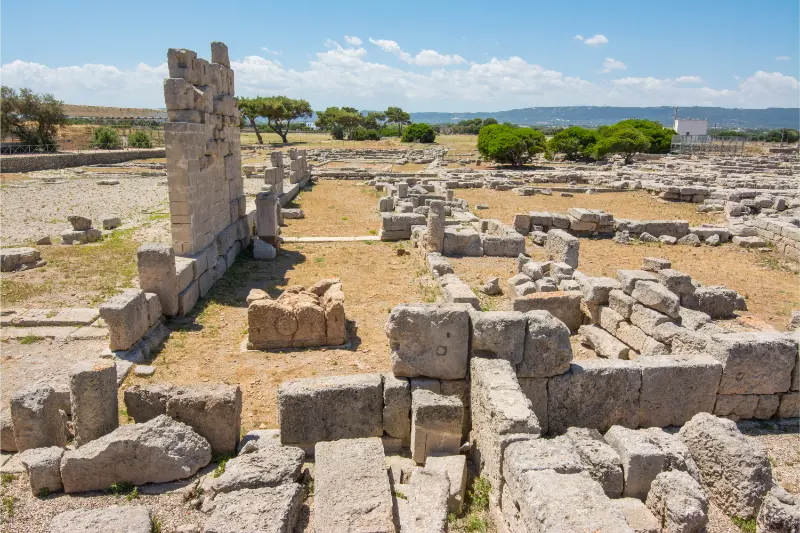
  • Scolacium Archaeological Park: Rome and the Norman Basilica

    Scolacium Archaeological Park: Rome and the Norman Basilica

    Scolacium is one of the most rewarding archaeological landscapes in southern Italy for travelers who want to see history in its physical setting rather than only behind museum glass. Near Roccelletta di Borgia on Calabria’s Ionian side, the park brings together evidence of a Greek settlement, a Roman city, a dramatic Norman basilica and later agricultural life. Ancient theaters and monumental fragments stand within a landscape famous for its olive trees. The result is beautiful, but it can be confusing if you expect every period to be displayed in a single chronological row. This guide explains what to look for, how the city changed over time, why the basilica matters and how to plan a visit responsibly when museum access or restoration conditions change.

    In this guide

    What is Scolacium and where is it?

    The national archaeological park lies in the territory of Borgia, close to Roccelletta on the Ionian coast of the Catanzaro area. The Ministry of Culture identifies it as the Museo e Parco archeologico nazionale di Scolacium. This exact name matters when planning transportation, because ‘Borgia,’ ‘Roccelletta’ and ‘Scolacium’ may produce different navigation results. The visitor entrance is not necessarily in the historic center of Borgia or at a nearby beach. Check the official address and current arrival instructions before setting off.

    Our Calabria travel guide places Scolacium Archaeological Park in the context of the wider region, including travel times and alternative bases.

    Scolacium is not just a Roman theater in a picturesque olive grove. Its sequence stretches from the earlier Greek city traditionally called Skylletion through Roman redevelopment and later medieval use of the location. A modern traveler sees only parts of that long sequence, but the layering is the attraction. Give yourself time to identify which ruins belong to which period; it changes the entire experience from a pleasant walk to a meaningful encounter with Calabria’s history.

    Archaeological Ruin Roman City Pompeii Destroyed Eruption Vesuvius Volcano Campania Italy

    From Greek Skylletion to Roman Scolacium

    Ancient sources associate the area with Skylletion, a Greek settlement whose origin was later surrounded by foundation traditions. The Ministry notes the later Roman colony of Minervia Scolacium, developed after the wars that transformed southern Italy’s political landscape. Roman imperial investment brought important public buildings, including the theater and amphitheater. These layers tell a story of continuity and change rather than a simple replacement of one culture by another overnight.

    When looking at the ruins, distinguish what archaeology securely documents from legendary attributions to Greek heroes. Founding stories are part of the ancient imagination, but they should not be presented as modern historical fact. The more useful question is how the coastal settlement connected with routes, agriculture and political centers during different periods. The transition to Roman urban life affected public architecture, commemorative sculpture and the organization of civic space. A guided interpretation can make those changes easier to visualize.

    The Roman theater: the site’s great outdoor landmark

    The theater is one of Scolacium’s most recognizable surviving structures. Its curved seating form and architectural footprint help visitors understand where public performances and civic gatherings took place. Imagine the relationship between spectators, stage structures and the surrounding city rather than focusing only on how many seats were once available. In archaeological parks, reconstructed diagrams are often more informative than attempts to walk through every ruined tier.

    Stay on designated visitor paths. Some stones may be loose and particular sections can close for safety or preservation. An ancient theater is not an unrestricted amphitheater for climbing or dramatic photo poses. From approved viewpoints, the structure’s geometry is already legible, and the olive groves around it create a striking visual relationship between archaeological and agricultural landscapes. If tours are offered, ask how the theater’s date and later modifications have been established.

    The amphitheater and the Roman city’s public spaces

    The archaeological record also includes an amphitheater and other public monuments, though the degree to which each area is visible can change. An amphitheater served different events from a theater, and it is worth learning to distinguish the two in Roman urban life. They are not interchangeable labels for any circular-looking ruin. The park also preserves evidence of commemorative buildings, inscriptions and statuary associated with civic representation in imperial times.

    If one monument is inaccessible, use the museum’s interpretation or site panels to understand its position within the city. The surviving remains may be lower than expected, but foundations and fragments can still reveal a deliberate public plan. Avoid claiming that every ancient road has been fully reconstructed. Archaeology proceeds by excavated evidence and scholarly interpretation, often across multiple campaigns. The park is a place of ongoing research, not a fixed display finalized decades ago.

    Portraits, sculpture and the museum collections

    The archaeological museum has displayed finds ranging across many centuries of local occupation, including Roman portrait sculpture and objects illuminating everyday life. The Ministry describes notable sculptural material and an unusual colossal bronze forearm among the finds. These objects can help visitors understand the scale of public representation and the connection between monumental architecture and political imagery. They also show why museum time complements, rather than duplicates, the outdoor walk.

    Crucially, museum access has at times been affected by renovation projects. The Ministry’s published visitor notices have described temporary closures of museum spaces while the park continued to welcome visitors. Do not assume a museum gallery is open simply because the overall site is listed as open. If a particular sculpture is central to your trip, contact the institution to confirm its display status. Allow yourself to enjoy the outdoor archaeology even if a museum room is closed, without pretending that the two experiences are identical.

    The Norman basilica at Roccelletta

    One of the park’s most memorable features is the ruined Norman basilica, often called the Basilica della Roccelletta. It introduces a much later chapter in the site’s history. The Ministry dates its development to the Norman era, when this area again played a role in the cultural and religious geography of the region. The surviving walls can appear startlingly large against the landscape, making the basilica an evocative contrast to the low Roman remains.

    Look for the relationship between scale, surviving openings and the building’s setting. The structure draws on a different architectural world from the theater, yet it occupies territory with a long earlier history. This does not mean the basilica was simply built as part of Roman Scolacium; it reflects a later society using an important location. Stay outside fenced or unstable areas, and do not climb masonry. A photograph from a safe marked point can show the walls’ monumental presence more effectively than standing inside a restricted section.

    Olive trees, the Mazza estate and industrial archaeology

    Scolacium’s landscape is distinctive because the ruins sit among extensive olive trees. These groves are not decorative park landscaping alone: they connect the modern visitor to centuries of agricultural use. The Ministry also describes the former Mazza estate and a twentieth-century oil mill that adds an industrial-heritage layer to the complex. If the mill interpretation is available, it can help explain how the land continued to produce and support communities long after the classical city changed.

    The olive grove can be an atmospheric walking environment, but remember that trees and agricultural structures require care. Stay on visitor paths, do not climb the trees and do not treat working or conserved equipment as a playground. In bright summer light the site can be exposed despite the groves, so bring water and a hat. The important insight is that Scolacium is not an isolated ruin preserved on empty land; its history includes the productive landscape that surrounded it across many centuries.

    How to organize the visit efficiently

    If the museum is open, begin with the orientation displays to understand the chronology. Then walk the designated outdoor route from the Roman remains toward the great basilica, pausing at interpretation panels. If museum access is unavailable, begin with the official site map and focus on identifying the theater, monumental areas and medieval church. Allow a generous half day rather than racing through in an hour. Uneven ground, photographic stops and summer heat can all slow the visit.

    You do not need to inspect every stone individually. Concentrate on three contrasts: Greek versus Roman urban history, Roman public life versus Norman religious architecture, and archaeology versus later olive cultivation. These themes provide a clear narrative for visitors unfamiliar with classical history. If a guided tour is offered by authorized staff or qualified local guides, it may be especially helpful because the visible fragments can be difficult to connect without explanation.

    Admission, hours and the need to confirm closures

    The Ministry of Culture provides the official listing for Scolacium, including contact information and current opening updates. Historical web pages can show ticket prices or hours that are no longer reliable, particularly when galleries close temporarily for improvements. Check the actual status close to your visit, and distinguish access to the archaeological park from access to the museum and oil-mill displays. Never state a future ticket price as if it were fixed.

    If traveling with a group, enquire about educational tours and accessibility options in advance. Some official listings may indicate that advance booking is not generally required, but special events and guided services can have different arrangements. Allow time for ticketing, restrooms and orientation. For a planned visit in 2028, rules published in 2026 are valuable context but cannot guarantee what will be open two years later. The appropriate editorial approach is to link visitors to the institution rather than offering false certainty.

    Reaching Scolacium from Catanzaro and the coast

    A car is often the simplest way to reach the park and combine it with other parts of the Ionian coast. Use the museum’s precise address near Roccelletta di Borgia rather than navigating to Borgia’s upper town. Road works or temporary event arrangements may change parking, so follow current signs. Do not stop on a highway shoulder because a map makes the ruins seem close. Arrive early enough to locate a proper entrance before the hottest part of the day.

    If you are staying in Catanzaro or Catanzaro Lido without a car, research actual local bus or taxi options. The presence of urban services in the wider area does not mean a frequent bus stops beside the park gate. Confirm both outbound and return routes before leaving, especially on Sundays or holidays. A prearranged return transfer may be sensible if the site has limited public transport. Comfortable walking shoes are essential even if transport delivers you close to the entrance.

    What to pair with a visit to Scolacium

    The most natural companions are other stops in the Catanzaro Ionian area, such as a relaxed meal by the water, a town walk or nearby cultural heritage. If you enjoy archaeology, Kaulon and Locri make excellent thematic comparisons on a wider regional itinerary, but their distances mean they deserve separate days rather than a frantic sequence. Scolacium’s special quality is its long chronology in one place; rushing elsewhere immediately can diminish the impact.

    A good day could begin at the park, continue with lunch in the Catanzaro Lido area and finish with a modest seaside walk. Alternatively, spend longer on a guided archaeological visit and keep the afternoon free. Families often appreciate the second approach because children may need a break after uneven outdoor walking. If your schedule includes a major evening commitment, do not underestimate travel time on busy coastal roads during summer.

    Accessibility, climate and family learning

    The park is an outdoor heritage landscape with potentially uneven surfaces, changing levels and exposed stretches. Ask the institution which areas have accessible routes and whether a visitor with limited mobility can see the major landmarks. A wheelchair-friendly entrance does not mean every ruin is reachable without obstacles. Similarly, parents with strollers should check the terrain and may prefer a baby carrier for some sections, provided conditions are safe.

    For children, turn the visit into a comparison of building types: what happens in a theater, what an amphitheater was used for and why a medieval basilica looks different. Use the olive groves to talk about how land keeps changing purposes over time. In hot weather, take frequent water breaks and avoid the most exposed hours where possible. After rain, stone surfaces and earth paths may become slippery. Stay within open visitor areas even if an enticing ruin is visible beyond a barrier.

    The value of a careful, unhurried visit

    Scolacium rewards visitors who accept that history is not always neatly restored for them. Greek, Roman, Norman and later agricultural evidence coexist, and not every fragment has a simple explanation. Read the site’s official material, ask qualified guides about uncertainties and resist attractive but unsupported legends. The park is also an active conservation environment, so closures and protective measures are signs that its heritage is being cared for.

    Take photographs respectfully, leave archaeological material untouched and avoid encouraging others to enter off-limits spaces. The basilica may become your favorite image, but the museum objects, theater and olive-mill story give that image depth. A visit that considers all those layers provides a far richer understanding of Calabria than the idea that its past is limited to classical ruins or picturesque medieval villages. Scolacium is both, and much more, in one remarkable landscape.

    At a glance

    DestinationRoccelletta di Borgia, Calabria
    Main attractionRoman theater and monumental remains in olive groves
    Other periodsGreek Skylletion and the Norman Roccelletta basilica
    ComplementMuseum collections and former Mazza olive mill if open
    Watch out forSeparate museum closures and uneven outdoor ground
    Time to allowA generous half day for the main visit; extend it for a second stop

    Related Calabria guides

    Official information and travel planning

    Confirm access, visitor arrangements and protected-area rules at the relevant official sources before departing: cultura.gov.it, cultura.gov.it.

    Frequently asked questions

    Where is Scolacium?

    The national archaeological park lies near Roccelletta di Borgia on the Ionian side of the Catanzaro area.

    Is it only a Roman archaeological site?

    No. It preserves Greek, Roman, Norman and later agricultural history in one landscape.

    Can I enter the museum as well as the park?

    Museum spaces may close separately for restoration. Verify current Ministry of Culture notices.

    Is the Norman basilica part of the visit?

    Yes, the impressive basilica ruins are one of the most distinctive later features of the park, subject to site route restrictions.

    How long should I allow?

    Allow a generous half day to see the outdoor monuments and museum collections when accessible.

    Last updated: October 17, 2026
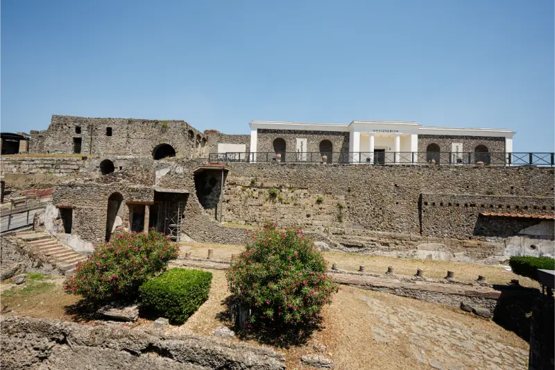
  • Capo Rizzuto Marine Protected Area: Beaches and Sea Rules

    Capo Rizzuto Marine Protected Area: Beaches and Sea Rules

    The Capo Rizzuto Marine Protected Area protects a substantial stretch of Ionian seascape around the province of Crotone. It is not a single beach, a single ticket booth or an ordinary theme-park attraction. Its coast includes headlands, sandy bays, underwater habitats and areas where the rules for vessels, fishing and swimming can differ depending on location and current regulations. For a visitor, that means the first decision is not simply which beach looks prettiest on a photograph, but what activity is permitted and appropriate where. This guide explains how to organize a responsible beach, snorkeling or boat day, how the reserve relates to Le Castella and Capo Colonna, and why checking the managing authority is essential before choosing an operator.

    In this guide

    What does ‘marine protected area’ actually mean here?

    Italy’s marine protected areas are designated to conserve ecosystems while regulating the activities that take place within them. Capo Rizzuto was established in the early 1990s and has been managed by the Province of Crotone, according to the provincial authority. Protection does not mean that the entire coastal zone is forbidden to visitors. It does mean that the coastline cannot be treated as a uniform open playground: some activities may be permitted only in designated zones, under specific conditions or with authorization.

    If Capo Rizzuto Marine Protected Area is part of a longer route through Calabria, our Calabria travel guide is a useful starting point for choosing the next stop.

    A responsible traveler begins with the latest official zoning information. Maps used by boat operators may show different categories of protection, commonly described with letters such as A, B and C, but you should not assume that one generic explanation of Italian marine zones applies identically at every point of this reserve. Check the current regulation and any seasonal notices. The precise rules for anchoring, fishing, diving, powered navigation and access may differ even when the two sites appear close on a tourist map.

    Capo DOrlando Sicily Italy

    The geography: from the Crotone coast toward Le Castella

    The protected landscape covers part of the Ionian coastline associated with Crotone, Capo Rizzuto and Le Castella. Headlands and beaches alternate, while the marine environment includes rocky and sandy habitats. Travelers often recognize the fortified island-like structure at Le Castella or the archaeological headland at Capo Colonna, but the reserve’s ecological story extends between and beyond those familiar viewpoints. It is worth looking at the geographic map before booking an excursion so you understand the actual area the boat will cover.

    Do not use a generic pin for ‘Capo Rizzuto’ to navigate to every activity. Capo Rizzuto, Le Castella and Crotone are separate starting points with different parking and boat arrangements. A tour described as visiting the marine area might operate from one harbor and never approach the coastline shown in your favorite image. Ask where boarding takes place, which zone is visited, whether snorkeling is included and how weather changes the route.

    Picking a beach without misreading the reserve

    Beaches along this coast vary in surface, access, exposure and facilities. Some provide organized summer lidos, while others are less developed or require more walking. When planning a family day, start with practical needs: lifeguard service, shade, accessible entry, restrooms and the real character of the seabed. A broad regional statement about clear water should never replace observing conditions on the day. Wind on the Ionian coast can create waves that make swimming unsuitable even when the beach looks inviting from a distance.

    Do not assume that a free beach automatically permits every recreational activity. Protected dunes and coastal habitats need care, and local restrictions may govern equipment, pets or access points. Use marked paths, take rubbish away and avoid collecting shells, stones or living organisms. If you find a quieter cove, its absence from a commercial beach guide does not make it exempt from environmental rules. Choose a location where you can enjoy the water without damaging what the reserve was created to protect.

    Snorkeling: observe, don’t interfere

    Snorkeling can be a rewarding way to notice fish, rock communities and the changing underwater terrain, provided the site and conditions are appropriate. Select a place where entry and exit are safe, visibility is reasonable and the current regulations allow your planned activity. If you are unfamiliar with the coast, a qualified local guide can improve both safety and interpretation. Never swim toward a boat channel or a distant headland merely because the water is transparent.

    Stay on the surface where appropriate, maintain buoyancy, and do not stand on seabed organisms. Avoid feeding fish, collecting marine life or moving stones to reveal animals. A short, careful swim can be more valuable than a long tour that constantly chases wildlife for photographs. If an operator suggests touching sea stars or lifting animals for pictures, that is a warning sign. Ask about group size, emergency procedures and whether the experience is suitable for beginners or children.

    Scuba diving and underwater heritage

    The wider marine area is also associated with underwater research and cultural heritage. The Province of Crotone has documented projects with scientific institutions involving seabed mapping and the study of shipwreck sites. That work is a reminder that marine protection includes archaeological as well as biological resources. Such sites are not invitations to independent artifact hunting, and diving access may be subject to rules, permits and professional qualifications.

    If you want to dive, contact an authorized center and disclose your certification level, experience and recent diving activity. Ask which zones are allowed, whether a guide is required, what equipment is included and how the operator decides whether sea conditions are acceptable. Never remove pottery, metal objects or other finds. A wreck’s precise location and fragile condition may make it inappropriate for visitor access, even when it is mentioned in tourism or scientific material.

    Boat trips: questions to ask before paying

    A boat tour is not automatically the best or most sustainable way to experience the reserve. It can be useful for seeing coastal geology and headlands without driving between them, but the value depends on the operator’s route, environmental practice and attention to local restrictions. Ask for the precise departure port, approximate time on the water, maximum group size, permitted swimming stops and cancellation policy. Check whether the boat is authorized for the activities advertised inside the protected area.

    Anchoring, vessel speed and approach distances may be regulated. Responsible operators should be able to explain these limits and tell you why certain coves or zones cannot be entered. Be skeptical of promotional language such as ‘exclusive unrestricted access’ to protected habitats. If the forecast predicts strong wind or unsafe seas, a cancelled trip is evidence of good judgment, not poor service. Keep a land-based alternative ready, such as a cultural visit in Crotone or Le Castella.

    Le Castella: an iconic image but a separate heritage visit

    The Aragonese fortress of Le Castella is one of the coast’s most recognizable landmarks. It has its own architectural history, visitor procedures and opening possibilities. The castle and marine protected area are connected by place but not by ticketing or purpose: a visit to the fortress is a cultural activity, while a marine excursion operates under environmental rules. Do not assume a castle admission ticket authorizes a boat trip or that a marine boat ticket includes access inside the fortification.

    Plan Le Castella as a complete stop if architecture interests you. Walk around the public waterfront, observe the castle from safe viewpoints and enter only when official access is available. In summer the surrounding lanes can be crowded and parking fills quickly. A pleasant combination is a morning boat outing and an afternoon castle visit, but only if the boat schedule and weather align. Alternatively, keep the day simpler and explore the fortress and public seafront without going on the water.

    Capo Colonna and the coastline’s ancient history

    Capo Colonna offers a different dimension to this part of Calabria: the archaeological landscape associated with the sanctuary of Hera Lacinia and its surviving column. A traveler interested in both cultural heritage and marine ecology can build an especially rewarding itinerary by visiting the headland on one day and the reserve’s beaches or guided waters on another. This avoids treating every coastal stop as merely another place to swim.

    Keep in mind that Capo Colonna has its own archaeological rules, museum access and opening arrangements. Parking and walking routes may differ from those used by boat or beach visitors. Do not cross archaeological barriers to reach the sea, and do not treat the shore beneath a protected site as an unrestricted shortcut. The relation between history and environment is one of the coast’s strengths, but each protected place deserves its own rules and enough visiting time.

    An itinerary for families and first-time visitors

    If your group includes children or nervous swimmers, begin with a well-serviced beach where facilities and lifeguard arrangements suit your needs. Schedule a short educational activity or visitor center stop if operating, rather than committing everyone to an all-day boat excursion. The protected area’s education initiatives may change with funding or season, so contact the managing authority rather than assuming a center listed online is open every day.

    For a one-day mix, choose either a morning guided snorkeling session or a permitted boat tour, followed by lunch and a gentle afternoon at a beach or in Le Castella. Do not attempt to visit every stretch of coast in one day. Children need shade and rest, and midday sun can be intense. Bring plenty of water, appropriate flotation support where needed, and a way to protect phones or documents from spray. Safety takes precedence over covering a long sightseeing route.

    Arriving, parking and choosing your base

    Crotone, Le Castella and the Capo Rizzuto area offer different accommodation and access possibilities. A stay in Le Castella can be practical for travelers interested in the fortress and local boat departures, while Crotone provides an urban base with more varied services and cultural sites. Verify the exact address of your accommodation and the starting point of any tour; the word ‘Capo Rizzuto’ in a listing does not guarantee that everything is walkable.

    A car is often convenient for exploring several coastal stops, but parking near beaches can be restricted or crowded in summer. Use legal designated spaces and walk via marked routes. Public transport options may be limited, particularly for smaller beaches and morning boat departures, so confirm services before choosing a car-free vacation. If accessibility matters, ask operators about boarding steps, stable access and nearby restrooms. A boat advertised as family-friendly may still be unsuitable for some mobility needs.

    Best season and safety conditions

    The busiest beach season generally coincides with warmer weather and a wider range of commercial activities, but not necessarily the calmest sea on every day. Late spring and early fall may be excellent for coastal walks and cultural visits, while boat schedules may be reduced. Always check forecast wind, sea state and local warnings. A sunny morning does not guarantee safe conditions by afternoon, and clear water alone says nothing about currents.

    Plan a backup activity if the sea is unsuitable. The fortress at Le Castella, Crotone’s historical sights or an appropriate museum can make a satisfying alternative, subject to their own opening hours. Avoid setting a future travel budget using unverified present-day boat fares or private lido prices. Operators set their own policies, and marine regulations may change. A guide written for a later publication date should point readers to official current information rather than pretending to know future rates.

    How to confirm the marine rules before your visit

    The reserve has an official information presence and the Province of Crotone identifies itself as the managing authority. Before visiting, obtain the current zoning map, relevant regulations and any notices for snorkeling, boating, fishing or diving. If you are unsure whether an activity is permitted, ask the authority or an approved operator and keep the answer on hand. Do not extrapolate from a different Italian marine reserve, since regulations and permissions can vary.

    Protecting the area is not opposed to tourism; it is the condition that makes meaningful tourism possible. Stay out of forbidden zones, do not anchor on sensitive seabeds, refuse wildlife handling and respect archaeological resources underwater. Even if your plan is only a quiet beach day, you are sharing a vulnerable ecosystem. The reward for traveling responsibly is more than a photograph: it is the experience of a coastline whose natural and cultural heritage is still being studied and cared for.

    At a glance

    DestinationIsola di Capo Rizzuto, Calabria
    Main experienceProtected Ionian coast with permitted guided activities
    Related heritageLe Castella fortress and Capo Colonna archaeological area
    Who sets rulesProvince of Crotone and official marine reserve notices
    Watch out forZone-specific anchoring, fishing, boating and diving limits
    Time to allowA generous half day for the main visit; extend it for a second stop

    Related Calabria guides

    Official information and travel planning

    Confirm access, visitor arrangements and protected-area rules at the relevant official sources before departing: riservamarinacaporizzuto.it, www.provincia.crotone.it.

    Frequently asked questions

    Can I swim anywhere in the marine reserve?

    Swimming permissions and conditions may vary by zone and local notice. Check official maps and instructions.

    Can I anchor or fish wherever I want?

    No. Anchoring, fishing and boating are subject to protected-area rules and may require authorization.

    Are snorkeling trips allowed?

    Some guided activities may be permitted in designated zones; select authorized operators and verify the current regulation.

    Is Le Castella Castle part of the same ticket?

    No. The fortress is a separate heritage attraction with its own visiting arrangements.

    Who should I contact about regulations?

    Consult the Province of Crotone, the managing authority, or the official marine protected area contact service.

    Last updated: October 17, 2026

  • San Giovanni in Fiore: The Florense Abbey and Sila Heritage

    San Giovanni in Fiore: The Florense Abbey and Sila Heritage

    San Giovanni in Fiore stands in the Sila mountains and offers something more than a convenient overnight stop for forest excursions. Its most distinctive landmark is the Abbazia Florense, tied to the religious thinker Joachim of Fiore, whose interpretation of history became influential well beyond Calabria. The town belongs to a highland landscape with a different rhythm from the Tyrrhenian and Ionian coasts: cooler air, mountain roads, local food traditions and communities shaped by both religious heritage and forestry. This guide focuses on the town itself and its abbey while helping you decide how to connect a historical visit with the lakes and trails of the Sila. It is not a substitute for checking current access to the abbey or seasonal mountain conditions.

    In this guide

    The difference between San Giovanni in Fiore and a Sila resort

    The Sila is often presented as a collection of lakes, pine forests and walking paths, but the region also has long-lived settlements with their own stories. San Giovanni in Fiore is a significant town in this landscape, not simply a hotel cluster beside a trailhead. Its abbey and urban fabric offer a way to understand why communities occupied and organized the highlands. Travelers who only drive through on the way to a lakeside picnic miss the part of the Sila shaped by faith, craft, work and changing social structures.

    You can pair San Giovanni in Fiore with other places in Calabria; the Calabria travel guide gives an overview of realistic connections and where to stay.

    The town can be a base for a longer stay, especially if you want both historical visits and road trips through the surrounding mountains. It does not provide direct walking access to every famous lake or nature route: distances within the Sila can be substantial and require driving. Decide whether your main interest is the abbey, highland culture or outdoor recreation before choosing accommodation. A central town room offers different advantages from a forest lodge well outside the urban area.

    San Giovanni Battista Church Matera Italy Dawn

    Joachim of Fiore and the origins of the Florense tradition

    Joachim of Fiore, or Gioacchino da Fiore, was a medieval religious thinker whose ideas about history and spiritual renewal influenced later theological and intellectual debates. His association with the community that developed at San Giovanni in Fiore is central to the town’s identity. He is often summarized through dramatic predictions about future ages, but that simplification can obscure the seriousness of his monastic work, interpretation of scripture and broader historical context.

    A thoughtful visit begins by recognizing that the medieval abbey was part of a religious movement, not merely a building with a famous name. Ask how the Florense community differed from other monastic traditions and how its ideals shaped the settlement. You do not need to agree with the theological ideas to appreciate their historical significance. Reliable interpretation distinguishes what Joachim wrote from later legends attributed to him, a useful caution when reading sensational accounts on travel blogs.

    Abbazia Florense: the monument to prioritize

    The Abbazia Florense is the defining architectural landmark, associated with the religious community founded in the medieval period. Its presence gives San Giovanni in Fiore a historical focus quite unlike that of a purpose-built mountain resort. The exterior, scale and spatial relationships of the complex are valuable even if only certain interior sections can be entered. Churches and former monastic spaces often have varied uses and may be subject to restoration, services or special events.

    Check official local information before traveling specifically for an interior visit. Do not assume the entire complex is a single ticketed museum with daily guided tours. If a worship service is taking place, be discreet or return afterward. Spend time observing how the abbey sits within the town and how nearby streets developed around an institution that was religious, economic and social. This setting may teach you as much as an isolated photograph of the façade.

    Reading the architecture without inventing details

    A medieval religious building changes over centuries. Stonework, openings and interior arrangements may reflect repairs or later adjustments as much as the original design. Rather than confidently dating every visible feature by style alone, use the available heritage interpretation or a knowledgeable guide. Notice proportions, light and movement through the sacred space. Austerity in one area and more elaborate later decoration elsewhere can be part of the building’s history.

    Avoid exaggerating underground secrets or hidden rooms that are not documented. If a section is closed, that closure may protect historic fabric or respond to ongoing work. Historic floors and steps can be uneven, so watch your footing and take extra care with children. The best way to appreciate the abbey is to ask what the community needed the building to do, and how it connected prayer, work and communal living over many generations.

    Walking through the town after the abbey

    The streets surrounding the abbey are worth exploring at a slow pace. They help you see how a mountain community grew around an important religious institution. Look for changes in building height, stairways and neighborhood squares rather than expecting a monumental attraction every few minutes. A café stop or a local shop gives the historical walk a more human dimension. Respect the fact that this is a working town, not an open-air museum.

    Choose a loop that makes sense for your mobility and the weather. In highland towns, inclines can be tiring even when the distance appears short on a screen. Ask where the easiest pedestrian access lies if you are traveling with older relatives or a stroller. It is better to explore a smaller area attentively than to cross town repeatedly in search of a checklist of obscure landmarks. Some museums or cultural institutions may have limited opening days, so regard them as optional additions unless you have confirmed admission.

    Local food and the mountain identity of the Sila

    San Giovanni in Fiore is a good place to look beyond Calabria’s coastal seafood image. Inland tables often highlight potatoes, mushrooms in season, preserved foods, cheeses and hearty preparations suited to the colder months. The protected geographical identity of some Sila products is part of the wider highland economy, but menus change with season and the individual restaurant. Ask what is prepared locally that day rather than expecting a rigid list of ‘must-eat’ dishes.

    Food can be an excellent way to connect a cultural day with the landscape. Lunch in town before a short afternoon drive gives everyone a break from abbey visits and walking. If you intend to gather mushrooms or wild plants yourself, do not do so casually: there are identification risks, regulations and protected areas. A local meal is the safer and more respectful way to explore highland ingredients. In quieter periods, verify restaurant opening hours instead of assuming a mountain town has continuous food service.

    Use San Giovanni in Fiore as a base—but plan the distances

    The Sila landscape includes forest roads, lakes and visitor areas, yet the word ‘nearby’ can hide long drives. Build a map of the particular places you want to see, whether a lake viewpoint, a designated nature trail or a small mountain village. Check how the roads climb and whether seasonal weather affects the route. In winter, mountain tires, snow equipment and an up-to-date forecast may matter more than the nominal distance shown by a mapping app.

    A reasonable two-day plan could dedicate the first day to San Giovanni in Fiore’s abbey, town and local food, with a short afternoon outing if conditions are good. Use the next day for a focused forest or lake excursion. This approach avoids treating the Sila as a single attraction that can be toured in an hour. If you have only one day, choose either a substantial cultural itinerary or a substantial outdoor itinerary with a small complementary stop.

    A practical one-day itinerary

    Arrive in the morning, park where legally permitted and begin around the Abbazia Florense. Check whether interior access is available and spend time reading the historical context instead of taking only an exterior picture. Continue through the surrounding streets, then pause for coffee or lunch. The town is best appreciated when you allow the movement from monument to neighborhood to unfold without rushing. A few hours should provide a meaningful introduction.

    In the afternoon, choose one additional activity according to weather and energy. That might be a local museum if open, a drive toward an accessible Sila viewpoint or a short marked nature walk. Do not plan an ambitious wilderness route late in the day. Forested mountains become dark earlier than open coastlines, and weather can turn quickly. If your base is far away, allow enough time for the return journey while the roads are still comfortable to drive.

    How to reach the town

    San Giovanni in Fiore lies inland, and for most independent travelers a car offers flexibility. Road access from Calabria’s larger centers can involve bends, climbs and slower mountain sections. Enter a precise parking destination rather than blindly following the shortest route into old streets. Check weather before departure, especially between late fall and early spring. Snow, fog and freezing conditions can make a normal-looking road itinerary much more demanding.

    Public transportation may connect the town with regional centers, but frequencies can be limited and may vary between weekdays, weekends and school holidays. Confirm the actual return connection before leaving without a car. A bus to town is not the same as a shuttle to distant trailheads. If you want to spend most of your time outdoors without driving, investigate a guided program with explicit pickup arrangements instead of assuming you can improvise onward transport from the center.

    Where to sleep: historic center or rural property?

    A room in or near central San Giovanni in Fiore makes it easier to walk to cafés and the abbey, and may be a good option for a culture-first stay. Ask about parking, steps, heating and noise. Highland nights can be cooler than seaside nights even in summer, and some traditional buildings have stairs that complicate arrival with heavy luggage. Verify the exact address and distance from the abbey rather than relying on an accommodation page’s broad neighborhood label.

    A rural guesthouse or forest-oriented lodging makes sense if your priority is hiking, quiet surroundings or longer drives across the Sila. It may also require a car for every meal and errand. Check road quality, mobile connectivity and late arrival instructions before booking. An isolated mountain property is not automatically convenient for sightseeing in town. For families with young children, consider the tradeoff between outdoor space and easy access to supplies.

    Seasons: choose according to your real reason for visiting

    Late spring and early autumn often provide comfortable conditions for a combined town-and-nature itinerary. Summer gives pleasant highland relief from coastal heat, though popular weekend areas can still be busy. Fall may bring attractive forest colors and food traditions, but rain and shorter days require flexibility. Winter can be atmospheric, with the important caveat that snow and ice change travel conditions and some visitor services may be limited.

    Abbey visiting conditions can change independently of the weather: services, restorations and local events may affect access. Confirm important interior visits directly. For a forest outing, look for the park’s current trail information, rather than copying route descriptions from summer blogs into a winter plan. The goal should be a sustainable visit with realistic walking and driving, not a promise that every attraction is available in every month.

    Accessibility, family visits and respect for the site

    The town’s historical streets may include steps, slopes and irregular paving. Ask the local office about step-free approaches to the abbey and whether parts of the interior can be reached with a wheelchair. A car can reduce the length of uphill walking, but it does not make all medieval architecture accessible. For children, focus the historical explanation on the abbey as a community that organized work and learning as well as worship; they do not need a long account of theology to understand its importance.

    Inside sacred spaces, keep voices low, follow posted photography rules and do not touch fragile surfaces. If adding an outdoor excursion, carry layers and water, stay on marked routes and leave the forest as you found it. Respect local residents when photographing homes and small streets. San Giovanni in Fiore rewards visitors who give equal attention to its monastic heritage and the living mountain community around it rather than seeing the town merely as a place to sleep between hikes.

    At a glance

    DestinationSan Giovanni in Fiore, Calabria
    Main historic sightAbbazia Florense and Joachim of Fiore heritage
    Landscape contextSila mountain roads, forests and food traditions
    Best pairingTown day followed by a separate lake or trail day
    Watch out forHighland weather and variable abbey access
    Time to allowA generous half day for the main visit; extend it for a second stop

    Related Calabria guides

    Official information and travel planning

    Confirm access, visitor arrangements and protected-area rules at the relevant official sources before departing: calabriastraordinaria.it, calabriastraordinaria.it.

    Frequently asked questions

    What is the main attraction in San Giovanni in Fiore?

    Abbazia Florense and its relationship with Joachim of Fiore are the town’s defining cultural landmarks.

    Who was Joachim of Fiore?

    He was a medieval religious thinker whose writings influenced later theological debates and a monastic community linked with the town.

    Is the town inside a single Sila resort area?

    No. It is a working highland town; Sila lakes and trailheads can require substantial separate drives.

    Is a car helpful?

    Usually yes, especially for combining the town with nature destinations around the Sila.

    Can I visit the abbey in winter?

    Potentially, but check interior access, services and mountain road conditions before traveling.

    Last updated: October 17, 2026