My Italy Experience

Author: admin

  • Zungri’s Rock-Cut Village: Exploring the Grotte degli Sbariati

    Zungri’s Rock-Cut Village: Exploring the Grotte degli Sbariati

    The rock-cut settlement at Zungri is among the most surprising excursions near Calabria’s Costa degli Dei. Travelers who know this part of the region only for Tropea’s beaches and Capo Vaticano’s viewpoints encounter something completely different: rooms cut into a rocky slope, passages, steps and spaces associated with work, storage and domestic life. These are often called the Grotte degli Sbariati, but ‘caves’ can be a misleading shorthand. Many spaces were shaped by people, altered across generations and linked to buildings above ground. This guide helps you approach the site with curiosity and caution, understand what is known and uncertain about its origins, and combine it with a village visit without turning a complex historic landscape into a quick photo stop.

    In this guide

    What are the Grotte degli Sbariati?

    The municipality of Zungri describes an extensive rock settlement of roughly 3,000 square meters, containing numerous units cut partly into rock and partly built. It records uses that included living areas, shelter for animals, storage of grain and activities connected with production. The place was not just a collection of natural caverns; the architecture reflects people adapting a landscape to daily needs. Look for the functional relationship between rooms, stairs and connecting paths rather than imagining every cavity as a separate ‘house.’

    Planning more than Zungri’s Rock-Cut Village? The Calabria travel guide compares the main areas and helps you put this stop into a manageable route.

    The local authority also emphasizes that investigation of the settlement’s origins continues. Hypotheses have connected it with eastern populations or a productive outpost serving the nearby kastron of Mesiano, while some early traces have been associated with the medieval period. It would be inaccurate to present one theory as conclusively proven. A responsible visit keeps that uncertainty in view and recognizes later reuse. Interpretive signs or a guide may provide more precise information about individual spaces than a generic tourism description.

    Green Tuscany Unique Medieval Village Stone Tower Perched Rock Cliff Italy

    Why an underground-looking village existed here

    Rock-cut architecture can offer shelter, usable storage and practical advantages in a landscape where soft stone can be shaped. At Zungri, however, it is better not to treat the entire complex as a secret refuge built for one emergency. Evidence of productive and domestic functions suggests a working settlement embedded in a wider territory. The carved spaces must be understood alongside surface buildings, agricultural land and historic routes between inland communities and the coast.

    As you move through the site, notice the height and width of passages and openings. Some spaces are cramped, while others suggest repeated modifications for different purposes. This is architecture made through subtraction as well as construction. Do not impose modern room labels too casually: a recess may not be a bed, and a circular depression is not automatically proof of a specific ritual. Traces require archaeological interpretation, and the most interesting answer is sometimes that specialists are still investigating.

    Navigating the pathways and stone rooms

    The site’s stepped paths and rock surfaces are a major part of the experience, but they also determine who can visit comfortably. Footing may be uneven or slippery after rain. Wear closed shoes with grip; sandals made only for the beach are not ideal. Take your time in shaded sections where dampness may be present, and do not use hands to climb on fragile carved features. Follow the marked route and any instructions from staff or your guide.

    Families should decide whether children can walk securely over steps and uneven terrain without being carried constantly. Very young children and travelers with significant mobility limitations may find the full route impractical. Ask the visitor service about partial access or viewpoint alternatives rather than assuming the whole complex can be reached with a stroller. A beautiful photograph of a doorway rarely shows the steep approach needed to get there. The safest visit is one paced to the slowest person in the group.

    Look for evidence of ordinary medieval work

    One of Zungri’s most rewarding aspects is the attention it draws to daily labor. Tourist itineraries often favor castles and princely palaces, while here the interest lies in how people might have stored harvests, worked materials and sheltered animals. The municipality explicitly mentions wine and lime production as well as grain storage among recorded uses. In the settlement, carved basins, niches and connecting spaces may suggest such functions, but rely on qualified interpretation rather than guessing a purpose for each opening.

    Imagine the practical problem of moving goods up and down a slope. Who had access to storage? How did work areas interact with dwellings? Which activities were seasonal? These questions turn the visit into a study of an inhabited landscape rather than a mysterious ‘underground city.’ They are also useful questions for a local guide, who can point out details easily overlooked when visitors focus only on the dramatic rock façades.

    The Museum of Rural Civilization

    Zungri is associated with a Museo della Civiltà Contadina, a local museum devoted to the material culture of rural life. Its potential value for visitors is to provide another perspective on tools, work and settlement, although the museum’s collections belong to periods and contexts that should not automatically be equated with the rock settlement’s earliest phases. Use the museum to broaden the question of how communities lived in this part of Calabria rather than treating every displayed object as a direct excavated find from the caves.

    Check whether a museum ticket is combined with the settlement visit and whether guided access must be booked in advance. The municipality’s own description notes guided visits by reservation, so it is especially important not to turn up assuming unrestricted independent entry. If the museum is closed during your planned visit, the settlement may also have limited arrangements. Contact the local service directly and allow time for a reply, particularly outside the high tourist season.

    How long does a visit require?

    Allow enough time to walk the authorized route carefully, listen to explanations and look at the relationship between carved spaces. A short visit may take only part of a morning, but squeezing it into the gap between two beaches would undermine much of its value. If museum access and a guided tour are available, plan a generous half day including your arrival, check-in and the village. You will also need extra time for parking and possibly for the return climb.

    Do not construct an itinerary based on an unverified twenty-minute tour promise. Access may be restricted to certain groups or time slots, and warm weather can slow movement. The experience is more satisfying when you are not worrying about reaching another admission window an hour away. A leisurely stop for lunch in the broader area creates a natural pause between the archaeological outing and the next destination.

    Zungri village and the context above the site

    The rock complex should not obscure the modern village. A walk through Zungri helps place the site within the living geography of the area, where communities have adapted to a landscape of inland hills, agricultural land and nearby coastal resort towns. Rather than rushing back to Tropea immediately, look for an opportunity to stop in a local café or restaurant. Small purchases make a difference to the local economy that hosts and maintains the heritage site.

    The most useful contrast is between the spaces people inhabit today and the older rock-cut architecture below. Both respond to the same landscape in different ways. Keep your walk modest if you are tired from the site itself; the goal is to understand the setting, not to accumulate unrelated monuments. If a local church or exhibition is open, it can add another layer to the story, but avoid assuming a permanent daily opening schedule without checking.

    Papaglionti and other nearby traces of settlement

    The broader Zungri area is associated with Papaglionti, a village often discussed in the context of abandonment and ruins. It can be tempting to combine every such location under the label of ghost villages, but that risks treating different histories as one story. If you are curious about Papaglionti, seek current access information and local guidance. Ruined buildings can be unstable, overgrown and privately owned; an enticing photo online is not evidence that entering is legal or safe.

    A more thoughtful combination is to use the rock settlement as the core cultural visit and treat any further village stop as optional. Ask what the road is like, whether parking is possible and whether a guided historical route exists. Do not substitute informal exploration of dangerous structures for supervised heritage access. A good day can contain one detailed archaeological experience and one relaxed village stop without needing an itinerary crowded with ruins.

    From Tropea and Capo Vaticano: plan the road journey

    Travelers based on the Costa degli Dei often have a car, which is the most practical way to reach Zungri. The site is inland, not on a seafront promenade, and roads may wind through smaller communities. Plan using the specific visitor entrance rather than a generic pin for the municipality. Parking instructions and meeting points may differ for guided groups. Leave additional time for local traffic or a slow approach on narrow roads.

    Without a car, enquire about a licensed local excursion or private transfer that explicitly includes an authorized visit. Do not assume regional buses will carry you directly to the archaeological gate, especially on weekends. If a tour advertises the settlement, verify whether admission and guiding are included, or whether it only passes through Zungri. A genuine cultural excursion should reserve time at the site, not reduce it to a ten-minute photograph between swimming stops.

    A half-day itinerary with enough breathing room

    Start by confirming your guided slot and reaching the visitor meeting point early. If the museum is available, examine its context before or after the settlement according to the operator’s sequence. During the walking route, focus on three questions: how spaces were connected, which activities the physical remains suggest and what archaeologists still cannot establish with certainty. Take pictures only where allowed and let others pass in narrow corridors.

    Afterward, rest in the village or nearby countryside and enjoy a simple lunch. If you still have energy, return to the coast for an afternoon swim in Tropea or near Capo Vaticano. This sequence keeps the archaeological visit in the cooler part of the day and leaves the afternoon flexible. Avoid planning a demanding extra hike immediately after Zungri; even a relatively short visit can involve more climbing than visitors expect.

    Seasons, weather and visitor comfort

    Spring and early fall are particularly suitable for the walking route because exposed stone surfaces and steps are more comfortable in moderate temperatures. Summer is feasible with an early slot and adequate hydration, though strong sun can make the climb tiring. After heavy rain, surfaces may be slippery and staff may restrict entry to protect people or the site. Winter visits may require advance arrangements and could be affected by weather or limited local services.

    Bring water, sun protection, closed shoes and a light layer if your tour includes shaded rock spaces. Carry a small bag rather than bulky beach equipment through narrow passages. If you are prone to vertigo or have trouble with uneven footing, ask for detailed route information beforehand. Honest accessibility advice is important here; there is no shame in choosing the museum or a viewpoint if the full carved pathway is unsuitable.

    Preservation matters more than dramatic photographs

    Rock-cut surfaces can be surprisingly vulnerable to repeated touching, climbing and informal shortcuts. Do not carve initials, leave objects inside cavities or enter blocked chambers. Follow the route given by your guide and leave any loose material exactly where it lies. Avoid making confident claims online about secret tunnels or ceremonial chambers unless they are supported by archaeological evidence. Zungri’s value comes from the careful study of an unusual settlement, not from mystery marketing.

    For current visiting procedures, use the municipality of Zungri and the authorized site service. Book in advance if requested and confirm whether your chosen date includes both the museum and rock complex. When describing your visit, share the richness of ordinary work, adaptation and uncertainty. That story is more distinctive—and ultimately more respectful—than reducing the site to a collection of ‘cave houses’ beside Calabria’s famous beaches.

    At a glance

    DestinationZungri, Calabria
    Main attractionRock-cut Grotte degli Sbariati settlement
    ComplementMuseum of Rural Civilization in Zungri
    AccessGuided visits by reservation according to the municipality
    Watch out forStone steps, uneven paths and uncertain origin theories
    Time to allowA generous half day for the main visit; extend it for a second stop

    Related Calabria guides

    Official information and travel planning

    Confirm access, visitor arrangements and protected-area rules at the relevant official sources before departing: www.comune.zungri.vv.it, calabriastraordinaria.it.

    Frequently asked questions

    Are the Zungri caves natural caves?

    Many spaces were cut and modified by people and relate to storage, production and settlement, not just natural caverns.

    What period does the settlement belong to?

    The municipality notes medieval traces and ongoing research into earlier origins; avoid treating any single hypothesis as settled fact.

    Do I need to book a guide?

    The municipality describes guided visits by reservation. Confirm arrangements before arrival.

    Is the site stroller-friendly?

    The route has steps and uneven surfaces. Ask about partial access or alternatives for limited mobility.

    Can it be combined with Tropea?

    Yes, with a car and enough time for a focused half-day cultural visit before returning to the coast.

    Last updated: October 17, 2026
  • Ancient Kaulon at Monasterace: Mosaics and Greek Calabria

    Ancient Kaulon at Monasterace: Mosaics and Greek Calabria

    On Calabria’s Ionian coast, just inland from the beaches of Monasterace Marina, the archaeological landscape of ancient Kaulon tells a story that does not fit neatly into a single postcard. This was a Greek colonial city with a planned street network, sacred spaces, houses and later transformations; finds from the site reveal a world of trade, craft and ritual extending far beyond today’s quiet coastline. The museum and archaeological park should be understood together, but access arrangements can change with excavation, conservation and staffing. This guide explains what survives, why the famous dragon mosaics and inscribed bronze tablet matter, and how to plan a visit without assuming everything pictured online will be visible on arrival.

    In this guide

    Kaulon, Kaulonia and Monasterace: three names to distinguish

    Kaulon, also spelled Kaulonia in modern references, identifies the ancient city. Monasterace is the present-day municipality; its marina district lies near the archaeological area at Punta Stilo. These are related but not interchangeable names. A traveler searching only for Monasterace’s beach might pass the museum without realizing the significance of the site, while someone setting a generic destination for Kaulonia could be sent toward a modern community with a similar name rather than the specific archaeological entrance.

    To see where Ancient Kaulon at Monasterace fits into a wider Calabria itinerary, use our Calabria travel guide for transport, bases and possible neighbouring stops.

    The safest planning method is to use the official Ministry of Culture listing for the Museo e Parco archeologico dell’antica Kaulonìa and confirm the entrance on the SS106 Ionica near Monasterace Marina. The museum and excavated areas are not necessarily a single continuous, freely accessible walk. Read the current visitor instructions for meeting points, ticketing and guided access. Check road crossings carefully: the coastal highway is not a place to improvise a pedestrian shortcut.

    Ancient Cave City Matera Basilicata Italy

    Why the Greek city was built here

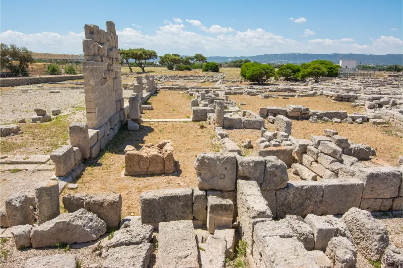
    The Ministry of Culture describes Kaulon as a colony linked to the Achaean world and Crotoniate settlers, with the earliest occupation dating to the second half of the seventh century BCE. Its coastal location offered contact with other Greek settlements and the wider Mediterranean, while the local territory supported agriculture and craft activity. It is important not to imagine the city as a modern compact ruin with intact temples standing beside the sea. Most of its story has been reconstructed through foundations, artifacts and careful archaeological interpretation.

    When you walk the site, use the street plan to understand daily life. Hellenistic blocks, narrow rectangular plots and orthogonal roads suggest a carefully ordered urban layout. The traces in the ground may look modest compared with a reconstructed classical monument, but they are valuable because they show how people moved between domestic, commercial and sacred spaces. Give the plan a few minutes before turning to the spectacular objects. It will make the mosaics and museum cases feel part of a lived city rather than unrelated curiosities.

    The temple area and the religious landscape

    Archaeologists have identified remains associated with a Doric temple, dated by the Ministry to the fifth century BCE, within a sanctuary area that had been used for centuries. Surviving sandstone blocks and archaeological cuts require imagination. You may not see a complete row of columns, and that is not evidence that the site’s value has been exaggerated. Instead, consider the scale of the original sanctuary and the way offerings, building changes and later uses reflect the evolving life of the settlement.

    The museum helps fill the gaps with materials from the sacred area, including votive objects and pieces of armor. Look closely at how labels distinguish objects deposited in ritual contexts from everyday household finds. Avoid presenting a single artifact as proof of a particular myth or an exact ritual unless the explanatory panel supports it. The best archaeological visit is comfortable with uncertainty: what can be dated precisely, what remains a scholarly interpretation and what may change with new excavations?

    The dragon and dolphin mosaics

    Kaulon is particularly associated with remarkable polychrome mosaic decoration, including dragons, dolphins and marine creatures. The so-called House of the Dragon produced a mosaic threshold associated with a banqueting room, while another complex, modified into baths, contained richly decorated flooring. The Ministry’s recent documentation describes the mosaic of the baths of Nannon, with marine beasts and a rosette threshold. These are not all the same floor, and it is worth checking their locations and conservation status before you visit.

    The imagery gives a vivid sense of domestic luxury and artistic exchange. A mosaic is both an object of skill and part of an architectural setting: consider what room it decorated, who might have seen it, and how visitors crossed its threshold. Do not step on exposed ancient floors unless permitted by the defined route. Photography restrictions, barriers or protective covers may be in place to preserve the surface. A guide or interpretive display can be especially valuable because viewing conditions for vulnerable mosaics may change.

    The Tabula Cauloniensis and why a bronze inscription matters

    One of the museum’s scientifically important finds is the Tabula Cauloniensis, a bronze inscription with a dedication to Zeus, recorded by the Ministry as written in an Achaean alphabet and dated to the fifth century BCE. To a first-time visitor it may appear less dramatic than a colored mosaic. Yet it offers a rare direct connection to the language, religious practice and written culture of the ancient inhabitants. Treat it as evidence to be read and contextualized, not merely a beautiful object in a display case.

    Spend time with any translation or explanatory label. The alphabet, formula and material raise questions about who commissioned the dedication and how public or private ritual worked in the city. If the original is temporarily on loan, moved for conservation or replaced by a reproduction, the interpretation is still worthwhile. Do not assume that an object mentioned on a historic museum webpage is permanently on view. Ask the museum team when a particular exhibit is central to your trip.

    Trade, the coast and objects found underwater

    The settlement’s maritime connections are represented by offshore finds, including architectural elements recovered from the seabed near the archaeological site. The Ministry also notes amphorae containing pitch, an unusually evocative reminder of materials traded and used in the ancient Mediterranean. These pieces help visitors imagine a coastline that functioned as a route for cargo and cultural exchange rather than a passive scenic backdrop.

    The coastline itself is sensitive. Modern tides, erosion and human activity change what survives and where excavation is possible. Never enter a restricted archaeological or underwater area hoping to locate artifacts independently. Removing even a small sherd from its context destroys evidence and may be unlawful. If you are interested in underwater archaeology, look for a recognized museum or authorized guided program instead of searching independently. The intellectual excitement of Kaulon lies in documented connections, not in souvenir hunting.

    Museum first or ruins first?

    If the museum is open, starting there can make the ground remains easier to interpret. Look at the introductory map and displays covering the city plan, sacred areas and necropolises before going outside. Alternatively, a guided site visit may establish the urban layout first and then use the artifacts to answer questions. Both sequences work. The important thing is not to rely exclusively on the outdoor ruins, which can seem difficult to read without context.

    Check whether the park, museum and particular mosaic rooms are all available on your chosen day. Official online listings can contain temporary closure notices and sometimes contradictory fragments of historical schedule information. In those circumstances, call or email the institution rather than extrapolating opening hours from an old event announcement. Allow a flexible half day, including time for travel and questions, rather than fitting the site into a few minutes between two long drives.

    How to reach the archaeological site

    Monasterace Marina sits on the Ionian road corridor. For many travelers, a car is the most straightforward way to connect the park with other sites along the coast. Enter the specific museum address, not just the municipality, in your navigation. Road conditions and parking instructions may change around excavations or events. Follow signs and use designated areas rather than stopping beside the SS106 in an unsafe location.

    Rail access may be possible through stations on the Ionian line, but confirm actual train frequency and the final route on foot or by taxi. A site that appears close to a station on a map can still be awkward to reach because of highways or missing pedestrian crossings. If traveling without a car, ask the museum about a safe access route before leaving. Avoid trying to cross barriers or walk on shoulders simply because an online map shows a shorter straight line.

    What to combine with Kaulon on the Ionian coast

    Stilo makes an excellent cultural complement because its Byzantine Cattolica introduces a later chapter in Calabria’s history. Monasterace’s seafront can also provide a relaxed meal or beach walk after the archaeological visit. Farther along the coast, Locri Epizefiri offers another opportunity to compare Greek colonial settlements; visiting both on separate days may be more rewarding than a rushed same-day circuit if you enjoy detailed museum interpretation.

    A disciplined one-day plan could begin with Kaulon’s museum and excavated remains, continue to lunch near the coast and finish with a visit to Stilo if road and opening conditions allow. Do not add Scolacium and Sibari automatically: their geographical separation and the time required to appreciate them deserve a longer itinerary. The theme should be depth, not the number of ancient Greek names collected in one day.

    Families, accessibility and heat

    The park’s open-air surfaces can be uneven, with exposure to sun and little shade in some sections. Families should bring water, hats and suitable shoes; children may engage more readily with the mosaic animals and city map than with long chronological lists. Ask which sections are stroller accessible or have a suitable alternative route. A museum with accessible galleries does not guarantee step-free access across every excavation area.

    Spring and fall generally make an outdoor archaeology day more comfortable than peak summer midday. If visiting in hot weather, schedule the site for morning and leave a quieter coastal activity for later. Wind, rain or conservation work may alter access, and some displays may be under restoration. These are normal realities of a living archaeological site. A little flexibility makes the day better, especially if you care about one fragile mosaic in particular.

    Reading the evidence rather than the legend

    Archaeological sites attract simplified stories about founding heroes, dramatic destruction and buried treasure. Kaulon’s richer account comes from stratigraphy, architecture, inscriptions, the relationship between sacred and domestic spaces, and the objects recovered both on land and offshore. Take the time to distinguish Greek-era remains from later transformations and modern restoration. The site was used and modified over many generations, so treating it as a frozen moment is misleading.

    Bring your questions to a qualified guide or the museum team. Ask how a mosaic’s date is established, why a building changed function, or how the relationship with nearby Greek cities is reconstructed. Those questions often lead to the most memorable conversations. Leave all artifacts untouched, respect closed trenches and share photographs without encouraging entry into protected areas. Kaulon offers a powerful encounter with ancient Calabria precisely because its evidence is carefully preserved rather than staged as a ruin theme park.

    At a glance

    DestinationMonasterace, Calabria
    Main attractionKaulon archaeological park and its museum
    Key objectsDragon/dolphin mosaics and Tabula Cauloniensis
    Best pairingStilo and the Byzantine Cattolica when opening aligns
    Watch out forMuseum or mosaic room conservation closures
    Time to allowA generous half day for the main visit; extend it for a second stop

    Related Calabria guides

    Official information and travel planning

    Confirm access, visitor arrangements and protected-area rules at the relevant official sources before departing: cultura.gov.it, cultura.gov.it.

    Frequently asked questions

    Is Kaulon the same as Monasterace?

    Kaulon was the ancient Greek city; the museum and park lie near modern Monasterace Marina.

    Can I see the original mosaics?

    The site is famous for exceptional mosaics, but display conditions and conservation access can change. Ask the museum before traveling for a specific floor.

    Is the park always open in summer?

    Do not assume so. Refer to the Ministry of Culture for current opening notices and temporary closures.

    How long should I allow?

    Plan a flexible half day with museum context and the excavated area rather than a rushed stop.

    Can I combine Kaulon and Stilo?

    Yes, often as a cultural day with a careful road plan, but verify opening hours before committing.

    Last updated: October 17, 2026
  • Badolato: Medieval Lanes Above Calabria’s Ionian Sea

    Badolato: Medieval Lanes Above Calabria’s Ionian Sea

    Badolato is easy to misunderstand if you see only the name on a map. One part of the municipality faces the Ionian Sea, where visitors come for the beach and practical holiday services. The other is Badolato Superiore, a hill village where stone streets and religious buildings cling to the landscape above the coast. The distinction is the key to planning a satisfying visit. You can enjoy a seaside stay and a historical excursion in a single trip, but do not assume the two districts are connected by a flat pedestrian promenade. This guide explains how to experience the old town without rushing, where a car helps, and how to avoid the common mistake of booking accommodation in the wrong part of Badolato.

    In this guide

    Badolato Superiore and Badolato Marina are two different experiences

    Badolato Marina is the practical seaside side of the municipality, with access to the Ionian coast, modern roads and seasonal services. Badolato Superiore stands inland and uphill. While both belong to the same local identity, they suit different types of vacation. A traveler who wants to walk to the water after breakfast should look at the marina. Someone who enjoys quiet evening lanes, old houses and hillside views may prefer the upper village. A property using the municipality’s name alone may not make the distinction obvious.

    For a broader Calabria itinerary, see the Calabria travel guide before deciding which destinations to combine with Badolato.

    If you have just one day, think of the itinerary as a deliberate pairing: historical walk in the cooler hours and beach time later, or the reverse in summer. Avoid trying to move between the districts repeatedly. The journey is much simpler with a car, especially outside the busiest holiday season when public transport can be infrequent. A transfer should be treated as a real part of the plan, not an invisible line on a map.

    Ancient Mountain Village Badolato Calabria Italy

    What the upper village actually feels like

    The pleasure of Badolato Superiore comes from its urban texture. Narrow lanes turn through compact buildings, arches and stairways, revealing glimpses of hills and water beyond the rooftops. It is not a theme park of medieval architecture. Some houses have been restored, while others show the passage of time. That mix is part of the visit: a genuine settlement changing through different periods, with residents and community uses rather than endless visitor-only attractions.

    Give yourself time to walk without a rigid objective. Instead of heading straight to the highest viewpoint, explore a sequence of small piazzas and note how the streets connect. The difference between a steep side lane and an easier route becomes important in the heat, particularly with a stroller. If the village seems unusually quiet, remember that this may be a normal weekday rather than evidence that everything is abandoned. Keep your expectations grounded and observe the details that a quick driving tour would miss.

    Churches and sacred heritage in a small hill town

    Religious buildings are among the main landmarks of Badolato’s older center. They reflect the way worship, confraternities and community life helped structure the settlement. A church façade can be meaningful even when the interior is closed, but a respectful visit inside may reveal altars, paintings or later rebuilding that complicate the idea of a town frozen in one medieval era. Opening hours can depend on services, volunteers, repairs and special occasions.

    Do not build the entire trip around an assurance that a particular church will be accessible on demand. If interior viewing matters, ask the local tourism office or parish for current arrangements before arriving. In the village, avoid walking into buildings that look ecclesiastical but function as community spaces or residences. Quiet observation is usually enough. For travelers interested in religious history, Badolato is best paired with a broader itinerary through Calabria’s Ionian villages rather than treated as a single isolated shrine.

    Understanding the village’s past without romanticizing decline

    Like many hill settlements in southern Italy, Badolato has experienced demographic changes and migration. The older fabric tells a story of adaptation, not simply a picturesque ruin. It is tempting to describe every weathered doorway as abandoned and every restored house as a revival project; both are simplifications. Families, local institutions and newcomers have shaped the town in different ways, and some houses that look empty from outside are private properties used seasonally.

    Read heritage signage carefully when available and distinguish documented dates from local tradition. Earthquakes and later rebuilding affected many towns in Calabria, so the presence of a medieval street layout does not prove every building has survived unchanged. The historically interesting question is how the community occupied a defensible inland position and later developed stronger links with the coast. Keeping that perspective makes a slow walk more informative than a sensational story about a ‘ghost village.’

    Panoramic viewpoints and photography

    The upper town offers rewarding views across the Ionian landscape. Depending on the exact viewpoint and visibility, you can read the relationship between the village, agricultural slopes, coastal plain and the sea. The best photographs often include a foreground of stone houses or a church tower rather than a wide empty horizon. Late afternoon may soften the light, but it also places you in the village as some shops begin closing. Plan your return drive accordingly.

    Be particularly careful near old walls, narrow terraces or unsupervised steps. A missing safety rail is not a challenge to take one step closer. Use public lookouts and avoid blocking residents’ doorways with tripods. Drones are subject to aviation, privacy and local restrictions; do not assume a remote village is an unrestricted flying area. Weather can also reduce the distant sea view, so photography should be one pleasure among many, not the sole purpose of your journey.

    A realistic walking circuit in Badolato Superiore

    Park legally near an appropriate entrance to the historic area, identify a return route and begin with the most comfortable lane. Spend an initial period simply orienting yourself before approaching the main religious landmarks and viewpoints. If a church is open, step inside quietly and take time to understand its details. Continue through smaller lanes only where pedestrian passage is clearly public. Finish in a piazza or café if businesses are operating that day.

    Allow at least a couple of relaxed hours, more if photography, lunch or conversations with local residents are part of the experience. A rushed twenty-minute detour rarely justifies the ascent. If driving with a family group, agree on a meeting point because mobile navigation can send people to different sides of a tangle of historic alleys. Do not assume everyone in the party will enjoy the same number of stairs; one person may prefer to wait comfortably in a central square.

    The Ionian coast and your beach-day options

    Badolato Marina is the natural place to add time by the water. As elsewhere on the Ionian side of Calabria, the characteristics of sand, small stones, beach facilities and swimming depth change from one stretch to another. Choose a specific beach on the basis of its actual access, available lifeguard services and conditions on the day. The sea can become rough when wind direction changes, and descriptions promising permanently calm, child-safe water are not reliable.

    A family beach day is easiest with shade, water and access to restrooms. Organized beach establishments may simplify that routine in summer, while free beach areas provide more flexibility for travelers bringing their own equipment. Respect marked pathways and never drive onto dunes or vegetation. If you are staying in the hill village and plan to swim daily, calculate the repetitive car trip honestly before reserving your room. A romantic historic address is not automatically the most convenient holiday base.

    Getting there by car, rail or bus

    Road access is generally the most convenient way to combine Badolato Marina with Badolato Superiore. Use the SS106 coastal corridor for regional travel, then follow the appropriate inland approach to the upper village. Because the old streets are narrow, the last section should often be on foot. Check parking rules and never rely on a navigation app to judge whether a street is suitable for a rental car.

    Rail travelers should check the current timetable for the relevant coastal station and confirm the onward connection before buying tickets. A station name linked to Badolato does not automatically mean you can walk to Badolato Superiore with luggage. Local buses and taxis may operate with limited frequency, particularly on Sundays. If public transport does not align with your day, choose a different outing instead of arranging a hazardous walk along roads designed primarily for vehicles.

    Where to stay and how long is enough

    For a summer beach vacation, choose a hotel or apartment in the marina with verified walking access to the beach. Read reviews for noise, parking, air conditioning and whether the immediate environment matches your expectations. In the upper village, accommodation may be atmospheric and quiet, but questions about stairs, luggage transport, heating and shops are essential. Check if the property is reached by car or whether you will carry bags through narrow lanes.

    Badolato Superiore itself is a strong half-day excursion. One night in the old village can add a completely different perspective, especially in the evening, but it is not necessary to make a meaningful visit. Two or three nights in the area work if you want a balance of beach time and nearby villages, including other points along the Jasmine Coast. Base decisions on your main activity, not simply on the most photogenic accommodation listing.

    Food, local rhythm and seasonality

    Meals here should feel like part of Calabria rather than a generic seaside resort menu. Look for seasonal vegetables, pasta preparations, local cheeses, preserved produce and fish dishes where available, while remembering that restaurants adapt their menus to daily supplies. Ask what is in season instead of assuming every traditional dish is served every day. In smaller hill towns, a restaurant may open only on selected evenings outside the summer period.

    Spring and fall favor the ascent and walking in the upper settlement; summer suits a mixed holiday with the sea, but afternoon heat can make stone streets uncomfortable. Winter is possible for a contemplative visit, though many visitor services may close or keep limited schedules. Carry water and sun protection and check the forecast before the drive. If an event or religious procession interests you, consult the municipal calendar because dates and arrangements can change.

    Pair Badolato with a sensible Ionian itinerary

    Badolato combines naturally with Soverato or Roccella Ionica on a multi-day coastal route, while the inland villages of the area offer a different cultural dimension. Keep drive times realistic: Calabria looks narrow on a small map but mountain roads and coastal traffic can stretch journeys. A full day might reasonably include the upper village, a seaside lunch and an afternoon swim. Adding several separate castles and archaeological parks may turn it into a race.

    Help preserve the character that attracted you. Park outside constrained lanes, do not enter private houses, avoid treating worn buildings as props and dispose of waste responsibly. If the village appears quiet, that is not permission to ignore residents’ privacy. A good visit leaves you with an understanding of why the hill settlement and marina developed different roles, and with enough time to appreciate both without forcing them into the same picture.

    At a glance

    DestinationBadolato, Calabria
    Main historic sightBadolato Superiore lanes and religious buildings
    Coastal additionBadolato Marina on the Ionian Sea
    Best transportA car or confirmed transfer between the two districts
    Watch out forSteep steps and confusion over hotel locations
    Time to allowA generous half day for the main visit; extend it for a second stop

    Related Calabria guides

    Official information and travel planning

    Confirm access, visitor arrangements and protected-area rules at the relevant official sources before departing: calabriastraordinaria.it, calabriastraordinaria.it.

    Frequently asked questions

    What is the difference between Badolato Superiore and Marina?

    Badolato Superiore is the historic inland hilltop; Badolato Marina is the coastal district for beach services and accommodation.

    Is Badolato an abandoned village?

    No. It is a lived-in village with historic buildings and evidence of demographic change; do not enter houses or assume quiet streets are abandoned.

    Can I walk from the beach to the old town?

    They are separate locations with a substantial elevation difference. Plan a drive or confirmed local transfer.

    Is the old village suitable for a stroller?

    Some historic streets have steps and uneven stone. Ask about a limited accessible circuit rather than assuming an easy stroller route.

    How much time should I allow?

    Allow a few hours in the old town, plus separate time at the coast if you want a swim or seaside meal.

    Last updated: October 17, 2026
  • Aspromonte National Park: Forests, Gambarie and Safe Hiking

    Aspromonte National Park: Forests, Gambarie and Safe Hiking

    Aspromonte occupies the southern end of Calabria's mountainous spine, but it is not simply a continuation of the better-known Sila. In a relatively short geographical area, the national park gathers forests, steep valleys, seasonal waterfalls, village traditions and remarkable views toward two seas. Gambarie is one of the better-known gateways, while interior routes can be remote enough that a careless itinerary becomes dangerous. This guide is aimed at travelers who want to enjoy the park responsibly, whether that means a modest walk, a scenic mountain drive or a guided hike. It distinguishes established visitor experiences from remote routes that demand local expertise, appropriate equipment and current information.

    What sets Aspromonte apart

    The mountain mass of Aspromonte rises in the province of Reggio Calabria, separating Tyrrhenian and Ionian perspectives. Its river valleys, locally associated with fiumare, give the landscape a distinctive shape: streams can appear modest in one season and become hazardous after heavy rain. Forests include broadleaf and coniferous habitats, while villages preserve cultural histories tied to geography and migration. The national park and regional tourism information highlight geological features and long-distance trails as well as natural heritage. Do not assume the park is a single gated attraction with a central entrance and uniform opening hours. It is a large protected landscape with multiple gateways, communities and access points. Planning begins by choosing one specific area, not typing 'Aspromonte' into a GPS and hoping for the best.

    For travel beyond Aspromonte National Park, consult our Calabria travel guide; it explains how to choose a base and link nearby destinations.

    Dam Menta River Large Hydraulic Work Heart Aspromonte Calabria Italy

    Gambarie as a practical mountain base

    Gambarie, within the municipality of Santo Stefano in Aspromonte, is one of the most recognizable mountain resorts in the park. It is known for a winter-sports setting, but its value extends beyond snow. Depending on the season and services operating, visitors can use it as a starting point for forest walks and mountain scenery. Never assume that lifts or ski facilities run daily, or that snow conditions are guaranteed in winter. Check official local information before traveling for an activity dependent on operating infrastructure. Accommodation in or near Gambarie can simplify an early walk; a day trip from the coast may require more driving than the distance suggests. For travelers unused to mountain roads, arrive with daylight to spare.

    Trails, gradients and realistic hiking choices

    Aspromonte has routes for varied abilities, but a line on an online map is not proof of a maintained trail. Start with an official or clearly documented route, check distance, cumulative elevation gain, route marking and expected time, and make sure you can return before dark. Weather at altitude may differ considerably from the coast. Carry layers, navigation that works offline, a charged phone, water and food suited to the duration. Inform someone of your route if you are walking away from a serviced area. Avoid crossing streams in spate or trying to shortcut switchbacks. A shorter circular route with good interpretation is generally better for a first visit than an ambitious valley crossing copied from someone else's fitness tracker.

    Waterfalls and the temptation of remote places

    Images of waterfalls in Aspromonte circulate widely, but access to individual sites can involve steep, unstable paths and season-dependent water levels. Do not treat every waterfall as a short family outing. Some routes require a qualified guide, special equipment or very specific safe conditions. Check whether the route is legally open and currently recommended by park authorities or experienced local guides. After heavy rain, a picturesque torrent can become a serious hazard, and after long dry periods a waterfall may not resemble the promotional photograph. The goal is to enjoy the landscape, not to reproduce an image. Travelers with children should strongly favor easy, well-defined nature walks over unverified descents into narrow valleys.

    Geology, forests and UNESCO distinctions

    Aspromonte's geological heritage features in the international recognition of the Aspromonte Geopark within UNESCO's Global Geoparks network. That designation has a different meaning from World Heritage inscription and should not be confused with it. Regional sources also discuss old-growth beech forest heritage and sensitive forest areas where professional guidance may be essential. Treat conservation boundaries seriously: they protect ecosystems and can restrict access. Read the interpretive information where available, noting how rock formations, erosion and vegetation interact with altitude. It is easy to treat mountains as scenery alone; learning why valleys look the way they do gives the trip a memorable story. Use official geology and park materials rather than unsourced claims about every peak or fossil.

    Villages and the cultural side of the park

    Aspromonte's communities are part of its identity, not incidental service stations for hikers. The Greek-Calabrian cultural territory around Bova provides one example, with local language traditions, food and religious histories connected to the southern mountains. Other settlements have stories linked to pastoral economies and routes that once joined coast and interior. A thoughtful itinerary may include a village lunch, a small museum or a short cultural walk rather than a full day focused only on elevation. Respect that people live and work in these places. Do not photograph homes or residents intrusively, and be realistic about restaurant opening hours in smaller settlements. Buying locally can be more meaningful than rushing back to a coastal resort immediately after a walk.

    The difference between summer and winter

    A warm day at the Strait of Messina does not guarantee mild conditions high in Aspromonte. Summer hikes can be sunny and exposed, while sudden storms or temperature changes remain possible; winter can involve snow, ice, fog and road closures. If you hope to ski near Gambarie, verify lift operation and current snow conditions. For a forest walk in fall, watch for shorter daylight and wet leaves that reduce grip. Spring may bring streams and flowers but also variable mountain weather. Build an alternative into every plan: a shorter walk, a village visit or a return to Reggio Calabria. The right season depends on the activity you actually intend, not a simple label declaring one month 'best.'

    Getting there from Reggio Calabria

    Reggio Calabria is a useful gateway for parts of Aspromonte, but the mountain transfer involves winding roads and substantial elevation changes. A car can provide the flexibility needed for independent access to some trailheads, provided the driver is comfortable with mountain conditions. Public transport may serve selected settlements or resort areas, yet schedules should be verified for the exact day and season. Do not assume that a bus going to a village also passes your chosen trailhead. For longer or remote hikes, a local qualified guide can solve logistical problems while improving safety and interpretation. If you are driving, keep fuel and daylight margin; do not rely entirely on mobile navigation to select the safest mountain route.

    A gentle first-day itinerary

    For a first experience, choose Gambarie or another established gateway and keep ambitions modest. Arrive in the morning, stop for current route information and select a short, marked forest walk suited to your party. Have lunch locally and reserve the afternoon for a viewpoint or an easy scenic drive before returning. This schedule gives you flexibility if clouds arrive or someone becomes tired. On a longer trip, dedicate a separate day to a guided walk or to the cultural villages toward Bova. Trying to combine a long mountain hike, a distant waterfall, several hill towns and a beach sunset is an excellent way to spend the day in a car rather than the park.

    Families, dogs and responsible access

    Children can enjoy forest walks, changes in tree cover and the excitement of being above the coast, but distance and gradient matter far more than the hike's popularity. Use an established route with a clear turning point and keep enough time for rest. Dog owners should check park and trail regulations, keep pets controlled and carry water for them, especially in warm weather. Wildlife is best observed from a distance; never feed animals or approach them for photographs. Drones, fires, collecting plants and camping may be controlled or prohibited in protected zones. Respect all posted rules, even where there is no ranger physically present. Conservation and visitor safety are both reasons to stay on authorized routes.

    When to choose a guide rather than go alone

    A guide is particularly valuable if you want a remote valley, specialist geology, a waterfall route, winter conditions or a long-distance crossing. Before booking, clarify the precise route, estimated elevation gain, equipment needed, languages offered, transport arrangements and what happens if conditions worsen. A guided outing should have a credible safety plan, not simply promise 'secret places' outside the normal trails. If your goal is a relaxed morning among trees, you may not need a guide when a well-marked, suitable path is open. Match the service to your intentions. The best mountain day is one where the level of challenge fits the least experienced member of the group.

    Planning snapshot
    PlaceGambarie, Calabria
    FocusGambarie and designated mountain trails
    AccessTrailhead transport and current mountain conditions
    AllowAt least a half-day; more for linked excursions
    Before leavingConfirm site access, seasonal services and weather

    Frequently asked questions

    Can you visit Aspromonte on a day trip from Reggio Calabria?

    Yes, especially for a selected gateway and modest walk with realistic transfer time.

    Is Gambarie only a ski destination?

    No. It can also serve summer and shoulder-season mountain visits.

    Are the waterfalls easy to access?

    Not all; some routes are challenging or require qualified guidance.

    Is the park suitable for kids?

    Selected shorter established trails can be, but check conditions and gradients.

    Do I need a car?

    It often helps, though arranged transport and guided outings offer alternatives.

    Continue exploring Calabria

    Related published guides: Calabria Travel Guide: Where to Go, Stay and How to Plan, Best Things to Do in Calabria: Coast, Culture and Nature, Sila National Park: Lakes, Forest Trails and Bases, Pollino National Park: Villages, Mountains and Hiking Bases.

    Official visitor information

    Check current visitor rules, access and operating details with the official regional or national institution before your trip. Services, weather and opening arrangements can change after this guide is published.

    Last updated: October 17, 2026
  • Bova, Calabria: Greek Heritage in an Aspromonte Hill Village

    Bova, Calabria: Greek Heritage in an Aspromonte Hill Village

    Bova is one of the most distinctive villages in Calabria because its identity is expressed not only in stone streets and mountain views but also in language. In the Grecanic area of southern Calabria, varieties of Greek heritage have survived through communities, songs, place names and cultural institutions. Bova, called Chòra tu Vùa in the local Greek-Calabrian tradition, sits high above the Ionian coast in the foothills of Aspromonte. Visitors should arrive with a willingness to listen rather than search only for a scenic viewpoint. This guide explains the village's main landmarks, the meaning of its linguistic history, and how to visit with respect for a living community rather than treating local culture as an exotic performance.

    Bova and the Greek-speaking area

    The Grecanic communities of southern Calabria form an important chapter in the Mediterranean's layered linguistic history. Their speech and traditions do not mean that everyday life in Bova is identical to modern Greece, nor that everyone you meet will speak the historic language. The culture has evolved through centuries of contact, migration and change. The regional tourism authority places Bova at the heart of the Bovesìa territory, with surrounding municipalities and villages contributing to its identity. This is an excellent place to learn how local language can survive through family memory, music, food and scholarship even when demographic patterns shift. Approach encounters with curiosity and avoid asking residents to perform phrases merely for your camera.

    Planning more than Bova, Calabria? The Calabria travel guide compares the main areas and helps you put this stop into a manageable route.

    Calabria Back Young Woman Crotone Promenade Coast Italy

    The old lanes and hilltop position

    Bova's historic center clings to an Aspromonte hillside, producing winding streets, stone architecture and dramatic outward views. Walk slowly uphill and pause in the spaces around churches and older civic buildings. The shape of the village is part of its history: elevated settlements balanced protection, religious institutions and access to agricultural land. A locomotive displayed near the entrance has become an unusual town landmark and invites questions about local memory and railway workers. Farther into the village, look for the cathedral area and the remains associated with the old castle. As with other hill towns, do not assume that a path leading toward a ruin is open or safe; use current local guidance and stay on established public routes.

    Learn about the language at the Rohlfs museum

    The Museum of the Greek-Calabrian Language, associated with scholar Gerhard Rohlfs, is a natural interpretive stop. It can help visitors understand the vocabulary, history and current cultural position of the Grecanic tradition. Before arrival, check the institution's current opening arrangements rather than assuming a museum in a small village operates on a large-city schedule. You do not need advanced linguistic knowledge to enjoy it. Read examples of words and place names, compare how language relates to geography, and pay attention to the role of schools and local associations in preservation. If the museum offers guided interpretation, that can add nuance that short wall labels cannot convey. The aim is to understand continuity and change rather than romanticize an imagined unbroken past.

    Religious buildings and local traditions

    Bova's cathedral and religious spaces show how different historical influences can be expressed within one settlement. Visits must respect services and any areas not normally open to tourists. During the calendar year, particular traditions may draw wider attention; regional tourism sources mention the elaborate Palm Sunday 'pupazze' figures and the Paleariza cultural festival associated with Greek-Calabrian music. Dates and individual programs change, so treat annual coverage as background and verify the current schedule. If you happen to visit during an event, be a considerate guest: stand clear of procession routes, follow instructions and avoid treating participants as a staged attraction. If you visit on a quieter day, the absence of a festival does not make the community's heritage less meaningful.

    Food that reflects place rather than stereotypes

    The regional tourism authority identifies dishes such as lestopitta, a local flatbread, in connection with Bova's Grecanic culinary identity. Food here can also reflect mountain agriculture, cheeses, seasonal vegetables and the wider Calabrian kitchen. Ask at restaurants about daily preparations, as small menus may change with availability. Do not expect every village to serve a standardized 'Greek menu'; this is a regional Italian culture with its own history. A long lunch can be the most enjoyable break between the museum and an uphill walk. If visiting outside peak periods, check whether a restaurant is open that day and consider booking ahead. Buy locally made products when possible, but read ingredients carefully if you have allergies or dietary restrictions.

    Reaching Bova from the Ionian coast

    Bova lies above the coastal settlements in the area of Bova Marina, and the uphill road is part of the journey. A short straight-line distance on the map should not be interpreted as a quick, flat drive. Mountain curves, changing weather and a narrower carriageway call for patient driving. A rental car is often the simplest way to combine the village with other Grecanic locations, though travelers without a car should investigate local bus services or an arranged excursion rather than assuming frequent connections. Do not drive into the most constricted old lanes in search of a parking place. Use recognized parking areas and allow time for a walk into the center. In poor visibility or heavy rain, reconsider the trip rather than pushing through to meet a fixed reservation.

    A day with Bova and Bova Marina

    A strong itinerary begins in Bova during the cooler morning, with the language museum and a slow historic walk. After lunch, descend toward the coast and choose an appropriate sea stop, perhaps around Bova Marina if conditions are suitable. The two places share a name but are distinct communities, and the change from mountain settlement to Ionian shore is central to the experience. If interested in Jewish archaeology, investigate current access to the archaeological evidence connected with the ancient synagogue found in the Bova Marina area. Check museum and site arrangements because displays and excavations can be managed separately. Avoid adding several more hill villages to the same day unless you already know the road network and available hours.

    The wider Grecanic landscape

    Bova serves as a gateway to a broader cultural territory that includes other villages and abandoned settlements. The regional tourism information mentions Roccaforte del Greco and Roghudi Vecchio in this context. These places should not be approached as ordinary open-air attractions without risk. Some abandoned areas involve damaged buildings, unstable ground or complicated access, so seek a qualified local guide and follow restrictions. Landscapes are often best appreciated from legal viewpoints or established routes. Travelers fascinated by the cultural story may prefer a guided cultural itinerary that includes people, language and present-day enterprises rather than one focused entirely on ruins. The value of the region lies in the living connections between mountain geography and community identity.

    Bova as part of an Aspromonte trip

    The mountainous setting makes Bova a natural companion to other explorations around Aspromonte, but this does not mean a long trail should be casually attached to a village visit. Choose an established route suited to your fitness and the weather, and consult the park's current trail information. Conditions can differ sharply between coast and mountains. Carry water, suitable shoes and offline maps, and do not count on mobile signal in every valley. A culturally focused day in Bova may be more rewarding than rushing onward to a remote waterfall. Travelers using Reggio Calabria as their main base should allow enough time for a leisurely drive back, especially if returning on winding roads after dark.

    Visiting with children and accessibility needs

    Children may connect to Bova through small visual details: the locomotive, the narrow alleys, the changes in language they notice on signs and a simple regional snack. A short scavenger-hunt approach can work well if it is respectful of the setting. The old town's gradients and stone surfaces can be challenging for strollers or anyone with limited mobility. Ask the tourist office or museum in advance about the most accessible entry routes and whether vehicles can drop passengers near particular public spaces. If mobility limits make a long circuit difficult, choose a few nearby landmarks and enjoy the view without insisting on a complete climb. Families should carry extra water and plan shade breaks during the warmer season.

    What not to misunderstand about Bova

    Do not confuse Bova with Bova Marina; they are different places at different elevations. Do not equate the Grecanic linguistic tradition with a tourist performance, or assume that every elder speaks it fluently. Avoid repeating claims about ancient origins as certainties when scholarship is more nuanced. Never enter abandoned mountain buildings or follow unverified road shortcuts because they appear adventurous. If a festival is central to your plan, check current official dates. Finally, allocate enough time to understand a museum or speak with a local guide: the experience is far richer than a quick panoramic photograph followed by departure.

    Planning snapshot
    PlaceBova, Calabria
    FocusGrecanic language culture and mountain lanes
    AccessWinding road above Bova Marina
    AllowAt least a half-day; more for linked excursions
    Before leavingConfirm site access, seasonal services and weather

    Frequently asked questions

    Why is Bova special?

    It is a cultural center of Calabria's historic Greek-speaking communities.

    Is Bova the same place as Bova Marina?

    No. Bova is the hill village; Bova Marina is on the coast.

    What is worth seeing?

    Historic lanes, cathedral area, viewpoints and the Greek-Calabrian language museum.

    Can I visit without a car?

    Possibly with arranged transport, but services and mountain-road connections require advance checks.

    How much time do I need?

    Plan a half-day for the village, longer if adding a cultural visit or the coast.

    Continue exploring Calabria

    Related published guides: Calabria Travel Guide: Where to Go, Stay and How to Plan, Best Things to Do in Calabria: Coast, Culture and Nature, Gerace: Cathedral, Stone Lanes and Views over the Locride, Stilo and the Cattolica: A Byzantine Church in the Hills.

    Official visitor information

    Check current visitor rules, access and operating details with the official regional or national institution before your trip. Services, weather and opening arrangements can change after this guide is published.

    Last updated: October 17, 2026

  • Sibari Archaeological Park: Greek Cities Beneath Calabria’s Plain

    Sibari Archaeological Park: Greek Cities Beneath Calabria’s Plain

    Sibari is the kind of archaeological destination that becomes far more rewarding once you understand why its ruins do not look like a neat, single-period Greek city. Near the modern settlement in the Sibaritide plain, successive urban worlds were built across the same landscape. The celebrated Greek colony of Sybaris, its later successor Thurii and the Roman settlement of Copia are all part of the story. At the National Archaeological Museum of the Sibaritide, objects give shape to lives that can otherwise be hard to imagine from walls and excavated surfaces. This guide explains what the museum and park each contribute, why the land and waterways matter, and how to plan an unhurried visit without expecting a cinematic avenue of standing temples.

    Three cities on overlapping ground

    The ancient city of Sybaris became famous for wealth and influence after Greek settlement of the Ionian coast. Its location on fertile lowlands between major waterways helped support agriculture, trade and regional connections. The city was later destroyed in conflict with Croton, and subsequent settlements developed in the same area, including Thurii and Roman Copia. This is why archaeological interpretation cannot be reduced to a single date or ruler. In excavated areas, visible remains often belong to later phases closer to the present surface, while earlier layers tell their story through finds and specialist work. The Ministry of Culture explicitly treats the sequence of Sybaris, Thurii and Copia as central to understanding the site. Arrive ready to learn about transformation rather than seek only ancient Greek monuments standing intact.

    Archaeological Ruin Roman City Pompeii Destroyed Eruption Vesuvius Volcano Campania Italy

    Extend a visit to Sibari Archaeological Park with the suggestions in our Calabria travel guide, which covers regional transport and where to base yourself.

    Start with the museum for context

    For many travelers the National Archaeological Museum of the Sibaritide is the best starting point. Exhibits bring together material from the settlement and its wider territory, helping you recognize pottery, daily objects, trade evidence and the symbolism of ancient coinage. The bull, associated with Sybaris in its coin imagery, is a useful visual thread to look for. Museum labels and temporary displays may change, so do not depend on a fixed gallery sequence found online. Instead, spend time understanding the chronology and the landscape before going outdoors. Travelers who visit the excavations first sometimes struggle to see why the remaining walls matter; the museum can give each layer a human context. A guided visit may be worthwhile if you are especially interested in Magna Graecia.

    Parco del Cavallo and the outdoor remains

    At the archaeological park, outdoor remains ask for slower observation. Reconstructed plans or panels can help show street organization, public spaces and later urban phases. Much of what you see is close to ground level, and archaeological protection may limit how near you can approach particular areas. Stay on authorized paths even when a wall looks easy to cross. The site has been affected historically by the Crati river system and flooding, a reminder that preservation here involves land and water management as much as excavation. Conditions can change after rain, maintenance or research activity. Confirm which sections are currently open; a notice about the entire park does not always explain whether every individual zone is accessible.

    The landscape is part of the history

    Sibari sits in a broad, relatively flat alluvial setting rather than on a dramatic hilltop. The absence of a spectacular elevated viewpoint can initially disappoint travelers accustomed to Greek temples framed by mountains. Yet the plain is exactly what made the ancient place important. Rivers, crops, approaches from the sea and routes inland influenced settlement and prosperity. Looking across the surrounding fields is not wasted time: you are seeing the productive environment that helped create an influential city. It is also why practical details matter. Summer sun can be intense in open archaeological terrain, and shade may be limited. Carry drinking water, wear a hat and consider the outdoor visit in the cooler portion of the day.

    Museum and archaeological park logistics

    Treat the museum and the excavations as related but distinct experiences. The Ministry of Culture's information indicates a combined visitor proposition, but opening arrangements, ticketing and site access can change. Check the official institution rather than relying on a seasonal special-event schedule. Ask whether there are guided visits in English and whether advance booking is recommended for groups or school periods. Travelers using public transport should establish the last-mile transfer from Sibari station; it is a mistake to assume that an archaeological park has a station at its entrance. Drivers should follow official wayfinding instead of navigating to an unspecified point labeled 'Sibari ruins.' Allow at least half a day when both museum and park are open, more if you want detailed reading.

    Understanding Magna Graecia without mixing up the sites

    The term Magna Graecia refers to Greek communities established in southern Italy, but each city has its own story. Crotone's associations with Pythagorean thought and the sanctuary at Capo Colonna differ from Sibari's story of agricultural wealth, conflict and layered reconstruction. Locri Epizefiri, farther south, offers yet another pattern of settlement and religious life. Visiting more than one site enriches the trip, provided you leave time to absorb each one. For a first encounter, consider pairing Sibari with Corigliano-Rossano instead of attempting a multi-site archaeological marathon. The combination brings together ancient cities, Byzantine manuscripts, a castle and the food traditions of the Ionian north. It also minimizes unnecessary long-distance driving.

    A route through Sibari and Corigliano-Rossano

    Begin at the museum, continue to the archaeological area under the conditions in force, and use a long lunch break before driving toward one historic center of Corigliano-Rossano. Choose Rossano if the Codex museum is your main interest, or Corigliano for the Ducal Castle. Do not assume that the combined municipality's old centers are one place. If you have two days, give the museum and park their own morning, explore Corigliano on the second day and reserve time for a different Rossano attraction. This creates a coherent historical journey rather than treating the archaeological park as a brief roadside stop. If you are staying on the beach, allow for a slower return during busy summer periods.

    Visiting with children or limited mobility

    Children often find museums more engaging when adults give them a clear mission: locate an ancient coin design, compare pottery shapes or identify what an object was used for. Explain that ruins at ground level are not 'unfinished' attractions; they survive in a different way from castles or standing churches. Outdoor archaeological paths can have uneven surfaces, exposure and occasional restricted sections. Visitors with mobility limitations should ask the institution about accessible entrances, path surfaces and available assistance, as arrangements may differ between indoor galleries and excavations. A stroller-friendly museum route does not guarantee the same experience outdoors. Plan breaks and keep the visit shorter if heat or fatigue becomes the limiting factor.

    When to visit the ancient site

    Spring and fall are particularly appealing for a combination of archaeology and town walks, with lower heat than midsummer. Summer still works if you visit early, but your itinerary should include plenty of shade and a realistic lunch break. After prolonged rain, outdoor access may be affected. Special evening openings and workshops occasionally provide unusual ways to experience the museum; these should be treated as date-specific events, never permanent hours. If traveling on a public holiday or Monday, confirm the current official schedule rather than assuming standard museum conventions. The best time is when both components are accessible and you have the energy to read, observe and connect their stories.

    Where to stay and transport trade-offs

    Accommodation along the Ionian coast can make sense for a mixed archaeology-and-beach trip, especially if you have a car. Those traveling by train need to research connections carefully and may prefer a location close to a reliable station plus a prearranged transfer to the site. Staying in Corigliano-Rossano creates a cultural base with restaurants and other sights, but it requires transport to the museum and park. If you plan to visit Pollino or the Sila as well, account for the switch from coastal and plain roads to mountain driving. Avoid booking three remote cultural sites on a single day because they appear close in a map view; the experience is about history, not mileage.

    What to double-check before departure

    Confirm the latest hours of both the National Archaeological Museum and the archaeological park, the relationship between any tickets, and the exact open excavation sectors. Ask whether accessibility support, guided tours and on-site facilities are available. Do not bring food into protected areas unless explicitly permitted, and avoid touching exposed remains. If you are researching on social media, check post dates: a festival or extraordinary evening admission from a past year is not a standing offer. Keep a backup plan for bad weather, such as a longer museum visit or a historical walk in Rossano. A small amount of verification makes this fascinating but understated archaeological landscape far easier to appreciate.

    Planning snapshot
    PlaceSibari, Calabria
    FocusGreek/Roman archaeology and Sibaritide artifacts
    AccessMuseum and park last-mile transfer required
    AllowAt least a half-day; more for linked excursions
    Before leavingConfirm site access, seasonal services and weather

    Frequently asked questions

    Is Sybaris the same as modern Sibari?

    The ancient cities occupied the wider plain; the modern settlement and archaeological zone are not identical.

    What is the difference between the park and museum?

    The museum presents artifacts and context; the park reveals excavated urban remains.

    How long does a combined visit take?

    Reserve at least half a day, subject to opening conditions.

    Are there large standing Greek temples?

    The appeal is the layered city history and artifacts, not a single monumental temple row.

    Can I arrive by train?

    Rail can serve the area, but verify last-mile transport to both visitor sites.

    Continue exploring Calabria

    Related published guides: Calabria Travel Guide: Where to Go, Stay and How to Plan, Best Things to Do in Calabria: Coast, Culture and Nature, Crotone and Capo Colonna: Greek Heritage on the Ionian Coast, Ancient Locri Epizefiri: Greek Ruins and Archaeological Museum.

    Official visitor information

    Check current visitor rules, access and operating details with the official regional or national institution before your trip. Services, weather and opening arrangements can change after this guide is published.

    Last updated: October 17, 2026

  • Corigliano-Rossano: Castles, the Purple Codex and Ionian Traditions

    Corigliano-Rossano: Castles, the Purple Codex and Ionian Traditions

    Corigliano-Rossano is not a compact town with a single center. Created as a municipality in 2018 from two historic communities, it combines separate hilltop quarters, a broad Ionian coastal plain and one of Calabria's richest concentrations of art and food heritage. The Ducal Castle in Corigliano, Rossano's Codex museum and religious buildings, and the Amarelli licorice tradition each require their own visit. This guide explains how to connect them without pretending they are all around the same square. It is a particularly good destination for travelers who enjoy architecture and objects with long histories, and who want a more thoughtful alternative to spending their entire Calabria trip on the Tyrrhenian shore.

    Two centers, not one walkable district

    Start by understanding the geography. Corigliano's older settlement stands uphill, while Rossano's historic quarter is also elevated and separate; coastal areas such as Schiavonea are elsewhere again. A map labeled simply 'Corigliano-Rossano' can therefore hide important driving distances and parking decisions. Choose one center for the morning and the other for the afternoon rather than switching repeatedly. A vehicle is often useful, especially if you also want the shore or the countryside. Train access serves the wider area, but the last climb into historic streets may require a local transfer. If you are planning without a car, verify each leg rather than assuming that the main station deposits you beside a castle or museum.

    For a broader Calabria itinerary, see the Calabria travel guide before deciding which destinations to combine with Corigliano-Rossano.

    Beautiful Medieval Village Corigliano Calabro Calabria Italy

    Corigliano's Ducal Castle

    The Ducal Castle provides a dramatic introduction to Corigliano's past. The building's roots reach into Norman-era history, and the complex reflects subsequent changes in defensive and aristocratic architecture. Even before an interior visit, its position shows how the hill town relates to the plain below. Check current museum admission and accessible sections directly; rooms may have independent openings or temporary exhibitions. The castle is not simply a photographic backdrop: use an interpretive visit to distinguish military elements from more decorative residential spaces. Pair it with a slow circuit through the upper streets and the main church area. One hour devoted to the castle plus a brief dash to the parking lot will miss much of Corigliano's personality.

    Rossano and the Codex Purpureus

    Rossano's most internationally significant cultural treasure is the Codex Purpureus Rossanensis, a lavish late-antique Gospel manuscript preserved through the centuries. It is recognized in UNESCO's Memory of the World register, which is different from a UNESCO World Heritage Site designation for an entire city. The Diocesan and Codex Museum is the natural place to understand it. Check which original pages or related materials are on display on your visiting date, because conservation needs govern exhibition conditions. Good interpretation matters more than staring briefly at a famous object: notice how pigments, script and images reveal the painstaking work of manuscript production. Allow time for the museum's accessibility resources where offered, and do not plan photography without checking its policies.

    Churches and the Byzantine legacy

    Rossano's religious heritage goes beyond the Codex. Its historic churches and the wider area's monastic connections help explain the overlap of Greek and Latin influences in medieval Calabria. Santa Maria del Patire, also called the Pathirion, stands outside the urban core and deserves independent planning if you wish to visit. The regional tourism source associates the abbey with Bartholomew of Simeri and an early twelfth-century monastic foundation. Access to religious buildings can be limited during services or conservation works, so verify hours and dress respectfully. Avoid planning the abbey as a five-minute detour from the center: road and visiting conditions determine whether it fits comfortably into one day.

    Licorice and Amarelli's local history

    Rossano is linked to Calabria's celebrated licorice tradition, and the Giorgio Amarelli museum gives that association a specific family and industrial history. A visit can illuminate how roots were processed, how a regional product became widely known and how family enterprises connect agriculture with trade. Check the museum's official visiting arrangements, especially if you need an English-language tour or are traveling with a group. At the shop, distinguish pure licorice from sweets that contain substantial sugar or other flavorings. People with certain medical conditions or medications should not assume licorice is an unlimited snack; consult professional advice where relevant. The story is more interesting when treated as living production history rather than just a stop to buy gifts.

    Schiavonea and the Ionian coast

    The seaside district of Schiavonea offers a change of pace from the elevated old towns. Its broad coastal setting lends itself to a promenade and a meal after a day of museums, but it is not just a scenic extension of Rossano's alleys. Allow for a transfer. The Ionian Sea behaves differently from the Tyrrhenian side of Calabria; check wind, shore material and local water conditions instead of assuming every beach has the same character. If you are traveling in the peak summer period, reserve restaurant flexibility and factor in evening traffic. For families, a short waterfront session after the castle or Codex museum can be much more enjoyable than forcing another indoor visit when everyone is tired.

    A balanced two-day itinerary

    On day one, devote the morning to Corigliano's Ducal Castle and historic lanes, take a proper lunch break and use the afternoon for the coast if conditions are good. On day two, focus on Rossano: the Codex museum first, then churches and the Amarelli story. Add the Pathirion only if you have confirmed access and your transportation makes the detour sensible. This sequence respects the scale of the municipality. Attempting both centers, the castle, Codex, abbey, licorice museum and beach in one day produces a schedule of parking lots rather than a travel experience. A one-day visitor should choose two primary sights and be content with that.

    Where to stay and who will enjoy it

    Corigliano-Rossano can suit visitors crossing the Ionian coast toward Sibari or Crotone, as well as those interested in a short cultural break. A coast-based property may make swimming easier but adds daily drives to the elevated historic quarters; staying near one old center offers atmosphere but can involve steep streets and less convenient parking. Check what neighborhood an accommodation is actually in, not just the combined municipality name. History-minded couples and travelers who appreciate museums will find substantial material here. Families should pace long indoor visits and select one visually memorable site per half-day. Visitors with limited mobility should ask each museum about lifts, rest areas and the exact route from parking or drop-off.

    Building a broader Sibaritide route

    A logical extension is the archaeological landscape of Sibari, where an excavation area and national museum bring the history of Greek colonization into focus. It pairs well with Rossano's cultural heritage but is not within the same walkable center. Allow time for a dedicated archaeological visit, particularly in hot weather when shaded areas can be limited. Travelers continuing toward the Sila should check mountain-road travel times separately from coastal distances. Those heading south may favor Crotone and Capo Colonna. The value of a route through the upper Ionian coast is the contrast between Greek antiquity, medieval religious culture, noble castles and agricultural traditions, not the speed at which you can collect locations.

    Tickets, hours and responsible visiting

    Museum hours, guided-tour language and access to churches can change seasonally or during conservation works. Use the relevant institutions' current pages rather than quoting a price from a blog published several years ago. The Codex in particular is a conservation-sensitive artifact; requests to reduce light or avoid flash photography are part of protecting it. If the Ducal Castle hosts an event, normal rooms may be unavailable, and if you visit the abbey, religious services take precedence over tourism. Leave room in the plan for such changes. Walk slowly in residential quarters, do not obstruct driveways with photography gear and support small local businesses without assuming every storefront accepts every payment method.

    What to prepare before a museum-centered visit

    If you are planning several cultural institutions in one day, write down their individual opening days and last admission times rather than assuming one standardized municipal schedule. Also confirm whether the Codex museum offers a specific language for guided interpretation; English information may be available in some formats and not in every live tour. The castle, churches and licorice museum represent very different organizations, so an opening displayed for one does not establish access to the others. On hot days, arrange the longest outdoor transfers before noon. Bring a small amount of cash for incidental purchases, but pay attention to payment rules at the specific institution. An unhurried visit with two confirmed highlights is more satisfying than racing between four uncertain entrances.

    Planning snapshot
    PlaceCorigliano-Rossano, Calabria
    FocusTwo distinct hill towns and museums
    AccessVehicle or planned transfers between districts
    AllowAt least a half-day; more for linked excursions
    Before leavingConfirm site access, seasonal services and weather

    Frequently asked questions

    Is Corigliano-Rossano one old town?

    No, it joins two distinct historical centers with coastal and rural districts between them.

    What is the Codex Purpureus?

    An important illustrated Gospel manuscript recognized by UNESCO's Memory of the World program.

    Can I see everything in one day?

    Not comfortably; prioritize the castle or Codex museum and one secondary experience.

    Is the Amarelli museum worth visiting?

    Yes for travelers interested in Calabria's food and industrial history; check tour availability.

    Where is a convenient base?

    Choose the old town for culture or coastal quarters for beach access, factoring in transfers.

    Continue exploring Calabria

    Related published guides: Calabria Travel Guide: Where to Go, Stay and How to Plan, Best Things to Do in Calabria: Coast, Culture and Nature, Cosenza, Calabria: Old Town, Duomo and a Walk Along the Crati, Ancient Locri Epizefiri: Greek Ruins and Archaeological Museum.

    Official visitor information

    Check current visitor rules, access and operating details with the official regional or national institution before your trip. Services, weather and opening arrangements can change after this guide is published.

    Last updated: October 17, 2026
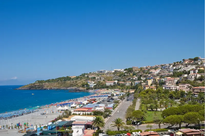
  • Scalea, Calabria: Medieval Lanes, Torre Talao and Beach Days

    Scalea, Calabria: Medieval Lanes, Torre Talao and Beach Days

    Scalea is a useful bridge between northern Calabria's two holiday identities. Below lies a contemporary seaside town with long beach days and transport connections; above it, a compact historic settlement climbs through stairways, old walls and unexpectedly wide views. The striking Torre Talao occupies a coastal promontory, while the broader Riviera dei Cedri puts Arcomagno and Dino Island within reach of travelers who are willing to plan transfers. Scalea is therefore more than a place to sleep between famous beaches. This guide shows how to combine its older architecture with the sea, what to expect of the gradients and why a realistic itinerary benefits from leaving the car parked for part of the day.

    Begin in the medieval center

    The most rewarding Scalea walk involves moving slowly from the newer streets toward the historic upper settlement. The shape of the lanes becomes the attraction: stone passages narrow, steps interrupt what looks like a simple route on a map, and small openings frame the sea. This is not a polished pedestrian shopping mall. Some façades show different stages of repair and everyday life continues behind modest doorways. Take your time rather than selecting the shortest GPS route to the highest point. The local historic character emerges through arches, church walls and changing viewpoints. Because of the gradient, this walk is better in morning or evening than at summer noon, particularly if you are traveling with small children.

    Our Calabria travel guide places Scalea, Calabria in the context of the wider region, including travel times and alternative bases.

    Low Angle Narrow Street Old Scalea Village Calabria Italy

    The castle ruins and older defenses

    Scalea's older defensive structures help explain the hillside setting. The remains associated with the Norman castle are worth viewing as part of the skyline and local history, but access to individual ruins should never be assumed. Look for official information about which areas are open before taking an unmarked staircase or entering a damaged structure. A ruin can be interesting even when seen from a safe public route. Nearby features such as Torre Cimalonga add another layer to the town's military and urban past. Rather than memorize a succession of dynasties, notice how the defensive lines, elevated position and routes toward the sea relate to each other. That geographic connection makes the historic center easier to remember.

    Torre Talao on the coast

    Torre Talao is Scalea's defining coastal landmark. It stands on a headland that once guarded the shoreline and later became associated with cultural activity. The regional tourism authority identifies the tower as a sixteenth-century coastal-defense structure. Its recognizable silhouette makes a good orientation point from the beach and a subject for a short history-focused detour. Interior access may vary; do not build a schedule around entering the tower unless current opening arrangements are confirmed. Even from outside, the structure illustrates how coastal communities responded to threats from the sea. It also helps reveal the contrast between Scalea's historic defenses and today's summer beach economy.

    Finding the right beach experience

    Scalea's waterfront can be convenient, especially for visitors who want to alternate swimming with lunch and an afternoon rest. However, stretches of coast may differ in sand, shingle, depth and the availability of beach facilities. Verify the specific section near your accommodation. In the height of summer, a beach club can simplify the day by providing shade and restrooms, but you can also look for lawful public-access areas. Check local water conditions before entering, even when the horizon appears clear. If your main ambition is snorkeling around dramatic rocks, nearby coastal excursions may be more rewarding than the most central beach. If your goal is convenience with kids, the opposite may be true.

    An easy half-day walk through town

    Start in the lower part of Scalea and choose a marked or well-used ascent into the historic center. Stop at a square rather than walking straight to the highest point, since the best photographs often come from the middle levels where rooftops and sea appear together. Continue toward the older defenses where access is lawful, then descend for a late morning coffee or early lunch. Use the afternoon for the shore and Torre Talao from outside. This sequence reduces uphill effort in the hottest period. If you have only a few hours between trains, shorten the upper walk and do not attempt the entire circuit with heavy rolling luggage. Scalea rewards calm exploration more than speed.

    Scalea as a base for the Riviera dei Cedri

    The town's transport position makes it attractive for travelers who want to see more than one coastal location. Praia a Mare, Dino Island, San Nicola Arcella and Diamante each offer a distinctive reason for a day out. They should not be merged into one rushed 'best beaches' day: boat departures, hill streets, visiting rules and parking consume real time. Choose one major excursion per day and use Scalea as a comfortable return point. If you are planning a car-free journey, train links may help with certain coastal towns, but the final stretch to a cliffside viewpoint or boat departure can require a taxi or organized tour. Build those transfers before committing to accommodation.

    Train connections and getting around

    Scalea-Santa Domenica Talao station lies on the Tyrrhenian corridor and provides a useful alternative to driving for some arrivals. Confirm the specific services for your dates, including whether your train is regional or long-distance and the station-to-hotel distance. The town's upper lanes are not well suited to moving heavy luggage, so pick accommodation in the lower area if you rely on a train and want an easy arrival. Drivers should check parking conditions in the actual neighborhood, not merely whether a property advertises free parking. Restricted and narrow streets in the historical center are better explored on foot. The difference between a location on the map and a comfortable walking route is often the local gradient.

    Eating and evening rhythms

    Scalea works well for simple coastal meals: fish where available, vegetable dishes, local cheeses and dishes associated with the wider northern Calabrian area. Check menus and current prices at the restaurant rather than assuming a famous seaside setting offers one fixed budget. An evening walk through the lower town may be livelier than a daytime visit outside high summer, while the old center can feel different when shops have closed. Travelers interested in regional food can use Scalea as a base to explore the Riviera dei Cedri, including citrus products and nearby villages. Resist packing every meal with a long drive: a quiet dinner close to where you sleep is often the best ending to a beach day.

    Family and accessibility considerations

    A stay near the seafront can be practical for families, particularly when accommodations allow a break during the afternoon heat. Children who enjoy castles may love the idea of the older town, but the climb and uneven steps deserve realistic expectations. A short loop with an ice-cream stop is often better than a forced full circuit. Travelers using a stroller or with mobility limits should request information about lifts, stairs and gradients in both the property and the local streets. The coastal promenade and selected lower routes may be easier than the hilltop streets; do not assume that a distance of a few hundred yards is flat. Bring water and use footwear that works on stone as well as beach material.

    Best months and a two-night plan

    July and August maximize the beach-resort atmosphere but also bring more demand for parking, restaurants and accommodations. Late spring and early fall can be excellent for walking through the historic center, although not every beach service operates daily. Spend the first afternoon settling in and enjoying the waterfront. Use the second morning for Scalea's hilltop architecture, with an afternoon swim. On a third morning, choose a nearby coast outing before departure. A two-night stay gives a balanced picture without pretending you can explore the entire northern coast. If weather disrupts a boat excursion, the town still offers a worthwhile combination of urban history and a sea-facing landscape.

    Practical mistakes to avoid

    Do not choose a hotel based solely on straight-line distance from the beach; stairs and slopes can change the journey. Do not assume entry to the historic castle ruins or Torre Talao without checking current rules. Avoid leaving a boat excursion to the final hour before your return train. Equally, resist driving into narrow historic streets merely because your navigation app finds a road. If your trip focuses on the Arcomagno, verify access regulations before using Scalea as the base. Above all, leave enough time to enjoy the town itself rather than reducing Scalea to a convenient station and a place to park.

    Planning snapshot
    PlaceScalea, Calabria
    FocusMedieval upper town and Torre Talao
    AccessTyrrhenian rail, then walk or local transfer
    AllowAt least a half-day; more for linked excursions
    Before leavingConfirm site access, seasonal services and weather

    Frequently asked questions

    Is Scalea worth visiting without a car?

    Yes, particularly for a central stay, though outlying cliff attractions require extra transport planning.

    What is the main historic sight?

    The hillside old town and its defenses, complemented by coastal Torre Talao.

    Can I enter Torre Talao?

    Verify current openings; its exterior and coastal setting can be appreciated independently.

    Is Scalea a good family base?

    It can be, especially near the beach, with attention to the old-town gradients.

    How long should I stay?

    Two nights allow a town walk, beach time and one nearby excursion.

    Continue exploring Calabria

    Related published guides: Calabria Travel Guide: Where to Go, Stay and How to Plan, Best Things to Do in Calabria: Coast, Culture and Nature, Where to Stay in Calabria: Best Areas and Bases, Cosenza, Calabria: Old Town, Duomo and a Walk Along the Crati.

    Official visitor information

    Check current visitor rules, access and operating details with the official regional or national institution before your trip. Services, weather and opening arrangements can change after this guide is published.

    Last updated: October 17, 2026

  • Diamante, Calabria: Murals, Beaches and the Riviera dei Cedri

    Diamante, Calabria: Murals, Beaches and the Riviera dei Cedri

    Diamante makes a particularly rewarding stop on northern Calabria's Tyrrhenian coast because the beach and the old town ask for entirely different kinds of attention. At sea level, the Riviera dei Cedri is about swimming, coastal light and a long view toward the island of Cirella. A short walk inland brings you into an outdoor gallery: artists have painted walls, stairways and façades in the historic center for decades. This guide helps you see both sides of Diamante without mistaking it for a resort that offers only umbrellas and gelato. It also explains how to visit the murals respectfully, when to consider the annual chili-pepper festivities, and why a day here pairs naturally with nearby Scalea or Praia a Mare.

    Follow the murals rather than racing to a single landmark

    The wall paintings are not concentrated inside a ticketed museum. They unfold through lanes and small squares, so the best strategy is to enter the historic center without a rigid route and let the surfaces guide the walk. Look up above shopfronts, around corners and along staircases: the change from a maritime scene to a contemporary portrait is part of the appeal. The regional tourism authority traces the artistic initiative to 1981, when painters were invited to work directly on the town's buildings. Some murals are vivid and recently maintained; others show weathering. This is living public art, not a sealed collection with permanent conditions. Give yourself at least ninety minutes, more if you like photographing details or reading plaques where available.

    Panoramic View City Diamante Cosenza Calabria Sea Great Place Relax Italy

    For travel beyond Diamante, Calabria, consult our Calabria travel guide; it explains how to choose a base and link nearby destinations.

    What the paintings say about the town

    Diamante's identity as a fishing and trading settlement gives many works a subject beyond visual decoration. Some paintings refer to people, boats, local customs or the relationship between the hillside streets and the sea. Others introduce imagery that has little to do with an expected Mediterranean postcard. That tension is useful: it stops the town from becoming a single souvenir photograph. Look for doors and windows that the artists have incorporated into compositions; these are houses and businesses, not stage scenery. Keep entrances clear, avoid photographing residents through open doors and remember that artwork on private walls is still part of a residential neighborhood. If you want a focused photo walk, start in the morning while side streets are quieter, then return to selected corners when the light changes.

    Choosing between the town beach and nearby coves

    Diamante's seafront is convenient for a swim between walks, cafés and an evening stroll, but do not assume every beach along the Riviera dei Cedri feels identical. Some stretches are pebbly, some have mixed sand and shingle, and water shoes are useful if you dislike walking on stones. Beach clubs may operate seasonally; public access areas also exist, but their exact layout can change. Decide what matters more: the ease of returning to your hotel, calm water for a young child or snorkeling around rocks. On windy days the sea may look inviting from the promenade while entry is less comfortable. Assess the actual conditions, including any lifeguard flags, before swimming. The best beach for photographs is not always the easiest for a relaxed afternoon.

    Cirella and the coast beyond Diamante

    Cirella, just north of town, offers a different landscape: a small offshore island, coastal stretches that invite boat excursions, and an older hill settlement whose ruins tell another story of the area. It is tempting to squeeze everything into one short visit, but boat access depends on operators and weather, and you should not assume the island is freely accessible wherever a vessel can approach. Ask licensed local operators exactly whether a trip circles the island, permits a swimming stop or includes any landing. From land, the shoreline itself rewards an unhurried walk. If you have a vehicle, consider visiting old Cirella at a cooler hour; combining exposed archaeological remains, beaches and the mural streets during peak midday heat is unnecessarily tiring.

    Peperoncino, local food and the festival question

    Diamante is closely associated with chili peppers, and food shops lean into the connection with oils, sauces, preserved vegetables and gift products. The Peperoncino Festival is usually associated with September, but the official dates and programming must be checked for the year you travel. During a festival, the center can be much busier and accommodation more expensive; outside it, the town can feel substantially slower. Do not buy a jar merely because it has a fiery label. Ask whether the product is very hot, what oil or other ingredients it contains, and how it should be stored. If you have allergies, read packaging rather than relying on an informal verbal assurance. For lunch, a simple seafood plate or vegetable dish often showcases the region more honestly than a novelty chili challenge.

    A realistic day from morning to evening

    Begin with coffee near the old center, then walk through the murals before the hottest hours. Take notes on two or three artworks you would like to see again instead of trying to document every painted surface. Continue toward the seafront for lunch, ideally leaving time for a proper sit-down break. Spend the afternoon at a beach that suits the sea conditions and your group. Later, return to the town when local life becomes more visible in the squares and promenades. A sunset walk works especially well here because you already know the route. Travelers combining Diamante with a larger northern Calabria trip can sleep in the area and dedicate the following day to the Arcomagno or Dino Island rather than rushing through all three.

    Arriving by train, car and regional road

    Diamante sits on the Tyrrhenian rail corridor, making a rail-based trip possible, although you must check the specific service and the walk from your chosen station to your accommodation. Train timetables and last evening departures are the details most worth confirming before a day trip. Drivers should plan for slower movement near the waterfront in high season and should not assume a hotel in the historic center provides parking next to the front door. Search for legal parking outside restricted or narrow lanes, then explore on foot. If you are arriving from an airport, compare the entire door-to-door journey rather than simply picking the airport that looks closest on a map. Northern Calabria's coastal distances may be modest while public transportation connections are not always frequent.

    Where to stay and how many nights

    A hotel near the seafront suits travelers who prioritize swimming and evening access to restaurants; a room in or near the older streets is more appealing for people who want to be immersed in the mural neighborhood. Check actual walking distance rather than a property's promotional phrase such as 'steps from the beach.' For a one-night stop, prioritize reliable parking or rail access over amenities you will barely use. For a longer stay, look for shade, air conditioning during summer, a beach option suited to your group and a flexible cancellation policy. Diamante is also a practical base for excursions toward Cirella and the northern coastal villages, but avoid building a daily itinerary that repeatedly doubles back along the same busy summer roads.

    Visiting thoughtfully with kids or mobility needs

    Children often enjoy spotting shapes and stories in the murals, but the old streets can involve uneven paving and steps. Choose a shorter loop and create small pauses rather than insisting on an exhaustive art trail. Families with a stroller should ask their accommodation about gradients and access before booking. Travelers with limited mobility may find the promenade more straightforward than the tight, sloping lanes; ask the local tourist office which sections are step-free. Sunscreen, water and footwear suited to a mixture of urban paving and beach stones are more useful than an elaborate packing list. Respect quiet residential streets, and avoid blocking doorways while your group takes photographs.

    Common planning mistakes

    The biggest mistake is scheduling Diamante as just another quick beach stop. If you arrive only for an hour, you might see neither the murals nor the coast properly. A second error is assuming that the festival is running whenever you visit in September; confirm the actual dates. A third is treating images of Cirella as proof that every boat permits landing. Also avoid planning a swim purely from a weather icon: wind, swell and local warnings matter. Finally, if you are staying in another coastal town, check the last train before dinner. A late and lively promenade is less attractive when the return service is already gone.

    Planning snapshot
    PlaceDiamante, Calabria
    FocusMural walks, Cirella and the sea
    AccessOn foot in the old center; rail to the coast
    AllowAt least a half-day; more for linked excursions
    Before leavingConfirm site access, seasonal services and weather

    Frequently asked questions

    Is Diamante worth visiting without going to the beach?

    Yes. The mural streets, food culture and old-town atmosphere support a satisfying half-day even outside swimming season.

    Do you need tickets to see the murals?

    The murals are generally on publicly accessible streets, not inside a single admission-based gallery; individual exhibitions may have separate rules.

    How much time should I allow?

    A half-day covers an easy mural walk and meal; a full day adds the beach without rushing.

    Is Cirella Island part of the same visit?

    It can be, but boat and sea conditions need checking separately.

    When is the chili-pepper festival?

    It is associated with September; use the official event schedule for exact annual dates.

    Continue exploring Calabria

    Related published guides: Calabria Travel Guide: Where to Go, Stay and How to Plan, Best Things to Do in Calabria: Coast, Culture and Nature, Cosenza, Calabria: Old Town, Duomo and a Walk Along the Crati, Catanzaro: Historic Streets, Views and the Ionian Waterfront.

    Official visitor information

    Check current visitor rules, access and operating details with the official regional or national institution before your trip. Services, weather and opening arrangements can change after this guide is published.

    Last updated: October 17, 2026
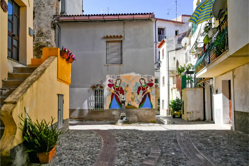
  • Riviera dei Fiori by Bike: Railway Tunnels and Sea Views

    Riviera dei Fiori by Bike: Railway Tunnels and Sea Views

    The Riviera dei Fiori cycle route offers a way to experience western Liguria without spending the whole day in traffic or fighting for a parking space near the water. Sections of former coastal railway line have been converted into a path for bicycles and pedestrians, with tunnels, sea views and access to towns and beaches. The experience is particularly appealing because the old railway alignment keeps much of the route gentler than the roads that climb into the surrounding hills.

    The route’s name, however, can create misleading expectations. It is not wise to assume that every stretch advertised in a guide from several years ago is continuously open and identical today. Extensions, closures, maintenance and changes in access can affect the available itinerary. A successful cycle day starts by checking the currently open segments, choosing a distance suited to your group and understanding where you can rent and return a bicycle. This guide explains how to plan the outing without inventing a single universally valid end-to-end distance.

    Our Liguria travel guide places Riviera dei Fiori by Bike in the context of the wider region, including travel times and alternative bases.

    FocusRiviera dei Fiori Cycle Path
    RegionLiguria, Italy
    Best approachCheck the official access and transport information close to your travel date
    2028 planning noteTimetables, prices and restricted access may change before publication

    In this guide: Why the old railway makes such a good route · Where the Riviera dei Fiori route is found · Sanremo: a practical base for first-timers · Ospedaletti and the tunnel experience · A shorter family ride versus a longer coastal day · An example planning table · Safety on the path and at town crossings · How to arrive, rent a bike and return it · Beaches, food and nearby villages · When is cycling most enjoyable? · Accessibility, children and mixed-ability groups · Avoid common planning mistakes · Frequently asked questions

    House Colorful Old Riviera Italy

    Why the old railway makes such a good route

    Liguria’s coastal geography is narrow and steep, so the former railway corridor provides a valuable strip of relatively level travel close to the sea. Tunnels cut through headlands and open into bright views of coves, promenades and waterfront towns. The contrast between tunnel shade and sunlit coast becomes part of the ride. For visitors used to car-based Riviera sightseeing, cycling creates a chance to notice ordinary coastal details that disappear through a windshield.

    The path is also shared space. Pedestrians, families, runners and casual cyclists may be using the same corridor. It is not a race track, and the safest pace is one that permits frequent slowing at crossings and busy access points. Ring a bell politely when needed, maintain enough distance for other users, and stop for photographs away from the principal line of travel.

    Where the Riviera dei Fiori route is found

    The widely known western Ligurian cycling route serves the coast around the Sanremo area and the neighboring towns. San Lorenzo al Mare, Sanremo and Ospedaletti are familiar names in descriptions of the route, but the status of individual links must be checked at the date of travel. Recent tourism information also discusses sections through areas such as Bussana and other coastside communities. The precise ride you can complete depends on the available open network, not on a permanent number printed in an old article.

    Start by deciding where you can conveniently arrive by train or car and whether the rental operator permits a one-way return. You may prefer an out-and-back route from Sanremo, especially with children, rather than a long one-way ride requiring uncertain transportation at the end. The path connects to beach access points and town centers at various places, but each detour can add walking, road crossings and time.

    Sanremo: a practical base for first-timers

    Sanremo has accommodation, food services and rail access that make it a sensible starting point for many visitors. From a base in town, you can plan a leisurely cycle segment, stop for coffee or lunch and return without reorganizing your luggage. It is also well suited to travelers who want to combine cycling with an afternoon in the historic center or the seafront instead of attempting a marathon ride.

    Before hiring a bike, ask where the operator’s pickup point lies relative to your hotel or station and how the deposit works. Confirm whether a helmet, lock and child seat are available and included, and whether the rental is timed by hours or the full day. A cheaper headline rate may be less useful than a bicycle that fits correctly and can be returned without a stressful deadline.

    Ospedaletti and the tunnel experience

    The coastal approach to Ospedaletti is attractive partly because stretches of railway infrastructure have been repurposed for recreation. Tunnels can be long enough for your eyes to adjust to a different light level, and the air may feel cooler inside than outside on a hot summer day. Use lights if required, keep your speed moderate and do not stop suddenly in a narrow tunnel to take a photograph. Riders behind you may have less visibility than you think.

    Some interpretive panels along the route refer to the area’s cycling history and its association with the Milan–Sanremo race. That heritage can interest sports enthusiasts, but do not confuse the cycle path with the professional race route. The leisure corridor is meant to be shared safely by people with very different abilities and aims.

    A shorter family ride versus a longer coastal day

    For families, choose a short segment with a clear turning point, toilets and an agreed place for a break. Children may enjoy the tunnels and changing sea views, but the novelty does not eliminate fatigue. Keep the outbound ride shorter than you think is necessary, remembering that you must still return. An electric bicycle may help an adult cover ground comfortably, yet it does not change a child’s stamina or make crowded paths safer.

    More confident cyclists can link several open sections, incorporating lunch and perhaps a beach stop. But assess the forecast, total travel time and practical logistics rather than chasing a record distance. An out-and-back trip is often easier than arranging a return train with bicycles, since rail carriage rules, bike spaces and service availability can vary. If you do intend to use the train, verify bike transport conditions with the operator before departure.

    An example planning table

    Rider type Plan Important check
    Family with young children Short out-and-back near a rental point Child seat, trailer or suitable bike availability
    Casual couple Half-day with a seaside lunch Rental return hour and restaurant stop
    Confident cyclist Several connected open segments Current network status and return logistics
    Visitor with access needs Selected flat part of the route Surface, access ramps and adaptive equipment

    This is intentionally not a fixed kilometers-per-hour itinerary. The coast may be crowded, the rental location may differ and an unexpected tunnel closure can change your plan. Build the ride from practical waypoints: starting point, snack stop, turning point and return. The route should remain enjoyable even if the total distance is shorter than expected.

    Safety on the path and at town crossings

    The old railway alignment removes some of the steep climbs and traffic exposure, but not every risk. Shared-path congestion, junctions with roads, tunnel lighting and sudden stops all require attention. Slow before intersections and around pedestrians, particularly children who may move unpredictably. Keep hands ready on the brakes when entering busier areas and give riders in the opposite direction sufficient room.

    On a hot day, sun exposure between tunnels can be intense. Carry water, sunscreen and a light layer for cooler or windy stretches. A small repair kit may be useful for independent cyclists, but rental users should ask what emergency support is included. If anyone in your group develops discomfort or dizziness, stop at a safe location and turn back. There is no need to finish a planned distance simply because it is drawn on a map.

    How to arrive, rent a bike and return it

    Regional trains serve several coastal towns along the western Riviera, including Sanremo. Check your nearest station and the actual route to the rental shop, as the path may not pass directly outside the railway entrance. Drivers should use appropriate parking rather than blocking beach access roads. If arriving in summer, reserving a suitable bicycle in advance can be prudent, especially for children or unusual frame sizes.

    Discuss the condition of the bicycle before departure. Check brakes, tire pressure, saddle height and the operation of lights. Photograph existing damage if required by the rental agreement, and ask what happens if the shop closes before your planned return. For e-bikes, confirm battery range and the policy for roadside problems. Never leave a locked rental bike in a prohibited area when stopping for food or a swim.

    Beaches, food and nearby villages

    The best reward of the ride may be the chance to stop in a town you would otherwise drive past. Coffee and focaccia, a leisurely lunch or a short coastal stroll give variety to the day. Beach access from the route may involve stairs or road crossings, so do not assume that every sea view leads directly to a safe bathing area. If swimming is part of your plan, carry a secure bag for dry clothes and keep track of the bicycle and key.

    Sanremo’s food options and historic center are an easy complement to cycling, while other stretches introduce smaller coastal communities. Avoid overloading the outing with too many town stops: the more time you spend entering and leaving the path, the less relaxed the ride becomes. Choose one or two places that genuinely interest you and give them enough attention.

    When is cycling most enjoyable?

    Spring and autumn are excellent for comfortable temperatures, especially if you hope to ride in the middle of the day. Summer is possible with an early departure, sunscreen and regular water stops; it can also bring heavy usage of the path near popular towns. Winter offers quiet conditions on suitable days, though wind and rain can make exposed stretches uncomfortable. The absence of steep gradients does not eliminate weather exposure.

    Wind direction matters on an out-and-back ride. An easy outward section may feel slower on the return if a headwind develops. Check the forecast and always keep a margin of energy. Following heavy rain, look for notices about maintenance, localized flooding or temporary route restrictions. A current official map is more valuable than a perfect-looking GPX file downloaded years ago.

    Accessibility, children and mixed-ability groups

    Former railway routes can be promising for visitors seeking gentler gradients, but access ramps, tunnel surfaces and shared-path sections differ. Travelers using mobility devices or adapted cycles should verify the exact segment and any barriers before setting out. Do not apply a blanket accessibility claim to an entire network simply because some sections are flat.

    With children, agree on basic cycling rules before joining the shared path: keep to the correct side, signal before stopping and remain behind the supervising adult where appropriate. A slower ride with several stops is not a compromise; it is often what makes the outing memorable. At crossings, adults should take charge rather than expecting a young child to interpret traffic independently.

    Avoid common planning mistakes

    Do not assume the path is continuous everywhere because a tourist brochure shows one colored line. Do not reserve a one-way ride until return transportation is settled. Do not ride through tunnels without considering visibility, and do not turn shared recreation space into a speed challenge. A final common error is trying to cover too much coast in one afternoon. The best day includes time to appreciate the sea, eat well and come back without exhausting the group.

    Frequently asked questions

    Is the Riviera dei Fiori cycle path completely flat?

    Much of the converted railway alignment has gentle gradients, but access points, detours and local connections may involve slopes. Verify the exact section for your needs.

    Can I rent a bike in Sanremo?

    Bike rental services are available in the area, but their location, fleet, seasonal hours and return rules vary. Confirm availability and suitability directly with the operator.

    Is the route suitable for small children?

    Selected shorter sections can be appropriate with supervision and the correct bike or child seat. Consider crowding, crossings, tunnel visibility and the need to return to the start.

    Can I ride the full length without interruption?

    Do not assume so. Extensions, works and local restrictions can affect continuity. Check the current official status and plan around confirmed open sections.

    When is the best season to cycle?

    Spring and autumn often offer pleasant temperatures, while summer favors early starts. At any time of year, check the wind, rain forecast and condition of the route before leaving.

    Continue planning with Sanremo Beyond the Festival, Alassio and the Bay of the Sun, Dolceacqua in the Nervia Valley, and Seven Days in Liguria. Each link leads to a separate guide already published on MyItalyExperience.

    Official information and planning updates

    Before traveling, consult Official visitor information. Check access, weather, seasonal opening hours and transport close to your departure, particularly for a trip in 2028.

    Accommodation disclosure: The following hotel-search link is an affiliate link. It does not change the price you pay under normal booking conditions, but MyItalyExperience may earn a commission.

    Last updated: October 17, 2026